Safety Score: 3,2 of 5.0 based on data from 9 authorites. Meaning please reconsider your need to travel to Denmark.
Travel warnings are updated daily. Source: Travel Warning Denmark. Last Update: 2024-04-25 08:17:04
Touring Amagerbro
The district Amagerbro of Copenhagen in København (Capital Region) is a subburb located in Denmark and is a district of the nations capital.
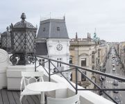
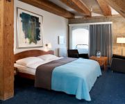
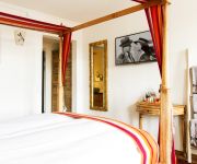
Need some hints on where to stay? We compiled a list of available hotels close to the map centre further down the page.
Being here already, you might want to pay a visit to some of the following locations: Tarnby, Frederiksberg, Charlottenlund, Dragor and Hvidovre. To further explore this place, just scroll down and browse the available info.
Local weather forecast
Todays Local Weather Conditions & Forecast: 7°C / 45 °F
| Morning Temperature | 3°C / 38 °F |
| Evening Temperature | 7°C / 45 °F |
| Night Temperature | 6°C / 42 °F |
| Chance of rainfall | 0% |
| Air Humidity | 66% |
| Air Pressure | 1005 hPa |
| Wind Speed | Moderate breeze with 10 km/h (6 mph) from North-West |
| Cloud Conditions | Overcast clouds, covering 100% of sky |
| General Conditions | Light rain |
Friday, 26th of April 2024
6°C (43 °F)
6°C (42 °F)
Moderate rain, moderate breeze, overcast clouds.
Saturday, 27th of April 2024
11°C (51 °F)
8°C (47 °F)
Overcast clouds, gentle breeze.
Sunday, 28th of April 2024
14°C (57 °F)
11°C (52 °F)
Broken clouds, moderate breeze.
Hotels and Places to Stay
Hotel d Angleterre
Phoenix Copenhagen
Admiral
BABETTE HOTEL GULDSMEDEN
Copenhagen Radisson Blu Scandinavia Hotel
First Twentyseven
HOTEL SKT. ANNAE
SCANDIC FRONT
Best Western Plus City
71 Nyhavn
Videos from this area
These are videos related to the place based on their proximity to this place.
Copenhagen, Denmark (HD) 1/2
VM Mountain, Part of Ørestad, Ørestad High School, DR Concerthall, Tietgen kollegium, Bikubben Kollegium, Emil Holms, Tivoli Hotel, Gemini Residence, SEB Bank & Pension, Islands Brygge Bridge,...
Harbour & canal trip in Copenhagen/København, Denmark, 1/3
DFDS Canal Tours in København/Copenhagen. Trip lasted 1h 15 min and was guided in Danish and English. Filmed 5th October 2011. This is part 1/3. The other 2 parts are lots shorter.
Copenhagen Metro from Amagerbro to Nørreport.
Filmed from the back window of the train set. Time/place: 0:00 Departure from Amagerbro station 0:00.
Harmonikasammenstød i København
Se hele videoen på http://localeyes.dk/article6783.html. Se fotos på http://www.facebook.com/localeyesdk. En person kom alvorligt til skade da han var impliseret i et harmoniokasammenstød...
2011 juni 7 KristofferAugust5.mov
Kristoffer August er sanger og sangskriver og manden bag August & The Red Apples. I smerte og lyst er sangene drevet mod mystikken i både det indre og ydre rum. Vist på Christiania...
2011 juni 7 Marianne Vestergaard_Science & Cocktails5
I denne omgang af Science og Cocktails vil hele det fysiske univers blive bragt til skærmen i Byens Lys set gennem astrofysikeren Marianne Vestergaards øjne. Marianne Vestergaard...
2011 juni 7 Marianne Vestergaard_Science & Cocktails2
I denne omgang af Science og Cocktails vil hele det fysiske univers blive bragt til skærmen i Byens Lys set gennem astrofysikeren Marianne Vestergaards øjne. Marianne Vestergaard...
Videos provided by Youtube are under the copyright of their owners.
Attractions and noteworthy things
Distances are based on the centre of the city/town and sightseeing location. This list contains brief abstracts about monuments, holiday activities, national parcs, museums, organisations and more from the area as well as interesting facts about the region itself. Where available, you'll find the corresponding homepage. Otherwise the related wikipedia article.
Freetown Christiania
Christiania, also known as Freetown Christiania is a self-proclaimed autonomous neighbourhood of about 850 residents, covering 34 hectares in the borough of Christianshavn in the Danish capital Copenhagen. Civic authorities in Copenhagen regard Christiania as a large commune, but the area has a unique status in that it is regulated by a special law, the Christiania Law of 1989 which transfers parts of the supervision of the area from the municipality of Copenhagen to the state.
Arnamagnæan Institute
The Arnamagnæan Institute (Danish: Den Arnamagnæanske Samling, formerly Det Arnamagnæanske Institut) is a teaching and research institute established in 1956 to further the study of the manuscripts in the Arnamagnæan Manuscript Collection, the collection bequeathed by the Icelandic scholar and antiquarian Árni Magnússon to the University of Copenhagen in 1730.
IT University of Copenhagen
The IT University of Copenhagen is a Danish globally oriented, independent university. The IT University of Copenhagen was established in Copenhagen, Denmark in 1999. At that time, it was - in Danish - called "IT-højskolen". In 2003, when a new Danish University Law was passed, the IT University was officially appointed a University, the twelfth and smallest university in Denmark, and therefore changed its name to the IT University of Copenhagen - IT-Universitetet i København in Danish.
Christianshavn
Christianshavn is an artificial island neighbourhood located in Copenhagen, Denmark. It was founded in the early 17th century by Christian IV as part of his extension of the fortifications of Copenhagen. Originally, it was laid out as an independent privileged merchant's town with inspiration from Dutch cities but it was soon incorporated into Copenhagen proper. Dominated by canals, it is the part of Copenhagen with the most nautical atmosphere.
Sundbyvester
Sundbyvester is one of the 15 administrative, statistical, and tax city districts (bydele) comprising the municipality of Copenhagen, Denmark. It lies on the south border of the municipality on the island of Amager. It covers an area of 5.21 km², has a population of 38,017 and a population density of 7,302 per km².
Christianshavn Station
Christianshavn Station is a rapid transit station on the Copenhagen Metro, served by the M1 and M2 lines. The station is located centrally in the Christianshavn district. It is located in fare zone 1 and opened in 2002. It is notable for having a different layout than other underground stations on the line. The platforms are much narrower, and the "diamonds" seen on street level are not present on this station. The station has bicycle parking facilities.
Church of Our Saviour, Copenhagen
Church of Our Saviour is a baroque church in Copenhagen, Denmark, most famous for its corkscrew spire with an external winding staircase that can be climbed to the top, offering extensive views over central Copenhagen. It is also noted for its carillon, which is the largest in northern Europe and plays melodies every hour from 8 am to midnight.
Amagerbro Station
Amagerbro Station is a rapid transit station on the Copenhagen Metro, located in the Sundbyøster district of Copenhagen. It opened in 2002. The station serves the M2 line and connects with bus services. It is located between the Christianshavn and Lergravsparken stations. It is located in fare zone 1. The station has bicycle parking facilities.
Center for Computer Games Research
The Center for Computer Game Research is a research group at the IT University of Copenhagen that represents one of the major nodes in both ludology and computational intelligence and games. The Center for Computer Game Research is heavily involved in the journal Game Studies, and also hosted the 2005 iteration of the Digital Arts and Culture conference. In 2010, the center hosted the IEEE Conference on Computational Intelligence and Games.
Statens Serum Institut
Statens Serum Institut (English: the State Serum Institute), or SSI for short, is a Danish sector research institute located on the island of Amager in Copenhagen. Its purpose is to combat and prevent infectious diseases, congenital disorders, and threats from weapon of mass destruction. Founded in 1902 in the barracks of the Artillerivej road, it has now expanded to much more than its original size and is now one of Denmark’s largest research institutions in the health sector.
Tietgenkollegiet
Tietgenkollegiet, named for Danish financier C. F. Tietgen (1829-1891), is a student residence built in new district Ørestad close to the centre of Copenhagen. The building has a conspicuous circular shape, inspired by traditional southern Chinese Hakka architecture, and is designed by Danish architects Lundgaard & Tranberg in 2006. The design has won it a RIBA European Award.
The Royal School of Library and Information Science
The Royal School of Library and Information Science (RSLIS), is an institution that provides higher education in the field of Library and information science. It is based in Copenhagen and Aalborg, Denmark. It is member of iSchools, a consortium directed to understanding the role of information in nature and human culture.
DR Byen
DR Byen is the headquarters of the Danish national broadcasting corporation, located in Copenhagen, Denmark. The buildings include the Copenhagen Concert Hall by architect Jean Nouvel. Here, DR gathered all activities in Copenhagen during 2006 and 2007, moving all employees to DR Byen from Radiohuset in Frederiksberg and TV-Byen in Søborg. DR Byen is also one of the stations of the Copenhagen Metro.
Christianshavns Vold
Christianshavns Vold is a former rampart which was part of the bastioned fortification ring which used to surround Copenhagen, Denmark. Running along the full south-eastern perimeter of Christianshavn and Holmen, it used to form a protective barrier towards the island of Amager. It consists of earthworks with 12 bastions and in front of it ran a moat, Stadsgraven, now forming a broad canal which separates Christianshavn from the rest of Amager.
Christianshavns Kanal
Christianshavns Kanal is a canal in the Christianshavn neighbourhodd of Copenhagen, Denmark. Running northeast-southwest, it bisects the neighbourhood along its length. To the north it connects to Trangraven, the canal which separates Christianshavn from Holmen; to the south it makes an angular break and empties in the main harbour a little north of the Langebro bridge. At the middle, Christianshavns Kanal is crossed by Børnehusbroen.
Dyssebroen
Dyssebroen is a pedestrian and cycle bridge located in the area known as Freetown Christiania in Copenhagen, Denmark. It connests the Christianshavn Side main portion of the community to its more 'rural' Amager Side backdrop across Stadsgraven, the former moat of the Christianshavn Rampart which formed part of the Bastioned Fortification Ring which used to guard the city.
Wilders Plads
Wilders Plads is a waterfront area located just north of Wilders Kanal, a branch of Christianshavns Kanal, in the north-western corner of the Christianshavn neighbourhood of Copenhagen, Denmark. The area is bounded by Christianshavn Canal to the east and Krøyers Plads to the north.
Wilders Kanal
Wilders Kanal is a canal which connects Christianshavns Kanal to the main harbour, opposite Søkvæsthuset, in the Christianshavn neighbourhood of Copenhagen, Denmark. It is crossed by Wilders Bro which carries Strandgade. The canal is named after father and son, Carl and Lars Wilder, who operated a shipyard in the area just north of it, now known as Wilders Plads.
Royal Danish Naval Museum
The Royal Danish Naval Museum is a museum dedicated to the history of the Royal Danish Navy. The displays include a collection of naval models which dates back to late 17th century. The museum is based in Søkvæsthuset, a former naval jospice which overlooks Christianshavn Canal. The museum is a branch of the Museum of Military History which also includes the Tøjhus Museum at Slotsholmen and two museum ships, the frigate HDMS Peder Skram and the submarine HDMS Sælen, both located at Holmen.
Old Artillery Barracks, Christianshavn
The Old Artillery Barracks, also known as Irgens House after an earlier owner, was the first of three barracks to be established in the Christianshavn district of Copenhagen, Denmark. The complex has been converted into apartments and is listed.
Brøste House
Brøste House, also known as Potter House after its founder, a Scottish born industrialist, is a late 18th century historic property at 10 Overgaden Oven Vandet, overlooking Christianshavn Canal, in the Christianshavn neighbourhood of Copenhagen, Denmark.
Steinfass House
Steinfass House is a listed house overlooking Christianshavn Canal in the Christianshavn neighbourhood of Copenhagen, Denmark. It is now part of the Sofiegården hall of residence.
Christianshavns Torv
Christianshavns Torv is the central public square of the Christianshavn neighbourhood of Copenhagen, Denmark. It is situated at the intersection of Torvegade and Christianshavn Canal, roughly at the centre of the area.
Wildersgade Barracks
Wildersgade Barracks was a barracks which existed from 1802 until 1822 in the Christianshavn district of Copenhagen, Denmark. Its former premises, which include a purpose-built main building on Wildersgade and converted warehouses, two of them facing Christianshavn Canal, are now listed. They surround a central courtyard which has been converted into a community garden.
Søkvæsthuset
Søkvæsthuset is a former Naval hospice located on Christianshavn Canal in the Christianshavn district of Copenhagen, Denmark. The listed building now houses the Royal Danish Naval Museum.


