Safety Score: 3,2 of 5.0 based on data from 9 authorites. Meaning please reconsider your need to travel to Czech Republic.
Travel warnings are updated daily. Source: Travel Warning Czechia. Last Update: 2024-04-20 08:25:34
Explore Janov
Janov in Okres Děčín (Ústecký kraj) with it's 205 inhabitants is located in Czechia about 54 mi (or 87 km) north of Prague, the country's capital.
Local time in Janov is now 01:14 PM (Saturday). The local timezone is named Europe / Prague with an UTC offset of 2 hours. We know of 10 airports in the wider vicinity of Janov, of which 5 are larger airports. The closest is airport we know is Dresden Airport in Germany in a distance of 29 mi (or 46 km). The closest airport in Czechia is Ruzyně International Airport in a distance of 52 mi (or 46 km), North-West. Besides the airports, there are other travel options available (check left side).
There are several Unesco world heritage sites nearby. The closest heritage site is Dresden Elbe Valley in Germany at a distance of 23 mi (or 37 km). The closest in Czechia is Historic Centre of Prague in a distance of 54 mi (or 37 km), North-West. If you need a place to sleep, we compiled a list of available hotels close to the map centre further down the page.
Depending on your travel schedule, you might want to pay a visit to some of the following locations: Rathmannsdorf, Steinigtwolmsdorf, Struppen, Demitz-Thumitz and Lohmen. To further explore this place, just scroll down and browse the available info.
Local weather forecast
Todays Local Weather Conditions & Forecast: 2°C / 36 °F
| Morning Temperature | 4°C / 38 °F |
| Evening Temperature | 4°C / 39 °F |
| Night Temperature | -0°C / 31 °F |
| Chance of rainfall | 1% |
| Air Humidity | 97% |
| Air Pressure | 1015 hPa |
| Wind Speed | Gentle Breeze with 8 km/h (5 mph) from South |
| Cloud Conditions | Overcast clouds, covering 100% of sky |
| General Conditions | Rain and snow |
Sunday, 21st of April 2024
6°C (42 °F)
0°C (33 °F)
Scattered clouds, gentle breeze.
Monday, 22nd of April 2024
8°C (46 °F)
0°C (33 °F)
Broken clouds, light breeze.
Tuesday, 23rd of April 2024
10°C (50 °F)
2°C (35 °F)
Light rain, light breeze, broken clouds.
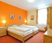
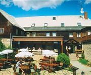
Hotels and Places to Stay
Vyprez
Zlata Lipa Wellness
Ceska Koruna
Gästehaus Kaiserkrone
Berghof Lichtenhain
Videos from this area
These are videos related to the place based on their proximity to this place.
Edmundova soutěska
Edmundova soutěska,dříve nazývaná Tichá nebo Dolní, skalnatý kaňon řeky Kamenice, poslední ze tří soutěsek na dolním toku řeky, východně od Hřenska. Její stěny tvoří...
EDEN - Discover Europe's Hidden Treasures
The Bohemian Switzerland National Park was honoured by EDEN (European Destinations of Excellence) award in 2009. Only protected areas supporting concept of sustainable developement and ...
Trip to Belveder
Short version - trip to Belveder (Bohemian Switzerland, Czech Republic) More : http://experienceczechrepublic.blogspot.cz/2014/11/hike-to-belveder-viewing-po...
Ausflug nach Herrnskretschen und die Edmundsklamm
Mit der Elbfähre geht es vom Bahnhof Schöna nach Hřensko, dem ehemaligem Herrnskretschen. Hier mündet die Kamenice / Kamnitz in die Elbe/ Labe. Am Ortsende beginnt die Wanderung entlang...
Hřensko 2013 [NaCestách.eu]
Naše další cesta vedla do místa, které je považováno za vstupní bránu do Národního parku České Švýcarsko. Hřensko. Obdivuhodné prostředí, dokonalá atmosféra, zážitek,...
Hřensko - Edmundova soutěska (16.09.2012)
http://www.zelenice.net Motovyjížďka do Českého Švýcarska + plavba Edmundovou soutěskou na řece Kamenici.Více o tomto čarokrásném přírodním koutku na http://www.soutesky-hrensko.cz/
Garganta del Kamenice. Hrensko. República Checa
El río Kamenice desemboca el Elba a la altura de Hrensko, y lo hace encajonado en una garganta que va desde esta población hasta la de Mezná. En el siglo XIX, y ya entonces pensando en...
Waterfall - Nikon 1 J1 - Slow Motion (Hřensko)
Vodopád - zpomalený film pořízený fotoaparátem Nikon 1 J1.
Böhmische Schweiz - Edmundsklamm, Gabrielensteig und Großes Prebischtor am 09.06.2012 - Tschechien
Tour in der Böhmischen Schweiz: Hrensko - Edmundsklamm - Mezni Louka - Gabrielensteig - Großes Prebischtor - Hrensko Streckenlänge: ca. 19 km mit etwa 500 Höhenmeter Mehr dazu: ...
Videos provided by Youtube are under the copyright of their owners.
Attractions and noteworthy things
Distances are based on the centre of the city/town and sightseeing location. This list contains brief abstracts about monuments, holiday activities, national parcs, museums, organisations and more from the area as well as interesting facts about the region itself. Where available, you'll find the corresponding homepage. Otherwise the related wikipedia article.
Hřensko
Hřensko is a small village of approximately 320 inhabitants in the Ústí nad Labem Region of the Czech Republic on the border with Germany. It is situated at the confluence of the Kamenice and Labe rivers and was established during the 15th century as a trading settlement. The lowest point in the Czech Republic can be seen in the town. A large number of shops near the border cater to the many German and Czech tourists who come to shop, eat, and drink here.
Bohemian Switzerland
Bohemian Switzerland, also known as Czech Switzerland, is a picturesque region in the north-western Czech Republic. It lies on the Czech side of the Elbe Sandstone Mountains north of Děčín on both sides of the Elbe River. It extends eastward into the Lusatian Mountains and westward into the Ore Mountains. Its highest elevation is the mountain Děčínský Sněžník at 726m above sea level. It has been a protected area (as ChKO Labske Piskovce) since 1972.
Kamenice (Labe)
Kamenice is a 35.6 km-long river in the Děčín District, northwestern Czech Republic. It originates in the Lusatian Mountains and then flows through the national park of Bohemian Switzerland, emptying into the Labe River (Elbe) in Hřensko at {{#invoke:Coordinates|coord}}{{#coordinates:50|52|27|N|14|14|10|E| |primary |name= }}.
Großer Winterberg
Großer Winterberg is a mountain of Saxony, southeastern Germany.
Pravčická brána
The Pravčická brána is located in the Bohemian Switzerland in the Czech Republic. The narrow rock formation is the largest natural sandstone arch in Europe. With a span of 26.5 metres, an inside height of 16 metres, 8 metre maximum width and 3 metre arch it is one of the most striking natural monuments in the Elbe Sandstone Mountains.
Kamnitz Gorge
The Kamnitz Gorge is a rocky ravine between Hřensko (Herrnskretschen), Mezná and Srbská Kamenice in Bohemian Switzerland in the Czech Republic. The river Kamnitz flows through it and discharges near Hřensko into the Elbe.
Mühlgrundbach
Mühlgrundbach is a river of Saxony, Germany.


!['Hřensko 2013 [NaCestách.eu]' preview picture of video 'Hřensko 2013 [NaCestách.eu]'](https://img.youtube.com/vi/aDp-46yFR34/mqdefault.jpg)


