Safety Score: 3,2 of 5.0 based on data from 9 authorites. Meaning please reconsider your need to travel to Czech Republic.
Travel warnings are updated daily. Source: Travel Warning Czechia. Last Update: 2024-04-25 08:17:04
Delve into Uhelná
Uhelná in Okres Liberec (Liberecký kraj) is a town located in Czechia about 58 mi (or 93 km) north of Prague, the country's capital town.
Time in Uhelná is now 10:21 PM (Thursday). The local timezone is named Europe / Prague with an UTC offset of 2 hours. We know of 9 airports closer to Uhelná, of which 4 are larger airports. The closest is airport we know is Dresden Airport in Germany in a distance of 53 mi (or 85 km). The closest airport in Czechia is Ruzyně International Airport in a distance of 60 mi (or 85 km), West. Besides the airports, there are other travel options available (check left side).
There are several Unesco world heritage sites nearby. The closest heritage site is Dresden Elbe Valley in Germany at a distance of 48 mi (or 78 km). The closest in Czechia is Historic Centre of Prague in a distance of 58 mi (or 78 km), West. In need of a room? We compiled a list of available hotels close to the map centre further down the page.
Since you are here already, you might want to pay a visit to some of the following locations: Olbersdorf, Mittelherwigsdorf, Liberec, Hainewalde and Grossschonau. To further explore this place, just scroll down and browse the available info.
Local weather forecast
Todays Local Weather Conditions & Forecast: 6°C / 44 °F
| Morning Temperature | -0°C / 32 °F |
| Evening Temperature | 9°C / 48 °F |
| Night Temperature | 2°C / 36 °F |
| Chance of rainfall | 3% |
| Air Humidity | 75% |
| Air Pressure | 1007 hPa |
| Wind Speed | Gentle Breeze with 9 km/h (5 mph) from North-East |
| Cloud Conditions | Overcast clouds, covering 96% of sky |
| General Conditions | Light rain |
Friday, 26th of April 2024
13°C (55 °F)
9°C (49 °F)
Scattered clouds, gentle breeze.
Saturday, 27th of April 2024
17°C (62 °F)
10°C (50 °F)
Scattered clouds, gentle breeze.
Sunday, 28th of April 2024
18°C (64 °F)
13°C (56 °F)
Broken clouds, moderate breeze.
Hotels and Places to Stay
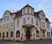
Apartmán-Hotel Jítrava
Hotel Jimmy
Dom Zegarmistrza
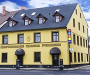
Penzion Gloria
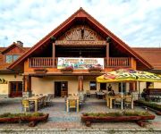
Hotel Farma Vysoká
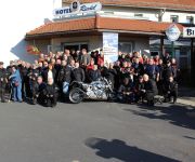
Riedel
Videos from this area
These are videos related to the place based on their proximity to this place.
Bei Zittau: Grenzübergang Kopaczow (Oberullersdorf) und Oldrichov border crossing
Fahrt von Polen nach Tschechien und zurück. Trinationale Verbindungstraße Deutschland-Polen-Tschechien. Hier in der Nähe von Hradek (Grottau). Die Bundesstraße B 178 beginnt bei Weißenberg...
Bogatynia 8 Tage später
Bogatynia 8 Tage später, die Aufräumarbeiten sind im Gange, gehen aber schleppend voran, die Menschen brauchen Hilfe.
Góry Łużyckie » Hrádek nad Nisou (Gródek nad Nysą - Czechy)
Gródek nad Nysą (czes. Hrádek nad Nisou, niem. Grottau) -- miasto w północnych Czechach, w Kotlinie Żytawskiej, nad Nysą Łużycką, u stóp Gór Łużyckich. Leży w pobliżu czesko-niemiec...
Marcellis @ Shotgun Festival Hrad Grabštejn Hrádek nad Nisou 2014
Marcellis @ Shotgun Festival Hrad Grabštejn Hrádek nad Nisou Czech Republic 16.08.14 - pix @ http://www.sound-of-e.de/shotgun2014 - Live: Deadbeat (CA) Frederic Robinson (CH) Elektrabel,...
Überschwemmung im Zentrum von Hradek nad Nisou (08.08.10)
Gravierende Schäden im Zentrum von Hradek nad Nisou.
Click Joe @ Shotgun Festival Hrad Grabštejn Hrádek nad Nisou 2014
Click Joe @ Shotgun Festival Hrad Grabštejn Hrádek nad Nisou Czech Republic 16.08.14 - pix @ http://www.sound-of-e.de/shotgun2014 - Live: Deadbeat (CA) Frederic Robinson (CH) Elektrabel,...
Mažoretky Mochomůrky Jiříkov - 2012_06_09 - Hrádek nad Nisou - pochod městem
Mažoretky Mochomůrky Jiříkov - Hrádek nad Nisou - pochod městem.
Videos provided by Youtube are under the copyright of their owners.
Attractions and noteworthy things
Distances are based on the centre of the city/town and sightseeing location. This list contains brief abstracts about monuments, holiday activities, national parcs, museums, organisations and more from the area as well as interesting facts about the region itself. Where available, you'll find the corresponding homepage. Otherwise the related wikipedia article.
Białopole, Lower Silesian Voivodeship
Białopole is a village in the administrative district of Gmina Bogatynia, within Zgorzelec County, Lower Silesian Voivodeship, in south-western Poland, close to the Czech and German borders. Prior to 1945 it was in Germany. It lies approximately 7 kilometres south-west of Bogatynia, 31 kilometres south of Zgorzelec, and 153 kilometres west of the regional capital Wrocław.
Opolno-Zdrój
Opolno-Zdrój is a village in the administrative district of Gmina Bogatynia, within Zgorzelec County, Lower Silesian Voivodeship, in south-western Poland, close to the Czech and German borders. Prior to 1945 it was in Germany. It lies approximately 5 kilometres south-west of Bogatynia, 31 kilometres south of Zgorzelec, and 151 kilometres west of the regional capital Wrocław. The village has a population of 1,100.
Rybarzowice, Lower Silesian Voivodeship
Rybarzowice is a former village in the administrative district of Gmina Bogatynia, within Zgorzelec County, Lower Silesian Voivodeship, in south-western Poland, close to the Czech and German borders. Prior to 1945 it was in Germany. It was situated approximately 5 kilometres south-west of Bogatynia, 29 kilometres south of Zgorzelec, and 152 kilometres west of the regional capital Wrocław.


