Safety Score: 3,3 of 5.0 based on data from 9 authorites. Meaning please reconsider your need to travel to Colombia.
Travel warnings are updated daily. Source: Travel Warning Colombia. Last Update: 2024-04-23 08:18:23
Explore Ciudad Bolívar
The district Ciudad Bolívar of in Bogotá D.C. (Bogota D.C.) is located in Colombia a little south-west of Bogota, the country's capital.
If you need a place to sleep, we compiled a list of available hotels close to the map centre further down the page.
Depending on your travel schedule, you might want to pay a visit to some of the following locations: Bogota, Nocaima, Villavicencio, Ibague and Tunja. To further explore this place, just scroll down and browse the available info.
Local weather forecast
Todays Local Weather Conditions & Forecast: 19°C / 67 °F
| Morning Temperature | 12°C / 53 °F |
| Evening Temperature | 15°C / 59 °F |
| Night Temperature | 12°C / 53 °F |
| Chance of rainfall | 5% |
| Air Humidity | 61% |
| Air Pressure | 1016 hPa |
| Wind Speed | Light breeze with 4 km/h (3 mph) from North-West |
| Cloud Conditions | Overcast clouds, covering 96% of sky |
| General Conditions | Moderate rain |
Thursday, 25th of April 2024
21°C (69 °F)
12°C (53 °F)
Light rain, light breeze, overcast clouds.
Friday, 26th of April 2024
19°C (66 °F)
13°C (56 °F)
Light rain, calm, broken clouds.
Saturday, 27th of April 2024
16°C (61 °F)
11°C (52 °F)
Light rain, calm, overcast clouds.
Hotels and Places to Stay
Four Seasons Hotel Bogota
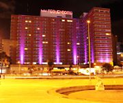
TEQUENDAMA BOGOTA
Casa Platypus
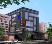
Hilton Bogota
Suites Tequendama Bogotá
Apartaestudios La Candelaria
Hotel Siar
Casa Hotel Victoria Av.30
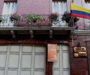
Zohar Hostel
SC House
Videos from this area
These are videos related to the place based on their proximity to this place.
PARQUE INDUSTRIAL MINERO, REALIDAD QUE AFECTA O BENEFICIA
Al sur oriente de Bogotá en la localidad de Ciudad Bolívar se encuentra ubicado la vereda mochuelo bajo, siendo la única zona rural de la localidad, que cuenta aproximadamente con 10.000...
dreamfly Colombia: Kids Tell Us Why Having Dreams Matters
By Laura Ferro and Jay Nargundkar for *dreamfly* Ciudad Bolivar, in the southern outskirts of the Colombian capital city of Bogota, is home to thousands of refugees from outlying provinces...
Festival Jzone 2014 - Festejo Cumpleaños :)
Festejo de Cumpleaños que Ocurrió en la Cafetería del Evento, afortunadamente teníamos la cámara cerca y no nos lo perdimos :) ahora lo compartimos para todos. ;) Estén al tanto de los...
Comunidad en el trabajo - Barrio Jan Pablo II, Ciudad Bolivar, Bogotà
http://www.youtube.com/playlist?list=PLTzY9kTw5ufmGS24ubWwb3X6y28R_Oc9r ---- https://en.wikibooks.org/wiki/Development_Cooperation_Handbook/Stories/Community_at_Work ...
La Bebe Más Inteligente Del Mundo Con 2 Años Es Increible ..!
Niña de dos Años manejando celular "Samsung Galaxy Ace" Es Increible Su Dominio Con Este Artefacto Tecnológico.
Sistema de Seguridad Comunitario para el Living Lab 'Ciudad Bolívar Localidad Digital'
Piloto de e-Seguridad (las Tecnologías de la Información y las Comunicaciones - TIC, apropiadas para la Seguridad Ciudadana), desarrollado en varios barrios de la Localidad de Ciudad Bolívar...
Rapeandole al miedo - Rapping at fear
"POLIMORFO" forma en el área de producción audiovisual a niños y jóvenes de familias en situación de desplazamiento forzoso por la violencia, habitantes de Bogotá. Estos jóvenes exploraron...
Fundación Sentires Porque los niños son El Tesoro
Sentires es una entidad sin ánimo de lucro encargada de brindar acompañamiento pedagógico, psicológico, lúdico y nutricional a niños y niñas de escasos recursos de la localidad de Ciudad...
Panfu! Un increible mundo en el que te divertiras!!
Panfu es un mundo virtual seguro para menores de edad, en la cual el niño (a) socializa con otros niños de su misma edad, aprendiendo vocabulario y el idioma ingles, desarrollando su mentalidad...
Videos provided by Youtube are under the copyright of their owners.
Attractions and noteworthy things
Distances are based on the centre of the city/town and sightseeing location. This list contains brief abstracts about monuments, holiday activities, national parcs, museums, organisations and more from the area as well as interesting facts about the region itself. Where available, you'll find the corresponding homepage. Otherwise the related wikipedia article.
Bogotá
Bogotá, Distrito Capital, from 1991 to 2000 called Santafé de Bogotá, is the capital, and largest city, of Colombia. It is also designated by the national constitution as the capital of the department of Cundinamarca, though the city of Bogotá now comprises an independent capital district and no longer belongs administratively to that department. Bogotá is the most populous city in the country, with 7,363,782 inhabitants as of 2010.
Avianca Flight 203
Avianca Airlines Flight 203 was a Colombian domestic passenger flight from El Dorado International Airport in Bogotá to Alfonso Bonilla Aragón International Airport in Cali. It was destroyed by a bomb over the municipality of Soacha on November 27, 1989. The aircraft took off from the Colombian capital Bogotá en route to Cali. It was in the air five minutes and flying at a speed of 794 kilometres per hour when an explosive charge detonated on board, igniting fuel vapors in an empty fuel tank.
Congress of Colombia
The Congress of the Republic of Colombia (Spanish: Congreso de la República de Colombia) is the name given to Colombia's bicameral national legislature. The Congress of Colombia consists of the 102-seat Senate (Senado), and the 166-seat Chamber of Representatives (Cámara de Representantes). Members of both houses are elected by popular vote to serve four-year terms.
Senate of Colombia
The Senate of the Republic of Colombia (Spanish: Senado de la República de Colombia) is the upper house of the Congress of Colombia, with the lower house being the Chamber of Representatives of Colombia. The Senate has 102 members elected for concurrent four-year terms.
Chamber of Representatives of Colombia
The House of Representatives is the lower house of the Congress of Colombia. The Chamber has 166 elected members for four-year terms.
Capitolio Nacional
Capitolio Nacional (or National Capitol) is a building on Bolivar Square in central Bogotá, the construction of which began in 1876, by order of president Tomás Cipriano de Mosquera, and was not concluded until 1926. It houses both houses of the Congress of Colombia. It was designed and started its construction by Thomas Reed.
Soacha
Soacha is a city in Colombia on the southern edge of Bogotá, the country's capital. It has an important industrial zone and is home to mostly working-class families.
Bolívar Square
The Bolívar Square is located in the heart of the historical area of Bogotá. It has a statue of Simón Bolívar sculpted in 1846 by the Italian Pietro Tenerani, which was the first ever public monument in the city. Plaza Bolívar is also the name given to the main square in every city or town of Venezuela, the native country of Simón Bolívar. On the Northern side of the square is the Palace of Justice, a big modern building where the Supreme Court works.
Antonio Nariño (Bogotá)
Antonio Nariño is the 15th locality of Bogotá, capital of Colombia. It is located in the city's south. It is named after an early Colombian leader, Antonio Nariño, who is often referred to as the precursor to the presidency.
Los Mártires
Los Mártires is the 14th locality of Bogotá, capital of Colombia. It is located near the city's downtown to its west. It takes its name in honor of those who died during the war for independence from Spain. It is completely urbanized, save for its parks and the banks of its rivers.
La Candelaria
La Candelaria is a historic neighborhood in downtown Bogotá, Colombia. It is the equivalent to the Old City in other cities. The architecture of the old houses, churches and buildings has Spanish Colonial and Baroque styles. It houses several universities, libraries and museums.
General Santander National Police Academy
General Santander National Police Academy (or Escuela General Santander de la Policia Nacional in Spanish) is the main educational center for the Colombian National Police. the academy functions as a university for the formation of its force.
San Cristóbal (Bogotá)
San Cristóbal, is the fourth locality of Bogotá, capital of Colombia. It is located in the south-east of the city.
Estadio Metropolitano de Techo
Estadio Metropolitano de Techo is a multi-use stadium in Bogotá, Colombia. It is currently used mostly for football matches and is the home stadium of La Equidad and Bogotá F.C.. The stadium holds 8,000 people.
Usme
Usme is the 5th locality of the Capital District of Bogotá, capital city of Colombia. Usme is located in the southwestern part of Bogotá limiting to the north with the localities of San Cristóbal, Rafael Uribe Uribe and Tunjuelito, to the west with the locality of Ciudad Bolívar, to the south with the locality of Sumapaz, and to the east with the municipalities of Ubaque, Chipaque and Une in the Department of Cundinamarca.
Tunjuelito
Tunjuelito is the 6th locality of the Capital District of the Colombian capital city, Bogotá. Tunjuelito is located to the south of Bogotá, bordering to the north with the localities of Bosa, Kennedy and Puente Aranda, to the east with the localities of Rafael Uribe Uribe and Usme, to the south with Usme and to the west with Ciudad Bolívar.
Bosa (Bogotá)
Bosa is the 7th locality of the Capital District of the Colombian capital city, Bogotá. Bosa is located in the southwestern part of Bogotá and is the 8th largest locality and 9th most populated.
Puente Aranda
Puente Aranda is the 16th location of the Capital District of the Colombian capital city, Bogotá. It is located in the midwest within the city and was named after an old bridge in the hacienda of Juan Aranda over the "Chinúa River" now called the San Francisco Creek that dates from the 16th Century. Puente Aranda has 1724 Ha of area which are almost entirely urban. This locality has more than 300,000 inhabitants, 5% of the total urban area inhabitants of Bogota.
Rafael Uribe Uribe (Bogotá)
The Rafael Uribe Uribe is the 18th locality of the Capital District in the Colombian capital city Bogotá. It was named after the Liberal General Rafael Uribe Uribe. Historically it has NOT been predominantly a residential area with a very small commercial activity. Since the 1940s urban expansion began from the plane lands to the higher lands. Nowadays the locality's southern part is underoing an urban expansion.
Ciudad Bolívar (Bogotá)
Ciudad Bolívar is the 19th locality in the Capital District of the Colombian capital city Bogotá. Ciudad Bolivar is located in the southwestern part of the city. The rural area of the Ciudad Bolivar locality covers most of its area. Its urban area concentrates the poorest population in Bogotá and is known for its rampant levels of violence due to a large activity of gangs, mafia, and at times FARC, one of the national terrorist groups of Colombia.
Colegio Salesiano de Leon XIII
The Leo XIII Salesian College is a private male educational institution managed by the Salesian Community in Colombia. It is headquartered in historic center of Candelaria of Bogotá, Colombia. The school was awarded the Educative Excellence Award, for the private schools category in 2006. In 2010 it celebrated its 120th anniversary.
Free University of Colombia
Universidad Libre is a university in Colombia initially founded under the name of Universidad Republicana in Bogota during the 19th Century. Since the original intention of this program was to offer the space for unbiased learning during a radical political period in the country, the proper translation would be Freedom University because it promotes the liberty of expression and political thoughts.
Air France Flight 422
Air France Flight 422 was a scheduled flight on 20 April 1998 by Air France from Bogotá, Colombia, to Quito, Ecuador. The Boeing 727 was destroyed, killing all 53 people on board, when it crashed into the mountains east of Bogotá because of foggy weather and low visibility after taking off from Bogotá's El Dorado International Airport. The plane was owned by TAME, the Ecuadoran airline, but leased to Air France.
Free and Independent State of Cundinamarca
See also: Cundinamarca State Free and Independent State of Cundinamarca ← 30px 1810–1815 30px → 30px → Flag Coat of arms Flag Coat of arms Location of Cundinamarca Capital Bogotá Languages Spanish Religion Roman Catholic Government Constitutional monarchy; republic President - 1811 Jorge Tadeo Lozano - 1812-1813 Antonio Nariño History - Established 1810 - Disestablished 1815 The Free and Independent State of Cundinamarca was a rebel state in modern Colombia between 1810 and 1815 during the Patria Boba period at the beginning of the Spanish American wars of independence.
Centro Mayor
Centro Mayor is a shopping mall located in the south of Bogotá, Colombia. It was inaugurated on March 26, 2010. Centro Mayor is the biggest mall in Colombia and the third one in Latin America.


