Safety Score: 3,3 of 5.0 based on data from 9 authorites. Meaning please reconsider your need to travel to Colombia.
Travel warnings are updated daily. Source: Travel Warning Colombia. Last Update: 2024-04-17 08:01:42
Explore San Gabriel
The district San Gabriel of Bogotá in Bogotá D.C. (Bogota D.C.) is located in Colombia and is a district of the nations capital.
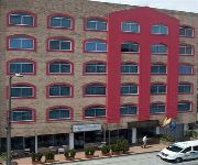
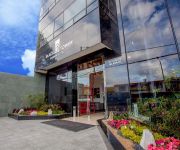
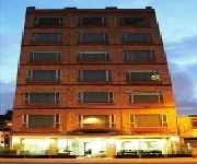
If you need a place to sleep, we compiled a list of available hotels close to the map centre further down the page.
Depending on your travel schedule, you might want to pay a visit to some of the following locations: Nocaima, Villavicencio, Ibague, Tunja and Manizales. To further explore this place, just scroll down and browse the available info.
Local weather forecast
Todays Local Weather Conditions & Forecast: 16°C / 62 °F
| Morning Temperature | 12°C / 53 °F |
| Evening Temperature | 14°C / 58 °F |
| Night Temperature | 13°C / 55 °F |
| Chance of rainfall | 5% |
| Air Humidity | 77% |
| Air Pressure | 1016 hPa |
| Wind Speed | Calm with 3 km/h (2 mph) from North |
| Cloud Conditions | Overcast clouds, covering 99% of sky |
| General Conditions | Light rain |
Friday, 19th of April 2024
20°C (69 °F)
13°C (56 °F)
Moderate rain, light breeze, overcast clouds.
Saturday, 20th of April 2024
20°C (67 °F)
13°C (55 °F)
Moderate rain, light breeze, overcast clouds.
Sunday, 21st of April 2024
20°C (69 °F)
13°C (55 °F)
Light rain, calm, broken clouds.
Hotels and Places to Stay
Embassy Park Hotel
Radisson Ar Bogotá Airport
TRYP BY WYNDHAM BOGOTA USAQUEN
Regency Boutique
Regency Suites
Imperial House
Hotel Macao Colombia
Hotel Diamante Internacional
Hotel Black Tower Premium
Santafé Real
Videos from this area
These are videos related to the place based on their proximity to this place.
Proyectos Tv Educativa 2008
Proyectos acompañados en el 2008 por el Ministerio de Educación Nacional de Colombia emitidos dentro de la parrilla educativa de Señal Colombia. Para mayor información visita http://www.colombi.
LOS TEEN AGERS, Gustavo Quintero interpreta a Leo Dan, Nueva Ola Colombia
Las canciones de LEO DAN se empiezan a poner de moda en la Nueva Ola Colombiana y las agrupaciones juveniles no son ajenas a su influencia. En este caso, LOS TEEN AGERS incluyen en sus ...
Country Club Canino
Adiestramiento canino por el Encantador de perros Colombiano Diego Espinosa en la Sede.
Despegue del A330 de Avianca sobre Bogotá, continuación..
Continuación del despegue del A330 de Avianca sobre Bogotá, volando hacia Fort Lauderdale. Desde el avión vista del Club Country de Bogotá.
Que no cierre el Club
Waldo Farela & Latin City. Integrantes: Carlos Taguada - Piano; John Jairo Escobar - Percusión; Richie Olaya - Bateria; Roberto Rozo - Bajo; Guio Iguarán - Guitarra y Director; Flaco - Trompeta;...
Parque Ambiental de Puente Aranda, Corredor Férreo Bogotá Colombia
Proyecto del Parque Ambiental mas largo de Bogotá, en la localidad de Puente Aranda, hoy es un proyecto aprobado en el Plan de Desarrollo Local y con compromisos de algunas entidades ...
Puente Aranda Humana T.V. Programa 4
Informativo Puente Aranda Humana T.V. Cuarta emisión. Recibimos -Sugerencias -Preguntas prensapuentearanda@gobiernobogota.gov.co Twitter: @localidad16.
Videos provided by Youtube are under the copyright of their owners.
Attractions and noteworthy things
Distances are based on the centre of the city/town and sightseeing location. This list contains brief abstracts about monuments, holiday activities, national parcs, museums, organisations and more from the area as well as interesting facts about the region itself. Where available, you'll find the corresponding homepage. Otherwise the related wikipedia article.
TransMilenio
TransMilenio is a bus rapid transit system that serves Bogotá, the capital of Colombia. The system opened to the public in December 2000, covering Av. Caracas and Calle 80. Other lines have been added gradually over the next several years, and as of 2012, 11 lines totalling 87 km run throughout the city.
National University of Colombia
The Universidad Nacional de Colombia (English: National University of Colombia), also called UNAL or just UN, is a public, national, coeducational, research university, located primarily in Bogotá, Medellín, Manizales and Palmira, Colombia.
Administrative Department of Security
The Administrative Department of Security (Spanish: Departamento Administrativo de Seguridad, DAS) was the Security Service agency of Colombia, also responsible for the immigration services. It was dissolved on 31 October 2011 as part of a wider Executive Reform, and was replaced by the National Directorate of Intelligence(DNI).
University City of Bogotá
The University City of Bogotá (Spanish: Ciudad Universitaria de Bogotá, CUB), also known as the White City, is the flagship campus of the National University of Colombia, located near Teusaquillo, in Bogotá, Colombia. It is the largest university campus in Colombia, with an overall area of 1,200,000 m and a constructed area of 308,541 m, giving it ample green areas, open spaces, and pedestrian paths.
Alfonso López Pumarejo Stadium
The Alfonso López Pumarejo Stadium is a soccer stadium of National University of Colombia located at University City of Bogotá. It is named after Alfonso López Pumarejo.
Antonio Nariño (Bogotá)
Antonio Nariño is the 15th locality of Bogotá, capital of Colombia. It is located in the city's south. It is named after an early Colombian leader, Antonio Nariño, who is often referred to as the precursor to the presidency.
Kennedy (Bogotá)
Kennedy, or Ciudad Kennedy, is the eighth locality of Bogotá, capital of Colombia. It is located in the south-west of the city and is the most populous of all localities being home to 14% of the city's residents.
Los Mártires
Los Mártires is the 14th locality of Bogotá, capital of Colombia. It is located near the city's downtown to its west. It takes its name in honor of those who died during the war for independence from Spain. It is completely urbanized, save for its parks and the banks of its rivers.
Maloka Museum
The Maloka Museum is an interactive science museum located in Bogotá, Colombia. Visitors interact with a wide variety of exhibits that explore topics in Science and Technology. The museum has 9 rooms, with different science and technology topics; the Telecommunications Room shows interactive games about Binary System, the Computers' language, How does the cellphone work or what's the communication process.
General Santander National Police Academy
General Santander National Police Academy (or Escuela General Santander de la Policia Nacional in Spanish) is the main educational center for the Colombian National Police. the academy functions as a university for the formation of its force.
Estadio Metropolitano de Techo
Estadio Metropolitano de Techo is a multi-use stadium in Bogotá, Colombia. It is currently used mostly for football matches and is the home stadium of La Equidad and Bogotá F.C.. The stadium holds 8,000 people.
Estadio Compensar
Estadio Compensar is a multi-use stadium in Bogotá, Colombia. It is currently used mostly for football matches and was the home stadium of Academia FC. The stadium holds 4,500 people and opened in 1998.
Office of the Attorney General of Colombia
The Office of the Attorney General of Colombia (Spanish: Fiscalía General de la Nación) is the Colombian institution part of the Colombian judicial branch of Government with administrative autonomy designed to prosecute offenders, investigate crimes, review judicial processes and accuse penal law infractions against judges and courts of justice. The Office of the Attorney General was created by the Colombian Constitution of 1991 and began operating on July 1, 1992.
Santa Fe (Bogotá)
Santa Fe is the third locality of Bogotá, Capital District of Colombia. Santa Fe is the traditional downtown of the city of Bogotá. This area once comprised Bogotá's total main urban area and was known as "Santa Fe de Bogotá" with its traditional neighborhoods. Santa Fe is one of Bogotá's most developed areas and includes the area by the Carrera Septima, one of the main arteries with most of Bogotá's skyscrapers.
Tunjuelito
Tunjuelito is the 6th locality of the Capital District of the Colombian capital city, Bogotá. Tunjuelito is located to the south of Bogotá, bordering to the north with the localities of Bosa, Kennedy and Puente Aranda, to the east with the localities of Rafael Uribe Uribe and Usme, to the south with Usme and to the west with Ciudad Bolívar.
Puente Aranda
Puente Aranda is the 16th location of the Capital District of the Colombian capital city, Bogotá. It is located in the midwest within the city and was named after an old bridge in the hacienda of Juan Aranda over the "Chinúa River" now called the San Francisco Creek that dates from the 16th Century. Puente Aranda has 1724 Ha of area which are almost entirely urban. This locality has more than 300,000 inhabitants, 5% of the total urban area inhabitants of Bogota.
Rafael Uribe Uribe (Bogotá)
The Rafael Uribe Uribe is the 18th locality of the Capital District in the Colombian capital city Bogotá. It was named after the Liberal General Rafael Uribe Uribe. Historically it has NOT been predominantly a residential area with a very small commercial activity. Since the 1940s urban expansion began from the plane lands to the higher lands. Nowadays the locality's southern part is underoing an urban expansion.
Central Cemetery of Bogotá
Central Cemetery of Bogotá is one of the main and most famous cemeteries in Colombia located in Bogotá. Houses several national heroes, poets and former Colombian presidents. It was opened in 1836 and was declared National Monument in 1984. Some of the sculptors of the mausoleums are Tenerani and Sighinolfi.
Air France Flight 422
Air France Flight 422 was a scheduled flight on 20 April 1998 by Air France from Bogotá, Colombia, to Quito, Ecuador. The Boeing 727 was destroyed, killing all 53 people on board, when it crashed into the mountains east of Bogotá because of foggy weather and low visibility after taking off from Bogotá's El Dorado International Airport. The plane was owned by TAME, the Ecuadoran airline, but leased to Air France.
Radio Televisión Nacional de Colombia
Radio Televisión Nacional de Colombia (RTVC, "Colombian National Radio Television") is a Colombian state-owned public service controlled by the Ministry of Information Technology. It was created by the Decree 3525 on October 28, 2004, after dissolving Inravisión and the public television production company Audiovisuales, during the President Álvaro Uribe Vélez administration. RTVC's slogan is "Sentimos a Colombia" ("We feel Colombia").
University of Quindío
The University of Quindío (Spanish: Universidad del Quindío), is a public institution and department in Colombia, under the Ministry of Education; Its headquarters are located in Armenia, Quindío, Colombia. The University of Quindío is a public establishment academic of Department Order, that is, a body with legal autonomy, academic autonomy, administrative and financial independent, assigned to the governorship of Quindío, by Ordinance No.
Technological University of Pereira
The Technological University of Pereira (Spanish: Universidad Tecnológica de Pereira), is a public, national, coeducational, research university based in the city of Pereira, Risaralda, Colombia.
Centro Mayor
Centro Mayor is a shopping mall located in the south of Bogotá, Colombia. It was inaugurated on March 26, 2010. Centro Mayor is the biggest mall in Colombia and the third one in Latin America.
Gran Estacion Mall
Gran Estación shopping mall is located in the Ciudad Salitre in Bogotá, Colombia. It opened its doors on December 1, 2006. The mall is the fourth biggest mall in Colombia and is also one of the biggest in South America. The mall opened its doors on December 1, 2006 elaborate architecture spanning more than 160 thousand square meters, including delivery to the city access roads and a public square of 12 thousand square meters.
Corferias
Corferias is a convention center located in the city of Bogotá Colombia in the barrio Quintaparedes. It's a venue of local, national and international events. Although it was originally created only as a fair space it has also served as an important place for social activities including voting and it's used by companies and individuals for cultural events.


