Safety Score: 3,3 of 5.0 based on data from 9 authorites. Meaning please reconsider your need to travel to Chile.
Travel warnings are updated daily. Source: Travel Warning Chile. Last Update: 2024-04-20 08:25:34
Discover Collico
The district Collico of Las Animas in Los Lagos is a district in Chile about 460 mi south of Santiago, the country's capital city.
Looking for a place to stay? we compiled a list of available hotels close to the map centre further down the page.
When in this area, you might want to pay a visit to some of the following locations: Valdivia, Temuco, Puerto Montt, Junin de los Andes and Bariloche. To further explore this place, just scroll down and browse the available info.
Local weather forecast
Todays Local Weather Conditions & Forecast: 14°C / 58 °F
| Morning Temperature | 4°C / 39 °F |
| Evening Temperature | 10°C / 50 °F |
| Night Temperature | 7°C / 45 °F |
| Chance of rainfall | 0% |
| Air Humidity | 51% |
| Air Pressure | 1020 hPa |
| Wind Speed | Light breeze with 3 km/h (2 mph) from South-East |
| Cloud Conditions | Broken clouds, covering 79% of sky |
| General Conditions | Broken clouds |
Sunday, 21st of April 2024
13°C (55 °F)
6°C (43 °F)
Overcast clouds, light breeze.
Monday, 22nd of April 2024
12°C (54 °F)
5°C (42 °F)
Sky is clear, light breeze, clear sky.
Tuesday, 23rd of April 2024
12°C (53 °F)
6°C (42 °F)
Few clouds, calm.
Hotels and Places to Stay
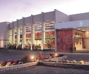
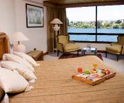
VILLA DE RIO HOTEL MARINA
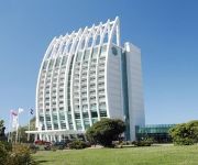
HOTEL DREAMS PEDRO DE VALDIVIA
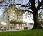
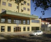
Hotel Puerta del Sur
Diego De Almagro Valdivia Hotel
VILLA DE RIO HOTEL MARINA
ZDIEGO DE ALMAGRO VALDIVIA
Videos from this area
These are videos related to the place based on their proximity to this place.
Terremoto Valdivia, 22 de Mayo 1960 1/2
Terremoto de Valdivia de 1960, el terremoto más fuerte registrado hasta el día de hoy. Habla de los daños a Valdivia, el maremoto y los posibles daños que pudo causar el lago Riñihue....
Valdivia, Chile - Geo viajes & aventura 36
Valdivia se encuentra a 842 km de Santiago, la capital del país, es un alto obligado en el trayecto por la Carretera Panamericana. Las suaves ondulaciones del camino ofrecen la oportunidad...
C.D. Valdivia vs C.D. Providencia sub 15 30/01/2015
Básquetbol Copa Antonio Azurmendy R. 2015. Segunda versión del Campeonato Internacional. Partido de semifinal sub 15.
FPV Volando sobre el Rio Calle Calle Valdivia
Vuelo a 1200 Metros de la pista de Aeromodelismo de Valdivia, sobrevolando el Rio Calle-Calle, Asenav y alrrededores FPV Volando Aeromodelismo R/C micro cámara Rió Calle-Calle Valdivia...
C.D. Valdivia vs C.D.S.C. Puerto Varas sub 13 23/08/2014 CoolTV
Básquetbol Liga Saesa 2014. Transmisión original de CoolTV http://www.cooltv.cl.
hidrogimnasia valdivia chile 2012
Actividad que se realiza en piscina Aqua y Akuatica (piscina animas) en la ciudad de Valdivia, a cargo del profesor Pablo Mohr.
Incendio en bodega de las Ánimas - Valdivia - Región de los Ríos
Pérdidas por incendio en bodega de las Ánimas superan los 400 millones de pesos. El director regional de Vialidad, Jaime Kramm, aseguró que las pérdidas ocasionadas por el incendio que...
Videos provided by Youtube are under the copyright of their owners.
Attractions and noteworthy things
Distances are based on the centre of the city/town and sightseeing location. This list contains brief abstracts about monuments, holiday activities, national parcs, museums, organisations and more from the area as well as interesting facts about the region itself. Where available, you'll find the corresponding homepage. Otherwise the related wikipedia article.
Austral University of Chile
Austral University of Chile (Spanish: Universidad Austral de Chile or UACh) is a research university in Chile based in Valdivia although it has some institutions and careers in Puerto Montt. Founded by decree on 7 September 1954 it is one of the eight original Chilean Traditional Universities. Juridically it is a nonprofit self-owned corporation under private law and is significantly state-financed.
Los Ríos Region
The XIV Los Ríos Region is one of Chile's 15 first order administrative divisions. Its capital is Valdivia. Pop. 356,396 (2002 census). It began to operate as region on October 2, 2007. It was created by subdividing the Los Lagos Region in southern Chile. It consists of two provinces: Valdivia and—the newly created—Ranco that was formerly part of Valdivia Province. The new region was established in consideration of territorial, historical and geographic factors.
Las Marías Airport
Las Marías Airport (Spanish: Aeródromo Las Marías) is an airport located 2 kilometres north of Valdivia, a city in the Los Ríos Region of Chile. The airport operates from sunrise to sunset year round.
Punucapa
Punucapa (from Mapudungun Cunucapi, black/fertile earth for legumes) is a hamlet of pre-Hispanic origin in Los Ríos Region, Chile. Its isolated location by the Cruces River and the Valdivian Coastal Range has make the village an ecotourism attraction. The wetlands of the river is the home to thousands of birds; the Black-necked Swan is the most emblematic. Punucapa is inhabited by 75 people according to INE's 2002 census.
Cruces River
The Cruces River is a river near Valdivia, Chile. Río Cruces originates from hills near the Villarica volcano and flows then in south-west direction. The southern and final part of the river follows the Valdivian Coastal Range. At the latitude of Valdivia it is crossed by Río Cruces Bridge near its outflow into Valdivia River. The small village of Punucapa is the main centre for tourism in Río Cruces. The river flow through (or near) the cities of Loncoche, Lanco, and Mariquina.
Pilolcura
Pilolcura (Mapudungun for hollow stone) is a beach and hamlet in Valdivia Province, Los Ríos Region, Chile. It is named after the conglomerate formations on its beach, which resemble a stone castle with large arches.
Cau-Cau River
Cau-Cau River is minor river in the city of Valdivia, southern Chile. Cau-Cau River acts as a regulating channel between Cruces River and Calle-Calle River forming the Isla Teja island in front of the city centre. It confluence with Calle-Calle River marks the beginning of Valdivia River.
Calle-Calle River
Calle-Calle River also called Gudalafquén in Mapudungun, is a river in Valdivia Province, southern Chile. It drains waters from the San Pedro River to the Valdivia River, which in turn flows into Corral Bay on the Pacific Ocean. The Calle-Calle is the only river in Chile that is considered navigable. Calle-Calle Bridge crosses the river in the city of Valdivia.
Teja Island
Teja island (Spanish isla Teja) is an island in the city of Valdivia, Chile surrounded by three rivers: Cau-Cau river to the north, Cruces river to the west and Valdivia river to the southeast. Initially it was outside the proper city, but with the arrival of the German immigrants many of them settled there and since 1939 the island is directly connected to downtown Valdivia through the Pedro de Valdivia bridge.
Curiñanco
Curiñanco is a coastal village in Valdivia commune in southern Chile. Curiñanco is inhabited by 274 people according to INE's 2002 census.
Pedro de Valdivia Bridge
Pedro de Valdivia Bridge is an arch bridge spanning Valdivia River, that separates downtown Valdivia from Isla Teja island a residential area. Together with Río Cruces Bridge (built in 1987) it allows connection from Valdivia to the coastal town Niebla. Pedro de Valdivia Bridge is named in honour of the founder of Valdivia the Spanish conquistador Pedro de Valdivia.
Río Cruces Bridge
Río Cruces Bridge is a triangular bridge spanning Cruces River that unites Isla Teja from Torobayo, a sub-urban area of Valdivia. Together with Pedro de Valdivia Bridge (built in 1954) it allows connection from Valdivia to the coastal town Niebla. Before the opening of Río Cruces Bridge the main access to Niebla was via a ferry from La Mulatas to Torobayo. Other areas that benefited from the bridge were Punucapa and Curiñanco.
Cutipay River
Cutipay River is a river in Valdivia municipality, southern Chile. Cutipay is often referred as an inlet of Valdivia River rather than a river. The water flow in Cutapay changes twice a day due the tide that affects Valdivia River.
Isla del Rey, Chile
Isla del Rey (Spanish for King's Island) is the largest island in Los Ríos Region of Chile. It is located at the outflow of Valdivia River into Corral Bay. To the east the island is separated from the mainland by Futa River and by south by Tornagaleones River.
Pichoy Airport
Pichoy Airport is an airport located 32 kilometres northeast of Valdivia, a city in the Los Ríos Region of Chile.
Calle-Calle Bridge
Calle-Calle Bridge is an arch bridge spanning Calle-Calle River, that separates downtown Valdivia from Las Animas a residential area. It allows connection from Valdivia to the airport of Pichoy and to the Pan American Highway.
Kunstmann
Kunstmann is a Chilean beer produced in Torobayo, Valdivia. The production began when the German-Chilean family Kunstmann started to brew for personal use in the 1960s, after Valdivia's main brewery Anwandter was destroyed by the 1960 Valdivia earthquake. Since 1997 the beer is sold to the public and today it can be found in most of Chile and is also exported to Germany, USA, Japan, New Zealand, Korea, Argentina and Brazil.
1575 Valdivia earthquake
The 1575 Valdivia earthquake was an earthquake in Chile that caused the subsequent flood of Valdivia much like the 1960 Valdivia earthquake caused the ensuing Riñihuazo flooding. It occurred at 14:30 local time on December 16, 1575. It had an estimated magnitude of 8.5 on the surface wave magnitude scale. Pedro Mariño de Lobera, who was corregidor of Valdivia by that time, wrote that the waters of the river opened like the Red Sea, one part flowing upstream and one downstream.
Torobayo
Torobayo is a suburb of Valdivia, Chile. It lies west of Isla Teja and connects to the city through Río Cruces Bridge. The Kunstmann beer factory and restaurant list within Torobayo and produces an ale beer named Torobayo Ale.
Pishuinco
Pishuinco is a hamlet in the commune of Valdivia, Chile. It lies at the northern end of the Calle-Calle River between the city of Valdivia and Antilhue.
Futa River
Futa River is a river in Los Ríos Region, Chile. It drains waters from the cordillera at the Valdivian Coast Range border north to Tornagaleones River, which in turn flows into the Pacific Ocean at Corral Bay.
Museo Histórico y Antropológico Maurice van de Maele
Museo Histórico y Antropológico Maurice van de Maele or (Spanish for Historical and Anthropologic Museum Maurice van de Maele) is an anthropology and history museum in Valdivia run by Universidad Austral de Chile. The exhibitions at the museum deals with Mapuche and Huilliche culture and the German colonization of southern Chile. The museums exhibits collections of archaeological artifacts and also tools, toys, jewelry, textiles, ceramics and photo collection.
Tornagaleones River
Tornagaleones River is a river and eastuarine channel in Los Ríos Region, Chile. Together with Valdivia and Futa River it encloses the fluvial island of Isla del Rey. The fresh waters of Tornagaleones comes from Futa, Naguilán and Valdivia River. During high tide brackish waters from Corral Bay enters the channel.
Iglesia San Francisco de Valdivia
Iglesia San Francisco de Valdivia is a church and convent in Valdivia, Chile. It was built between 1586 and 1628 and is the oldest building in the city, having withstood three major earthquakes.


