Safety Score: 3,2 of 5.0 based on data from 9 authorites. Meaning please reconsider your need to travel to Bolivia.
Travel warnings are updated daily. Source: Travel Warning Bolivia. Last Update: 2024-04-24 08:14:40
Explore Mapaiso
Mapaiso in Departamento de Santa Cruz is a city in Bolivia about 153 mi (or 246 km) north-east of Sucre, the country's capital.
Local time in Mapaiso is now 06:30 PM (Wednesday). The local timezone is named America / La Paz with an UTC offset of -4 hours. We know of 8 airports in the vicinity of Mapaiso. The closest airport in Bolivia is El Trompillo Airport in a distance of 8 mi (or 13 km), North-East. Besides the airports, there are other travel options available (check left side).
There are several Unesco world heritage sites nearby. The closest heritage site in Bolivia is Fuerte de Samaipata in a distance of 72 mi (or 116 km), East. If you need a place to sleep, we compiled a list of available hotels close to the map centre further down the page.
Depending on your travel schedule, you might want to pay a visit to some of the following locations: Santa Cruz de la Sierra, Santa Fe, San Julian, Cotoca and Puearto Pailas. To further explore this place, just scroll down and browse the available info.
Local weather forecast
Todays Local Weather Conditions & Forecast: 32°C / 90 °F
| Morning Temperature | 23°C / 74 °F |
| Evening Temperature | 29°C / 84 °F |
| Night Temperature | 26°C / 80 °F |
| Chance of rainfall | 0% |
| Air Humidity | 50% |
| Air Pressure | 1011 hPa |
| Wind Speed | Moderate breeze with 10 km/h (6 mph) from South-East |
| Cloud Conditions | Scattered clouds, covering 32% of sky |
| General Conditions | Scattered clouds |
Wednesday, 24th of April 2024
33°C (92 °F)
24°C (76 °F)
Scattered clouds, moderate breeze.
Thursday, 25th of April 2024
32°C (90 °F)
25°C (77 °F)
Sky is clear, moderate breeze, clear sky.
Friday, 26th of April 2024
31°C (87 °F)
25°C (77 °F)
Light rain, fresh breeze, few clouds.
Hotels and Places to Stay
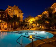
Buganvillas Hotels Suites & Spa
Los Cedros Resort & Convention Center
Videos from this area
These are videos related to the place based on their proximity to this place.
Alto Las Palmas Residencias - Santa Cruz de la Sierra
ALTO LAS PALMAS RESIDENCIAS plantea un modelo de condominio novedoso para la cuidad. Desde la construcción de cada una de las viviendas, hasta la concepción de su espacio común, hacen ...
Pigeon Hunting
Pigeon hunting trip to Wingshooting Safaris de Bolivia Amazonica - Pigeon Palace Lodge - Santa Cruz - Bolivia http://pigeonbolivia.com/en/index.php?idcat=13.
Comunicación y Desarrollo de los Pueblos Indígenas - parte 4
II Encuentro Internacional de Comunicación y Desarrollo de los Pueblos Indígenas Santa Cruz - Bolivia, Abril 2007 Realización: Fundación CARENAS Producción: CIDOB, UNPFII, FAO, IFAD.
Sarjam-parte 2
"La voz aymara SARJAM sintetiza la historia mítica del volcán Sajama, el mayor APU o cerro sagrado de un extenso territorio dominado en tiempos pre-hispánicos por el señorío Carangas y...
Mission Resources International and Orange Hill Baptist Church mission trip to Bolivia 2008
Mission Resources International leads Orange Hill Baptist Church on a mission trip to Bolivia 2008.
My Car Collection 2002 Ford Mustang GT
First of all this was my first REAL FAST car, I bought it in 2003 and it was the best and most beautiful car in my city(for me) I know that its not a 302 its a 281 BUT that number is for the...
CAMILA VASQUEZ S - GLORIA - DERBY CCC 12JUN2011
Derby Country Club Cochabamba, Bolivia Amazona Camila Vasquez Soleto montando a Gloria Categoria Escuela Menor.
TRAFFIC IN SANTA CRUZ.. with my husband Tariq!!
ATENTION!! he is not the mime.. he is the guy laughing :p **Plaza 24 de Septiembre**
¿Qué pasa si desaparecen los bosques?
Campaña de sensibilización que expone uno de los riesgos en el caso de perder el principal bosque de la ciudad de Santa Cruz de la Sierra. Porque el agua es fruto de nuestro bosque.
PES 2009 GOL Y PENAL ATAJADO
mi bro ql k tiene la mensa cuea ase un gol kuliao al minuto 14 del ST extra y ataja un penal.
Videos provided by Youtube are under the copyright of their owners.
Attractions and noteworthy things
Distances are based on the centre of the city/town and sightseeing location. This list contains brief abstracts about monuments, holiday activities, national parcs, museums, organisations and more from the area as well as interesting facts about the region itself. Where available, you'll find the corresponding homepage. Otherwise the related wikipedia article.
Andrés Ibáñez Province
Andrés Ibáñez Province is one of the fifteen provinces of the Bolivian Santa Cruz Department, situated in the western part of the department. Its capital is Santa Cruz de la Sierra which is also the capital of the department. The province was created on December 6, 1944, during the presidency of Gualberto Villarroel López.
El Carmen (Santa Cruz)
El Carmen (Santa Cruz) is a town in Bolivia. In 2009 it had an estimated population of 19,382.
Villa Simón Bolívar
Villa Simón Bolívar is a small town in Bolivia.


