Safety Score: 3,2 of 5.0 based on data from 9 authorites. Meaning please reconsider your need to travel to Bolivia.
Travel warnings are updated daily. Source: Travel Warning Bolivia. Last Update: 2024-04-19 08:03:45
Touring Sacramento Central
Sacramento Central in Departamento de La Paz is a town located in Bolivia about 253 mi (or 408 km) north-west of Sucre, the country's capital place.
Time in Sacramento Central is now 10:51 PM (Friday). The local timezone is named America / La Paz with an UTC offset of -4 hours. We know of 8 airports nearby Sacramento Central. The closest airport in Bolivia is El Alto International Airport in a distance of 34 mi (or 54 km), South-West. Besides the airports, there are other travel options available (check left side).
There are two Unesco world heritage sites nearby. The closest heritage site in Bolivia is Tiwanaku: Spiritual and Political Centre of the Tiwanaku Culture in a distance of 63 mi (or 102 km), North-East. Need some hints on where to stay? We compiled a list of available hotels close to the map centre further down the page.
Being here already, you might want to pay a visit to some of the following locations: Coroico, La Paz, Guanay, Independencia and Desaguadero. To further explore this place, just scroll down and browse the available info.
Local weather forecast
Todays Local Weather Conditions & Forecast: 14°C / 57 °F
| Morning Temperature | 4°C / 39 °F |
| Evening Temperature | 10°C / 51 °F |
| Night Temperature | 6°C / 43 °F |
| Chance of rainfall | 1% |
| Air Humidity | 47% |
| Air Pressure | 1016 hPa |
| Wind Speed | Gentle Breeze with 7 km/h (4 mph) from South-West |
| Cloud Conditions | Clear sky, covering 6% of sky |
| General Conditions | Light rain |
Saturday, 20th of April 2024
15°C (59 °F)
7°C (45 °F)
Light rain, light breeze, few clouds.
Sunday, 21st of April 2024
14°C (57 °F)
7°C (45 °F)
Light rain, gentle breeze, clear sky.
Monday, 22nd of April 2024
13°C (55 °F)
7°C (44 °F)
Light rain, gentle breeze, few clouds.
Hotels and Places to Stay
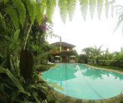
House-Hotel Villa Saracena
Hotel Gloria Coroico
Videos from this area
These are videos related to the place based on their proximity to this place.
Mountain Biking Coroico ( BOLIVIA) 2ª Parte
Este es el famoso descenso en Bicicleta por la Carretera de la Muerte, en la localidad de Coroico, cerca de LA PAZ. Unas muy buenas vistas y gran descarga de adrenalina. Muy recomendable.
Downhill na ruta de la muerte, Coroico (Lélio/Léo/Sakai) - queda Sakai 6:40
Parte do downhill na estrada da morte, Bolívia Queda do Sakai em 6:40 Integrantes: Lélio (filmando com a GoPro), Léo (capacete branco), Sakai (que sofreu a queda) e na frente o guia/instrutor.
Estrada da morte... death road... Downhill Coroico Bolivia... Guminha cinegrafista... furazooi...
estrada mais perigosa do mundo e a galera descendo... doido de mais... saimos de Cumbre a 4.670 mts de altitude descemos 63 km ate a cidade de Coroico a 1.120 mts de altitude... estrada q jah...
Bolivia / Yungas / Tocaña y Coroico
http://prensasurbolivia.blogspot.com // http://prensasur.podomatic.com // http://juannicastro.wordpress.com // El video empieza cuando nos vamos... nos vamos de Coroico, nos vamos de Tocaña......
Coroico, Death Road 死の道 - The Most DANGEROUS Road of the World 世界一危険な道路
毎年死者の出る死の道、転落事故が頻発する世界一危険な道路と言われています。2007年には新道が完成しましたが、この動画はまだ新道が完成す...
Paseo en moto a Coroico - Bolivia
Paseo en motocicleta a Coroico Bolivia. Todo el camino de ida con mucha lluvia, el de vuelta, que fue en la noche, estuvo lleno de neblina y mucho frio, muy interesante el de vuelta aunque...
Leti en Bici a Coroico por la Ruta de la Muerte - Parte 1/4
Descenso a Coroico por la Ruta de la Muerte. Se sube de La Paz hasta la cumbre y luego todo descenso. Emocionante de principio a fin! Primer tramo, asfalto, fácil.
Mountain Biking Coroico ( BOLIVIA ) 1ª Parte
Este es el famoso descenso en Bicicleta por la Carretera de la Muerte, en la localidad de Coroico, cerca de LA PAZ. Unas muy buenas vistas y gran descarga de adrenalina. Muy recomendable.
Videos provided by Youtube are under the copyright of their owners.


