Safety Score: 3,0 of 5.0 based on data from 9 authorites. Meaning we advice caution when travelling to Austria.
Travel warnings are updated daily. Source: Travel Warning Austria. Last Update: 2024-04-17 08:01:42
Touring Mühltal
Mühltal in Politischer Bezirk Innsbruck Land (Tirol) is a town located in Austria about 240 mi (or 387 km) west of Vienna, the country's capital place.
Time in Mühltal is now 01:17 PM (Wednesday). The local timezone is named Europe / Vienna with an UTC offset of 2 hours. We know of 12 airports nearby Mühltal, of which 5 are larger airports. The closest airport in Austria is Innsbruck Airport in a distance of 7 mi (or 11 km), North-West. Besides the airports, there are other travel options available (check left side).
There are several Unesco world heritage sites nearby. The closest heritage site is Pilgrimage Church of Wies in Germany at a distance of 42 mi (or 68 km). The closest in Austria is Historic Centre of the City of Salzburg in a distance of 86 mi (or 68 km), North-West. We collected 3 points of interest near this location. Need some hints on where to stay? We compiled a list of available hotels close to the map centre further down the page.
Being here already, you might want to pay a visit to some of the following locations: Schoenberg im Stubaital, Ellbogen, Patsch, Pfons and Mieders. To further explore this place, just scroll down and browse the available info.
Local weather forecast
Todays Local Weather Conditions & Forecast: 7°C / 44 °F
| Morning Temperature | 4°C / 39 °F |
| Evening Temperature | 4°C / 40 °F |
| Night Temperature | 2°C / 36 °F |
| Chance of rainfall | 7% |
| Air Humidity | 88% |
| Air Pressure | 1008 hPa |
| Wind Speed | Light breeze with 4 km/h (2 mph) from South |
| Cloud Conditions | Overcast clouds, covering 100% of sky |
| General Conditions | Rain and snow |
Thursday, 18th of April 2024
7°C (44 °F)
-0°C (32 °F)
Rain and snow, light breeze, overcast clouds.
Friday, 19th of April 2024
8°C (46 °F)
4°C (39 °F)
Rain and snow, light breeze, overcast clouds.
Saturday, 20th of April 2024
7°C (44 °F)
3°C (37 °F)
Rain and snow, light breeze, overcast clouds.
Hotels and Places to Stay
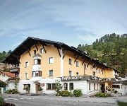
Parkhotel Matrei
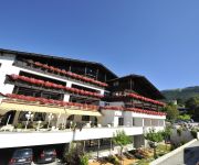
Serles
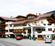
Stolz
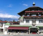
Landgasthof Walzl
Landhof "Wilder Mann"
Sporthotel Igls
Bauernhof Gasthof Neuwirt
Steiner
Isserwirt
Haus Rappold
Videos from this area
These are videos related to the place based on their proximity to this place.
Austria (Österreich) B183 Schönberg im Stubaital - Fulpmes x3
Przejazd drogą B183 Schönberg im Stubaital -Fulpmes x3 Austria (Österreich)
182 tussen Schönberg im Stubaital en de Europabrug Oostenrijk
Een impressie van de 182 tussen Schönberg im Stubaital en de Europabrug Oostenrijk. Goh, wat zou ik deze graag een keer met de Thundercat willen doen.
Hausstrecke im Stubaital mit Gsxr 1000 K6 (GoPro HD)
Eine chillige Runde im Stubaital (Schönberg B182 Richtung Insbruck) mit DB-Eater! :/ Reifen: Michelin Power Pure "E" 190/55/17 Auspuff: Mivv GP mit DB-Killer.
Austria (Österreich) A13 Schönberg Stubaital - Knoten Innsbruck Amras x3
Przejazd drogą A13 Schönberg Stubaital - Knoten Innsbruck Amras Austria (Österreich)
Sturz beim Stubaitaler Bike-Marathon 2006
Unmittelbar nach einem Sturz beim Stubaitaler Bike-Marathon am 30. Juli 2006 entstand diese kurze Szene mit dem Verunfallten. Passiert ist vor allem auf Grund des getragenen Helms praktisch...
Bungee Jumping Europabrücke Brennerautobahn bei Innsbruck 3.8.2013
Bungee Jumping Europabrücke Brennerautobahn bei Innsbruck 3.8.2013.
1969 - Innsbruck, Austria
August 15, 1969, Innsbruck, Austria. Lutheran Heritage Tour Group. (Video 16 of 17 of 1969 Europe Trip - William R. Noack and William R. Noack, Jr.)
Hotel Wipptaler Hof 2008
Hotel direkt an der Brenner-Autobahn in Österreich - Mehr Infos & Fotos auf unserer Homepage: http://www.griechenlandurlaub.net/Unterwegs/Oesterreich/WipptalerHof/
Nieve donde nunca nieva on Board Cam Mercedes G Class CMGE
Buen día de nieve y sol en el llano... ¿verdad, Maleni?
Videos provided by Youtube are under the copyright of their owners.
Attractions and noteworthy things
Distances are based on the centre of the city/town and sightseeing location. This list contains brief abstracts about monuments, holiday activities, national parcs, museums, organisations and more from the area as well as interesting facts about the region itself. Where available, you'll find the corresponding homepage. Otherwise the related wikipedia article.
Innsbruck-Land District
The Bezirk Innsbruck Land is an administrative district in Tyrol, Austria. It encloses the Statutarstadt Innsbruck, and borders Bavaria in the north, the district Schwaz in the east, South Tyrol in Italy to the south, and the district of Imst in the west. Area of the district is 1,986.45 km², with a population of 167,339 (January 1, 2012), and population density of 84 persons per km². Administrative center of the district is Innsbruck.
Patscherkofel
Patscherkofel is a mountain and ski area in Tyrol in western Austria, 7 km (4 mi. ) south of Innsbruck. The peak rises to a summit elevation of 7639 feet (2246 m) above sea level During the 1964 and 1976 Winter Olympics, the mountain was the venue of the men's downhill race, along with the bobsleigh and luge competitions in neighboring Igls. The other five alpine skiing events were held at Axamer Lizum.
Ruetz
The Ruetz River flows from the glacier area of the valley to the Wipptal in north-east direction. Near the famous "Europe bridge" it merges with the Sill River after a route length of appr. 25 km. The river crosses straight the village of Fulpmes providing a nearby power station of the Austrian Railway Services with electricity. As a typical rapid-river the Ruetz is pretty dangerous and full of rapids. Before several defence structures had been constructed, it was quite feared due to floods.
Olympic Sliding Centre Innsbruck
The Olympic Sliding Centre Innsbruck is a venue for bobsleigh, luge and skeleton located in Igls, Austria. The most recent version of the track was completed in 1975 and is the first permanent, combination artificially refrigerated bobsleigh, luge, and skeleton track, serving as a model for other tracks of its kind worldwide. It hosted the bobsleigh, luge, and skeleton competitions for the 2012 Winter Youth Olympics.


