Safety Score: 3,0 of 5.0 based on data from 9 authorites. Meaning we advice caution when travelling to Austria.
Travel warnings are updated daily. Source: Travel Warning Austria. Last Update: 2024-04-23 08:18:23
Delve into Oberbuch
Oberbuch in Politischer Bezirk Linz-Land (Oberösterreich) is a town located in Austria about 102 mi (or 165 km) west of Vienna, the country's capital town.
Time in Oberbuch is now 06:54 PM (Tuesday). The local timezone is named Europe / Vienna with an UTC offset of 2 hours. We know of 11 airports closer to Oberbuch, of which 5 are larger airports. The closest airport in Austria is Linz Airport in a distance of 2 mi (or 3 km), South-East. Besides the airports, there are other travel options available (check left side).
There are several Unesco world heritage sites nearby. The closest heritage site is Historic Centre of Český Krumlov in Czechia at a distance of 40 mi (or 65 km). The closest in Austria is Hallstatt-Dachstein / Salzkammergut Cultural Landscape in a distance of 53 mi (or 65 km), North. In need of a room? We compiled a list of available hotels close to the map centre further down the page.
Since you are here already, you might want to pay a visit to some of the following locations: Holzhausen, Marchtrenk, Ottensheim, Goldworth and Walding. To further explore this place, just scroll down and browse the available info.
Local weather forecast
Todays Local Weather Conditions & Forecast: 7°C / 44 °F
| Morning Temperature | 2°C / 36 °F |
| Evening Temperature | 5°C / 41 °F |
| Night Temperature | 4°C / 40 °F |
| Chance of rainfall | 3% |
| Air Humidity | 73% |
| Air Pressure | 1015 hPa |
| Wind Speed | Moderate breeze with 10 km/h (6 mph) from West |
| Cloud Conditions | Overcast clouds, covering 99% of sky |
| General Conditions | Moderate rain |
Wednesday, 24th of April 2024
8°C (46 °F)
3°C (38 °F)
Light rain, moderate breeze, overcast clouds.
Thursday, 25th of April 2024
9°C (47 °F)
3°C (37 °F)
Light rain, moderate breeze, overcast clouds.
Friday, 26th of April 2024
15°C (59 °F)
7°C (45 °F)
Sky is clear, light breeze, clear sky.
Hotels and Places to Stay
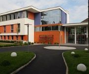
eee hotel
Maxlhaid Hotel
Airotel ***superior
Hotel Vinothek Schwarzer Adler
Gasthof Maxlhaid
Videos from this area
These are videos related to the place based on their proximity to this place.
Fahrsicherheitstraining + Ural
Fahrsicherheitstraining am ÖAMTC-Gelände in Marchtrenk, organisiert von www.ural.at + Coach Erwin Machtlinger.
LKW Fahrsicherheitstraining für Einsatzfahrzeuge
Auschschnitte aus unserem Kurs "Aus- und Weiterbildung für Lenker von Einsatzfahrzeugen" im ÖAMTC Fahrtechnikzentrum in Marchtrenk.
Fahrerschulung für landw. Transporte - Übung 3
Die Fahrerschulung wird von der VLÖ für die Mitglieder veranstaltet. Ziel dieser Übung ist bei einer Anfahrtsgeschwindigkeit von in diesem Beispiel 27 km/h bei einem definierten Bremspunkt...
Bundesheer-Workshop für Assistenzeinsätze in Linz-Hörsching
Direkt zum Artikel: http://www.austrianwings.info/aw/?p=15575.
Lufthansa City Line Embraer 190 takeoff Linz Airport LOWL | LNZ
Airline: Lufthansa City Line Aircraft:Embraer ERJ-190LR (ERJ-190-100 LR) Registration: D-AECI From: Linz To: Frankfurt / Main.
Riesenwuzzlerturnier 2015 Trailer - Pfadfindergruppe Hörsching
Heuer wird am 20. Juni 2015 das dritte Hörschinger Riesenwuzzlerturnier über die Bühne gehen, veranstaltet von der Pfadfindergruppe Hörsching. Lasst euch das Spektakel nicht entgehen! ...
Markus Kral Antiquitäten in Hörsching, Oberösterreich
Zu Markus Kral Antiquitäten aus Hörsching finden Sie ein ausführliches Porträt unter http://firmenabc.at/markus-kral-antiquitaeten_rvQ Ihr Spezialist auf dem Gebiet der Antiquitäten!...
Lufthansa CityLine Canadair Regional Jet CRJ-701ER --- Abflug in Linz (Full HD)
Am Montag, dem 1. September 2014 startete ein Canadair CL-600-2C10 Regional Jet CRJ-701ER der Lufthansa CityLine am Linz Blue Danube Airport (LNZ/LOWL). KANAL-HAUPTSEITE: ...
Schweres Rüstfahrzeug (SRFK) der FF Bludenz
Teilnahme beim Fotoshooting für das Schwere Rüstfahrzeug der Freiwilligen Feuerwehr Bludenz, aufgebaut von Rosenbauer, am Flughafen Linz-Hörsching am 20. Jänner 2014.
Videos provided by Youtube are under the copyright of their owners.
Attractions and noteworthy things
Distances are based on the centre of the city/town and sightseeing location. This list contains brief abstracts about monuments, holiday activities, national parcs, museums, organisations and more from the area as well as interesting facts about the region itself. Where available, you'll find the corresponding homepage. Otherwise the related wikipedia article.
Schloss Hartheim
Schloss Hartheim, located at Alkoven in Upper Austria, some 14 km. from Linz, Austria, became notorious as one of the Nazi Euthanasia killing centers, where the killing program Action T4 took place. The castle was built by Jakob von Aspen in 1600. It is one of the most important Renaissance castles in Austria. In 1898, Prince Camillo Heinrich Starhemberg (1835 - 1900) donated the castle as a gift to the Upper Austria Charity Organization.
Linz Airport
Linz Airport, also known as Blue Danube Airport (and formerly Hörsching Airport), is an airport near Linz, Austria.
Hartheim Euthanasia Centre
The Hartheim Euthanasia Centre was a Nazi killing centre that was part of their euthanasia programme, since also referred to as Action T4. It was housed in Hartheim Castle in the municipality of Alkoven near Linz in Austria.


