Safety Score: 3,0 of 5.0 based on data from 9 authorites. Meaning we advice caution when travelling to Austria.
Travel warnings are updated daily. Source: Travel Warning Austria. Last Update: 2024-04-25 08:17:04
Touring Schubertsiedlung
The district Schubertsiedlung of Tullnerbach-Lawies in Politischer Bezirk Sankt Pölten (Niederösterreich) is a subburb located in Austria about 12 mi west of Vienna, the country's capital place.
Need some hints on where to stay? We compiled a list of available hotels close to the map centre further down the page.
Being here already, you might want to pay a visit to some of the following locations: Pressbaum, Wolfsgraben, Gablitz, Breitenfurt bei Wien and Purkersdorf. To further explore this place, just scroll down and browse the available info.
Local weather forecast
Todays Local Weather Conditions & Forecast: 8°C / 47 °F
| Morning Temperature | 3°C / 37 °F |
| Evening Temperature | 9°C / 49 °F |
| Night Temperature | 5°C / 42 °F |
| Chance of rainfall | 0% |
| Air Humidity | 59% |
| Air Pressure | 1010 hPa |
| Wind Speed | Moderate breeze with 11 km/h (7 mph) from East |
| Cloud Conditions | Overcast clouds, covering 95% of sky |
| General Conditions | Light rain |
Friday, 26th of April 2024
13°C (55 °F)
8°C (46 °F)
Scattered clouds, gentle breeze.
Saturday, 27th of April 2024
15°C (59 °F)
10°C (50 °F)
Sky is clear, gentle breeze, clear sky.
Sunday, 28th of April 2024
16°C (61 °F)
15°C (59 °F)
Broken clouds, gentle breeze.
Hotels and Places to Stay
Wiental
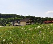
Wienerwaldhof
Schlosspark Mauerbach
Austria Hotel
Land-gut-Hotel Rosner
Cafe-Pension Familie Parzer
Flic-Flac
Videos from this area
These are videos related to the place based on their proximity to this place.
Yamaha MT-07 trip
Das ist die Strecke: http://www.motorrad-tour.com/329.Best%20Of%20-%201?var_tour=5.
Autohaus Köfler & Ernst GmbH in Tullnerbach-Pressbaum, Niederösterreich
http://www.firmenabc.at Zu Köfler & Ernst GmbH Autohaus aus Tullnerbach-Pressbaum finden Sie ein ausführliches Porträt unter http://www.firmenabc.at/koefler-ernst-gmbh-autohaus_Ydj http://www....
OeBB - Koleje w Austrii - Westbahn
Film nakręcono w 2010 na stacjach Kolei Zachodniej ( Westbahn ) w Austrii. Ujęcia do filmu kręcono na stacjach Tullnerbach-Pressbaum i Rekawinkel.
Frag den Giebl Teil 1 - Warum Barfen, warum Frischfleischfütterung
"Frag den Giebl" eine Video Informationsreihe von HiNX gesunde Hundekost http://www.hinx.at Dipl.Tierarzt Rainer Giebl ist Tierarzt in Pressbaum, Niederösterreich, praktiziert seit über...
Videos provided by Youtube are under the copyright of their owners.
Attractions and noteworthy things
Distances are based on the centre of the city/town and sightseeing location. This list contains brief abstracts about monuments, holiday activities, national parcs, museums, organisations and more from the area as well as interesting facts about the region itself. Where available, you'll find the corresponding homepage. Otherwise the related wikipedia article.
Mayerling
Mayerling is a small village in Lower Austria belonging to the municipality of Alland in the district of Baden. It is situated on the Schwechat River, in the Wienerwald (Vienna woods), 15 miles (24 km) southwest of Vienna. From 1550, it was in the possession of the abbey of Heiligenkreuz.
Vienna Woods
The Vienna Woods are forested highlands that form the northeastern foothills of the Northern Limestone Alps in the states of Lower Austria and Vienna. The 45 kilometres long and 20–30 kilometres ( ) wide range of hills is heavily wooded and a popular recreation area with the Viennese.
Hietzing
Hietzing is the 13th municipal District of Vienna . It is located west of the central districts, west of Meidling. Hietzing is a heavily populated urban area with many residential buildings, but also contains large areas of the Vienna Woods, along with Schönbrunn Palace.
Hütteldorf
Hütteldorf is a part of Vienna's 14th district, Penzing. It is located in the west of Vienna, but roughly in the geographical center of the district, stretching roughly from Deutschordenstraße (which forms the border to Baumgarten) in the east to Wolf in der Au in the west, where Hütteldorf borders Hadersdorf-Weidlingau. Hütteldorf is well known throughout Austria and beyond as the site of the Gerhard-Hanappi-Stadion, the stadium in which Rapid Vienna hosts its home games.
Gerhard Hanappi Stadium
The Gerhard Hanappi Stadion is a football stadion in Hütteldorf, in the west of Vienna, Austria. It is the home ground of Rapid Vienna. It was officially opened in 1977 as "Weststadion" (Western stadium). In 1980 it was renamed, to honor its architect, Austrian football player Gerhard Hanappi. Among fans the stadium is also known as "Sankt Hanappi" (Saint Hanappi), which relates to the fans' slogan Rapid ist uns're Religion ("Rapid is our religion").
Wotruba Church
The Kirche Zur Heiligsten Dreifaltigkeit (English: Church of the Most Holy Trinity) in Vienna, better known as the Wotruba Church, is located on the Sankt Georgenberg in Mauer (corner of Rysergasse and Georgengasse) in Liesing, the 23rd District of Vienna. It was built between August 1974 and October 1976 on the basis of a model by Fritz Wotruba. Wotruba died before the completion of the church, which was inspired by a visit to Chartres Cathedral.
Via Sacra (Wienerwald)
The Via Sacra (Latin for Holy Road) is a centuries old pilgrimage trail in Lower Austria. It starts in Vienna and passes through the Wienerwald to Mariazell. The trail goes from Mödling through Gaaden, Heiligenkreuz, Alland, and the pilgrimage destination Hafnerberg, first into the Triestingtal, and then over the Gerichtsberg into the Gölsental and Traisental. Along it there are many remarkable shrines. The pilgrims have been an economic factor in the area since early in its history.
Mauerbach Charterhouse
Mauerbach Charterhouse, in Mauerbach on the outskirts of Vienna, Austria, is a former Carthusian monastery, or charterhouse. Founded in 1314 and rebuilt in the 17th and 18th centuries, the Baroque monastic complex is one of the most important structures of its kind in Austria. Since 1984 the former charterhouse has been undergoing restoration by the Austrian Federal Monuments Office, which has its workshops there.
Penzing (Vienna)
Penzing is the 14th District of Vienna and consists of the boroughs of Penzing, Breitensee, Baumgarten, Hütteldorf and Hadersdorf-Weidlingau. In the west, it shares a border with Purkersdorf and Mauerbach. A large portion of the district is made up of greenery, including the Steinhof park, the Dehnepark and a portion of the Wienerwald.
Mauer, Vienna
Mauer is a former village of Lower Austria that since 1938 has been part of Vienna. Today it is part of the 23rd District of Vienna, Liesing. Its name literally means "wall".
Mödling District
Bezirk Mödling is a district of the state of Lower Austria in Austria.
Mayerling Incident
The Mayerling Incident is the series of events leading to the apparent murder-suicide of Crown Prince Rudolf of Austria (21 August 1858 – 30 January 1889) and his lover Baroness Mary Vetsera (19 March 1871 – 30 January 1889). Rudolf was the only son of Emperor Franz Josef I of Austria and Empress Elisabeth, and heir to the throne of the combined Austrian-Hungarian Empire. Rudolf's mistress was the daughter of the late Baron Albin Vetsera, a diplomat at the Austrian court.
Lainzer Tiergarten
The Lainzer Tiergarten is a 24.50 km² wildlife preserve in the southwest corner of Vienna, Austria, 80% of it being covered in woodland. It dates back to 1561, when Ferdinand I of Austria created it as a fenced-in hunting ground for his family to use. Since 1919, it has been open to the public. Its name consists of its location by the Lainz district of Vienna's 13th District, and Tiergarten, which means zoo (literally, "animal garden").
Exelberg Telecommunication Tower
Exelberg Telecommunication Tower is a 109 metre tall tower built of reinforced concrete on Exel mountain at Vienna, Austria. Exelberg Telecommunication Tower is used for directional radio services.
Sanatorium Purkersdorf
The Sanatorium Purkersdorf was built as a sanatorium in Purkersdorf, Wien-Umgebung, Lower Austria. It was built in 1904-05 by the architect Josef Hoffmann for the industrialist Victor Zuckerkandl and is an example of the style of the Viennese Secession in architecture.
Wienerwald Tunnel
The Wienerwald Tunnel is a 13.35-kilometre-long railway tunnel near Vienna in service since 9 December 2012 passing underneath the northern part of Wienerwald between Gablitz and Mauerbach. It is part of a new 250 kilometres per hour section between Vienna and St. Pölten which is part of the Western Railway (Austria).
Sandstein-Wienerwald natural park
The Sandstein-Wienerwald natural park (Naturpark Sandsteinwienerwald) is a natural park near Purkersdorf in the Vienna Woods (Wienerwald), Austria. Although a protected area under Austrian law, it is freely accessible. The park's 77 hectare area is mostly covered by oak forest. (The German version of this web page says Beech forest. ) Its highest point is the Rudolfshöhe (475 m), on whose top a lookout tower has been constructed.
Kollegium Kalksburg
The Kollegium Kalksburg is Catholic private school in the Kalksburg, 23rd district of Vienna. http://books. google. com/books?id=drXFHAAACAAJ&dq=%22Kollegium+Kalksburg%22&hl=en&sa=X&ei=3QcVT87_Danu0gGQ_NWGAw&ved=0CDwQ6AEwAQ The school was founded in 1856 by the Jesuits, who were in charge until 1988. It was then given under the authority of "Vereinigung von Ordensschulen Österreichs".
Kalksburg
Kalksburg is a former municipality in Lower Austria that is now a part of the 23rd Viennese district Liesing. Today, the cadastral commune Atzgersdorf has got an area of 375,7 hectare.
Gaugefechtsstand Wien
The Gaugefechtsstand Wien (regional combat command center Vienna) was a World War II subterranean command bunker situated in the densely forested Wienerwald western parts of Ottakring, the 16th district of Vienna. Commonly known as the Schirach-Bunker (named after the Nazi governor for the Reichsgau Wien, Baldur von Schirach), the facilities were constructed between 1942 and 1945 as a massive underground extension to barracks that had been established in 1940.
Gallitzinberg
The Gallitzinberg (449 m) is a forested hill in the West of Austria's capital, Vienna. While it is relatively unconspicous in the broader context of the Northeastern end of the Wienerwald mountain range, it is nevertheless remarkable because of its multifaceted history, and because it functions as an important recreational area in the Western uphill part of the densely populated Ottakring district.
Aubad
The Aubad is a 50,000-square-metre man-made lake in Tulln on the Danube, Austria. It is the centerpiece of a recreational park (Erholungspark) that includes facilities for swimming, as well as a 10-hectare area for sport and leisure activities—such as soccer, volleyball, baseball and basketball—and 15 hectares of woodland. The lake and park are popular summertime resorts for both townspeople and tourists.
Comagena
Comagena was a fortified Roman camp on the Danube, on the site of the modern town of Tulln on the Danube in Austria. Built as a defensive work along the Norican frontier, it originally housed an ala of up to 500 cavalry troops (ala I Commagenorum). From its exposed situation, it was able to guard a militarily significant ford over the Danube and control the valley lowlands for a good distance upstream and down.
Wienerwaldsee
The Wienerwaldsee is a shallow reservoir, located 20 kilometres west of Vienna, Austria. It is located just north of Austria's main motorway, the West Autobahn, between Tullnerbach and Neu-Purkersdorf. It was created over three years, 1895–1897, by damming the Wienfluss and letting it fill the valley behind. The area around the lake is a nature conservation area. On the northern shore, near the weir, stands the statue of Wilhelm Kress.
Egon-Schiele-Museum
The Egon-Schiele-Museum in Tulln is a Museum in Lower Austria dedicated to the Austrian painter Egon Schiele who was born in Tulln.


