Safety Score: 3,0 of 5.0 based on data from 9 authorites. Meaning we advice caution when travelling to Austria.
Travel warnings are updated daily. Source: Travel Warning Austria. Last Update: 2024-04-23 08:18:23
Explore Asperlkeller
The district Asperlkeller of Unterrohrbach in Politischer Bezirk Korneuburg (Niederösterreich) is located in Austria about 13 mi north of Vienna, the country's capital.
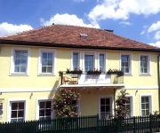
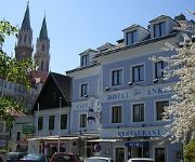
If you need a place to sleep, we compiled a list of available hotels close to the map centre further down the page.
Depending on your travel schedule, you might want to pay a visit to some of the following locations: Spillern, Leobendorf, Leitzersdorf, Niederhollabrunn and Korneuburg. To further explore this place, just scroll down and browse the available info.
Local weather forecast
Todays Local Weather Conditions & Forecast: 5°C / 41 °F
| Morning Temperature | 5°C / 41 °F |
| Evening Temperature | 9°C / 48 °F |
| Night Temperature | 5°C / 41 °F |
| Chance of rainfall | 5% |
| Air Humidity | 97% |
| Air Pressure | 1008 hPa |
| Wind Speed | Moderate breeze with 9 km/h (6 mph) from East |
| Cloud Conditions | Overcast clouds, covering 100% of sky |
| General Conditions | Light rain |
Thursday, 25th of April 2024
9°C (49 °F)
6°C (43 °F)
Broken clouds, moderate breeze.
Friday, 26th of April 2024
13°C (55 °F)
10°C (50 °F)
Few clouds, gentle breeze.
Saturday, 27th of April 2024
16°C (60 °F)
13°C (56 °F)
Sky is clear, fresh breeze, clear sky.
Hotels and Places to Stay
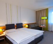
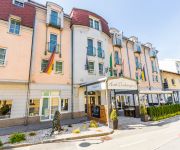
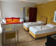
City Hotel Stockerau
Familie HOPFELD - Hotel DREIKÖNIGSHOF
Schrannenhof Hotel-Residenz
Alte Post Greifenstein
Alte Mühle
Anker
Schwarzer Adler Gasthaus
Hauerhof 99
Ferienwohnung Wagner
Videos from this area
These are videos related to the place based on their proximity to this place.
Замок Кройценштайн,Корнойбург-Burg Kreuzenstein,Korneuburg
Очередной ролик из серии об Австрийских замках.На этот раз замок Кройценштайн в Нижней Австрии.
Austria (Österreich) S1 Knoten Korneuburg - Knoten Eibesbrunn x3
Przejazd drogą S1 Knoten Korneuburg - Knoten Eibesbrunn Austria (Österreich)
Perwein Baumaschinen-Systeme GmbH in Korneuburg - Baggerschaufeln, Baumaschinen-Technik
http://www.firmenabc.at Zu Perwein Baumaschinen-Systeme GmbH aus Korneuburg in Niederösterreich finden Sie ein ausführliches Porträt unter ...
Hochwasser in Korneuburg - Flood in Korneuburg - Austria
Hochwasser in der Korneuburger Siedlung entlang der Donau am 4. Juni 2013.
Haller Erich Bauma-Technik in Korneuburg, Niederösterreich
Zu Haller Erich Bauma-Technik aus Korneuburg finden Sie ein ausführliches Porträt unter http://firmenabc.at/haller-erich-baumatechnik_Kfc Seit wann gibt es das Unternehmen? Das Unternehmen...
Patrizia Genner in Korneuburg, Niederösterreich
Zu Patrizia Genner aus Korneuburg finden Sie ein ausführliches Porträt unter http://firmenabc.at/patrizia-genner_evp Die eigene Persönlichkeit durch die neuesten Modetrends und durch die...
Die großen 10 m. Udo Huber aus dem Dorian(Q)Gray in Leobendorf bei Korneuburg Teil 4
Die 100.Sendung aus dem Dorian (Q)Gray aus dem Jahr 1991 . Mit dabei als Gäste : Holly Johnson,Reinhold Bilgeri,Reinhard Fendrich,Klaus Eberhartinger,Mo,Etta Scollo,Christian Kolonovits,Dieter...
PQT2012_Burg Kreuzenstein (2D)
27.Mai 2012 Tour zur Burg Kreuzenstein mit Greifvogelschau Trip to Kreuzenstein castle with birds of prey show.
Greifvogelvorführung auf der Adlerwarte Kreuzenstein
Mitschnitt einer Greifvogelvorführung auf der Adlerwarte der Burg Kreuzenstein (Leobendorf/NÖ)
Videos provided by Youtube are under the copyright of their owners.
Attractions and noteworthy things
Distances are based on the centre of the city/town and sightseeing location. This list contains brief abstracts about monuments, holiday activities, national parcs, museums, organisations and more from the area as well as interesting facts about the region itself. Where available, you'll find the corresponding homepage. Otherwise the related wikipedia article.
Sendeanlage Bisamberg
The Sendeanlage Bisamberg was an Austrian medium wave transmission facility built in 1933 and demolished on February 24, 2010. The original transmitter was destroyed at the end of World War II, but was later rebuilt. It had two guyed steel framework masts, one with a height of 265 metres and another with a height of 120 metres. Both masts were insulated against ground.
Hermannskogel
The Hermannskogel is a hill in Vienna. At 542 metres above sea level, it is the highest natural point in the city of Vienna. It lies on the border to Lower Austria. The Habsburgwarte, which stands atop the Hermannskogel marked until 1918 the kilometre zero in cartographic measurements used in Austria-Hungary.
Kahlenberg
Kahlenberg is a mountain located in the 19th District within Vienna, Austria.
Döbling
Döbling is the 19th District in the city of Vienna, Austria . It is located on the north end from the central districts, north of the districts Alsergrund and Währing. Döbling has some heavily populated urban areas with many residential buildings, and borders the Vienna Woods. It hosts some of the most expensive residential areas such as Grinzing, Sievering, Neustift am Walde and Kaasgraben and is also the site of a large number of Heurigen restaurants.
Kahlenberg Transmitter
The Kahlenberg Transmitter is a facility for FM- and TV on the Kahlenberg near Vienna. It was established in 1953 and used until 1956 an antenna on the observation tower Stefaniewarte. From 1956 to 1974 a 129 metre high guyed mast built of lattice steel was used. Since 1974 a 165 metre high guyed steel tube mast has been used, which is equipped with rooms of technical equipment.
Schloß Pötzleinsdorf
Schloß Pötzleinsdorf or Schloss Pötzleinsdorf is a former palace in Pötzleinsdorf, Vienna. The palace was a nobleman's residence in the mid-17th century, but in the next century the building became known as Ricci'scher Freihof, after a merchant called Ricci who used it for cloth manufacture and silk dying. The estate was bought by Countess Philippina von Herberstein toward the end of the 18th century.
Sisi Chapel
The Sisi Chapel is located in Sievering part of in the Viennese District of Döbling near the Vienna Woods (Wienerwald).
Korneuburg District
The political district Bezirk Korneuburg is located in Lower Austria and borders Vienna to the north.
De Lacy
de Lacy (Laci, Lacie, Lascy, Lacey) is the surname of an old Norman noble family originating from Lassy (Calvados). The first records are about Hugh de Lacy (1020–1049). Descendent of Hugh de Lacy left Normandy and travelled to England along with William the Conqueror. Walter and Ilbert de Lacy fought in the battle of Hastings. The family took a major role in the Norman conquest of England and Ireland.
Leopoldsberg
The Leopoldsberg (425 m, 1,394 ft) is perhaps Vienna’s most famous hill, towering over the Danube and the city. Leopoldberg’s most prominent landmark is the church which stands at the top, and which is clearly visible from Vienna below. The construction of Saint Leopold's Church on Leopoldsberg began in 1679; an expansion following a design by Antonio Beduzzi was undertaken from 1718 to 1730. Other renovations were to follow.
Wien-Umgebung District
Bezirk Wien-Umgebung is a district of the state of Lower Austria in Austria. The district comprises four non-contiguous districts on the outer fringes of Vienna: these are Klosterneuburg and Gerasdorf to the north of the city, Schwechat to its south-east and Purkersdorf on Vienna's western side. Vienna International Airport, the headquarters of Austrian Airlines, and the headquarters of Niki are in the city of Schwechat, in the district.
Exelberg Telecommunication Tower
Exelberg Telecommunication Tower is a 109 metre tall tower built of reinforced concrete on Exel mountain at Vienna, Austria. Exelberg Telecommunication Tower is used for directional radio services.
Institute of Science and Technology, Austria
The Institute of Science and Technology Austria, popularly known as IST Austria, is an institute of basic research located in Klosterneuburg, close to Vienna (Austria). The draft concept was developed by the Austrian physicist Anton Zeilinger in 2002. Preparation work started in 2007.
MODUL University Vienna
MODUL University Vienna (MU Vienna) is a private university established in 2007 in Vienna, Austria, focusing on social and economic development, particularly in the areas of tourism, new media information technology, sustainability, business management, and public governance. The university consists of four departments which reflect the core competences, educational, and research focii of the university.
Hackenberg, Vienna
The Hackenberg is a hill in the suburb of Sievering in the 19th district of Vienna, Döbling. It is 306 metres tall. Hackenberg is covered in sand and gravel. The Arbesbach flows around the hill’s north-eastern flank, while the Krottenbach flows around its south-western flank, although both rivers have been enclosed in canals in this area. The hill extends as far as the Krim (an area in Unterdöbling) in the west.
Arbesbach (river)
The Arbesbach, also known as the Erbsenbach and Sieveringerbach, is a stream in the 19th district of Vienna, Döbling. The stream, partially enclosed in a canal, is the most important tributary of the Krottenbach. Almost all of its 4.3 kilometres lie within the suburb of Sievering.
Kaasgrabenkirche
The Kaasgrabenkirche, also known as the Wallfahrtskirche “Mariä Schmerzen”, is a Roman Catholic parish and pilgrimage church in the suburb of Grinzing in the 19th district of Vienna, Döbling. The church has been managed since 1903 by the order of the Oblates of St. Francis de Sales and is equally the seat of the branch of the order covering Austria and Southern Germany. It has had the status of a parish church since 1939.
Habsburgwarte
The Habsburgwarte is a 27 metre-tall tower that stands on Hermannskogel hill in Vienna. It was built by architect Franz von Neumann to resemble a medieval tower. The construction of the Habsburgwarte was funded by the Österreichische Touristenklub (Austrian Tourist Club) to mark the Emperor Franz Joseph I’s 40th jubilee in 1888. It was completed in 1889. In 1972, the tower was listed. Today, it is used as a lookout.
Meiselberg
The Meiselberg is a hill in the 19th district of Vienna, Döbling. It is 291 metres tall
Schenkenberg, Vienna
The Schenkenberg is a hill in the 19th district of Vienna, Döbling. It is 345 metres tall.
Burg Greifenstein
Burg Greifenstein is a castle in Lower Austria, Austria, overlooking the Danube.
Burg Kreuzenstein
Burg Kreuzenstein is a castle near Leobendorf in Lower Austria, Austria. It was constructed in the 19th century by the Wilczek family. Kreuzenstein is interesting in that it was constructed out of sections of medieval structures purchased by the family from all over Europe to form an authentic-looking castle. Thus, the castle can be considered both a 'neo-' and 'original' medieval structure. The castle is sometimes used as a location for films.
Kahlenbergerdorf Parish Church
The Kahlenbergerdorf Parish Church (Kahlenbergerdorfer Pfarrkirche) is a Roman Catholic parish church in the suburb of Kahlenbergerdorf in the 19th district of Vienna, Döbling. It is dedicated to Saint George.
Heiligenstädter Friedhof
Heiligenstädter Friedhof is a cemetery in Döbling, the 19th district of Vienna, Austria. It is named after the Heiligenstadt neighbourhood of Döbling. The cemetery is among the oldest of the Austrian capital, with an ossuary existing at the site from approx. 1500 and the first walls around the yard being erected in 1831. It comprises an area of 20,315 square metres, with 2,655 grave sites.
Battle of Leitzersdorf
The Battle of Leitzersdorf was a battle between the Holy Roman Empire and the Kingdom of Hungary in 1484. Fuelled by the earlier conflicts of Matthias Corvinus and Frederick III, Holy Roman Emperor it marked the end of anti-Ottoman preparations and initiations of a holy war. It was the only open field battle of the Austro-Hungarian War, and the defeat meant – in long terms – the loss of the Archduchy of Austria for the Holy Roman Empire.


