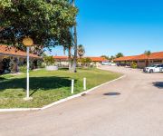
Delve into North Plantations
The district North Plantations of Carnarvon in Carnarvon (Western Australia) is a subburb in Australia about 2,223 mi west of Canberra, the country's capital town.
If you need a hotel, we compiled a list of available hotels close to the map centre further down the page.
To further explore this place, just scroll down and browse the available info.
Hotels and Places to Stay
Carnarvon Motel
BEST WESTERN HOSPITALITY INN
Videos from this area
These are videos related to the place based on their proximity to this place.
Vertrek Ralph Tuijn vanuit Carnarvon
Start van de TriFinance Ocean Challenge op Woensdag 1 augustus 2012.
Offroad warm up in Toyota Hilux in - W.Australia - Carnarvon
This is a vid before we thrashed the poor thing. As you can hear, the exhaust is broken and sounds rubbish. Don't worry, the dogs didn't get driven over.
Stefano and Yaisa's fishing & camping trip Part I
Part I of our trip to Carnarvon, Coral Bay, Kalbarri and the Pinnacle Desert.
Vertrek vanaf de kant in Carnarvon
vertrek van Ralph Tuijn voor de TriFinance Ocean Challenge op 1 augustus vanuit Carnarvon, Australië.
Prawning Jetty Part 1
Fishing at one of the local Jetties in Carnarvon WA turned into one of the hottest bream sessions i had ever experienced on this day alone we would have caught at least 60 bream in this day...
Prawning Jetty Part 3
After going to this spot on the 3rd and 4th of july (part one and two) and seeing the amounts of fish available , we gave it a rest for one day and headed back out on the 6th of july to see...
Videos provided by Youtube are under the copyright of their owners.
Attractions and noteworthy things
Distances are based on the centre of the city/town and sightseeing location. This list contains brief abstracts about monuments, holiday activities, national parcs, museums, organisations and more from the area as well as interesting facts about the region itself. Where available, you'll find the corresponding homepage. Otherwise the related wikipedia article.
Carnarvon, Western Australia
Carnarvon is a coastal town situated approximately 900 kilometres north of Perth, Western Australia. It lies at the mouth of the Gascoyne River on the Indian Ocean. The popular Shark Bay world heritage area lies to the south of the town and the Ningaloo Reef lies to the north. At the 2006 census, Carnarvon had a population of 5,283.
St Mary's Star of the Sea Catholic School
St Mary's Star of the Sea Catholic School is a coeducational school for students from Kindergarten - Year 10 located in Carnarvon, Western Australia, a coastal town located 900 kilometres north of Perth (just south of the Tropic of Capricorn). St Mary’s has a current enrollment of approximately 300 students. The school's students come from Carnarvon itself or the surrounding areas and the school involves itself in many of the sporting and community activities in Carnarvon.
Gascoyne River
At 865 kilometres, the Gascoyne River is the longest river in Western Australia. The river rises as the Gascoyne River (North Branch) on Three Rivers Station near the Great Northern Highway, 100 kilometres northeast of Peak Hill, and flows into Shark Bay and the Indian Ocean at Carnarvon. It is joined by the 561 kilometres long Lyons River about 160 kilometres above its mouth which together provide a catchment area of 68,326 square kilometres .
Carnarvon Tracking Station
The Carnarvon Tracking Station in Western Australia was a tracking station built in 1963 for use by NASA for the Gemini program, the second step for NASA's plan to put a human on the Moon. It replaced the Muchea Tracking Station and used some of the equipment from Project Mercury. The Station also included an FPQ-6 precision tracking radar, a STADAN scientific satellite tracking facility, a planet Jupiter monitoring system, and a Solar Particle Alert Network (SPAN) facility.
Shire of Carnarvon
The Shire of Carnarvon is a local government area in the Gascoyne region of Western Australia, located about 900 kilometres north of the state capital, Perth. The Shire covers an area of 46,664 square kilometres, and its seat of government is the town of Carnarvon. The major industries in the area are wool, agriculture and, more recently, tourism.
OTC Satellite Earth Station Carnarvon
The OTC Satellite Earth Station Carnarvon was established to meet the need for more reliable and higher quality communications for NASA's Apollo Moon project. NASA contracted Australia's Overseas Telecommunications Commission (OTC) "to provide an earth station near Carnarvon, Western Australia to link the NASA tracking station in that area to the control centre in the USA", also contracting the COMSAT Corporation to launch three Intelsat-2 communications satellites.
Carnarvon Senior High School
Carnarvon Senior High School is a comprehensive public high school located in Carnarvon, a regional centre 906 kilometres north west of Perth, Western Australia. The school was established in 1954 and by 2012 had an enrolment of 196 students between Year 8 and Year 12, approximately 46% of whom were Aboriginal. Initially opened as a junior high school, the school was upgraded in 1974 to become senior high school.


