Touring Balcatta
The district Balcatta of in Western Australia with it's 9,495 residents Balcatta is a subburb located in Australia about 1,922 mi west of Canberra, the country's capital place.
Need some hints on where to stay? We compiled a list of available hotels close to the map centre further down the page.
Being here already, you might want to pay a visit to some of the following locations: City of Cockburn, Rockingham, , and . To further explore this place, just scroll down and browse the available info.
Local weather forecast
Todays Local Weather Conditions & Forecast: 27°C / 80 °F
| Morning Temperature | 19°C / 67 °F |
| Evening Temperature | 23°C / 74 °F |
| Night Temperature | 22°C / 71 °F |
| Chance of rainfall | 0% |
| Air Humidity | 30% |
| Air Pressure | 1023 hPa |
| Wind Speed | Moderate breeze with 9 km/h (6 mph) from North-East |
| Cloud Conditions | Few clouds, covering 18% of sky |
| General Conditions | Few clouds |
Sunday, 21st of April 2024
25°C (76 °F)
19°C (67 °F)
Sky is clear, gentle breeze, clear sky.
Monday, 22nd of April 2024
21°C (70 °F)
16°C (61 °F)
Overcast clouds, fresh breeze.
Tuesday, 23rd of April 2024
18°C (64 °F)
15°C (59 °F)
Broken clouds, fresh breeze.
Hotels and Places to Stay
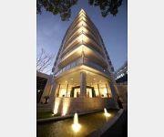
The Richardson Hotel and Spa
Sage Perth
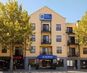
BEST WESTERN NORTHBRIDGE APART
QUEST ON RHEOLA SERVICED APTS
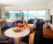
SEASHELLS SERVICED APARTMENTS
NORTHBRIDGE HOTEL
QUEST SCARBOROUGH
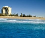
Rendezvous Perth Scarborough
Lakeside Retreat
Trigg Retreat Bed and Breakfast
Videos from this area
These are videos related to the place based on their proximity to this place.
Perth House Rental Hamersley Villa 3BR/1BA by Perth Property Management
Check out http://www.totalcarepropertymanagement.com.au/ to learn about our "Perth Property Management" services! You can also check out http://www.totalcarepropertymanagement.com.au/rentals/.
Pet City Balcatta Intro
Pet City Balcatta For pets and pet products visit us at: http://petcitywa.com.au/stores/balcatta.
Total Action Air Conditioning and Solar Power in Perth, WA
Total Action Installed Ducted Reverse Cycle Air Conditioning and a 1.6kw Premium Solar Power for Mark from Hamersley, WA.
Lego AK-47 Shooting Practise
A normal Lego Citizen Tries out an AK-47. And something bad goes wrong.
Primary Industry Jobs In Western Australia - Osborne Park WA | (08) 9322 9722
http://www.westjobs.com.au Primary Industry Jobs In Western Australia - Osborne Park WA | (08) 9322 9722 Jobs in Perth and WA for jobseekers. Search Mining jobs, Oil & Gas, Construction,...
Hair Salon Osborne Park Call (08) 9344 1321
http://www.hair-salon-osborne-park.com Call us now on (08) 9344 1321 or visit at 225 Main Street, Osborne Park 6017 WA.
Reilly Tattoo 2014
If you're considering getting a tattoo, or are planning to add to your collection -- we invite you to come and take a look inside Reilly Tattoo. We're located just off the freeway in Main Street,...
1EN851 Australia Post Rider 14-02-14
King Edward St, Osborne Park WA @ 0832hrs 14-02-14. AP rider comes around the corner from the street on the left, turning immediately into the cycle lane in the wrong direction. He spots...
Videos provided by Youtube are under the copyright of their owners.
Attractions and noteworthy things
Distances are based on the centre of the city/town and sightseeing location. This list contains brief abstracts about monuments, holiday activities, national parcs, museums, organisations and more from the area as well as interesting facts about the region itself. Where available, you'll find the corresponding homepage. Otherwise the related wikipedia article.
City of Stirling
The City of Stirling is a local government area in the northern suburbs of the Western Australian capital city of Perth, located about 10 kilometres north of Perth's central business district. The City covers an area of 105.2 square kilometres and had a population of 205,960 in 2011, making it the largest local government area by population in Western Australia.
Balcatta, Western Australia
Balcatta is a suburb of Perth, Western Australia. Its local government area is the City of Stirling. It is a primarily middle-class suburb made up of mainly Italian Catholic, Greek and Macedonian Orthodox families, as well as many families from other European Orthodox religions. It is also one of the largest suburbs in the northern part of the Perth metropolitan area. Much of Balcatta is a commercial and industrial area.
Balga, Western Australia
Balga is a suburb of Perth, the capital city of Western Australia, 13 kilometres north of Perth city's central business district (CBD). Its Local Government Area is the City of Stirling. The name "Balga" was adopted in 1954 and is the Noongar word for the indigenous grass tree Xanthorrhoea preissii. It was designed by the State Housing Commission along with Nollamara and Westminster as part of the "Mirrabooka Project", and the laying of streets and building of homes commenced in the 1960s.
Gwelup, Western Australia
Gwelup is a suburb of Perth, the capital city of Western Australia, and is located 12 km north of Perth's central business district (CBD) along the Mitchell Freeway. Its Local Government Area is the City of Stirling.
Hamersley, Western Australia
Hamersley is a residential suburb 14 kilometres north-northwest of the central business district of Perth, the capital of Western Australia, and six kilometres (4 mi) from the Indian Ocean. The suburb adjoins two major arterial roads—Mitchell Freeway to the west and Reid Highway to the south—and is within the City of Stirling local government area.
Joondanna, Western Australia
Joondanna is a suburb of Perth, Western Australia. Its Local Government Area is the City of Stirling. There is a Catholic church, St. Denis, in Joondanna, and a small Catholic primary school of the same name. Joondanna is named after a farm said to be owned by an early settler in the area.
Nollamara, Western Australia
Nollamara is a suburb of Perth, Western Australia. Its Local Government Area is the City of Stirling. The name "Nollamara" is the Aboriginal word for the plant known as the Black Kangaroo Paw.
Osborne Park, Western Australia
Osborne Park is a suburb of Perth, Western Australia in the local government area of the City of Stirling. Osborne Park was named after William Osborne, a butcher who owned an abattoirs on Wanneroo Road and was elected to the Perth Road Board (the City of Stirling's predecessor), in 1875. The suburb was originally market gardens, due to rich peaty soil from the swamps between Lake Monger and Herdsman Lake. The area was popular among Chinese and Italian settlers.
Tuart Hill, Western Australia
Tuart Hill is a suburb of Perth, Western Australia. Tuart Hill is named after the Tuart tree (Eucalyptus gomphocephala) that once grew extensively throughout the area, especially around Dog Swamp. In 1914 the suburb name of Grenville was proposed as a name for the suburb by the Grenville Progress Association, but not accepted due to its likeness to Granville in New South Wales.
Westminster, Western Australia
Westminster is a northern suburb of Perth, Western Australia. Its Local Government Area is the City of Stirling. Westminster was formerly the southern part of Balga but was renamed in 1994 at the request of residents. This was the name of the original estate that existed before residential subdivision. Between 1936 and 1955, a limestone road named "Westminster Boulevard" passed through the area. Westminster is served by a small shopping centre, Stirling Central.
Yokine, Western Australia
Yokine is a suburb of Perth, Western Australia. Its local government area is the City of Stirling.
Division of Stirling
The Division of Stirling is an Australian electoral division in the inner northern and beachside suburbs of Perth, Western Australia. It includes the suburbs of Balcatta, Balga, Carine, Innaloo, Nollamara, North Beach, Scarborough, Stirling, Trigg and Yokine. The electorate was created in the Western Australia redistribution of 10 August 1955, and was named after Sir James Stirling, the 19th-century founding lieutenant governor and governor of Western Australia.
Stirling railway station, Perth
Stirling railway station is a Transperth rail and bus interchange located 9 kilometres northwest of Perth railway station in Western Australia, on the Joondalup Line.
Mirrabooka bus station
The Mirrabooka bus station is a Transperth bus station located next to Mirrabooka Square Shopping Centre in the suburb of Mirrabooka, about 12 kilometres north of Perth. The Public Transport Authority is currently (as of February 2011) upgrading the bus station with new signage, paint and more accessible paths.
Glendalough railway station
Glendalough Station is a Transperth railway station 5 km from Perth railway station in Western Australia. It is on the Joondalup Line.
720 ABC Perth
720 ABC Perth is a radio station located in Perth, Western Australia broadcasting on 720 kHz on the AM band. The station is a member of the Australian Broadcasting Corporation's ABC Local Radio network.
Girrawheen, Western Australia
Girrawheen is a northern suburb of Perth, the capital city of Western Australia. Its Local Government Area is the City of Wanneroo.
Warwick Senior High School
Warwick Senior High School is a co-educational government school in the northern suburbs of Perth, Western Australia. It teaches years 8 to 12 in the Australian education system, and has around 900 students. It was founded in 1981. Specialist programs offered include drama, netball, dance, football, and music .
Westfield Innaloo
Westfield Innaloo is a major shopping centre in the northern suburbs of Perth, located approximately 8 km north-west of the CBD at the corner of Scarborough Beach Road and Ellen Stirling Boulevard (formerly Oswald Street) in Innaloo. This location is now part of Stirling City Centre. The centre is approximately 1 km, or 3 minutes by bus, from Stirling Train Station.
Stirling, Western Australia
Stirling is a suburb of Perth, the capital city of Western Australia, about 10 km north of Perth's central business district (CBD) along the Mitchell Freeway. Its local government area is the City of Stirling, whose council offices and administration centre are located in the southwest of the mostly residential suburb.
Mirrabooka Senior High School
Mirrabooka Senior High School is a co-educational state high school in Mirrabooka in the northern suburbs of Perth, Western Australia. It teaches years 8 to 12 in the Australian education system, and has around 640 students.
John Septimus Roe Anglican Community School
John Septimus Roe Anglican Community School (JSRACS or JSR) is a dual-campus, co-educational private school in Perth, Western Australia named after the notable West Australian and first Surveyor-General of Western Australia, John Septimus Roe. It is a largest member of the Anglican Schools Commission and also noted for having the longest name of any school in Western Australia
Servite College
Servite College is a co-educational Roman Catholic high school in the Perth suburb of Tuart Hill, Western Australia. The school is operated by the Servite Order.
Balga Senior High School
Balga Senior High School is a public co-educational high school in Western Australia. The school is located on Markham Way in the suburb of Balga. Established in 1970, the school caters for students in Year 8 to 12. A fire was delibrately lit at the school in 2002 causing $200,000 worth of damage. Merv Hammond, the school principal from 1995 to 2006, was named Principal of the Year by the then education minister Alan Carpenter in 2002.
Balcatta Senior High School
Balcatta Senior High School is a public co-educational high school in Perth, Western Australia. The school is located on Poincaire Road in the Perth suburb of Balcatta.


