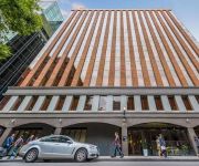
Delve into West Melbourne
The district West Melbourne of in Melbourne (Victoria) with it's 3,037 habitants West Melbourne is a district located in Australia about 290 mi south-west of Canberra, the country's capital town.
In need of a room? We compiled a list of available hotels close to the map centre further down the page.
Since you are here already, you might want to pay a visit to some of the following locations: Melbourne, Currie, Hay, Canberra and . To further explore this place, just scroll down and browse the available info.
Local weather forecast
Todays Local Weather Conditions & Forecast: 17°C / 63 °F
| Morning Temperature | 12°C / 53 °F |
| Evening Temperature | 15°C / 60 °F |
| Night Temperature | 13°C / 56 °F |
| Chance of rainfall | 0% |
| Air Humidity | 55% |
| Air Pressure | 1029 hPa |
| Wind Speed | Gentle Breeze with 8 km/h (5 mph) from North |
| Cloud Conditions | Clear sky, covering 6% of sky |
| General Conditions | Sky is clear |
Sunday, 21st of April 2024
16°C (61 °F)
13°C (56 °F)
Scattered clouds, light breeze.
Monday, 22nd of April 2024
21°C (69 °F)
16°C (61 °F)
Sky is clear, light breeze, clear sky.
Tuesday, 23rd of April 2024
23°C (73 °F)
19°C (66 °F)
Overcast clouds, moderate breeze.
Hotels and Places to Stay
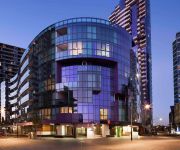
The Sebel Melbourne Docklands
ALTO HOTEL ON BOURKE
CITY TEMPO
ACD Apartments
QUEST DOCKLANDS
Hotel Sophia
Accent Accommodation at Docklands Melbourne
Radisson on Flagstaff Gardens Melbourne
MANTRA CITY CENTRAL
MANTRA ON LITTLE BOURKE
Videos from this area
These are videos related to the place based on their proximity to this place.
Aerial Video - Melbourne Cineflex HD
Aerial video sequences from shoot over Melbourne, Australia. Footage is Raw and has not undergone any colour grading. www.lensaloft.com.au.
Melbourne Cyclist doored by a TAXI passenger on Collins Street, Melbourne
Everyone in Melbourne is talking about this! This is the incident where a passenger exited a TAXI and opened the door onto a cyclist. this video has the entire incident and all the people interviewed.
Melbourne City Circle tram 728
Memories of Melbourne SW5 class tram 728 operating on the City Circle tram line. As at the beginning of 2010, 728 was the oldest tram operating on the Melbourne tramway system. 728 was filmed...
North Melbourne 2014 Railway Action
Railway action at North Melbourne on 31 October 2014, including V/Locity sets, an N class loco-hauled train and the P class push/pull workings to Bacchus Marsh. The scenes include the revamped...
Prediction Manchester City vs Barcelona Champions League HD | Wednesday 25 February 2015
Prediction Manchester City vs Barcelona Champions League HD | Wednesday 25 February 2015, Prediction Manchester City vs Barcelona Champions League HD | Wednesday 25 February 2015, ...
Pulp City Review - The Basic Game Mechanics
G'day Everyone, thanks for watching! This is such a great game to play, so much variation to every encounter! In this part, I simply go over some of the basic game mechanics from Pulp...
Manchester City vs Real Madrid Champions League Anthem 2012.11.21
Manchester City vs Real Madrid Champions League Anthem 2012.11.21.
Serviced Apartments Melbourne CBD at City Point 668 Bourke St, Melbourne with Living Corporate
Welcome to the serviced apartments Melbourne loves, Living Corporate's City Point Melbourne Short Stay Apartments. Located at 668 Bourke St, Melbourne, right on corner of Bourke and Spencer...
Prediction Manchester City vs Newcastle United BPL HD | Sunday 22 February 2015
Prediction Manchester City vs Newcastle United BPL HD | Sunday 22 February 2015, Prediction Manchester City vs Newcastle United BPL HD | Sunday 22 February 2015, Prediction Manchester City...
Videos provided by Youtube are under the copyright of their owners.
Attractions and noteworthy things
Distances are based on the centre of the city/town and sightseeing location. This list contains brief abstracts about monuments, holiday activities, national parcs, museums, organisations and more from the area as well as interesting facts about the region itself. Where available, you'll find the corresponding homepage. Otherwise the related wikipedia article.
Southern Cross railway station
Southern Cross (formerly known as Spencer Street) is a major railway station and transport hub in Docklands, Melbourne, Victoria, Australia. It is on Spencer Street, between Collins and La Trobe Streets, at the western edge of the central business district. The Etihad Stadium sports arena is 500 metres north-west of the station.
Docklands Stadium
Docklands Stadium (also known by its former sponsored names of Colonial Stadium and Telstra Dome and its current sponsorship name of Etihad Stadium) is a multi-purpose sports and entertainment stadium in the Docklands precinct of Melbourne, Victoria, Australia. Construction started in October 1997 under the working name, "Victoria Stadium" and was completed in 2000 at a cost of A$460 million.
Flagstaff railway station
Flagstaff is an underground station in the suburban train network of Melbourne, Australia. It is one of five stations (and one of three underground) on the City Loop, which encircles the central business district (CBD). The station services Melbourne's legal district, and is under La Trobe Street at William Street, near the north western corner of the CBD, and takes its name from the nearby Flagstaff Hill, a significant site in Melbourne's early history.
North Melbourne railway station
North Melbourne railway station located on the northern edge of the central business district of Melbourne, Australia. The station is the point through which pass the west and north-west bound Craigieburn, Flemington Racecourse, Sunbury, Upfield, Werribee and Williamstown suburban railway lines, as well as an interchange point with the Victorian regional network. The station is listed on the Victorian Heritage Register.
HM Melbourne Assessment Prison
HM Melbourne Assessment Prison is an Australian remand and reception prison located in Spencer Street, West Melbourne, Victoria. The facility is operated by Corrections Victoria, an agency of the Department of Justice, of the Victorian Government.
Queen Street massacre
The Queen Street massacre was a spree-killing-suicide that occurred on 8 December 1987 at the Australia Post offices at 191 Queen Street in Melbourne, Victoria. The attack resulted in nine fatalities, including the perpetrator, and five injuries.
Spencer Street, Melbourne
Spencer Street is a major street in the central business district of Melbourne, Victoria, Australia. It is named for John Spencer, 3rd Earl Spencer, Chancellor of the Exchequer under Lord Melbourne, the Prime Minister of the United Kingdom. Spencer Street was the site of the first permanent buildings in the settlement now called Melbourne.
Batman's Hill
Batman's Hill in Melbourne, Australia was named for the Vandemonian adventurer and grazier John Batman. Now removed, the 18 metre high hill was located to the south of today's Collins Street and Southern Cross railway station, and is the site of a steel marker the same height as the original hill. The hill was settled by Batman and his family, who built a house at the base in April 1836, where he lived until his death in 1839.
Flagstaff Gardens
Flagstaff Gardens is the oldest park in Melbourne, Victoria, Australia, first established in 1862. In 2005 it is one of the most visited and widely used parks in the city by nearby office workers and tourists. The gardens are notable for their archeological, horticultural, historical and social significance to the history of Melbourne. The gardens are 7.2 hectares (18 acres) of Crown Land bounded by William, La Trobe, King and Dudley streets, managed by the City of Melbourne.
La Trobe Street, Melbourne
La Trobe Street (also Latrobe Street) is a major street in the central business district of Melbourne, Victoria, Australia. It runs roughly from east to west and forms the northern boundary of the CBD (known as the Hoddle Grid). La Trobe Street is home to a number of precincts and types of public and private spaces. The Carlton Gardens lie at the eastern end of the street, and the western end is at Victoria Harbour in the Docklands precinct.
King Street, Melbourne
King Street is a main street in the Melbourne central business district. King Street is used to be part of National Route 1 until the city by-pass road linking the Monash Freeway with the Westgate Freeway was completed. The street is named after Phillip Gidley King, Governor of New South Wales. King Street begins at Flinders Street, continues through the Melbourne CBD and ends at the intersection of Hawke and Victoria Streets in West Melbourne, Victoria.
St. Joseph's College Melbourne
St Joseph's College Melbourne opened in 1903 and closed in 2010. As a Roman Catholic secondary college, it was part of the Association of Edmund Rice schools, founded and run in the tradition of the Christian Brothers. Between 2000 and 2009 it operated two campuses, one located in Queensberry Street North Melbourne and the other in Brearley Parade Pascoe Vale South. The school allowed students, from a wide variety of cultural and economic backgrounds, an opportunity to enter a range of careers.
William Street, Melbourne
William Street is a major street in the central business district of Melbourne, Victoria, Australia. It runs roughly north-south from Flinders Street to Victoria Street, and is located in the western half of the Hoddle Grid. Notable landmarks in William Street include the Queen Victoria Market, the Flagstaff Gardens, Immigration Museum, Supreme Court of Victoria, AMP Tower and 140 William Street (formerly BHP House).
Supreme Court of Victoria
The Supreme Court of Victoria is the superior court for the State of Victoria, Australia. It was founded in 1852, and is a superior court of common law and equity, with unlimited jurisdiction within the state. Those courts lying below it include the County Court of Victoria, the Magistrates' Court of Victoria and the Victorian Civil and Administrative Tribunal (which is technically not a court, but serves a judicial function). Above it lies the High Court of Australia.
Melbourne Custody Centre
The Melbourne Custody Centre is the main reception facility in Melbourne, Australia for people who have been arrested by police. The centre is located underneath the Melbourne Magistrates' Court the centre is utilised during the day to hold prisoners who will be attending hearings at the Magistrates, County or Supreme Courts.
Festival Hall (Melbourne)
Festival Hall is a concert and sporting venue, located at 300 Dudley Street, West Melbourne, Victoria, Australia. It is one of Melbourne's larger concert venues and has hosted a variety of local and international acts over many years. Formerly known as the West Melbourne Stadium (shortened to The Stadium), it was originally built in 1915 by John Wren (Chairman) and Dick Lean (General Manager) of Stadiums Ltd as a multi-function venue for boxing and pro wrestling.
140 William Street
140 William Street (formerly BHP House) is a skyscraper in Melbourne, Australia. It is one of few heritage registered skyscrapers in Melbourne. It is located at 140 William Street and is situated on the corner of Bourke Street, in the central business district, and was completed in 1972. As an early plot ratio building, it features a large open plaza and public artworks and is an example of the modern style.
Little Lonsdale Street, Melbourne
Little Lonsdale Street is located in the centre of Melbourne, Victoria, Australia. A part of the Hoddle Grid, it runs roughly east-west. North of Lonsdale Street and south of La Trobe Street, Little Lonsdale Street's eastern end intersects with Spring Street while its western end intersects with Spencer Street. It was named after William Lonsdale, the first administrator and magistrate in Melbourne. Unlike the other little streets, it runs one-way in the easterly direction, not the west.
Spencer Street Power Station
Spencer Street Power Station was a Victorian era coal-fired power station which operated on Spencer Street in central Melbourne, Victoria, Australia. Opened in 1892, it was closed in 1982 after being deemed an eyesore, and in 2006 demolition commenced.
Simonds Catholic College
Simonds Catholic College is a Roman Catholic Independent school for boys located in the Melbourne suburb of West Melbourne. Simonds is within walking distance of the Queen Victoria Market. The school consists of two campuses (St Marys & St Brigids) years 7-10 is at the St Marys campus in West Melbourne with years 11-12 at the St Brigids campus in Fitzroy North. The college is an associate member of the Associated Catholic Colleges.
Melbourne Terrace Apartments
Melbourne Terrace is a set of 60 apartments at the corner of Franklin and Queen Street, Melbourne. The apartment complex, designed by architect Nonda Katsalidis, comprises four self-contained buildings, Equus, Mondo, Roma and Fortuna. This division creates a low population for each, ensuring moderate demands upon the building services and a high degree of privacy. At the entrance of each building is a signature sculpture by Peter Corlett.
William Angliss Institute of TAFE
William Angliss Institute of TAFE is a TAFE institute located in the Melbourne CBD, Victoria, Australia providing a specialist centre for training and vocational education in Hospitality, Tourism and Culinary Arts. It is the oldest and largest provider of hospitality training in Victoria, with the capacity to train up to 1400 chefs and patissiers a year.
Taylors College
Taylors College is a provider of university preparation programs in Australia and New Zealand. Established in Melbourne, Australia in 1920, Taylors College provides secondary school education (Year 10 - Year 12) and specialised University Foundation programs in partnership with some of the leading universities in Australia and New Zealand. The college has campuses in Melbourne, Sydney, Perth and Auckland.
Taylors UniLink
Taylors UniLink is located in the city of Melbourne, Australia, offering accredited higher education diplomas. These programs combine detailed academic preparation with educational enrichment features, to ensure students are prepared for all aspects of university learning.
Melbourne City School
Melbourne City School is an independent, co-educational Prep to Year 9 school located in the Melbourne Central Business District on King Street. Melbourne City School was founded in 2010 as an initiative of Eltham College of Education. The current Principal of Melbourne City School is Jennifer Langmead and Head of City Schools is Belinda Cupples. The CEO of Eltham College and Melbourne City is Dr. David Warner.


