Delve into Lyndhurst
The district Lyndhurst of in Casey (Victoria) is a district located in Australia about 288 mi south-west of Canberra, the country's capital town.
In need of a room? We compiled a list of available hotels close to the map centre further down the page.
Since you are here already, you might want to pay a visit to some of the following locations: Melbourne, Currie, Hay, Canberra and . To further explore this place, just scroll down and browse the available info.
Local weather forecast
Todays Local Weather Conditions & Forecast: 17°C / 62 °F
| Morning Temperature | 9°C / 49 °F |
| Evening Temperature | 13°C / 55 °F |
| Night Temperature | 11°C / 51 °F |
| Chance of rainfall | 0% |
| Air Humidity | 57% |
| Air Pressure | 1029 hPa |
| Wind Speed | Gentle Breeze with 6 km/h (3 mph) from North |
| Cloud Conditions | Clear sky, covering 8% of sky |
| General Conditions | Sky is clear |
Sunday, 21st of April 2024
17°C (63 °F)
11°C (51 °F)
Scattered clouds, light breeze.
Monday, 22nd of April 2024
20°C (68 °F)
13°C (55 °F)
Sky is clear, gentle breeze, clear sky.
Tuesday, 23rd of April 2024
23°C (73 °F)
17°C (63 °F)
Overcast clouds, gentle breeze.
Hotels and Places to Stay
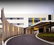
ATURA DANDENONG
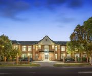
RAMADA ENCORE DANDENONG
QUEST DANDENONG SERVICED APTS
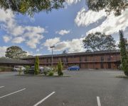
The Prince Mark Motor Inn
Comfort Inn Mahogany Park
QUEST NARRE WARREN SERVICED APTS
Comfort Inn Dandenong
Videos from this area
These are videos related to the place based on their proximity to this place.
The City of Casey - a great place to call home
Welcome to Casey - a great place to call home! This video includes information on the role of Council and the diversity of services and programs it delivers to the City's 230000-plus residents.
Connex Train leaving Merinda Park for Cranbourne over Thompsons Road crossing
Connex train at night leaving Merinda Park for Cranbourne. This runs as a shuttle between Dandenong and Cranbourne after 8.
AgentX Real Estate Berwick Presents - 7 Fieldstone Crescent Cranbourne North Property Tour
AgentX Real Estate Berwick - AgentX Real Estate Berwick are real estate agents in Berwick. We are happy to share with you a lovely property in Cranbourne North that we are proud to market....
Cranbourne Botanical Gardens
The Gardens are situated from Melbourne past Dandenong in Gippsland direction . The Australian Garden which I visited contains only native plant species . It would be advisable to visit...
Origin Driving School Testimonial - Vanesha
Origin Driving School Instructors also have the responsibility of making you feel relaxed and comfortable so that learning to drive is an enjoyable experience. Origin Driving School Instructors...
Bristlebot v001
My first attempt at a bristlebot. I'm using an iphone 3g vibrator (turns out that iphones are good for something after all), an old almost empty battery, and a free airline travel toothbrush.
Melbourne Australia Lightning Show November 13, 2011
A 20 minute lightning show passed over Cranbourne in Melbourne Australia on November 13th, 2011 just before Midni.
Weird objects in sky over Melbourne seen with night vision
Some strange objects recorded with night vision over Narre Warren, Melbourne Australia in the last few weeks.
AgentX Real Estate Berwick - Presents 32 Cobblestone Avenue Narre Warren South - Property Tour
AgentX Real Estate Berwick - AgentX Real Estate Berwick are real estate agents in Berwick. We are happy to share with you a lovely property in Berwick that we are proud to market. 32 Cobblestone...
Videos provided by Youtube are under the copyright of their owners.
Attractions and noteworthy things
Distances are based on the centre of the city/town and sightseeing location. This list contains brief abstracts about monuments, holiday activities, national parcs, museums, organisations and more from the area as well as interesting facts about the region itself. Where available, you'll find the corresponding homepage. Otherwise the related wikipedia article.
Radio VNG
Radio VNG was Australia's national time signal service. It was inaugurated by the Australian Post Office on 21 September 1964. Originally it transmitted on 4500, 7500 and 12000 kHz from Lyndhurst, Victoria. After 1987 it relocated to Shanes Park, NSW, and transmitted on 2500, 5000, 8638, 12984, and 16000 kHz.
Cranbourne North, Victoria
Cranbourne North is a suburb in Melbourne, Victoria, Australia, 40 km south-east from Melbourne's central business district. Its Local Government Area is the City of Casey. At the 2011 Census, Cranbourne North had a population of 14,570. Merinda Park railway station is located within the suburb's boundaries. The station is located on the Cranbourne railway line.
Eumemmerring, Victoria
This article is about the suburb of Eumemmerring. For the Secondary College, see Eumemmerring College.
Hallam, Victoria
Hallam is a suburb in Melbourne, Victoria, Australia, 35 km south-east from Melbourne's central business district. Its Local Government Area is the City of Casey. At the 2011 Census, Hallam had a population of 10,162. The suburb has its own railway station. Hallam is bounded by the South Gippsland Freeway in the west, Eumemmerring Creek and Hallam North Road in the north, a drain easement in the east, and Centre Road in the south.
Hampton Park, Victoria
Hampton Park is a suburb in Melbourne, Victoria, Australia, 36 km south-east from Melbourne's central business district. Its Local Government Area is the City of Casey. At the 2011 Census, Hampton Park had a population of 23,767. Hampton Park is bounded by the South Gippsland Freeway in the west, Centre Road in the north, a line generally parallel to Langbourne Drive in the east, and Glasscocks Road in the south.
Lynbrook, Victoria
Lynbrook is a suburb in Melbourne, Victoria, Australia, 36 km south-east from Melbourne's central business district. Its Local Government Area is the City of Casey. At the 2011 Census, Lynbrook had a population of 6,772. Lynbrook is positioned on the South Gippsland Highway, slightly north-west of Cranbourne, and just south of the residential suburb of Hampton Park.
Narre Warren South, Victoria
Narre Warren South is a suburb in Melbourne, Victoria, Australia, 41 km south-east from Melbourne's central business district. Its Local Government Area is the City of Casey. At the 2011 Census, Narre Warren South had a population of 28,594. As of April 2005, the area is one of the fastest growing areas within the state of Victoria.
Dandenong South, Victoria
Dandenong South is a suburb in Melbourne, Victoria, Australia, 31 km south-east from Melbourne's central business district. Its Local Government Area is the City of Greater Dandenong. At the 2006 Census, Dandenong South had a population of 4867. Dandenong South is a primarily industrialized suburb that borders Hallam and the City of Casey region. The suburb contains the closed General Motors railway station.
Lyndhurst, Victoria
Lyndhurst is a suburb in Melbourne, Victoria, Australia, 35 km south-east from Melbourne's central business district. Its Local Government Area is both the City of Casey and the city of Greater Dandenong. Lyndhurst Post Office opened on 1 January 1867 and closed in 1976. After the Bracks government's decisions to abandon plans for a toxic waste dump near Mildura, the continued use of the existing Lyndhurst facility was part of the replacement plan.
Hallam railway station
Hallam is a railway station in Melbourne, Victoria, Australia, located in the suburb of Hallam, on the Pakenham railway line. Hallam is unmanned and is in Metcard Zone 2.
Narre Warren railway station
Narre Warren is a railway station in Melbourne, Victoria, Australia, located in the suburb of Narre Warren, on the Pakenham railway line. Narre Warren is classed as a Premium Station and is in Metcard Zone 2.
Merinda Park railway station
Merinda Park is a railway station in Melbourne, Victoria, Australia, located in the suburb of Cranbourne North, on the Cranbourne railway line. Merinda Park is unmanned and is in Metcard Zone 2.
Cranbourne railway station
Cranbourne is a railway station in Melbourne, Victoria, Australia, located in the suburb of Cranbourne, on the Cranbourne railway line. Classed as a Premium Station, it is in Public Transport Victoria Zone 2, and is the terminus for the line.
Division of Holt
The Division of Holt is an Australian Electoral Division in Victoria. The division was created in 1969 and is named for Harold Holt, who was Prime Minister of Australia 1966-67. It is located in the outer south-eastern suburbs of Melbourne, including Cranbourne, Doveton, Hampton Park, Endeavour Hills, Narre Warren, and Hallam.
Sandhurst, Victoria
Sandhurst is an official bounded locality in Melbourne, Victoria, Australia, 37 km south-east from Melbourne's central business district. Its Local Government Area is the City of Frankston. Prior to 15 December 1994, the area now Sandhurst was part of the City of Cranbourne formerly the Shire of Cranbourne, and shares its postcode 3977 with Cranbourne.
Narre Warren South College
Narre Warren South College is a school in Narre Warren South, Victoria, Australia. Narre Warren South P-12 College commenced operations in 2002 but was not officially opened until 2007. The prep to twelve college actually began as a prep to year seven school in 2002 and it was not until 2007 (when it was officially opened) that the college went to year 12.
Cranbourne West, Victoria
Cranbourne West is a suburb in Melbourne, Victoria, Australia, 41 km south-east from Melbourne's central business district. Its Local Government Area is the City of Casey. At the 2011 Census, Cranbourne West had a population of 8,743. Cranbourne West has developed since the 1990s, and in 2006 had a new shopping centre opened called 'The Sandhurst Centre', on the corner of Duff Street and Monahans Road.
Hallam Bypass Trail
No image available yet Hallam Bypass Trail Length 13.7 km Difficulty Easy
Lynbrook railway station
Lynbrook is a railway station on the Cranbourne railway line in the suburb of Lynbrook, Victoria. Lynbrook is located in Public Transport Victoria Zone 2, and currently is an unstaffed station. The station opened on 22 April 2012.
General Motors railway station
General Motors is a disused railway station on the Pakenham line of the Melbourne suburban rail system. It is located between Dandenong and Hallam stations, in the suburb of Dandenong South.
Narre Warren, Victoria
Narre Warren is a suburb of Melbourne, Victoria, Australia, 42 km south east from Melbourne's central business district. Its Local Government Area is the City of Casey. At the 2011 Census, Narre Warren had a population of 25,882. Narre Warren has a population density of over 2000 people per square kilometre. Narre Warren has its own railway station, located on Webb Street and is home to Australia's second largest shopping centre, Westfield Fountain Gate after Chadstone Shopping Centre.
Lyndhurst railway station
Lyndhurst is a former railway station on the South Gippsland line. In 1979, it had a single platform on the east side of the track, and a loop siding. In the 1969 Melbourne Transportation Plan, a new passenger line was proposed linking Frankston and Lyndhurst. Today the platform is demolished and is closed to passengers, with cement traffic from Waurn Ponds, near Geelong being the only traffic. This ended in 2009 after Pacific National increased the costs charged to Blue Circle Southern.
Lyndhurst Secondary College
Lyndhurst Secondary College is a co-educational secondary school, located in Cranbourne North, Victoria, Australia, which is approximately 40 km south east of Melbourne.
Narre Warren Fire Brigade
The Narre Warren Fire Brigade is a fully volunteer brigade of the Victoria Country Fire Authority (CFA), located in the south-east Melbourne suburb of Narre Warren. The primary brigade area consists of 193,700 square metres of office, commercial and retail floor space, representing in 2001 12,300 houses and a population of 34,300. The brigade has over 8,800 cars registered in its area.
Hampton Park Secondary College
Hampton Park Secondary College is a secondary college in Melbourne. It is next to River Gum Primary School.


!['My AMD Dragon Watercooled PC - Bloodcrazz. [HD]' preview picture of video 'My AMD Dragon Watercooled PC - Bloodcrazz. [HD]'](https://img.youtube.com/vi/AJK1RA0kvZg/mqdefault.jpg)


