Delve into Everard Park
The district Everard Park of in Unley (South Australia) is a subburb in Australia about 597 mi west of Canberra, the country's capital town.
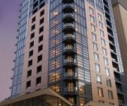
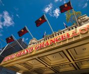
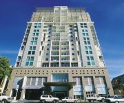
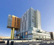
If you need a hotel, we compiled a list of available hotels close to the map centre further down the page.
While being here, you might want to pay a visit to some of the following locations: Adelaide, Mitcham, Honiton, Koomooloo and Loxton. To further explore this place, just scroll down and browse the available info.
Local weather forecast
Todays Local Weather Conditions & Forecast: 17°C / 62 °F
| Morning Temperature | 14°C / 58 °F |
| Evening Temperature | 16°C / 61 °F |
| Night Temperature | 12°C / 54 °F |
| Chance of rainfall | 0% |
| Air Humidity | 62% |
| Air Pressure | 1029 hPa |
| Wind Speed | Gentle Breeze with 8 km/h (5 mph) from North-East |
| Cloud Conditions | Scattered clouds, covering 29% of sky |
| General Conditions | Light rain |
Friday, 26th of April 2024
17°C (62 °F)
12°C (53 °F)
Few clouds, gentle breeze.
Saturday, 27th of April 2024
16°C (61 °F)
14°C (58 °F)
Broken clouds, light breeze.
Sunday, 28th of April 2024
18°C (65 °F)
16°C (61 °F)
Sky is clear, light breeze, clear sky.
Hotels and Places to Stay
Comfort Hotel Adelaide Riviera
PEPPERS WAYMOUTH HOTEL
Astra Apartments Adelaide
GRAND CHANCELLOR HINDLEY
Adelaide Rockford
Oaks Embassy
iStay Precinct
Quest King William South
RNR APARTMENTS ADELAIDE
Franklin Central Apartments
Videos from this area
These are videos related to the place based on their proximity to this place.
Adelaide Central Market, Adelaide, Australia.
The Adelaide Central Market is a must see if you are in Adelaide. It is located between Gouger and Grote Streets right next to China Town. It's open Tuesday, Thursday, Friday and Saturday....
Travel to Australia, Top 10 Tourist Destinations
http://www.australian-information-stories.com/ Travel to Australia. If you're planning Australia tourism anytime soon you may be interested to know the top 10 tourist destinations of Australian...
Riot City Recap - Riot City Rumble 2014
Live Wrestling in Adelaide Filmed live at the Latvian Hall Matches: Luke Santamaria Vs Andy "Voodoo" Roy Adam Brooks Vs Big Brodie Marshall S.M.A.S.H (Super Mega Action Super Heros) Vs...
Inspirational Volunteers - Adding Life to the City
To mark International Year of Volunteers 10th Anniversary, Volunteering SA&NT and Adelaide City Council sponsored the making of a short film about volunteers in Adelaide CBD. The film showcases...
Trams in Adelaide - City, South Terrace
2014-03-28 Bombardier Flexity Classic I/Type 100; Office of the Rail Commissioner, Adelaide Metro; City, South Terrace, Adelaide [AU]
PC_TV - Adelaide City Library Digital Hub
Nizar and Jared visit the Adelaide City Library Digital Hub to showcase the free courses on offer for the public. Vist them at: http://www.adelaidecitycouncil.com/your-community/library-services/c...
Riot City Recap: RCWLUCHA 2014
Riot City Wrestling Live Wrestling in Adelaide,, South Australia Filmed Live at the Latvian Hall February 22 2014 Matches: Andy Voodoo Roy & Marvel Vs The The Benchwarmers Luke Santamaria...
Riot City Recap -Transgression 2014
Live Wrestling in adelaide Filmed Live at the Latvian Hall April 5 2014 Matches: Andy Voodoo Roy Vs Adam Brooks Vs Chris Mimic Basso Josh Shooter Vs Marvel Vs Brad Smyth Bulldog Mackenzie...
Videos provided by Youtube are under the copyright of their owners.
Attractions and noteworthy things
Distances are based on the centre of the city/town and sightseeing location. This list contains brief abstracts about monuments, holiday activities, national parcs, museums, organisations and more from the area as well as interesting facts about the region itself. Where available, you'll find the corresponding homepage. Otherwise the related wikipedia article.
Goodwood railway station
Goodwood railway station is the last common railway station of the Noarlunga, Tonsley and Belair lines when travelling away from Adelaide. The Belair line diverges southeast towards Millswood (closed) and Unley Park Stations, while the Noarlunga and Tonsley lines diverge southwest towards Clarence Park. The Glenelg tram line crosses over the railway lines immediately south of Goodwood station.
Keswick railway station, Adelaide
Keswick railway station was a station on the Belair, Noarlunga Centre and Tonsley railway lines, and was located in the inner western Adelaide suburb of Keswick. It was located 3.8 kilometers by railway from the Adelaide Railway Station. This was the only station in the Adelaide Metro System that didn't contain a wheelchair access. Keswick railway station was demolished in March 2013 during the closure of the Seaford and Tonsley lines in preparation of electrification of those lines.
Millswood railway station
Millswood railway station is a closed railway station on the Belair railway line in Adelaide, South Australia. It is situated 5.9 km from Adelaide Railway Station, adjacent to the Goodwood Road underpass, on the border of the suburbs of Millswood and Kings Park.
Adelaide Parklands Terminal
The Adelaide Parklands Terminal is the only interstate railway station for the whole of the metropolitan area of Adelaide, South Australia. It is located 3 km from the City centre, adjacent to the suburb of Keswick and within the southern part of the West Parklands.
Glandore, South Australia
Glandore (postcode 5037) is a suburb of Adelaide, South Australia, partly in the City of Marion and partly in the City of West Torrens. The name is believed to come from Glandore in County Cork, Ireland, from whence came the family of John O'Dea, one of the original property owners of the area. Glandore lies south-west of Adelaide, halfway between the beachside suburb of Glenelg and the central business district.
Wayville, South Australia
Wayville is an inner-southern suburb of Adelaide in the City of Unley. It is most notable for its hosting of the Royal Adelaide Show at the Royal Adelaide Showgrounds. The suburb is bordered to the north with the South Park Lands of Adelaide, and to the south with the tramline. Wayville Post Office opened around 1909. Wayville Military Post Office was open from 16 July 1940 until 19 October 1946 while the Showgrounds were used as an army camp.
Everard Park, South Australia
Everard Park is a suburb of Adelaide in the City of Unley, part of the once extensive land holdings of the prominent colonist Dr. Charles George Everard, and the location of "Marshfield", the home of part of his family. Some of the streets that are located within Everard Park are Norman Terrace, Everard Terrace and Orchard Avenue.
Clarence Park, South Australia
Clarence Park (formerly Goodwood South) is an inner southern suburb of Adelaide, South Australia in the City of Unley. Its borders are Mills Street (north), the Noarlunga railway line (north-west from East Avenue to Emerson Crossing), Goodwood Road (east) and Cross Road (south).
Black Forest, South Australia
Black Forest is an inner southern suburb of Adelaide, South Australia. It is located in the City of Unley.
Forestville, South Australia
Forestville is a suburb of Adelaide in the City of Unley. Forestville basketball stadium was demolished in 2001. The Forestville Eagles Basketball Club of the Central ABL conference was named after this suburb.
Millswood, South Australia
Millswood is an inner-southern suburb of Adelaide in the City of Unley. It is dissected by Goodwood Road, which travels north to the Adelaide central business district from the southern suburb of Pasadena. Millswood also had its own railway station along the Goodwood-Belair line, but this was closed in 1995. Goodwood Road passes under the railway line in a deep underpass which may flood during heavy rain.
Clarence Park railway station
Clarence Park railway station is a railway station on the Noarlunga Centre and Tonsley railway lines, and is located in the inner southwestern Adelaide suburbs of Black Forest and Clarence Park. It is located 6.3 km by railway from the Adelaide Railway Station.
Emerson railway station
Emerson railway station is a railway station on the Noarlunga and Tonsley railway lines, which is located in the inner southwestern Adelaide suburbs of Black Forest and Clarence Park. It is located 7.1km by railway from the Adelaide Railway Station. In July 2008 Emerson station became the first station to install a Caution More than One Train (CMToT) warning device.
City of West Torrens
The City of West Torrens is a local government area in the western suburbs of Adelaide, South Australia. Since the 1970s the area was mainly home to many open spaces and parks, however after the mid-1990s (1993-1995) the LGA became more residential.
Adelaide Showgrounds
The Adelaide Showgrounds, formerly the Royal Adelaide Showgrounds and most commonly known as the Wayville Showgrounds holds many of Adelaide's most popular events, including the Royal Adelaide Show. The Showgrounds are located in the inner-southern Adelaide suburb of Wayville, just south of Greenhill Road. They are bordered by Goodwood Road (east), Leader Street (south), the railway line (west) and Rose Terrace (north).
Kurralta Park, South Australia
Kurralta Park is a suburb of Adelaide, South Australia in the City of West Torrens.
Ashford, South Australia
Ashford is a suburb of Adelaide, in the City of West Torrens. It is triangular in shape and bordered by South Road, Anzac Highway and Everard Avenue. Two of the main features of the suburb are Ashford Hospital and Ashford Special School. Brownhill Creek also flows through Ashford in a cement channel, behind the school. The name commemorates the property and residence (now Ashford Special School) of Dr. Charles George Everard, who settled in the area in 1838, and named for Ashford in Kent.
Marleston, South Australia
Marleston is a suburb of Adelaide, South Australia in the City of West Torrens.
Mile End South, South Australia
Mile End South is a suburb of Adelaide, South Australia, in the City of West Torrens. The name, denoting an area south of Mile End, was in use as early as 1913, but was only formally adopted by the state's nomenclature committee in 1944.
Richmond Oval (South Australia)
Richmond Oval (currently City Mazda Stadium and formerly Broadspectrum Oval) is an Australian rules football oval in Richmond, a western suburb of Adelaide, South Australia. It is the home of South Australian National Football League (SANFL) club West Adelaide Football Club. Richmond Oval is historically important as the first ground purpose-built for Australian Rules football, predating Waverley Park in Melbourne by over a decade.
Capri Theatre
The Capri Theatre is a cinema in Goodwood, a suburb of Adelaide, South Australia, built in the Art Deco style. It is owned by the Theatre Organ Society of Australia (South Australian Division) Inc, which bills the cinema as a "Unique Entertainment Showplace in the World". A feature of the cinema is the Wurlitzer theatre organ, which is used regularly for recitals, as well as an entertainment feature supporting the screening of films.
Apollo Stadium
Apollo Stadium (officially called the Apollo Entertainment Centre) was an indoor arena located at 41 Kingston Avenue, Richmond, South Australia, just 5 minutes from the Adelaide city centre. The stadium had an original seating capacity of 4,000 until the early 1980s when the bench seats were replaced by individual plastic seats giving a reduced seating capacity of 3,000 and an overall capacity of just 3,500. Opened in 1969, the stadium was named for the Apollo moon landing of the same year.
Ashford Hospital, Adelaide
Ashford Hospital is a private hospital, located in the Adelaide suburb of Ashford.
Goodwood Primary School
Goodwood Primary School is a primary school in the Adelaide inner southern suburb of Goodwood.
Keswick Barracks
Keswick Barracks is a barracks of the Australian Army in Keswick, South Australia. It is home to the 9th Brigade, 10th/27th Battalion, Royal South Australia Regiment, the 48th Field Battery, 3rd Health Support Battalion and the Australian Army Cadets.


