Discover Glenunga
The district Glenunga of in Burnside (South Australia) with it's 1,869 citizens Glenunga is a district in Australia about 593 mi west of Canberra, the country's capital city.
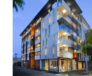
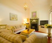
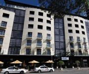
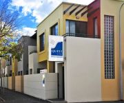
Looking for a place to stay? we compiled a list of available hotels close to the map centre further down the page.
When in this area, you might want to pay a visit to some of the following locations: Mitcham, Adelaide, Honiton, Koomooloo and Loxton. To further explore this place, just scroll down and browse the available info.
Local weather forecast
Todays Local Weather Conditions & Forecast: 17°C / 62 °F
| Morning Temperature | 11°C / 51 °F |
| Evening Temperature | 16°C / 60 °F |
| Night Temperature | 11°C / 52 °F |
| Chance of rainfall | 0% |
| Air Humidity | 49% |
| Air Pressure | 1028 hPa |
| Wind Speed | Gentle Breeze with 8 km/h (5 mph) from North-East |
| Cloud Conditions | Broken clouds, covering 55% of sky |
| General Conditions | Broken clouds |
Saturday, 27th of April 2024
17°C (62 °F)
14°C (58 °F)
Scattered clouds, light breeze.
Sunday, 28th of April 2024
19°C (67 °F)
17°C (62 °F)
Sky is clear, gentle breeze, clear sky.
Monday, 29th of April 2024
16°C (60 °F)
12°C (53 °F)
Overcast clouds, moderate breeze.
Hotels and Places to Stay
Pullman Adelaide
Clarion Hotel Soho
Hilton Adelaide
Windsor Apartments
Westbury Cottage B & B
Adina Adelaide Treasury
MANTRA HINDMARSH SQUARE
RNR APARTMENTS ADELAIDE
Adabco Boutique Hotel
MANTRA ON FROME
Videos from this area
These are videos related to the place based on their proximity to this place.
Seo Company Adelaide
SEO Company Adelaide Call 1300 796 774 for a FREE $200 Consultation & Audit Here at the SEO Company Adelaide we specialise in search engine optimisation and social media marketing. If you...
APT - New Zealand - Inflight Travel
http://www.inflight-travel.com.au Contact Inflight Travel about your New Zealand Tour - (08) 8373 1220.
Insight - France Spain & Italy - Inflight Travel
http://www.inflight-travel.com.au Contact Inflight Travel about your Tour of France Spain & Italy - (08) 8373 1220.
Opal mine underground,South Australia
Underground opal mine in the main street of South Australia's capital city Adelaide. Recreation of old opal mines at Coober Pedy in South Australia's mid north which is the Opal capital of the world.
Damon & Elena or Ethan & Lily - All I need - Extended Version
Okay this is the extended verion of my Ethan and Lily / Damon and Elena All I Need video. So its basically the same summary and such. I just think this one is better. But just so you don't...
adelaide lightning storm
lightning less than 1 km away. The first half of the video is the flash in real time, the second half is each frame shown.
Trev's Clay brick oven- part 1 of 3 - Base
Making a clay brick oven- part 1 - foundation & base part 2 - dome igloo part 3 - finishing & quantities.
Garden Railways_Wx56-return movement to Kingston - K&PCR
Wx 56 is powered by an LGB power block in the tender and is battery powered and radio controlled. I have an original W class nearly finished as I am very interested in the early days of the...
Videos provided by Youtube are under the copyright of their owners.
Attractions and noteworthy things
Distances are based on the centre of the city/town and sightseeing location. This list contains brief abstracts about monuments, holiday activities, national parcs, museums, organisations and more from the area as well as interesting facts about the region itself. Where available, you'll find the corresponding homepage. Otherwise the related wikipedia article.
Urrbrae Agricultural High School
Urrbrae Agricultural High School is a public high school in the state of South Australia, with approximately 1,058 students. The school is located in the Adelaide suburb of Netherby, about 5 kilometres south-east of the Adelaide city centre.
Marryatville High School
Marryatville High School is a public state school in Adelaide, South Australia. It was founded in 1976 during the Don Dunstan era of South Australia and was formed out of the old Norwood Boys Technical High School. The school is situated on a large area of land in the eastern suburb of Marryatville, part of the City of Norwood Payneham and St Peters. First Creek cuts through the middle of the school grounds and large gum trees line the property.
Langman Reserve
Langman Reserve is a large reserve situated in the Adelaide foothills between the suburbs of Burnside and Waterfall Gully, South Australia. It was converted from a quarry in the late 1960s, and is named after a former mayor of the City of Burnside. The reserve, frequented by people of all ages, comprises a sporting oval, toilets, barbecues, tennis courts and a walk through native bushland. The carpark is located on Waterfall Gully Road.
Glenunga, South Australia
Not to be confused with Glenalta, South Australia. 50x40pxThis article needs additional citations for verification. Please help improve this article by adding citations to reliable sources. Unsourced material may be challenged and removed.
Glenside, South Australia
Glenside is a suburb in the City of Burnside, Adelaide, South Australia, around 2 kilometres south-east of the Central business district, home to 2,985 people in a total land area of 1.40 km². It is ordered on the north by Greenhill Road, on the east by Portrush Road, on the south by Flemington Street and Windsor Road and the west by Fullarton Road. The suburb has a rectangular layout.
Mount Osmond, South Australia
Mount Osmond is a small suburb of 2,497 people in the South Australian capital city of Adelaide. It is part of the City of Burnside local government area and located in the foothills of the Adelaide Hills, five kilometres south east of the city centre. The suburb is high on the hill of the same name, which is the last hill on the right when approaching Adelaide down the South Eastern Freeway before the road levels out onto the Adelaide Plains.
Glen Osmond, South Australia
Glen Osmond is a small suburb of Adelaide, South Australia in the City of Burnside which is in the foothills of the Adelaide Hills.
Dulwich, South Australia
Dulwich is a suburb in the City of Burnside, Adelaide, South Australia with a census area population of 2,663 people. The suburb is adjacent to Adelaide's east parklands, and forms part of the western boundary of the City of Burnside. Dulwich is a mix of residential housing and commercial activity - corporate offices and businesses line Fullarton and Greenhill Roads.
Eastwood, South Australia
Eastwood is a suburb of Adelaide, South Australia in the City of Burnside.
Frewville, South Australia
Frewville is a small suburb located in the South Australian city of Adelaide. It is located three kilometres south-east of Adelaide's central business district (CBD). The name Frewville is taken from an early settler James Frew. Frewville is in the local government area of the City of Burnside. It has a triangular layout, bounded on the north by Flemington Street, the east by Conyngham Street, and the south-west by Glen Osmond Road.
Linden Park, South Australia
Linden Park is a suburb of Adelaide, South Australia in the City of Burnside.
St Georges, South Australia
St Georges is a suburb of Adelaide in the City of Burnside.
Tusmore, South Australia
Tusmore is a suburb in the inner east of Adelaide, South Australia.
Toorak Gardens, South Australia
Toorak Gardens is a leafy, mainly residential inner eastern suburb of Adelaide, South Australia, located 2 km east of the Adelaide city centre. It is characterised by tree-lined streets and detached single story villas and bungalows built in the 1920s and 1930s on allotments of around 0.25 acres (0.1 hectares). The Toorak Gardens area was part of the then larger and now adjacent suburb of Rose Park. Between 1912 and 1917 it was named "Toorak" and subsequently "Toorak Gardens".
Fullarton, South Australia
Fullarton is an inner-southern suburb of Adelaide, South Australia in the City of Unley.
Highgate, South Australia
Highgate is a suburb of Adelaide in the City of Unley.
Myrtle Bank, South Australia
Myrtle Bank is a suburb of Adelaide, South Australia in the City of Unley. The suburb is named after a property near the foothills built in 1842 by William Sanders (1801-1880), who arrived in South Australia in 1838. He named the premises 'Myrtle Bank', because his friend James Gall of Trinity living in Edinburgh had a fine property of the same name. During World War I the property became a repatriation hospital.
Burnside Village
Burnside Village is an upscale shopping centre located in Adelaide, South Australia. It is situated in the City of Burnside suburb of Glenside, in the eastern suburbs. Burnside Village is home to over 100 premium lifestyle and fashion stores. The centre features a diverse mix of retail and is home to a 100-year-old River Red Gum Tree in the aptly named Tree Mall. Burnside Village is home to South Australia’s first Zara store, as well as the first for stores such as Husk, Willow and Thurley.
Urrbrae, South Australia
Urrbrae is a suburb of Adelaide, South Australia. It is located in the City of Mitcham. Located at the foot of the Adelaide Hills, it is bordered on the east by the South Eastern Freeway, and the Old Toll House, which marked the traditional entrance to the city of Adelaide in the 19th century.
Glenunga International High School
Glenunga International High School (informally known as Glenunga or GIHS) is a publicly funded school in Adelaide, South Australia. It is located approximately four km south-east of the Adelaide city centre in the suburb of Glenunga, between L'Estrange St and Conyngham St, adjoining the major thoroughfare Glen Osmond Road. In terms of academic performance, it is one of the top schools in the state, performing exceptionally in the NAPLAN, SACE, and International Baccalaureate Diploma.
Loreto College, Marryatville
For other schools of the same name, see Loreto College (disambiguation). Loreto College Marryatville Loreto College Marryatville crest. Source: www. loreto. sa. edu. au (Loreto College Marryatville website) Latin: Maria Regina Angelorum.
South Australian Research and Development Institute
The South Australian Research and Development Institute (SARDI) is a state government funded institute with locations throughout South Australia. SARDI is part of Primary Industries and Resources South Australia (PIRSA)
Parkside Primary School
Parkside Primary School is a coeducational R-7 school (5–12 year olds) located in the Adelaide inner suburb of Parkside. The school is located at 12 Robsart Street and occupies the land between Young Street, Robsart Street and Castle Street. It is one of South Australia's earliest established Primary Schools and currently has an enrolment of approximately 250 students who come from different cultural backgrounds.
Beautiful (2009 film)
Beautiful is a 2009 Australian independent film, written and directed by Dean O'Flaherty, which was released by Adelaide-based Kojo Pictures on 5 March 2009. The film marked the feature filmmaking debut of both O'Flaherty and Kojo Pictures. The South Australian Film Corporation provided approximately 10 per cent of the $1.5m budget, while the rest came from private investors.
Benacre, Glen Osmond
Benacre is a house in Glen Osmond,, which is listed on the Register of the National Estate. It is located at 6 Benacre Place.


