Delve into Spring Hill
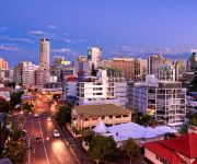
The district Spring Hill of in Queensland with it's 4,835 habitants Spring Hill is a district located in Australia about 587 mi north-east of Canberra, the country's capital town.
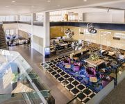
In need of a room? We compiled a list of available hotels close to the map centre further down the page.
Since you are here already, you might want to pay a visit to some of the following locations: Sunshine Coast, Carrolls Creek, , and . To further explore this place, just scroll down and browse the available info.
Local weather forecast
Todays Local Weather Conditions & Forecast: 26°C / 79 °F
| Morning Temperature | 18°C / 64 °F |
| Evening Temperature | 24°C / 75 °F |
| Night Temperature | 19°C / 66 °F |
| Chance of rainfall | 2% |
| Air Humidity | 46% |
| Air Pressure | 1014 hPa |
| Wind Speed | Gentle Breeze with 7 km/h (4 mph) from West |
| Cloud Conditions | Few clouds, covering 10% of sky |
| General Conditions | Light rain |
Saturday, 20th of April 2024
23°C (73 °F)
18°C (64 °F)
Heavy intensity rain, gentle breeze, overcast clouds.
Sunday, 21st of April 2024
19°C (66 °F)
19°C (67 °F)
Heavy intensity rain, moderate breeze, overcast clouds.
Monday, 22nd of April 2024
20°C (68 °F)
20°C (68 °F)
Moderate rain, moderate breeze, overcast clouds.
Hotels and Places to Stay
Sofitel Brisbane Central
Oaks Lexicon
WATERMARK HOTEL BRISBANE
Novotel Brisbane
Frisco Apartments
SUMMIT APARTMENTS
Best Western Astor Metropole
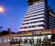
HOTEL URBAN BRISBANE
Hotel Jen (formerly Traders Brisbane)
MANTRA TERRACE HOTEL
Videos from this area
These are videos related to the place based on their proximity to this place.
Brisbane City Hall Light Spectacular 2013 (Full Show)
This is the full animated light show projected on Brisbane City Hall for Christmas 2013. The video was recorded on the evening of 14 December 2013.
Brisbane City 'Riverside Precinct' Apartment - SOLD by the Ray White Pahl Team
Sold - 245/171 North Quay Brisbane City Marketed by Stephen Pahl 0404 266 085 Sold by Stephen Pahl Look no further than this 5 year old contemporary sleek apartment in the Statuesque ...
Apartments for Rent in West End QLD Spring Hill Apt 2BR/1BA by Property Management West End
Call 07 3844 8399 or go to http://www.metrocityrealty.com.au/ to know more about "Property Management West End". Visit http://www.metrocityrealty.com.au/search/rentals for a list of our available...
Unit for Rent in Spring Hill Spring Hill Unit 3BR/2BA by West End Property Management
Click http://www.metrocityrealty.com.au/ to visit Metrocity Realty for your "Brisbane Property Management" needs! You may also visit http://www.metrocityrealty.com.au/search/rentals for a list...
454 Upper Edward St, Spring Hill Inner City Brisbane living Real estate investment Flynn Apartments
454 Upper Edward St, Spring Hill is proudly marketed by Jocelyn Frost from RE/MAX Profile Bardon. Call her today on 0414 490 270, you'll be delighted you did. An excellent investment opportunity...
Unit 50, 287 WIckham Terrace Spring Hill 4000 QLD by Andrew ...
Property Video shoot of Unit 50, 287 WIckham Terrace Spring Hill 4000 QLD by PlatinumHD http://www.platinumhd.tv for Harcourts Solutions Inner City.
Unit 208, 491 Wickham Terrace - Spring Hill (4004) Queensland by Andrew Turvey
Property Video shoot of Unit 208, 491 Wickham Terrace - Spring Hill (4004) Queensland by PlatinumHD http://www.platinumhd.tv for.
Sunday Afternoon over Roma Street Station
Just a little attempt at a tilt-shift time lapse over Roma Street Station in Brisbane City. Should try it during peak hour, might be a little more tumultuous.
Sold by Jonzun Lee 0418 885 708 RE/MAX Profile Bardon & Smakk Media video
Sold 40 Union Street Spring Hill Marketed by Jonzun Lee 0418 885 708 DIRECTIONS: http://www.whereis.com/qld/spring-hill/40-union-st YOUTUBE: http://www.youtube.com/user/JonzunLee1 LARGE.
How to use the Green Drink for Natural Hair Loss Treatments
How to use the Green Drink for Natural Hair Loss Treatments http://www.hair-loss-treatments.com.au/ http://www.brisbanehairloss.com.au/ http://www.hair-loss-sydney.com.au/ On the subject...
Videos provided by Youtube are under the copyright of their owners.
Attractions and noteworthy things
Distances are based on the centre of the city/town and sightseeing location. This list contains brief abstracts about monuments, holiday activities, national parcs, museums, organisations and more from the area as well as interesting facts about the region itself. Where available, you'll find the corresponding homepage. Otherwise the related wikipedia article.
Roma Street Parkland
Roma Street Parkland covers 16 hectares in the centre of Brisbane, Queensland, Australia. The Roma Street Parkland is adjacent to Brisbane Transit Centre and the Roma Street Station. There is pedestrian access to the Roma Street Parkland from the Roma Street Station, as well as from Albert Street, and from the section of the Parkland which used to be called Albert Park, in Wickham Terrace.
Central railway station, Brisbane
Central is, as the name suggests, the central railway station for the Queensland Rail City network in the Brisbane central business district, the state capital of Queensland, Australia. A major interchange for train services on the City network, Central is located in Zone 1 of the TransLink integrated public transport system.
Roma Street railway station
Roma Street is a major railway station in the Brisbane central business district, the state capital of Queensland, Australia. It was Brisbane's first railway station, opening in 1876. Roma Street is part of the Queensland Rail City network, in Zone 1 of the TransLink integrated public transport system, and is the Brisbane terminus for most Queensland long-distance trains. The station has a total of ten platforms. Platform 10 is for long-distance train travel within Queensland.
Queensland Police
The Queensland Police Service (QPS) is the law enforcement agency responsible for policing the Australian state of Queensland. In 1990, the Queensland Police Force was officially renamed the Queensland Police Service and the old motto of "Firmness with Courtesy" was changed to "With Honour We Serve". The headquarters of the Queensland Police Service is located at 200 Roma Street, Brisbane. The 1980s was a turbulent period in Queensland Police history.
Brisbane Girls Grammar School
Brisbane Girls' Grammar School, is an independent, secular, secondary day school for girls, located in Spring Hill, an inner suburb of Brisbane, Queensland, Australia. Founded in 1875, the school is one of eight grammar schools in Queensland which were established under the Grammar Schools Act of 1860. The school originally opened as a branch of the Brisbane Grammar School, with fifty students, under the direction of a Lady Principal, Janet O'Connor.
ANZAC Square, Brisbane
ANZAC Square, named in honour of the Australian and New Zealand Army Corps, is a Queensland state memorial to men and women who participated in overseas armed service. It is located between Ann Street and Adelaide Street, in Brisbane, Australia. ANZAC Square is adjacent to ANZAC Square Arcade. It was opened on Armistice Day, 1930. ANZAC Square contains the Shrine of Remembrance and the 'Eternal Flame of Remembrance' held in a continuously lit bronze urn, dedicated on Tuesday, 11 November 1930.
King George Square
King George Square is a public square, located between Adelaide Street and Ann Street (and between two sections of Albert Street), in Brisbane, Queensland, Australia. Adjacent to King George Square is Brisbane City Hall Originally, Albert Street ran west from the Botanic Gardens as far as Ann Street and the original city markets. A square was located between Ann Street and Adelaide street, south of Albert Street and was called Market Square.
Wickham Park (Brisbane)
Wickham Park is on Wickham Terrace in Spring Hill, Brisbane, Queensland, Australia. Wickham Park is located next to the Roma Street Parkland in the section of the parkland which used to be called Albert Park. Wickham Park, which was named after John Clements Wickham, contains The Old Windmill, the oldest surviving building in Brisbane.
Holy Name Cathedral, Brisbane
Holy Name Cathedral was a planned, then partially built, then discontinued project to build a Catholic cathedral in Fortitude Valley, Brisbane, Australia. It was to have been the seat of the Archbishopric of Queensland and was intended to have been the largest church building of any Christian denomination in the Southern Hemisphere. The formidable Archbishop James Duhig was the chief proponent of the project.
St Joseph's College, Gregory Terrace
St Joseph's College, Gregory Terrace (commonly known as Terrace) is a Greater Public Schools private, Roman Catholic, day school for boys only, located in Spring Hill, an inner suburb of Brisbane, Queensland, Australia. Founded on 5 July 1875 by three Irish Christian Brothers, the College follows the Edmund Rice tradition, and currently caters for approximately 1370 students from Years 5 to 12.
Shrine of Remembrance, Brisbane
The Shrine of Remembrance is located in ANZAC Square, between Ann Street and Adelaide Street, in Brisbane, Queensland, Australia. With its 'Eternal Flame', the Shrine is a war memorial dedicated to the Australian and New Zealand Army Corps (Anzacs). The Shrine of Remembrance is a major Brisbane landmark of cultural, architectural and historic importance and is a key component of the Queensland Heritage listed square and annually hosts ceremonies for ANZAC Day and Armistice Day.
Roma Street busway station
The Roma Street Busway Station is an integration of bus and rail services at Roma Street Station beneath the coach deck of the Brisbane Transit Centre. It forms part of the Northern Busway. The station is in Zone 1 of the TransLink integrated public transport system. The Roma Street Busway Station's platforms are at the same level as the train platforms and use the pedestrian access that links the Transit Centre to the Roma Street Parkland.
Whiskey Au Go Go fire
The Whiskey Au Go Go fire was a fire that occurred at 2.10 am on Thursday 8 March 1973, in the Whiskey Au Go Go nightclub in Fortitude Valley, Brisbane, Australia that killed 15 people. The building is at 356 St Pauls Terrace, Fortitude Valley (on the corner of Amelia Street and St Paul's Terrace) and still stands as of 2013.
Adelaide Street, Brisbane
Adelaide Street, which is a major thoroughfare in Brisbane, Queensland, Australia, runs parallel to Queen Street and Ann Street. Notable buildings and parks along Adelaide Street include Brisbane City Hall, King George Square, ANZAC Square with the Shrine of Remembrance (both of which honour Australia's war dead), ANZAC Square Arcade, Law Courts Complex, Brisbane Square, and Post Office Square.
Anglican Diocese of Brisbane
The Anglican Diocese of Brisbane is based in Brisbane, Australia. The diocesan bishop's seat is St John's Cathedral, Brisbane. The current Archbishop of Brisbane is the Most Revd Phillip Aspinall, who is also the elected Primate of the Anglican Church of Australia. The diocese stretches from the south-eastern coastline of Queensland, south to the New South Wales border, and west to the Northern Territory border.
Brisbane Grammar School
Brisbane Grammar School (BGS) is an independent, non-denominational, day and boarding school for boys, located in Spring Hill, an inner suburb of Brisbane, Queensland, Australia. It is the oldest secondary boys school in Brisbane. Established in 1868 under the Grammar Schools Act which was passed by the Queensland Government in 1860, the school has a non-selective enrolment policy and currently caters for approximately 1424 students from Years 6 to 12, including 135 boarders.
St James College, Brisbane
St James College, Brisbane teaches over 400 students from grades 8 to 12, it is under the direction of the headmaster Mr Gerry Crooks. St James College, Brisbane or "Jimmies" as it is also known was established in 1868 with only 12 students and is the oldest Catholic boys' school in Queensland. In 1893, the Christian Brothers agreed to take over the school following major economic depression, the governments refusal to pay staff wages and inconsistent student enrolment.
Task Force Argos
Task Force Argos is a highly specialised branch of the Queensland Police Service responsible for the investigation of on-line child exploitation and abuse. Founded in 1997, the unit’s original charter was to investigate historical, institutional child abuse alleged during the Forde Inquiry. The unit's name was derived from Greek mythology in which Argus Panoptes or Argos, was a primordial “all seeing” giant with multiple eyes and who was guardian of lo.
St Joseph's College, Nudgee
St Joseph's Nudgee College (commonly referred to simply as Nudgee) is a private, Roman Catholic, day and boarding school for boys, located in Boondall, a northern suburb of Brisbane, Queensland, Australia. In 1891 it was decided by the Congregation of Christian Brothers that because of the large numbers of boarders at St. Joseph's College, Gregory Terrace and insufficient room to house them that a new school be opened to cater for the boarders at Nudgee. Both schools share St.
All Saints Anglican Church, Brisbane
All Saints Anglican Church, Wickham Terrace, Brisbane is the oldest Anglican Church in the City of Brisbane, first founded in 1862. The existing structure dates from 1869. For most of its history, it has been identified with the High Church or Anglo-Catholic tradition within Anglicanism.
Brisbane Magistrates Court
Brisbane Magistrates Court is located at 363 George Street, Brisbane in Queensland, Australia. The building is a modern, purpose-built facility which currently contains 26 courtrooms. These include a dedicated Murri Court, two Coroners courts and four Small Claims hearing rooms. The building has the capacity to expand to 39 courtrooms. Construction started in September 2002 and the building was opened on 16 November 2004 by the Queensland Premier, Peter Beattie.
Ann Street Church of Christ
Ann Street Church of Christ is a Christian church in the CBD of Brisbane, Australia that holds public worship services each Sunday morning. Its website details a range of activities for people of all ages including student outings, community barbecues, women's meetings, music and family ministries. The church is affiliated with the Churches of Christ in Australia and traces its roots to the Restoration Movement. The church was formed in 1883.
Creek Street, Brisbane
Creek Street is a major street in the central business district of Brisbane. Although the street is immediately within the Brisbane CBD, it has not been named accordingly, similar to that of other streets in the CBD. It follows a one-way south-north direction, starting at the beginning of Charlotte Street, cutting through Elizabeth Street, Queen Street, Adelaide Street, Ann Street, before coming to an end at Turbot Street in the northern end of the CBD.
St. Andrew's Uniting Church, Brisbane
St Andrew's Presbyterian Church is a church building of the Presbyterian denomination built on the corner of Ann and Creek Streets, Brisbane, Queensland, Australia in 1905. Following the merger of Protestant non-conformist churches in Australia in 1977, St Andrew's became part of the Uniting Church and became known as St. Andrew's Uniting Church, Brisbane. The congregation originally met in a church in Wickham Terrace.
City Congregational Church, Brisbane
City Congregational Church was a church building of the Congregational Church in Brisbane, Queensland, Australia, which replaced the Wharf Street Congregational Church, Brisbane.


