Explore Scarborough
The district Scarborough of in Queensland with it's 9,837 inhabitants Scarborough is located in Australia about 606 mi north of Canberra, the country's capital.
If you need a place to sleep, we compiled a list of available hotels close to the map centre further down the page.
Depending on your travel schedule, you might want to pay a visit to some of the following locations: Brisbane, Sunshine Coast, Carrolls Creek, and . To further explore this place, just scroll down and browse the available info.
Local weather forecast
Todays Local Weather Conditions & Forecast: 26°C / 78 °F
| Morning Temperature | 18°C / 65 °F |
| Evening Temperature | 22°C / 71 °F |
| Night Temperature | 21°C / 69 °F |
| Chance of rainfall | 0% |
| Air Humidity | 49% |
| Air Pressure | 1014 hPa |
| Wind Speed | Moderate breeze with 9 km/h (6 mph) from West |
| Cloud Conditions | Few clouds, covering 15% of sky |
| General Conditions | Few clouds |
Saturday, 20th of April 2024
21°C (71 °F)
17°C (63 °F)
Moderate rain, moderate breeze, overcast clouds.
Sunday, 21st of April 2024
19°C (67 °F)
19°C (66 °F)
Heavy intensity rain, fresh breeze, overcast clouds.
Monday, 22nd of April 2024
24°C (75 °F)
20°C (68 °F)
Moderate rain, fresh breeze, overcast clouds.
Hotels and Places to Stay
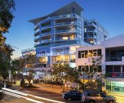
Scarborough Beach Resort
HarbourSide B&B
Oaks Mon Komo
Videos from this area
These are videos related to the place based on their proximity to this place.
Video Of Beautiful Scarborough Queensland - Views!!
BEAUTIFUL Scarborough Queensland - Views - We have stayed a number of times at the Scarborough Beach Resort, Scarbrough, Queensland and just love this cute little seaside suburb. So secluded.
25 Reef Point Esplanade - Scarborough (4020) Queensland by I...
Property Video shoot of 25 Reef Point Esplanade Scarborough 4020 QLD by PlatinumHD http://www.platinumhd.tv for Ian Thompson Properties.
SOLD | 11 Queen Street, Scarborough - Chilli Real Estate - Dean Eldridge
4 Bed 3 Bath 4 Car Only 100 metres to the waterfront sits this high-set, renovated home that offers a complete separate flat for those looking for functional living options for the growing...
20/8 Bunton St Scarborough Queensland
http://www.chillirealestate.com.au Unit 20/8 Bunton Street Scarborough Studio/Office in heart of Scarborough Potentially, this could be a 2 bedroom apartment upstairs (subject to council approval)...
SOLD - 13 Herne Road, Scarborough - Chilli Real Estate - Dean Eldridge
http://chillirealestate.com.au/ 3 Bed 2 Bath 1 Car With not many blocks this size still available in Scarborough, this home is one not to be missed! Set on a huge 1012sqm allotment, this solid...
Teppanyaki Night Morgans Seafood Restaurant Scarborough 08 March 2014
Teppanyaki Night, Morgans Seafood Restaurant, Scarborough, 08 March 2014 Happy 80th Birthday mum !!!
SOLD! 7 Central Avenue, Scarborough - Chilli Real Estate - Dean Eldridge
5 Bed 2 Bath 2 Car Modern living for the growing family in one of the most desired addresses in Scarborough. There is plenty of room for Mum and Dad, and the Kids with 5 large bedrooms, a...
Kite Surfing in Scarborough Queensland
Just a short clip of kite surfing shot on the Canon 100D with a 18-55mm Image Stabilised STM Kit Lens. Shot at 1080p 25fps, stabilised & sharpened further in post and final output at 720p.
Gorgeous & Relaxing Scarborough Marina Video 01
From Jodiesjourney.com - Exploring SCARBOROUGH Marina 01 - with my daughter checking out the establishment of Morgan's Seafood and the fishing boats out the back. Lots of fun. Brought to...
Wow!! Video of Beautiful Scarborough Marina 02
From Jodiesjourney.com - Exploring SCARBOROUGH Marina 02 - with my daughter checking out the establishment of Morgan's Seafood and the fishing boats out the back. Lots of fun. Brought to...
Videos provided by Youtube are under the copyright of their owners.
Attractions and noteworthy things
Distances are based on the centre of the city/town and sightseeing location. This list contains brief abstracts about monuments, holiday activities, national parcs, museums, organisations and more from the area as well as interesting facts about the region itself. Where available, you'll find the corresponding homepage. Otherwise the related wikipedia article.
HMQS Gayundah
HMQS Gayundah was a flat-iron gunboat operated by the Queensland Maritime Defence Force and later the Royal Australian Navy (as HMAS Gayundah). She entered service in 1884 and was decommissioned and sold in 1921. She then served as sand and gravel barge for Brisbane Gravel Pty Ltd until 1950, when she was scrapped. In 1958, Gayundah was run aground at Woody Point at Redcliffe, to serve as a breakwater structure.
Redcliffe, Queensland
RedcliffeQueensland 270px Population: 8,981 (2006) Established: 13 September 1824 Postcode: 4020 Location: 28 km NNE of Brisbane CBD LGA: Moreton Bay Region State/territory electorate(s): Redcliffe Federal Division(s): Petrie Suburbs around Redcliffe: Newport Scarborough Moreton Bay Kippa-Ring Redcliffe Moreton Bay Clontarf Margate Moreton Bay Redcliffe is a residential suburb of the Moreton Bay Region in the north-east of the Redcliffe peninsula, approximately 28 kilometres north-north-east of Brisbane, the state capital of Queensland, Australia.
Division of Petrie
The Division of Petrie is an Australian Electoral Division in Queensland. The division was created in 1949 and named after Andrew Petrie (1798–1872), a noted civil engineer, pioneer and explorer, and the first free settler in Brisbane (1837). The electorate has a higher-than-average percentage of pensioners and self-funded retirees, and is mainly residential, with some light industrial and commercial activities.
Scarborough, Queensland
Scarborough is a residential suburb of the Moreton Bay Region at the northernmost of the Redcliffe peninsula, approximately 30 kilometres north-northeast of Brisbane, the state capital of Queensland, Australia. Officially established on 27 March 1971, the suburb used to act as a gateway to Moreton Island via the Combie Trader barge, but this service was recently sold.
Woody Point, Queensland
Woody Point is a residential suburb of the Moreton Bay Region at the south-east of the Redcliffe peninsula, approximately 24 kilometres north-northeast of Brisbane, the state capital of Queensland, Australia. It was formerly a banana plantation. Woody Point's Apex Park & Bicentennial Park were constructed by reclaiming land along the foreshore in the 1970s.
Clontarf, Queensland
Clontarf is a residential and light industrial suburb of the Moreton Bay Region in the south-west of the Redcliffe peninsula, approximately 29 kilometres north-northeast of Brisbane, the state capital of Queensland, Australia. It was named after Clontarf in Ireland.
Dolphin Oval
Dolphin Oval, based on the corner of Ashmole and Klingner Roads in Kippa-Ring, north of Brisbane, is the home ground for the Redcliffe Dolphins rugby league football club, who play in the Queensland Wizard Cup. The ground regularly hosts pre-season NRL trials, and hosted the 2001, 2002 and 2003 Queensland Cup Grand Finals.
Deception Bay, Queensland
Deception Bay is a suburb north of Brisbane, Queensland, Australia. Its Local Government Area is the Moreton Bay Region and is located approximately 32 km north of Brisbane in the south-eastern corner of the bay of the same name which separates the Redcliffe peninsula and Bribie Island. Deception Bay was named in 1823 by Lt John Oxley, who thought the bay was a river and because of his mistake and the shallowness, named it Pumice Stone River; he later changed the name to Deception Bay.
Grace Lutheran College
Grace Lutheran College (GLC), founded in 1978, is a co-educational, private high school based in Rothwell and Caboolture in Queensland, Australia. Grace Lutheran Primary School is located in Clontarf, approximately a 10 minute drive from the main Grace College Campus at Rothwell. The current Principal is Mrs Ruth Butler, who took up the post in 2010 after the founding Principal, Mr Fred Stoltz, retired. The college's enrolment at the start of the 2011 school year was over 1800.
Kippa-Ring, Queensland
Kippa-Ring is a residential and light industrial suburb of the Moreton Bay Region at the center of the Redcliffe peninsula, approximately 27 kilometres north-northeast of Brisbane, the state capital of Queensland, Australia. Designated as the commercial, retail & financial centre for the Redcliffe region, Kippa-Ring houses the bulk of the commercial and retail sectors on the Peninsula including the largest shopping centres.
Deception Bay State High School
Deception Bay State High School is a co-educational, state run high school located in Deception Bay, Queensland, Australia. The School services the Deception Bay area's high school students- years 8 to 12. The school first opened its doors to students in 1992. Today, there are approximately 850 students enrolled in the school. The school principal is David Friis. The school motto is "We Care, We Learn, We Prosper".
City of Redcliffe
City of Redcliffe is a local government area in South East Queensland, Australia. It is in the northern part of the County of Stanley. The council covers the suburbs of Clontarf, Kippa-Ring, Margate, Redcliffe, Rothwell, Scarborough and Woody Point – a total area of 38.1 km² with a population of 51,174. For more details on this topic, see Redcliffe City, Queensland.
Margate, Queensland
Margate is a residential suburb of the Moreton Bay Region in the east of the Redcliffe peninsula, approximately 26 kilometres north-northeast of Brisbane, the state capital of Queensland, Australia.
Rothwell, Queensland
Rothwell is a residential suburb of the Moreton Bay Region in the west of the Redcliffe peninsula, approximately 28 kilometres north-northeast of Brisbane, the state capital of Queensland, Australia. Saltwater Creek marks the suburb's southern and western border.
Newport, Queensland
Newport is a residential suburb of the Moreton Bay Region at the north of the Redcliffe peninsula, approximately 29 kilometres north-northeast of Brisbane, the state capital of Queensland, Australia.
Burpengary Creek
Burpengary Creek is located about 40 kilometres north of Brisbane, in Queensland, Australia and has a total catchment area of 7,960 hectares. Burpengary Creek is an area serviced by Moreton Bay Regional Council. The Burpengary Creek catchment forms part of the larger Deception Bay catchment and encompasses two distinctive creeks–Little Burpengary Creek (6,360ha) and Burpengary Creek (6, 360ha).
Talobilla Park
Talobilla Park is a sporting facility located in the suburb of Kippa-Ring, Queensland in Australia. Sports include baseball, canoeing, dragon boating, football (soccer), rugby league and softball. Talobilla Park also contains an Automated Weather Observing System for the Australian Bureau of Meteorology. It is built on an old landfill reserve.
Redcliffe Showgrounds
The Redcliffe Showgrounds is a showground in Redcliffe, Queensland for the annual Redcliffe Show the June holidays. Whilst the show isn't on, it is home to the Redcliffe Darts club, Redcliffe Bingo as well as PCYC Over 35 soccer club. It used to be the main field for the Redcliffe Dolphins up until 1982 before the club moved to Dolphin Oval, but still serves as a training ground.
Clontarf Beach State High School
Clontarf Beach State High School (CBSHS), opened 1964, is a co-educational, public high school based in Clontarf in Queensland, Australia. Clontarf State Primary School is located not far from it. The current Principal is Lisa Starmer. The school's enrolment in 2008 was approximately 1148. In December 2008 the number was 1240.
Southern Cross Catholic College
Southern Cross Catholic College (SCCC), opened 30 January 1995, is a co-educational school based in Redcliffe in Queensland, Australia.
Redcliffe State High School
Redcliffe State High School (RSHS) is a co-educational, public high school based in Redcliffe in Queensland, Australia. Scarborough State School is located not far from it. The current Headmistress is Shona McKinlay.
Saltwater Creek
Saltwater Creek is a creek in Rothwell, Queensland. It flows north from Hays Inlet and separates Mango Hill from Rothwell, creating a border for Redcliffe City. Its name derives from the water being, in fact, salt water.
Ted Smout Memorial Bridge
The Ted Smout Memorial Bridge is a new bridge in Brisbane, Australia. It is located 30 metres to the east, and forming the duplication, of the Houghton Highway. It crosses Bramble Bay, linking the Redcliffe suburb of Clontarf with the Brisbane suburb of Brighton. The Ted Smout Memorial Bridge and its twin, the Houghton Highway, are Australia's longest bridges, with the former opened by Premier Anna Bligh on 11 July 2010. The new bridge consists of 78 spans, each 35 m long.
99.7 FM (Redcliffe)
99.7 FM (callsign 4RED) is a community radio station serving Greater Brisbane North Region, Queensland.
A.J. Kelly Park
AJ Kelly Park is a football (soccer) venue located at Kippa Ring, Queensland. It is home to Peninsula Power.


