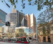
Discover Sylvania
The district Sylvania of in New South Wales is a subburb in Australia about 142 mi north-east of Canberra, the country's capital city.
If you need a hotel, we compiled a list of available hotels close to the map centre further down the page.
While being here, you might want to pay a visit to some of the following locations: Parramatta, Katoomba, Canberra, and . To further explore this place, just scroll down and browse the available info.
Local weather forecast
Todays Local Weather Conditions & Forecast: 22°C / 72 °F
| Morning Temperature | 15°C / 59 °F |
| Evening Temperature | 22°C / 71 °F |
| Night Temperature | 18°C / 64 °F |
| Chance of rainfall | 0% |
| Air Humidity | 50% |
| Air Pressure | 1024 hPa |
| Wind Speed | Moderate breeze with 10 km/h (6 mph) from South |
| Cloud Conditions | Clear sky, covering 0% of sky |
| General Conditions | Sky is clear |
Wednesday, 24th of April 2024
22°C (72 °F)
16°C (61 °F)
Overcast clouds, fresh breeze.
Thursday, 25th of April 2024
19°C (67 °F)
15°C (59 °F)
Scattered clouds, gentle breeze, broken clouds.
Friday, 26th of April 2024
18°C (64 °F)
15°C (59 °F)
Light rain, gentle breeze, few clouds.
Hotels and Places to Stay
EVENTHOUSE CRONULLA
QUEST CRONULLA BEACH SERVICED APTS
Novotel Sydney Brighton Beach
Mercure Sydney International Airport
Abcot Inn
Metro Hotel Miranda
Sutherland Motel
Cronulla Motor Inn
Amaaze Airport Serviced Apartments
Meriton Suites Campbell Street
Videos from this area
These are videos related to the place based on their proximity to this place.
Drones, boats and towing
This is my 1st attempt at capturing and editing some drone action footage. I used the "DJI Phantom 2" drone and a "GoPro Hero 3+ Black Edition" Camera. Hope you enjoy the video- its my first...
16/20 Kiora Road | Miranda - Pulse Property Agents - Ben Pike
Enjoying leafy treetop views of the Miranda skyline, this renovated apartment is perfect for low maintenance, high quality living, and is just a stroll to cafes, Westfield, parks and transport....
4Networking Sutherland Group Blood Donation at Miranda, Sydney
http://www.paulsproductions.com http://www.4networking.com.au http://www.facebook.com/4NSutherland http://www.donateblood.com.au ...
Commercial Electrician Miranda NSW | Call 0402 738 436
www.sparkelectrician.com.au --- Commercial Electrician Miranda NSW | Call 0402 738 436 With a vast knowledge in the Residential, Commercial and Industrial sectors of the industry we are the...
Port Hacking High School Graduating Class of 2014 Reflections Video
Its been six years and despite it all, I wouldn't change a day. Best of luck to the best cohort out there, see you all on the long journey to the middle xx - ...
BEC Southern Sydney Breakfast Networking 5th June 2013 - Sarah Morton
The Business Enterprise Centre Southern Sydney (BEC) is here to guide you on your business journey. No matter where you're starting from, we help you stay on track to reach your business goals....
Agrarian System - defined
An agrarian system is the dynamic set of economic and technological factors that affect agricultural practices. It is premised on the idea that different systems have developed depending on...
99 Holt Road Taren Point (2229)
For most people, including me, paddling from home, hopping on a boat to visit neighbors and taking a trip up rhe river any time I want - well, that's just a pipe drean. Not if you live at...
What are Exchange rates ?
Exchange rates are the price of one country's' currency in relation to another. Reference: http://stats.oecd.org/glossary/detail.asp?ID=877 Created at http://www.b2bwhiteboard.com.
Videos provided by Youtube are under the copyright of their owners.
Attractions and noteworthy things
Distances are based on the centre of the city/town and sightseeing location. This list contains brief abstracts about monuments, holiday activities, national parcs, museums, organisations and more from the area as well as interesting facts about the region itself. Where available, you'll find the corresponding homepage. Otherwise the related wikipedia article.
Miranda, New South Wales
Miranda is a suburb in southern Sydney, in the state of New South Wales, Australia. Miranda is located 24 kilometres south of the Sydney central business district, in the Sutherland Shire. Miranda has a mixture of low, medium and high density residential and is known as a commercial centre for the southern suburbs. Miranda's Westfield shopping centre attracts many shoppers from the Sutherland Shire, the St George area and as far away as Wollongong.
Gymea, New South Wales
Gymea is a suburb in southern Sydney, in the state of New South Wales, Australia. Gymea is located 26 kilometres south of the Sydney central business district in the local government area of the Sutherland Shire. The postcode is 2227, which it shares with adjacent suburb Gymea Bay.
Kyle Bay, New South Wales
Kyle Bay is a suburb in southern Sydney, in the state of New South Wales, Australia. Kyle Bay is 19 kilometres south of the Sydney central business district, in the local government area of the Municipality of Kogarah and is part of the St George area. Kyle Bay takes its name from the bay that sits on the northern shore of the Georges River. It is a tiny, picturesque suburb around this bay and Harness Cask Point.
Division of Cook
The Division of Cook is an Australian Electoral Division in New South Wales. The division was created in 1969 and is named for James Cook, who mapped the east coast of Australia in 1770. It is located in the southern suburbs of Sydney, including Caringbah, Cronulla, Miranda and Sylvania. In the 1970s it was a marginal seat, but demographic change has made it a blue ribbon safe seat for the Liberal Party.
Gymea Technology High School
Gymea Technology High School (commonly known by its acronym, GTHS) is located on the Princes Highway in the suburb of Gymea, in the Sutherland Shire, Sydney, next to Gymea TAFE. It is a technology oriented, public and co-educational high school in New South Wales. Gymea Technology High School achieves above average marks in both the School Certificate (SC) and the Higher School Certificate (HSC).
Miranda railway station
Miranda is a CityRail railway station on the Cronulla branch line of Sydney's Illawara line. Located in the Sydney suburb of Miranda, it serves a residential area and the Sutherland Shire's main shopping centre Westfield Shoppingtown Miranda (known locally as "Miranda Fair"). It has an island platform.
Gymea railway station
Gymea is a CityRail railway station on the Cronulla branch of Sydney, Australia's, Illawarra line. It serves the residential area of Gymea.
Taren Point, New South Wales
Taren Point is a suburb, in southern Sydney, in the state of New South Wales, Australia 20 kilometres south of the Sydney central business district in the local government area of the Sutherland Shire. Taren Point is a small suburb surrounded by the suburbs of Sylvania Waters and Caringbah. Taren Point is on the peninsula where the Captain Cook Bridge crosses north over the Georges River to Sans Souci, in the St George area.
Sylvania Waters, New South Wales
Sylvania Waters is a suburb, in southern Sydney, in the state of New South Wales, Australia 21 kilometres south of the Sydney central business district in the local government area of Sutherland Shire. Sylvania Waters surrounds Gwawley Bay on the southern side of the Georges River. Sylvania is a separate suburb to the west, and Sylvania Heights is a locality within that suburb. Much of the waterfront areas of Sylvania Waters were reclaimed from Gwawley Bay.
Sylvania, New South Wales
Sylvania is a suburb, in southern Sydney, in the state of New South Wales, Australia 22 kilometres south of the Sydney central business district in the Sutherland Shire. Sylvania is mostly residential but also contains areas of native bushland and some commercial developments on the Princes Highway and Port Hacking Road. Sylvania Heights is a locality in the western part of the suburb. Sylvania Waters and Kangaroo Point share the same postcode (2224).
Oyster Bay, New South Wales
Oyster Bay is a suburb in Southern Sydney, in the state of New South Wales, Australia. Oyster Bay is located 26 kilometres south of the Sydney central business district in the local government area of the Sutherland Shire.
Kareela, New South Wales
Kareela is a suburb in southern Sydney, in the state of New South Wales, Australia 24 kilometres south of the Sydney central business district in the local government area of the Sutherland Shire. Kareela is located on Oyster Bay, on the southern banks of the Georges River. Kareela Golf Course and Kareela Oval are prominent recreational areas located on either side of Bates Drive. Kareela Primary School is in Freya Street.
Kangaroo Point, New South Wales
Kangaroo Point is a tiny suburb in southern Sydney, in the state of New South Wales, Australia. It is 22 kilometres south of the Sydney central business district in the local government area of the Sutherland Shire. Kangaroo Point takes its name from the peninsula which sits on the southern bank of the Georges River. It is completely surrounded by the suburb of Sylvania which it was originally part of and still shares the same postcode.
Caringbah High School
Caringbah High School is located on Willarong Road North in the suburb of Caringbah, in the Sutherland Shire, Sydney. It is one of ten academically selective, public and co-educational high schools in New South Wales. Caringbah High School students achieve consistently high marks in both the School Certificate (SC) and the Higher School Certificate (HSC).
Blakehurst, New South Wales
Blakehurst is a suburb in southern Sydney, in the state of New South Wales, Australia 18 kilometres south of the Sydney central business district, in the local government area of the Municipality of Kogarah. It is part of the St George area. Blakehurst is connected to Sylvania, in the Sutherland Shire, to the south, by Tom Uglys Bridge over the Georges River. Tom Uglys Point is the southernmost part. The eastern border runs along Kogarah Bay and the western border runs along Kyle Bay.
Westfield Miranda
Westfield Miranda (also known as Miranda Fair), owned and managed by the Westfield Group, is a large shopping centre in the suburb of Miranda in the local government area of Sutherland Shire in southern Sydney in the state of New South Wales, Australia.
Green Point Observatory
Green Point Observatory is a private observatory in Oyster Bay, Sydney, Australia, and is the home of the Sutherland Astronomical Society. It is located at the corner of Green Point and Caravan Head Roads. It consists of a dome, library, 41cm Newtonian telescope, a meeting hall seating 100 people, and a roll-off roof observatory with a 35cm Schmidt Cassegrain Telescope.
Caravan Head, New South Wales
Caravan Head is a locality in southern Sydney, in the state of New South Wales, Australia. It is located in the north-eastern part of the suburb of Oyster Bay. It is situated on the southern bank of the Georges River.
Tom Uglys Bridge
Tom Uglys Bridge is one of three major road crossings of the Georges River in southern Sydney, New South Wales, Australia. It consists of two separate bridges that carry the Princes Highway, linking the St George area at Blakehurst to the Sutherland Shire at Sylvania.
Sutherland Hospital
Sutherland Hospital is part of the South Eastern Sydney and Illawarra Area Health Service and is located in Caringbah, a southern suburb of Sydney, New South Wales, Australia. The hospital has a general medicine, general surgery, obstetrics and gynaecology, paediatrics, aged care, rehabilitation and psychiatry service. It is a teaching hospital of the University of New South Wales. The contact number is +61 2 9540 7111.
Sutherland Parish, Cumberland
Sutherland Parish is one of the 57 parishes of Cumberland County, New South Wales, a cadastral unit for use on land titles. It was originally proclaimed as the parish of Southerland with an 'o', but was misspelled without it on the government gazette. It includes all of the Kurnell peninsula, with Botany Bay and the Georges River to the north; part of the Woronora River to the west; and Port Hacking to the south.
Sylvania High School
Sylvania High School is a high school situated in the Sutherland Shire, in the South-East region of Sydney, New South Wales.
Seymour Shaw Park
Seymour Shaw Park is a football (soccer) stadium in Miranda, New South Wales, Australia. It is the current home ground of the Sutherland Sharks Football Club who play in the state league, the New South Wales Premier League.
Forshaw Park
Forshaw Park is a rugby stadium in Sylvania Waters, New South Wales, Australia. It is located just 28 km south of the City of Sydney. The ground can fit 2,000 people. It has been the home ground to the Southern Districts Rugby Club since 1989.
Port Hacking High School
Port Hacking High School is a high school situated in the Sutherland Shire, in the South-East region of Sydney, New South Wales. It was opened in 1959 and was the first comprehensive high school within the Sutherland Shire Council that provided education up to and including the Higher School Certificate level.


