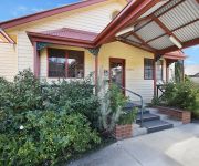
Delve into South Gundagai
South Gundagai in Gundagai (New South Wales) is located in Australia about 60 mi (or 96 km) west of Canberra, the country's capital town.
Current time in South Gundagai is now 06:33 AM (Friday). The local timezone is named Australia / Sydney with an UTC offset of 10 hours. We know of 8 airports close to South Gundagai, of which one is a larger airport. The closest airport in Australia is Tumut Airport in a distance of 15 mi (or 24 km), South-East. Besides the airports, there are other travel options available (check left side).
Also, if you like playing golf, there are some options within driving distance. If you need a hotel, we compiled a list of available hotels close to the map centre further down the page.
While being here, you might want to pay a visit to some of the following locations: Canberra, Katoomba, Parramatta, Hay and Sydney. To further explore this place, just scroll down and browse the available info.
Local weather forecast
Todays Local Weather Conditions & Forecast: 16°C / 62 °F
| Morning Temperature | 5°C / 40 °F |
| Evening Temperature | 11°C / 51 °F |
| Night Temperature | 8°C / 46 °F |
| Chance of rainfall | 0% |
| Air Humidity | 34% |
| Air Pressure | 1021 hPa |
| Wind Speed | Gentle Breeze with 6 km/h (4 mph) from East |
| Cloud Conditions | Clear sky, covering 0% of sky |
| General Conditions | Sky is clear |
Friday, 26th of April 2024
18°C (64 °F)
9°C (49 °F)
Sky is clear, light breeze, clear sky.
Saturday, 27th of April 2024
20°C (69 °F)
12°C (54 °F)
Sky is clear, light breeze, clear sky.
Sunday, 28th of April 2024
22°C (71 °F)
16°C (60 °F)
Overcast clouds, gentle breeze.
Hotels and Places to Stay
Comfort Inn Sovereign Gundagai
Videos from this area
These are videos related to the place based on their proximity to this place.
Images of Natwash - AUSTRALIA ..... Snake Gully Cup 2010
Fashions on the Field. Gundagai NSW Australia was the location for the running of the Gundagai - Adelong Snake Gully Cup 2010. Fashions on the field attracted contestants,..... Kelly Thompson...
Microlight Jabiru Air Escape Tumut+61418278012
60 seconds of onboard footage with www.airescape.com.au Tumut Australia.
Videos provided by Youtube are under the copyright of their owners.
Attractions and noteworthy things
Distances are based on the centre of the city/town and sightseeing location. This list contains brief abstracts about monuments, holiday activities, national parcs, museums, organisations and more from the area as well as interesting facts about the region itself. Where available, you'll find the corresponding homepage. Otherwise the related wikipedia article.
Gundagai
Gundagai is a town in New South Wales, Australia. Although a small town, Gundagai is a popular topic for writers and has become a representative icon of a typical Australian country town. Located along the Murrumbidgee River and Muniong, Honeysuckle, Kimo, Mooney Mooney, Murrumbidgee and Tumut mountain ranges, Gundagai is 390 kilometres south-west of Sydney, the state capital and largest city in Australia. Gundagai is the administrative centre of Gundagai Shire Council local government area.
Gundagai Shire
Gundagai Shire is a local government area in the Riverina region of New South Wales, Australia. The Shire is located adjacent to the Hume Highway. Gundagai Shire is primarily rural, with a small population. 80% of the Shire's population live in the town of Gundagai. The four villages in the Shire are Coolac, Tumblong, Muttama and Nangus, with populations ranging from 40 to 90 people. The Mayor of Gundagai Shire is Cr. Abb McAlister, an unaligned politician.
Prince Alfred Bridge
The Prince Alfred Bridge is a wrought iron truss and timber beam road bridge over the Murrumbidgee River and its floodplain at Gundagai, New South Wales. The bridge was named for the then reigning Queen Victoria's consort, Prince Alfred, Duke of Saxe-Coburg and Gotha, and was built to carry the Great Southern Road across the Murrumbidgee. It has existed in three forms, with only the main spans across the river itself being common to all three.


