
Address & Contact
Contact Information:
Wikipedia page
Street address:
Bedourie Airport
Bedourie Queensland 4829
Australien
GPS Coordinates:
Longitude: 139,460°
Latitude: -24,346°
Summary
Bedourie Airport is a small airport in Australia, serving the region of Bedourie, Queensland. The longest runway is 4.921 feet or 1.500 meters long.
Facts:
Airport size: medium airport Serving area: Bedourie, Queensland Longest runway: 4921 (ft)
Codes:
IATA: BEU,
ICAO: YBIE
Flight information:
Departure times (FlightStats)
Flight times (FlightRadar24)
Location on map
Show bigger map on Openstreetmap
About the airport
Bedourie Airport (IATA: BEU, ICAO: YBIE) is a small regional airport located in the town of Bedourie, Australia. Situated in the state of Queensland, this airport serves as a vital transportation hub for travellers visiting the region.
With a single asphalt runway, Bedourie Airport primarily caters to light aircraft and small charter flights. It offers limited facilities, including a small terminal building with basic amenities such as toilets and seating areas. However, it is important to note that there are no commercial airlines operating at this airport, and flights are typically arranged through private charter companies or air taxi services.
Bedourie Airport provides convenient access to the stunning landscapes and attractions of the surrounding area. Travellers can explore the nearby Simpson Desert, renowned for its mesmerizing sand dunes and unique wildlife. The airport also serves as a gateway to the remote town of Bedourie, where visitors can experience the rich cultural heritage of Outback Australia.
Please note that due to its remote location, it is advisable to plan your trip to Bedourie Airport well in advance and make necessary arrangements for transportation and accommodation.
Videos from the area of the airport

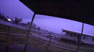
Lightning Strike - Close Call - Simpson Desert - Australia - Bedourie.mp4
Lightning struck just meters away on the house next door - lucky for me I had 2 Hi Definition video cameras running at 60fps - Bedourie, Qld Australia 25/04/11 - Close Call - Cool Lightning...
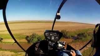
Aerial Stock Mustering
Chopper pilot Andrew helping muster on a cattle station in the Channel country. Footage taking early 2014 after a flood.
Videos provided by Youtube are under the copyright of their owners. 
 Cluny Airport
Small airport - 15 mi (25 km)
Glengyle AirportSmall airport - 33 mi (54 km)
Marion Downs AirportSmall airport - 69 mi (111 km)
Monkira AirportSmall airport - 75 mi (121 km)
Springvale AirportSmall airport - 96 mi (154 km)
Boulia AirportMedium airport - 103 mi (166 km)
Roseberth AirportSmall airport - 103 mi (167 km)