Safety Score: 3,2 of 5.0 based on data from 9 authorites. Meaning please reconsider your need to travel to Argentina.
Travel warnings are updated daily. Source: Travel Warning Argentina. Last Update: 2024-04-25 08:17:04
Discover Villa Pineral
The district Villa Pineral of in Partido de Tres de Febrero (Provincia de Buenos Aires) is a district in Argentina a little west of Buenos Aires, the country's capital city.
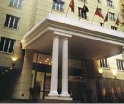
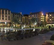
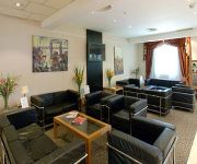
Looking for a place to stay? we compiled a list of available hotels close to the map centre further down the page.
When in this area, you might want to pay a visit to some of the following locations: Caseros, General San Martin, San Justo, Moron and Hurlingham. To further explore this place, just scroll down and browse the available info.
Local weather forecast
Todays Local Weather Conditions & Forecast: 15°C / 60 °F
| Morning Temperature | 14°C / 57 °F |
| Evening Temperature | 17°C / 62 °F |
| Night Temperature | 17°C / 62 °F |
| Chance of rainfall | 0% |
| Air Humidity | 77% |
| Air Pressure | 1017 hPa |
| Wind Speed | Light breeze with 5 km/h (3 mph) from South-West |
| Cloud Conditions | Broken clouds, covering 84% of sky |
| General Conditions | Broken clouds |
Friday, 26th of April 2024
17°C (62 °F)
15°C (59 °F)
Moderate rain, gentle breeze, overcast clouds.
Saturday, 27th of April 2024
17°C (63 °F)
14°C (57 °F)
Broken clouds, gentle breeze.
Sunday, 28th of April 2024
18°C (64 °F)
15°C (59 °F)
Sky is clear, light breeze, clear sky.
Hotels and Places to Stay
LOISUITES RECOLETA HOTEL
RIVIERA HOTEL
Sheraton Pilar Hotel & Convention Center
AEROPARQUE HOTEL INN AND SUITES
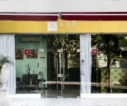
Ker Urquiza Hotel and Suites
Ayres De Recoleta Hotel
Hotel El Dorado
Art Factory
Hotel Bahia Sardina
Hotel Lord Pierre
Videos from this area
These are videos related to the place based on their proximity to this place.
LA VILLA 1-11-14 Y LA MUERTE DE UN TAXISTA
MAYO 2010 - El taxista de 40 años llamado Fernando Vásquez Catorceno fue herido de muerte de un balazo por una persona que residía en la villa 1-11-14, el hecho ocurrió en la intersección...
Escuela de Adultos 703 del barrio Ejército de los Andes
Un año de trabajo con amor, avances y hechos!!
GM GT-22CW #9048 de FerroSur en el LSM ingresando a Chacarita
En el siguiente vídeo podremos apreciar a la EMD GM GT-22CW #9048 de "Ferrosur Roca" prestando servicio en el LSM, ingresando a los bosinazos a la estación Chacarita (Tren Descendente).
Martín Jofré en Urbana BA
El edil del Frente Renovador visitó los estudios de www.UrbanaBa.com.ar y se refirió a sus intenciones de ser el próximo intendente. “Los vecinos quieren que haya un cambio”, sentenció....
Gustavo Antognazza Maestro V DAN Taekwondo DTA
Gustavo Antognazza Maestro V DAN de la DTA,Realiza su Forma de IV Dan ante tre distingidos Maestros de las Artes Marciales 29/11/2008.
GM J16CW/AC serie 319-237 ingresando a Caseros
En el siguiente vídeo veremos a una de las Locomotoras General Motors J16CW/AC serie 319-237 "Retales" de la UGOFE LSM con un tren local proveniente del lado Retiro ingresando a Caseros ...
UGOFE LSM: ALCO RSD-16 NºB-826 al mando del Tren de los Cartoneros
Aquí podemos ver a la ALCO RSD- NºB-826 de UGOFE LSM al mando del "Tren de los Cartoneros" a su paso por estación Caseros y en dirección a Retiro LSM. Autor: Enrique O. Medina.
UGOFE LSM: ALCO RSD-16 NºB-807 saliendo de estación Caseros con rumbo a Retiro
Aquí podemos ver a la ALCO RSD-16 NºB-807 de UGOFE LSM partiendo de estación Caseros con rumbo a Retiro LSM. Tren proveniente de Pilar y con destino a Retiro (Tren Descendente).
UGOFE LSM: ALCO RSD-16 NºB819 ingresando a estación Caseros con Rumbo a Pilar
Aquí vemos a una hermosa ALCO RSD-16 NºB819 de UGOFE LSM ingresando a la estación Caseros. Tren proveniente de Retiro LSM y con Rumbo a Pilar (Tren Ascendente). Autor: Enrique O.
ALCO RSD-16 #B814 saliendo de Caseros rumbo a Retiro
En el siguiente vídeo veremos a una bella locomotora que ya lleva años surcando nuestras vías. una bella ALCO RSD-16 #B814 de UGOFE LSM Saliendo de Caseros con un local rumbo a Retiro ...
Videos provided by Youtube are under the copyright of their owners.
Attractions and noteworthy things
Distances are based on the centre of the city/town and sightseeing location. This list contains brief abstracts about monuments, holiday activities, national parcs, museums, organisations and more from the area as well as interesting facts about the region itself. Where available, you'll find the corresponding homepage. Otherwise the related wikipedia article.
Chacarita Juniors
Club Atlético Chacarita Juniors (usually known simply as Chacarita) is an Argentine football club headquartered in Villa Crespo, Buenos Aires while the stadium is located in Villa Maipú, General San Martín Partido of Greater Buenos Aires. The squad currently plays at Primera B Metropolitana, the third division of the Argentine football league system.
Estadio José Amalfitani
The Estadio José Amalfitani is a stadium located in the Liniers neighbourhood of Buenos Aires, Argentina, in close proximity to Liniers railway station. The venue is the home of the Argentine Primera División club Vélez Sársfield and is also known as El Fortín de Liniers or Vélez Sarsfield. The stadium was built between 1941 and 1943 in wood, and rebuilt in cement between 1947 and 1951. 27 years later, it was expanded in preparation for the 1978 FIFA World Cup.
Battle of Caseros
The Battle of Caseros was fought near the town of Caseros, more precisely between the present-day railway stations of Caseros and Palomar (the actual battlefield is now occupied by the Colegio Militar de la Nación, a military academy) in Buenos Aires Province, Argentina, on 3 February 1852, between the Army of Buenos Aires commanded by Juan Manuel de Rosas and the Grand Army (Ejército Grande) led by Justo José de Urquiza.
Morón, Buenos Aires
Morón is a city in the Argentine province of Buenos Aires, capital of the Morón Partido, located in the Greater Buenos Aires metropolitan area, at {{#invoke:Coordinates|coord}}{{#coordinates:34|39|S|58|37|W||| | |name= }}. Located 20 km (13 mi) west of Downtown Buenos Aires, Morón is easily reached via bus along Avenida Rivadavia, via National Highway 7, and the TBA Sarmiento railway line.
Liniers
Liniers is a barrio (neighborhood) of Buenos Aires on the edge of the city, centered on Rivadavia Avenue. It is also an important train station and bus hub, connecting western Gran Buenos Aires with the Buenos Aires Metro. The barrio was built up following the building of Liniers railway station. File:Buenos Aires - Estadio José Amalfitani (Vélez Sársfield). jpg José Amalfitani Stadium. The neighbourhood is home to football club Club Atlético Vélez Sársfield.
Villa Devoto
Villa Devoto is a neighborhood or district located in the northern area of the city of Buenos Aires, Argentina, its administrive limits are defined by Lope de Vega, General Paz, San Martín, and Francisco Beiró avenues, and Joaquín V. González, Baigorria and Campana streets. Villa Devoto, a primarily middle to upscale neighbourhood, is characterised by quiet tree-lined streets and is often considered as The garden of Buenos Aires.
Estadio Almagro
Estadio Tres de Febrero is a multi-use stadium in Buenos Aires, Argentina. It is the home ground for Club Almagro. The stadium holds 21,000 people. It was renovated in 2000 after Almagro were promoted to the Primera División Argentina.
Villa Martínez de Hoz
Villa Martínez de Hoz is a locality of the Lanús Partido in Buenos Aires Province. It is named after the Martinez de Hoz family, owners of the land until the first years of the 20th century.
Ciudadela, Buenos Aires
Ciudadela is a city in Greater Buenos Aires, Buenos Aires Province, Argentina. It is located in the Tres de Febrero Partido, immediately to the west of the neighborhood of Liniers in Buenos Aires city proper. It is separated from the city by General Paz avenue.
National Technological University – Haedo Regional Faculty
The National Technological University - Haedo Regional Faculty is an affiliate of the Universidad Tecnológica Nacional, the leading institution of its type in Argentina. Located in Haedo, a western suburb of Buenos Aires, it was established in 1967 and offers academic degrees in the following subjects: Aeronautical Engineering Electronic Engineering Industrial Engineering Mechanical Engineering
Tres de Febrero Partido
Tres de Febrero (3rd of February) is a partido of the Greater Buenos Aires conurbation area in Buenos Aires Province, Argentina.
Monte Castro
Monte Castro is a western barrio (neighborhood) in Buenos Aires, Argentina, belonging to the 10th comuna (district). Its borders are: Alvarez Jonte Ave. , Lope de Vega Ave. , Juan Agustín García St. , Joaquín V. González St. , Baigorria St. , and Irigoyen St. It is located in one of the highest zones in the city and is currently a middle-income neighborhood. However, at the end of 1930, many low-rent houses were built by the Compañía General de Construcciones, which have been rebuilt since.
Devoto "R"
Devoto "R" (Residential) refers to a particular section of the Villa Devoto Ward of Buenos Aires. An upscale section charactrized by larger, single-family homes, and early twentieth-century architecture, Devoro R has a lower population density than the rest of the Villa Devoto ward. The area is centered around Plaza Arenales, along Salvador María del Carril Boulevard.
Ciudad Jardín Lomas del Palomar
Ciudad Jardín Lomas del Palomar is a planned community, part of the partido Tres de Febrero in Greater Buenos Aires and located adjacent to the city of El Palomar. It is served by two railway lines, the San Martín Line and the Urquiza Line, which provide easy access to the Capital about 20 kilometres away.
Villa Luro
Villa Luro is a barrio (district) of Buenos Aires, Argentina. It is located in the western part of Capital Federal. The district owes its name to Dr. Pedro Luro, a prominent local physician and real-estate developer who, during the 1870s, sold most of his property in the area as residential lots.
Villa Real, Buenos Aires
Villa Real is a barrio (district) of Buenos Aires, Argentina. It is located in the western part of the City of Buenos Aires.
El Palomar Airport
El Palomar Airport, is a military airport in El Palomar, Argentina. It is the homebase of Argentine Air Force 1st Air Brigade (Spanish: Primera Brigada Aérea), located 18 km west of Buenos Aires, near the El Palomar station of the San Martín railway line.
Ramos Mejía
Ramos Mejía is a city in La Matanza Partido, Buenos Aires Province. The city has an area of 11.9 km² and a population of 98,457. The city is one of the largest commercial districts in the Western Zone of Greater Buenos Aires.
Lomas del Mirador
Lomas del Mirador is a locality of the La Matanza partido in Greater Buenos Aires. Located outside Buenos Aires along the southwest edge of the General Paz Freeway, the city has a population of 51,488. The land where Lomas del Mirador is located was sold by Ezequiel Ramos Mexía to Pablo Pelluse in 1868. The ranch at the site was known as Terrenos del Mirador ("the lookout property") in reference to the estancia therein, Mirador Santa Lucía.
National University of General San Martín
The National University of General San Martín (Spanish: Universidad Nacional de General San Martín, UNSAM) is an Argentine national university located in San Martín, Buenos Aires Province. Some courses are taken at INTI and CNEA. The Instituto Sabato is a branch of this university. {{#invoke:Coordinates|coord}}{{#coordinates:34|34|47|S|58|31|36|W| |primary |name= }} {{#invoke: Navbox | navbox }}
National University of La Matanza
The National University of La Matanza (Spanish: Universidad Nacional de La Matanza, UNLM) is an Argentine national university situated in La Matanza Partido, Buenos Aires Province.
National University of Tres de Febrero
The National University of Tres de Febrero (Spanish: Universidad Nacional de Tres de Febrero) is an Argentine national university.
Colegio Militar de la Nación
The National Military College (Spanish: Colegio Militar de la Nación) is the institution in charge of the undergraduate education of officers of the Argentine Army. It is located at El Palomar, Buenos Aires. Established on October 11, 1869, by President Domingo Sarmiento at the height of the Paraguayan War, its original quarters were opened in where the Parque Tres de Febrero stands today.
Estadio Ciudad de Caseros
Estadio Ciudad de Caseros is a football stadium in Caseros, Buenos Aires, Argentina. It is the home ground of Club Atlético Estudiantes. The stadium holds 16,740 people and was opened on 11 May 1963.
Liniers railway station
Liniers railway station (Estacion Liniers in Spanish) is located in the Liniers barrio of Buenos Aires, Argentina. It is on the FFCC Sarmiento line, between the stations of Ciudadela and Villa Luro. It was first authorised and named in 1872, taking its name in honour of Santiago Liniers.


