Safety Score: 2,7 of 5.0 based on data from 9 authorites. Meaning we advice caution when travelling to United States.
Travel warnings are updated daily. Source: Travel Warning United States. Last Update: 2024-04-24 08:14:40
Touring Capitol Heights
The district Capitol Heights of in Maryland with it's 4,574 residents Capitol Heights is a subburb located in United States a little east of Washington DC, the country's capital place.
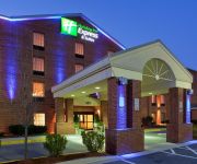
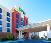
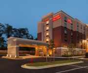
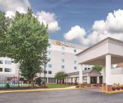
Need some hints on where to stay? We compiled a list of available hotels close to the map centre further down the page.
Being here already, you might want to pay a visit to some of the following locations: Washington DC, Alexandria, Upper Marlboro, Arlington and Falls Church. To further explore this place, just scroll down and browse the available info.
Local weather forecast
Todays Local Weather Conditions & Forecast: 21°C / 70 °F
| Morning Temperature | 14°C / 57 °F |
| Evening Temperature | 18°C / 65 °F |
| Night Temperature | 11°C / 52 °F |
| Chance of rainfall | 0% |
| Air Humidity | 38% |
| Air Pressure | 1013 hPa |
| Wind Speed | Moderate breeze with 11 km/h (7 mph) from South-East |
| Cloud Conditions | Broken clouds, covering 80% of sky |
| General Conditions | Light rain |
Thursday, 25th of April 2024
14°C (57 °F)
8°C (46 °F)
Sky is clear, gentle breeze, clear sky.
Friday, 26th of April 2024
16°C (61 °F)
9°C (48 °F)
Sky is clear, gentle breeze, clear sky.
Saturday, 27th of April 2024
14°C (57 °F)
13°C (55 °F)
Overcast clouds, light breeze.
Hotels and Places to Stay
DoubleTree Hotel Largo
Malolo Bed and Breakfast
Fairfield Inn & Suites Washington DC/New York Avenue
Holiday Inn Express & Suites I-95 CAPITOL BELTWAY-LARGO
Residence Inn Largo Capital Beltway
Hampton Inn - Suites Glenarden MD-Washington DC
Courtyard Largo Capital Beltway
Holiday Inn Express & Suites WASHINGTON DC NORTHEAST
Hampton Inn - Suites Camp Springs-Andrews AFB MD
LA QUINTA INN STE DC METRO CAPITOL BELTW
Videos from this area
These are videos related to the place based on their proximity to this place.
2004 Acura RL Used Cars District Heights MD
http://www.amko123.com This 2004 Acura RL is available from Amko Auto. For details, call us at 301-736-4600.
2005 BMW 7-Series Used Cars District Heights MD
http://www.amko123.com This 2005 BMW 7-Series is available from Amko Auto. For details, call us at 301-736-4600.
2006 Mercedes-Benz S-Class Used Cars District Heights MD
http://www.amko123.com This 2006 Mercedes-Benz S-Class is available from Amko Auto. For details, call us at 301-736-4600.
1996 Chevrolet Impala SS Used Cars District Heights MD
http://www.amko123.com This 1996 Chevrolet Impala SS is available from Amko Auto. For details, call us at 301-736-4600.
2010 GMC Acadia Used Cars District Heights MD
http://www.amko123.com This 2010 GMC Acadia is available from Amko Auto. For details, call us at 301-736-4600.
2006 Dodge Charger Used Cars District Heights MD
http://www.amko123.com This 2006 Dodge Charger is available from Amko Auto. For details, call us at 301-736-4600.
2007 Ford Freestyle Used Cars District Heights MD
http://www.amko123.com This 2007 Ford Freestyle is available from Amko Auto. For details, call us at 301-736-4600.
2010 Infiniti QX56 Used Cars District Heights MD
http://www.amko123.com This 2010 Infiniti QX56 is available from Amko Auto. For details, call us at 301-736-4600.
WMATA Blue Line Part 3
Another interior shot of 6142 further into the Blue Line entering Addisson Road.
Videos provided by Youtube are under the copyright of their owners.
Attractions and noteworthy things
Distances are based on the centre of the city/town and sightseeing location. This list contains brief abstracts about monuments, holiday activities, national parcs, museums, organisations and more from the area as well as interesting facts about the region itself. Where available, you'll find the corresponding homepage. Otherwise the related wikipedia article.
Capitol Heights, Maryland
Capitol Heights is a town in Prince George's County, Maryland, United States. The population was 4,337 at the 2010 census. Development around the Capitol Heights Metro station has medical facilities and eateries to support the community. The Washington Redskins football stadium is just to the east of Capitol Heights, near the Capital Beltway (I-95/495) and Hampton Mall shopping center which features a hotel and eateries. The town borders Washington, D.C. , and has a ZIP code of 20743.
Carmody Hills-Pepper Mill Village, Maryland
Carmody Hills-Pepper Mill Village was a census-designated place (CDP) in Prince George's County, Maryland during the 2000 census. The combination was arbitrary, and in the mind of most local people there are two separate communities: Carmody Hills and Pepper Mill Village. For the 2010 census the area has been renamed as the Peppermill Village CDP.
Coral Hills, Maryland
Coral Hills is an unincorporated area and census-designated place (CDP) in Prince George's County, Maryland, in the United States. As of the 2010 census, the CDP population was 9,895.
Fairmount Heights, Maryland
Fairmount Heights is a town in Prince George's County, Maryland, United States. The population was 1,494 at the 2010 census. The town was formally incorporated in 1935, making the town the second oldest African-American-majority municipality in Prince George's County. The town is composed of six subdivisions: Fairmount Heights (1900), Waterford (1907), Mount Weissner (1909), North Fairmount Heights (1910), West Fairmount Heights (1911) and Sylvan Vista (1923).
Seat Pleasant, Maryland
Seat Pleasant is an incorporated city in Prince George's County, Maryland, United States, immediately east of Washington D.C. The population was 4,542 at the 2010 census. Two state highways run through it — Maryland Route 704 (now called Martin Luther King Highway and previously named George Palmer Highway after a banker and community leader) and Maryland Route 214 (Central Avenue). The Washington Metro's Blue Line is nearby.
Walker Mill, Maryland
Walker Mill is an unincorporated area and census-designated place (CDP) in Prince George's County, Maryland, United States. The population was 11,302 at the 2010 census.
Benning Road (WMATA station)
Benning Road is an island platformed Washington Metro station in the Benning neighborhood of Northeast Washington, D.C. , United States. The station was opened on November 22, 1980, and is operated by the Washington Metropolitan Area Transit Authority (WMATA). Providing service for the Blue Line, the station is located in a residential area near the intersection of Benning Road and East Capitol Street. It is the first station after the Blue and Orange Lines diverge east of the Anacostia River.
Capitol Heights (WMATA station)
Capitol Heights is an island platformed Washington Metro station in Capitol Heights, Maryland, United States. The station was opened on November 22, 1980, and is operated by the Washington Metropolitan Area Transit Authority (WMATA). Providing service for the Blue Line, the station is located at 133 Central Avenue in a residential area at East Capitol Street and Southern Avenue.
Addison Road (WMATA station)
Addison Road is an island platformed Washington Metro station in the unincorporated area of Walker Mill, Maryland, United States. The station was opened on November 22, 1980, and is operated by the Washington Metropolitan Area Transit Authority (WMATA). Providing service for the Blue Line, the station is located near the residential area of Seat Pleasant on Central Avenue near Addison Road.
WPGC-FM
WPGC-FM is an urban-leaning rhythmic-formatted station, and one of the most popular among Washington, D.C. 's radio stations, and has been ranked as one of its top rated radio stations for over 20 years, according to the Arbitron ratings. It has a city of license of Morningside (its studios are located in Lanham) at the 95.5 MHz frequency on the FM dial. Its tower operates at an effective radiated power of 50 kilowatts (kW) and is located in Capitol Heights, Maryland.
Deanwood
Deanwood is a neighborhood in Northeast Washington, D.C. , bounded by Eastern Avenue to the northeast, Kenilworth Avenue to the northwest, and Nannie Helen Burroughs Avenue to the south. One of Northeast's oldest neighborhoods, Deanwood’s relatively low density, small wood-frame and brick homes, and dense tree cover give it a small-town character that is unique in the District of Columbia. Much of its housing stock dates from the early 20th century.
WJFK (AM)
WJFK (1580 AM, "CBS Sports Radio 1580") is a radio station broadcasting a sports radio format. Licensed to the suburb of Morningside, Maryland, it serves the Washington, D.C. metropolitan area. The station is currently owned by CBS Radio.
Benning Heights
Benning Heights is a residential neighborhood located in Northeast Washington, D.C. It is bounded by East Capitol Street to the south, Brooks Street NE to the north, 44th Street NE and Benning Road to the west, and Division Avenue NE to the east. It is served by the Benning Road station on the Blue Line of the Washington Metro. Politically, Benning Heights is in Ward 7.
Benning Ridge
Benning Ridge is a residential neighborhood located in Southeast Washington, D.C. It is bounded by Fort Chaplin Park to the northwest, Southern Avenue to the south, Benning Road to the east, and Ridge Road SE to the west.
Burrville (Washington, D.C.)
Burrville is a neighborhood located in Northeast Washington, D. C, east of the Anacostia River. It is triangular in area, bounded by Nannie Helen Burroughs Avenue to the south, Division Avenue to the northwest, and Eastern Avenue to the northeast.
Capitol View (Washington, D.C.)
Capitol View is a neighborhood located in both southeast Washington, D. C, straddling East Capitol Street east of the Anacostia River. It is triangular in area, bounded by East Capitol Street to the north, Central Avenue SE to the southwest, and Southern Avenue to the southeast. Capital View is located within Ward 7 and is represented on the D.C. Council by Yvette Alexander.
Northeast Boundary
Northeast Boundary is a small neighborhood located in northeast Washington, D.C. It is Eastern Avenue to the northeast, Southern Avenue to the southeast, Marvin Gaye Park to the southwest, 55th Street NE to the west. Northeast Boundary immediately borders Seat Pleasant, Maryland.
Civic Betterment
Civic Betterment is a small neighborhood located in Southeast Washington, D. C, on the border of Prince George's County, Maryland. It is triangular in area, bounded by G and Fitch Streets SE to the north, Benning Road SE to the southwest, and Southern Avenue to the southeast.
Central Northeast
Central Northeast, also sometimes called Mahaning Heights, is a small neighborhood located in Northeast Washington, D. C with Fort Mahan Park at its center. It is bounded by Nannie Helen Burroughs Avenue to the north, Benning Road to the south, the tracks of the Washington Metro and Minnesota Ave station to the west, and 44th Street NE to the east. It is home to the Friendship Collegiate Academy, a public charter high school. This neighborhood is part of Ward 7.
Hillbrook, Washington, D.C
Hillbrook is a neighborhood in Northeast Washington, D.C. It is bounded by Nannie Helen Burroughs Avenue to the north, Brooks Street to the south, 44th Street NE to the west, and Division Avenue to the east.
Lincoln Heights, Washington, D.C
Lincoln Heights is a residential neighborhood in Northeast Washington, D.C. It is bounded by Nannie Helen Burroughs Avenue to the north, Blaine Sreet to the south, Division Avenue to the west, and 49th Street NE to the east.
Marshall Heights, Washington, D.C
Marshall Heights, sometimes called Glendale, is a residential neighborhood in Southeast Washington, D.C. It is bounded by East Capitol Street and Central Avenue SE on the north, Fitch Street on the south, Southern Avenue on the east, and Benning Road on the west.
WYCB
WYCB, or Spirit 1340 AM, is an Urban Gospel Station in Washington, DC, owned by Radio One.
Fairmont Heights High School (Maryland)
Fairmont Heights High School (est.1950) is a public comprehensive secondary school located in Fairmount Heights, Maryland in Prince George's County just outside of Washington D.C. It is part of the Prince George's County Public Schools system. Two middle schools (G. James Gholson and Kenmoore, both in Landover) feed into Fairmont Heights. It is one of the oldest high schools in Prince George's County and is part of the School Board District 3.
Central High School (Capitol Heights, Maryland)
Central High School is a public magnet high school, located in Capitol Heights, Maryland. The school is part of the Prince George's County Public Schools system. The school hosts the county's only high school-level French Immersion magnet program, as well as an International Baccalaureate (IB) magnet program. The school also has two school-wide signature programs, AVID and America's Choice. The principal is Mr. Fletcher James, III.


