Safety Score: 3,0 of 5.0 based on data from 9 authorites. Meaning we advice caution when travelling to United Kingdom.
Travel warnings are updated daily. Source: Travel Warning United Kingdom. Last Update: 2024-04-18 08:12:24
Delve into Benderloch
Benderloch in Argyll and Bute (Scotland) is located in United Kingdom about 405 mi (or 652 km) north-west of London, the country's capital town.
Current time in Benderloch is now 12:21 AM (Friday). The local timezone is named Europe / London with an UTC offset of one hour. We know of 11 airports close to Benderloch, of which 4 are larger airports. The closest airport in United Kingdom is Oban Airport in a distance of 2 mi (or 3 km), South. Besides the airports, there are other travel options available (check left side).
Also, if you like playing golf, there are some options within driving distance. We encountered 2 points of interest near this location. If you need a hotel, we compiled a list of available hotels close to the map centre further down the page.
While being here, you might want to pay a visit to some of the following locations: Lochgilphead, Greenock, Dumbarton, Irvine and Paisley. To further explore this place, just scroll down and browse the available info.
Local weather forecast
Todays Local Weather Conditions & Forecast: 8°C / 46 °F
| Morning Temperature | 6°C / 43 °F |
| Evening Temperature | 9°C / 49 °F |
| Night Temperature | 8°C / 46 °F |
| Chance of rainfall | 17% |
| Air Humidity | 99% |
| Air Pressure | 1016 hPa |
| Wind Speed | Moderate breeze with 9 km/h (6 mph) from North-East |
| Cloud Conditions | Overcast clouds, covering 100% of sky |
| General Conditions | Moderate rain |
Friday, 19th of April 2024
9°C (49 °F)
5°C (41 °F)
Scattered clouds, moderate breeze.
Saturday, 20th of April 2024
9°C (48 °F)
8°C (46 °F)
Broken clouds, light breeze.
Sunday, 21st of April 2024
12°C (54 °F)
10°C (49 °F)
Broken clouds, light breeze.
Hotels and Places to Stay
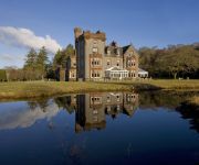
Isle of Eriska Hotel and Spa
The Pierhouse Hotel
Airds Hotel
BEST WESTERN MUTHU QUEENS HOTEL
Lochnell Arms Hotel
The Palace Hotel
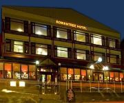
Rowantree Hotel
Muthu Alexandra Hotel
Oban Bay Hotel
Royal
Videos from this area
These are videos related to the place based on their proximity to this place.
Tralee Bay Holidays underwater at the slipway
Just off the slipway at Tralee bay Holidays, around the point towards the beach, Shot late September, seems void of life but it is there. The water clarity is incredible.
LORN Christmas Fayre 2nd Dec 2010
A snippet into the wonderful produce you can get when you come to our local Farmers and Crafters Markets. Thank you Breege Smyth for this great video. Last one of the year is 16th December...
bi-plane stunting Oban
just arrived at North Ledaig caravan park ,unhooked and took the pups to the beach to stretch their legs when we were treated to the red Baron doing a little airobatics for us.
Take off from Oban on board a Hebridean Air Services BN-2B Islander
Take off from Oban for Islay and Colonsay on board a Hebridean Air Services BN-2B Islander. Thanks to the the pilot, Julie for a superb flight! The cruise ship moored in Oban Bay is the MS...
StAUCC: Falls of Lora 2011
On a spring tide, The Falls of Lora tidal race on the West Coast of Scotland becomes a mecca for whitewater kayakers. This is a mini film of kayak playboating shot during the biggest tide of...
SS Breda May 2009
Sorry if this vid is a bit long, but I wanted to show how good the sea and weather was in May. Andy Seals stearing (his wife next to him)Shana Seals the airoplane sound at the end is from a...
Videos provided by Youtube are under the copyright of their owners.
Attractions and noteworthy things
Distances are based on the centre of the city/town and sightseeing location. This list contains brief abstracts about monuments, holiday activities, national parcs, museums, organisations and more from the area as well as interesting facts about the region itself. Where available, you'll find the corresponding homepage. Otherwise the related wikipedia article.
Falls of Lora
The Falls of Lora is a tidal race which forms at the mouth of Loch Etive when a particularly high tide runs out from the loch. They form white water rapids for two to five days either side of the spring tides. The falls are generated when the water level in the Firth of Lorn (i.e. the open sea) drops below the level of the water in Loch Etive as the tide goes out.
Connel
Connel is a village in Argyll and Bute, Scotland. It is situated on the southern shore of Loch Etive. The Lusragan Burn flows through the village and into the loch. The most noticeable feature in the village is Connel Bridge, a large cantilever bridge that spans Loch Etive at the Falls of Lora. It was built to carry the Callander and Oban Railway's branch line to Ballachulish that opened in 1903.
Connel Bridge
Connel Bridge is a cantilever bridge that spans Loch Etive at Connel in Scotland. The bridge takes the A828 road across the narrowest part of the loch, at the Falls of Lora.
North Connel
North Connel is a hamlet on the north side of Loch Etive in Argyll and Bute, Scotland. Connel Bridge connects the community to Connel on the south shore of the loch, 7 kilometres from Oban. While the bridge belonged to British Rail, a toll was charged to cross and it closed at night. Once sparsely populated, the number of houses in North Connel quickly increased after the bridge was handed over to Argyllshire County Council in the late 1960s. Oban Airport or Connel Airfield is nearby.
Eriska
Eriska is a flat, tidal island at the entrance to Loch Creran on the west coast of Scotland. Privately owned by the Buchanan-Smith's, the island is run as a hotel with wooded grounds. The island is evidently populated although no record for the total was provided by the 2001 census.
SS Breda
SS Breda was a Dutch cargo-passenger ship sunk in Scotland during World War II.
Benderloch
Benderloch is a village in Argyll and Bute, Scotland. The name is derived from Beinn eadar dà loch, meaning "mountain between two lochs". Benderloch lies on the A828 road in the coastal area of Appin, Argyll, Scotland. Its railway station closed in 1966. Benderloch forms part of the Lynn of Lorn National Scenic Area, one of 40 in Scotland.


