Safety Score: 3,0 of 5.0 based on data from 9 authorites. Meaning we advice caution when travelling to United Kingdom.
Travel warnings are updated daily. Source: Travel Warning United Kingdom. Last Update: 2024-04-19 08:03:45
Explore West Norwood
The district West Norwood of in England is located in United Kingdom a little south of London, the country's capital.
If you need a place to sleep, we compiled a list of available hotels close to the map centre further down the page.
Depending on your travel schedule, you might want to pay a visit to some of the following locations: Camberwell, Croydon, City of Westminster, City of London and Catford. To further explore this place, just scroll down and browse the available info.
Local weather forecast
Todays Local Weather Conditions & Forecast: 11°C / 53 °F
| Morning Temperature | 9°C / 49 °F |
| Evening Temperature | 9°C / 48 °F |
| Night Temperature | 6°C / 42 °F |
| Chance of rainfall | 1% |
| Air Humidity | 81% |
| Air Pressure | 1016 hPa |
| Wind Speed | Moderate breeze with 12 km/h (7 mph) from South |
| Cloud Conditions | Broken clouds, covering 75% of sky |
| General Conditions | Light rain |
Saturday, 20th of April 2024
9°C (48 °F)
5°C (41 °F)
Scattered clouds, moderate breeze.
Sunday, 21st of April 2024
8°C (46 °F)
5°C (41 °F)
Broken clouds, gentle breeze.
Monday, 22nd of April 2024
9°C (49 °F)
5°C (42 °F)
Light rain, gentle breeze, overcast clouds.
Hotels and Places to Stay
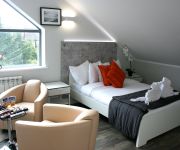
Westciti Caroco Aparthotel
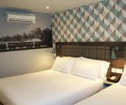
Best Western Plus London Croydon Aparthotel
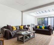
onefinestay - Clapham private homes
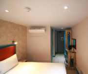
Queens Euro Hotel
Pasha
Holiday Inn Express LONDON - VAUXHALL NINE ELMS
BEST WESTERN PLUS VAUXHALL HTL
TRAVELODGE LONDON CRYSTAL PALACE
TRAVELODGE LONDON BALHAM
Belgrave Hotel
Videos from this area
These are videos related to the place based on their proximity to this place.
Fifth Croydon Boys' Brigade - National Table Tennis v 10th Mid-Surrey
5th Croydon host the 10th Mid-Surrey in the 4th round of the national table tennis competition on 28th February 2015.
Matami Sangat Rab-e-Wafa | Matamdari at Norbury, Croydon (26/10/2013)
Matami Sangat Rab-e-Wafa | Matamdari at Norbury, Croydon | 26th October 2013.
ALS Ice Bucket Challenge
Was nominated by my good friend Symbiant, had 24 hours to do this, it's a Sunday, bank holiday on Monday, no time to hire a camera, so iPhone it was. If you'd like to donate then please follow...
South London Samba at Lambeth Fireworks 2014
Here's a clip of our roaming performance at Lambeth Fireworks 2014 in Brockwell Park. This piece is called Afro Lata (dedicated to the group Afro Lata). Please like and subscribe for more...
My Trip to Rockefeller Center
Created using the Stupeflix Youtube App. Thanks for watching! Please subscribe!
Loft Conversions in Dulwich
Loft Conversions in Dulwich. To learn more about Dulwich loft conversions, check out our website http://www.loftlife.net/loft-conversions-dulwich-se21.asp Ar...
Interior And exterior Painting Contractors Dulwich London
Fully Insured Interior & Exterior Painting Contractors Call us now to arrange a visit or a free quote. Web: http://paintingline.co.uk Office:08002118493 Mobile: 07960844375 Email: customer.servic...
The UnExplained (Official Trailer)
Contact :- venomeuk@hotmail.co.uk ************************************************************** Three may keep a secret ......if two of them are dead -- Benjamin Franklin ***********************...
Funk In G, Jake Rigden Live at Half Moon, Herne Hill SE24
Hi all Jake here (15) this is me playing at Zoom @ The Moon SE24/Half Moon, Herne Hill in support of The Clark/Smith Super Group (aka salt Stevie Smith & Mick Clarke) . Thanks to Pete...
Steam train-44932 beats up AC/DC unit at Herne Hill. Blue Belle Explorer 9/11/13.
44932 (Black 5) huffs and puffs into Herne Hill (S. London) before racing an empty electirc unit out of the station. Blue Belle tour 9 November 2013. Sheffield Park - London Victoria. Organised...
Videos provided by Youtube are under the copyright of their owners.
Attractions and noteworthy things
Distances are based on the centre of the city/town and sightseeing location. This list contains brief abstracts about monuments, holiday activities, national parcs, museums, organisations and more from the area as well as interesting facts about the region itself. Where available, you'll find the corresponding homepage. Otherwise the related wikipedia article.
Dulwich College
Dulwich College is an independent school for boys in Dulwich, southeast London, England with branches in China and South Korea. The college was founded in 1619 by Edward Alleyn, a successful Elizabethan actor, with the original purpose of educating 12 poor scholars as the foundation of "God's Gift". It currently has about 1,500 boys, of whom 120 are boarders. This makes it one of the largest (in terms of numbers of pupils) independent schools in the United Kingdom.
South Circular Road
The A205 or South Circular Road is the 20.7 mile long route which crosses South London, running from Woolwich in the east to the junction of the A406 (North Circular Road), the M4 and the A4 at Gunnersbury in the west. Together with the North Circular Road, the South Circular forms a ring road through the inner part of Outer London. This ring road does not make a complete circuit of the city, as the crossing of the River Thames in the east is made on the Woolwich Ferry.
Pear Tree House
Pear Tree House was the former Civil Defence control centre for South-East London. It is a block of council flats in the Central Hill Estate of Upper Norwood with 8 two-bedroom flats and the control centre in the basement.
Dulwich Picture Gallery
Dulwich Picture Gallery is an art gallery in Dulwich, South London. The Gallery in its current form was designed by Regency architect Sir John Soane using an innovative and influential method of illumination, and was opened to the public in 1817.
Brockwell Park
Brockwell Park is a 50.8 hectare (125.53 acres) park located between Brixton, Herne Hill and Tulse Hill, bordered by Brixton Water Lane, Norwood Road, Tulse Hill (Road), and Dulwich Road in South London. It is home to the Lambeth Country Show, which usually takes place in July, though this has been moved to September for 2012. An annual fireworks display also takes place around November 5. The park also commands views of the skyline of the city and Central London.
West Norwood Cemetery
West Norwood Cemetery is a 40-acre cemetery in West Norwood in London, England. It was also known as the South Metropolitan Cemetery. One of the first private landscaped cemeteries in London, it is one of the Magnificent Seven cemeteries of London, and is a site of major historical, architectural and ecological interest. Its grounds are a mixture of historic monumental cemetery and modern lawn cemetery, but it also has catacombs, cremation plots and a columbarium for cinery ashes.
South London Botanical Institute
The South London Botanical Institute was founded in 1910 by Allan Octavian Hume, a former civil servant for the British Raj in India. After returning to England in 1894 Hume turned his attention to horticulture, which eventually led him to create the Institute in a large Victorian house in Norwood Road, near Tulse Hill, South London, to provide an environment where anyone interested in plants, whether amateur or professional, could meet to develop their knowledge of botany.
Norwood Park (London)
Norwood Park is a 33 acre park in South London It commands a great view across Dulwich to The City and Central London 7 miles (11 km) away. On a clear day it may even be possible to see the Alexandra Palace in North London.
Knight's Hill
Knights Hill is a main road on the A215 in West Norwood, London and a mound to the north adjoining Tulse Hill. The road itself starts in the north at West Norwood in the Norwood Triangle. It ends in the south at a junction with the A214 at Crown Lane and Crown Dale. Knights Hill becomes Beulah Hill at this point. In the north, Knights Hill is home to a large parade of shops. See A215 road for more information.
Oakfield School
Oakfield Preparatory School is an independent coeducational preparatory school, situated near Tulse Hill, Dulwich, Lambeth. Oakfield is a member of the Independent Schools Association. With over 500 boys and girls aged between 2 and 11, it is housed in historic Georgian buildings either side of the South Circular at the junction with Croxted Road, and uses Dulwich Sports Club for football and rugby, and the swimming facilities at Dulwich Sports Centre.
All Saints Church, West Dulwich
All Saints Church is a Grade I-listed Gothic Revival church in West Dulwich, South London. It was built 1888—1897 and designed by George Fellowes Prynne.
Belair Park
Belair Park is located in West Dulwich part of the London Borough of Southwark, southeast London, England. Formerly the grounds belonged to Belair House, a country villa built in Adam style and now a Grade II listed building. There are two other Grade II listed structures within the park: the lodge and entrance gate and an old stable building.
St Luke's Church, West Norwood
St Luke's Church in West Norwood is an Anglican Church in the London Borough of Lambeth. It currently has an Evangelical emphasis.
Kingswood House
Kingswood House, formerly known as King's Coppice, is a Victorian mansion in West Dulwich at the southerly tip of the London Borough of Southwark, England. It is a Grade II listed building. In 1811 William Vizard was granted a 63 year lease for Kingswood Lodge. When Vizard returned to his native Gloucestershire in 1831, others were granted the property leases. From 1891 the house was owned by John Lawson Johnston who extended the house and remodelled the facade including adding battlements.
Fenstanton Primary School
Fenstanton Primary School is a community school in Tulse Hill, London. The school serves children from 3 to 11 years old and is situated in the London Borough of Lambeth.
Bishop Thomas Grant School
Bishop Thomas Grant School (BTG) is a Catholic high school situated in Streatham, London. The school was named after the first Bishop of Southwark, Thomas Grant (1816-1870) who was named in the First Vatican Council. The school was opened on the 9th September 1959. The current headmaster of the school is Mr. Louis Desa. BTG is specialist school in Mathematics and ICT. In September 2009 Bishop Thomas Grant re-opened their sixth form which had closed in 1986.
Rosendale Primary School
Rosendale Primary School is a primary school in West Dulwich, Lambeth, south London, England. It is at the north end of Rosendale Road, between the railway and Turney Road.
Gallery Road
The archaeological gallery roads (棧道) were roads through remote mountain areas of China. They consisted of wooden planks erected on holes cut into the sides of cliffs. They were most notably used in the Qin Mountains linking the Wei River and the Han River valleys. The first gallery roads were built during the Warring States Period (476-221 BC) and used by Qin to invade Shu and Ba. They were fully consolidated into a thriving network during the Han Dynasty.
Dunraven School
Dunraven School is an inner city coeducational secondary school with academy status located in Streatham in the London Borough of Lambeth. The school takes its name after the Earl Of Dunraven and still has ties with the Earl until this day. The buildings are based over two sites that were previously used as a teacher training college (this site is now known as upper school) and a primary school (this site is now known as lower school). There are building works going on around the school.
Thurlow Park (ward)
Thurlow Park ward is an administrative division of the London Borough of Lambeth, England. It is located towards the South of the borough containing much of West Norwood and Tulse Hill including Tulse Hill railway station. It is bordered in the North by Brockwell Park.
Old College Lawn Tennis and Croquet Club
The Old College Lawn Tennis and Croquet Club is in West Dulwich, Southwark, southeast London, England, to the east off Gallery Road. "Old College" refers Dulwich College, set up through Alleyn's College in Dulwich, a charity that has now become the Dulwich Estate. The club has seven tennis courts. In 2009, three of the courts were resufaced with cushioned porous acrylic. The remaining courts have all-weather macadam surfaces. In 2010, an online booking system was introduced.
Streatham Wells (ward)
Streatham Wells ward is an administrative division of the London Borough of Lambeth, United Kingdom. It contains part of Streatham town centre to the east of the A23 Streatham High Road. Streatham Wells ward is located in the Streatham Parliamentary constituency.
Knight's Hill (ward)
Knight's Hill ward is an administrative division of the London Borough of Lambeth, United Kingdom. The boundaries of Knights Hill are the A214 in the south and the A215 to the east. The population of Knights Hill is 13,687 according to the 2001 census, this is an increase of around 2000. This is 5.1% of the Lambeth borough population. The population is predominantly over 65. The area of the ward is 146.8 hectares.
Gipsy Hill (ward)
Gipsy Hill ward is an administrative division of the London Borough of Lambeth, England. The ward contains much of West Norwood as well as Norwood park and West Norwood Cemetery. it also contains Gipsy Hill railway station. Gipsy Hill ward is located in the Dulwich and West Norwood Parliamentary constituency.
Honor Oak Cricket Club Ground
Honor Oak Cricket Club Ground is a cricket ground in Dulwich, London. The first recorded match on the ground was in 1943, when the Buccaneers played Northamptonshire in a wartime charity match. In 1967, the ground hosted a single Second XI Championship match between the Surrey Second XI and the Glamorgan Second XI. The ground hosted a single Women's One Day International in the 1993 Women's Cricket World Cup when Australia women played Denmark women.


