Safety Score: 3,0 of 5.0 based on data from 9 authorites. Meaning we advice caution when travelling to United Kingdom.
Travel warnings are updated daily. Source: Travel Warning United Kingdom. Last Update: 2024-04-23 08:18:23
Delve into South Norwood
The district South Norwood of in England is a district located in United Kingdom a little south of London, the country's capital town.
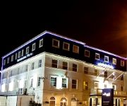
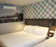
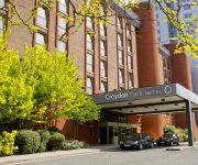
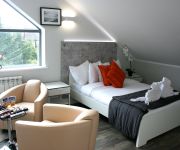
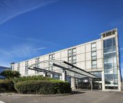
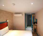
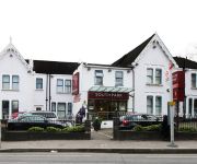
In need of a room? We compiled a list of available hotels close to the map centre further down the page.
Since you are here already, you might want to pay a visit to some of the following locations: Croydon, Catford, Camberwell, Bromley and City of Westminster. To further explore this place, just scroll down and browse the available info.
Local weather forecast
Todays Local Weather Conditions & Forecast: 8°C / 46 °F
| Morning Temperature | 5°C / 42 °F |
| Evening Temperature | 9°C / 48 °F |
| Night Temperature | 6°C / 43 °F |
| Chance of rainfall | 1% |
| Air Humidity | 77% |
| Air Pressure | 1023 hPa |
| Wind Speed | Moderate breeze with 10 km/h (6 mph) from South |
| Cloud Conditions | Overcast clouds, covering 100% of sky |
| General Conditions | Light rain |
Wednesday, 24th of April 2024
7°C (45 °F)
4°C (39 °F)
Broken clouds, moderate breeze.
Thursday, 25th of April 2024
10°C (49 °F)
7°C (44 °F)
Overcast clouds, gentle breeze.
Friday, 26th of April 2024
12°C (53 °F)
8°C (46 °F)
Light rain, gentle breeze, overcast clouds.
Hotels and Places to Stay
Hallmark Croydon
Best Western Plus London Croydon Aparthotel
Croham Park Bed & Breakfast
De Vere Selsdon Estate
Croydon Park
Westciti Caroco Aparthotel
Hilton London Croydon
Queens Euro Hotel
Grand Sapphire Hotel
Flexistay South Park Aparthotel
Videos from this area
These are videos related to the place based on their proximity to this place.
Southern Service journey from Selhurst to Caterham (Part 1 of 3 Selhurst Depot to South Croydon)
This is the first of three window journey's to Caterham, obviously on a Southern service. The journey starts from just outside Selhurst, at Selhurst Depot where we were awaiting signal clearance...
London 2012 Olympic torch relay
London 2012 Olympic torch relay going through Thornton Heath High Street.
WCKUK Norwood - Wing Chun 1st Grading
Norwood Wing Chuns first student grading on pre-emptive striking, after 3 months of weekly training. Grading was 2.5hrs, the test itself was 1.5hrs, and consisted of calisthenics, theory &...
プラレール Tomy Thomas - Plarail Trackmaster Belle in Beckenham [HD]
Trackmaster Belle goes on a layout in our new flat in Beckenham, June 2012. More Tomy & Plarail videos on: ...
Crystal Palace to Beckenham Junction
The journey from just outside Crystal Palace to Beckenham Junction via Birkbeck on 456018 and 456021, recorded on Saturday 7th April 2012.
Beckenham Junction train departs Crystal Palace
Heading for Beckenham Junction, as with all services leaving Crystal Palace, they are noisy leaving due to the curvature of track on the south bound direction. Actually northbound services...
London Overground and Southern trains at CrystalPalace (London)
Some shots at Crystal Palace railway station.
Crystal Palace v Charlton Ahtletics
Crystal Palace fans singing after the goal in the 1-0 match v Charlton 30 sept 2008 at Selhurst Park. Me and two friends flew from Gothenburg, Sweden just to watch this game. And we had an...
I found myself a cheerleader
I meet Crystal Palace's cheerleaders the Crystals at Palace's great win against Man CIty.
Videos provided by Youtube are under the copyright of their owners.
Attractions and noteworthy things
Distances are based on the centre of the city/town and sightseeing location. This list contains brief abstracts about monuments, holiday activities, national parcs, museums, organisations and more from the area as well as interesting facts about the region itself. Where available, you'll find the corresponding homepage. Otherwise the related wikipedia article.
Capital London
Capital London is a London-based radio station that launched on 16 October 1973 and is owned by Global Radio. On 3 January 2011 it formed part of the nine-station Capital radio network.
Crystal Palace F.C
Crystal Palace Football Club is an English Football league club based in South Norwood, London. The team plays its home matches at Selhurst Park, where it has been based since 1924. The club currently competes in the second tier of English Football, The Championship. Crystal Palace was formed in 1905 by workers at The Crystal Palace. The club reached the top division of English Football in 1969–70, and its first major final was in 1990.
Selhurst Park
Selhurst Park is an association football stadium located in the London suburb of South Norwood in the Borough of Croydon. It is the current home ground of Crystal Palace Football Club. Its present capacity is 26,309.
Croydon transmitting station
The Croydon transmitting station (also known as the NTL Tower) is a broadcasting and telecommunications facility on Beulah Hill in Upper Norwood, London, England, in the London Borough of Croydon, owned by Arqiva. It was established in 1955 and initially used a small lattice tower. The present tower is 152 metres high and was built in 1962. It was originally used to broadcast the London ITV signal on VHF Band III. When UHF broadcasting began, nearby Crystal Palace transmitting station was used.
Croydon Common Athletic Ground
This page is on the former stadium of Croydon Common F.C. and Crystal Palace F.C. For the ex-Norwich City F.C. stadium of the same name see The Nest (football ground). {{#invoke:Coordinates|coord}}{{#coordinates:51|23|27.74|N|0|5|9.10|W|region:GB_type:landmark |primary |name= }} Croydon Common Athletic Ground, commonly referred to as The Nest, was a football stadium in Selhurst, south London. The original occupiers of the ground were Croydon Common F.C.
Norwood Junction rail accident
The Norwood Junction railway crash occurred on 1 May 1891, when a cast iron underbridge over Portland Road, some 60 yards north east of Norwood Junction railway station, fractured under an express train from Brighton to London in southern England. The locomotive crossed the bridge safely with most of its carriages, but the brake van fell into the gap on the bridge. There were no casualties, apart from a dislocated ankle.
Woodside Green
Woodside Green is an area and street located in Woodside, London, centred on a village green. The station is located near to Woodside tram stop in the London Borough of Croydon. The green is over 44¾ acres (1.92 hectares).
Spurgeon's College
Spurgeon's College is a Christian theological college in South Norwood Hill, Croydon, London.
Woodside tram stop
For other stations of the same name, see Woodside railway station. {{#invoke:Coordinates|coord}}{{#coordinates:51.386987|-0.065566||||||| |primary |name= }} Woodside tram stop is a light rail stop situated between Woodside Green and Ashburton Park in the London Borough of Croydon in the southern suburbs of London. The stop is located on the site of the former Woodside railway station of the Woodside and South Croydon Railway; the old station buildings survive, though not used by Tramlink.
Blackhorse Lane tram stop
Blackhorse Lane tram stop is a light rail stop in the London Borough of Croydon in the southern suburbs of London.
Beaulieu Heights
Beaulieu Heights is an extensive woodland area between South Norwood and Upper Norwood, London. It is managed by the London Borough of Croydon. It's located between South Norwood Hill and Auckland Road with Auckland Rise to the north and Tummonds Gardens to the south. There are pedestrian entrances from South Norwood Hill and Auckland Rise.
Harrington Road tram stop
Harrington Road tram stop is a light rail stop in South Norwood in the London Borough of Croydon in the southern suburbs of London. Harrington Road is in a residential area, and along with Woodside tram stop is the nearest tram stop to the town of South Norwood. Beckenham Cemetery lies immediately to the east. The tram stop is served by Tramlink route 2, which connects central Croydon with Beckenham. The stop is at ground level on double track, with platforms on each side of the track.
South Norwood Leisure Centre
South Norwood Leisure Centre is a leisure centre located on Portland Road in South Norwood in the Croydon, London. It contains a 25m sized swimming pool with seating for spectators. The centre is managed by Fusion Lifestyle and Sport Croydon.
South Norwood Recreation Ground
South Norwood Recreation Ground is a park located in South Norwood in the London Borough of Croydon. This recreation ground was acquired by the council in 1889 and the Borough Road Surveyor estimated that it would cost £1,326. 19s. 6d. to lay out. Over a quarter of this cost was to put land drainage in which suggests that the site was quite wet The recreation ground includes a sports area, football pitches, tennis court, floodlit courts, bowling green with pavilion and a children's playground.
Heavers Meadow
Heavers Meadow is a meadow located in South Norwood and Selhurst in the London Borough of Croydon. South Norwood Recreation Ground is on the other side of the road. The meadow covers an area of 8¾ acres (3.34 hectares). With meadows there are not usually many facilities. Heavers is no exception; the only facility stated on the council's website is a footpath through a flood meadow.
Brickfields Meadow
Brickfields Meadow is a meadow in South Norwood in the London Borough of Croydon. It is located on the former site of a brickworks in Tennison Road and Dickensons Lane in Woodside. The meadow covers an area of about 4.37 hectares.
South Norwood Lake and Grounds
South Norwood Lake and Grounds is a park in South Norwood in the London Borough of Croydon. The main entrance is in Woodvale Avenue while other entrances are located in Auckland Road and Sylvan Road. The area measures up to 28⁄2 acres 11.53 hectares. The lake itself was originally created as a reservoir for the Croydon Canal, which from 1809 to 1836 ran between Croydon and the Grand Surrey Canal at New Cross.
South Norwood Library
South Norwood Library is a public library in South Norwood, South London. It stands in the London Borough of Croydon and is part of the Croydon Libraries arm of the council. It's next to the High street on Selhurst Road / Lawrence Road and is also close to South Norwood Recreation Ground. The library, like many other Croydon libraries, is based on more than one level.
Apsley Road Playground
Apsley Road Playground is a park and playground situated in South Norwood, London, England. It is managed by the London Borough of Croydon. The park is mainly located on Apsley Road which is also the main entrance for the park. It is more targeted to the surrounding residential area. The playground's nearest Tramlink stop is Harrington Road, which is served by Route 2.
Grangewood Park
Grangewood Park is an extensive woodland area situated in South Norwood, London. It is managed by the London Borough of Croydon. It is bounded by Grange Road, Wharncliffe Road, and Ross Road. It covers an area of 27¾ acres 11.23 hectares. The park is located on the main A212 road (Grange Road) between Thornton Heath and Upper Norwood/Crystal Palace. The nearest stations are Thornton Heath, Selhurst and Norwood Junction.
Harris Federation
Harris Federation is a federation of Primary and Secondary academies in London, England. There are currently thirteen open academies in the federation which span over five London boroughs including the London Borough of Croydon, London Borough of Southwark, London Borough of Bexley, London Borough of Merton and most recently the London Borough of Bromley. Their most recently opened Academy is based in the Essex Borough of Thurrock.
Selhurst Road
Selhurst Road is a main road between South Norwood and Selhurst in the London Borough of Croydon, South London. It forms part of the A213 road which is a major A Road connecting both Sydenham and Croydon. The road starts in South Norwood from the High Street, which is also part of the A213, then it carries on to Selhurst railway station opposite Heavers Meadow then on a side road it passes the BRIT School.
South Norwood Primary School
South Norwood Primary School is a primary school for pupils aged between 4 and 11 years. The school is located on Crowther Road in South Norwood, as the name suggests. The Local Education Authority for the school is the London Borough of Croydon. The school caters for pupils from Reception to Year 6. South Norwood Primary is close to Harris Academy South Norwood, whom they have secondary links with, along with Harris City Academy Crystal Palace and the current Headmistress of the school is Ms.
Woodside (London) railway station
Woodside railway station was opened by July 1871 by the Mid-Kent Railway, to serve a nearby race course. A ramp facilitated the loading of racehorses. After the course closed in 1890, use of the station decreased. The former down bay platform fell into disuse in 1917 following closure of the line to Selsdon. The line to Selsdon was reopened upon electrification in 1935 with through services to London. By the early 1960s patronage of the station was in decline .
Betts Park
Betts Park is a public park in Penge, London Borough of Bromley, England. It has a number of attractions, including part of the old Croydon Canal. It was opened in December 1928.







!['プラレール Tomy Thomas - Plarail Trackmaster Belle in Beckenham [HD]' preview picture of video 'プラレール Tomy Thomas - Plarail Trackmaster Belle in Beckenham [HD]'](https://img.youtube.com/vi/CaudcdUBbLE/mqdefault.jpg)


