Safety Score: 3,0 of 5.0 based on data from 9 authorites. Meaning we advice caution when travelling to United Kingdom.
Travel warnings are updated daily. Source: Travel Warning United Kingdom. Last Update: 2024-04-23 08:18:23
Touring Sladesbridge
Sladesbridge in Cornwall (England) is a town located in United Kingdom about 215 mi (or 346 km) west of London, the country's capital place.
Time in Sladesbridge is now 10:25 AM (Tuesday). The local timezone is named Europe / London with an UTC offset of one hour. We know of 10 airports nearby Sladesbridge, of which 3 are larger airports. The closest airport in United Kingdom is Newquay Cornwall Airport in a distance of 10 mi (or 15 km), South-West. Besides the airports, there are other travel options available (check left side).
There is one Unesco world heritage site nearby. It's Cornwall and West Devon Mining Landscape in a distance of 27 mi (or 44 km), South. Also, if you like the game of golf, there is an option about 21 mi (or 34 km). away. Need some hints on where to stay? We compiled a list of available hotels close to the map centre further down the page.
Being here already, you might want to pay a visit to some of the following locations: Helland, Roche, Padstow, Tregoney and Newquay. To further explore this place, just scroll down and browse the available info.
Local weather forecast
Todays Local Weather Conditions & Forecast: 12°C / 53 °F
| Morning Temperature | 8°C / 46 °F |
| Evening Temperature | 11°C / 51 °F |
| Night Temperature | 5°C / 42 °F |
| Chance of rainfall | 0% |
| Air Humidity | 82% |
| Air Pressure | 1025 hPa |
| Wind Speed | Moderate breeze with 10 km/h (6 mph) from South |
| Cloud Conditions | Overcast clouds, covering 89% of sky |
| General Conditions | Light rain |
Wednesday, 24th of April 2024
11°C (52 °F)
4°C (40 °F)
Broken clouds, gentle breeze.
Thursday, 25th of April 2024
12°C (53 °F)
6°C (43 °F)
Light rain, gentle breeze, overcast clouds.
Friday, 26th of April 2024
11°C (51 °F)
8°C (47 °F)
Moderate rain, gentle breeze, overcast clouds.
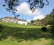
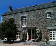
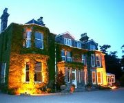
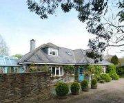
Hotels and Places to Stay
Costislost Boutique B and B (Adults only)
Trehellas House
Tremoren
Tredethy House
White Hart
Berry Lane Cottage B&B
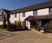
TRAVELODGE WADEBRIDGE
Bodmin
Videos from this area
These are videos related to the place based on their proximity to this place.
Lanjew Park Holiday Accommodation near Wadebridge, Bodmin and Padstow, Cornwall
Self catering farm holiday accommodation ideal for Padstow, Polzeath and the north Cornwall coast, with easy driving to all Cornwall.
Withiel Cornwall. A Moment in Time. Part 1
Part 1. Photographic History of Withiel a North Cornwall Village & Parish from the 1900's. Featuring The Village, Carnivals. Events, The School and it's pupils organisations & Farming.
St Mabyn Holiday Park
Set in 12 acres of landscaped parkland we offer self catering in timber lodges, luxurious bungalows and caravan holiday homes. Our holiday homes provide the comforts of home, but in a unique...
Fisherton Sarum at Wadebridge
First the Devon Belle runs by with a West Country light pacific up front, then a Q1 passes in the opposite direction on a goods train and finally a Battle of Britain light pacific is turned...
Starting out in business: Tony Faragher from the 'Wadebridge Renewable Energy Network'
Filmed at the 'Skills Show Experience Cornwall' held at the Royal Cornwall Show Ground on the 16th and 17th of October 2014. The Real Ideas Organisation and Talent Match Cornwall attended...
Wadebridge Model Railway Exhibition 2011 - West London Parcels
John Baggaley's BR(S) layout set in the 'BR Blue' era and based on a long gone LSWR line near what is now Kensington Olympia.
SUBTRACKT event at the www.alivemusicstudios.org studio bar in Wadebridge on Friday 16th Novemb...
Video created with the Socialcam app on iPhone: http://socialcam.com.
Wadebridge Model Rly Exhibition 2008
This clip has two "toy train" layouts: American 0 Gauge and The Oval, a Hornby Dublo 3-rail layout.
Open Decks Night at the #studio #bar #Wadebridge #Cornwall AliveMusicStudios.co.uk #club
Video created with the Socialcam app on iPhone: http://socialcam.com.
Videos provided by Youtube are under the copyright of their owners.
Attractions and noteworthy things
Distances are based on the centre of the city/town and sightseeing location. This list contains brief abstracts about monuments, holiday activities, national parcs, museums, organisations and more from the area as well as interesting facts about the region itself. Where available, you'll find the corresponding homepage. Otherwise the related wikipedia article.
North Cornwall
North Cornwall (Cornish: An Tiredh Uhel) is an area of Cornwall, England, United Kingdom. It is also the name of a former local government district, which was based in Wadebridge {{#invoke:Coordinates|coord}}{{#coordinates:50.516|-4.835||||||| |primary |name= }}. Other towns in the area include Bude, Padstow, and Camelford. North Cornwall is an area of outstanding natural beauty that is of important geological and scientific interest.
Kelly Rounds
Kelly Rounds, or Castle Killibury is an Iron Age hill fort in Cornwall, England, United Kingdom. It is situated beside the A39 trunk road approximately two miles east of Wadebridge. The site is north of the village of St Mabyn, approximately 300 metres east of Three Holes Cross on the border of the parish of Egloshayle. Radiocarbon dating has dated the occupation of Kelly Rounds to between 400 and 100 BC. More carbon dating has dated a pre-hill fort occupation as between 1250 and 950 BC.
Wadebridge Town F.C
Wadebridge Town F.C. is a football club based in Wadebridge, Cornwall, England, United Kingdom. They play in the South West Peninsula League Division One West. The club is affiliated to the Cornwall County Football Association
Tregarden
Tregarden is a Grade II* listed large house built by the Barrett family in the late 16th century in the parish of St Mabyn, Cornwall, England, UK. It is built to a traditional E shaped Elizabethan plan. The entrance archway is dated 1631, the date that William Godolphin married the Barrett heiress. The Hearth Tax Returns for 1664 record it having 8 hearths. The house became a farmhouse in the 19th century. It is currently a restored manor house owned by the Tremayne family.
Sladesbridge
Sladesbridge is a small village located near Wadebridge in Cornwall, England, UK. It is situated at the confluence of the River Allen and the Croan Stream about 1 km upstream of the confluence with the River Camel. The surrounding area is in the Cornwall Area of Outstanding Natural Beauty and the floodplain is a Special Area of Conservation, a Site of Special Scientific Interest and a County Wildlife Site.
Polbrock
Polbrock (Cornish: Polbrogh, meaning badger's pool) is a small hamlet in north Cornwall, England, United Kingdom. It is situated two miles south-east of Wadebridge at grid reference SX 014 695. Polbrock is situated in the steep-sided and heavily wooded valley of the River Camel and is the site of a bridge carrying a minor road over the river. The bridge is the first crossing of the River Camel upstream of Wadebridge; the next crossing is at Nanstallon two miles further upstream.
Three Holes Cross
Three Holes Cross is a crossroads on the A39 trunk road approximately 2 miles east of Wadebridge, Cornwall, United Kingdom at grid reference SX 012 736. The name is derived from the Cornish cross sited there. There is a settlement of a few houses nearby. The nearest house, a little way away from the cross was formerly the toll house in olden days to allow passage to Wadebridge.
Brocton, Cornwall
Brocton is a hamlet in the parish of St Breock, Cornwall, England, UK.


