Tanzania
in Eastern Africa
Africa
 Burundi
 Democratic Republic of the Congo
 Kenya
Kenya Malawi
 Mozambique
 Rwanda
 Uganda
 Zambia
- Currency and Currency Code:
- Shilling - TZS
- Spoken languages:
- Swahili, English, Arabic
- Local electricity:
- 230 V - 50 Hz (plugs: D, G)
- Mobile phone / cellular frequencies (MHz):
- 900 MHz, 1800 MHz, 3G, 4G
- ISO 2-Letter code:
- TZ
- Internet top level domain:
- .tz
- Country phone prefix:
- +255
- Local Time (capital):
- Timezone:
- UTC/GMT offset: hours
Safety Score: 3,0 of 5.0 based on data from 9 authorites. Meaning we advice caution when travelling to Tanzania.
Travel warnings are updated daily. Source: Travel Warning Tanzania. Last Update: 2024-04-23 08:18:23
Explore Tanzania
Tanzania with its capital Dodoma is located in Africa (Eastern Africa, bordering the Indian Ocean). It covers some 947,301 square kilometers (more than six times the size of Georgia) with 53,950,900 citizens. Swahili, English and Arabic are the languages commonly used by the people in Tanzania (consider regional differences). Burundi, Democratic Republic of the Congo, Kenya, Malawi, Mozambique, Rwanda, Uganda and Zambia are bordering countries.
Tanzania is the largest country in East Africa, bordered by Kenya and Uganda to the north; Rwanda, Burundi, and the Democratic Republic of the Congo to the west, and Zambia, Malawi, and Mozambique to the south. Tanzania is a country with great national parks, where you can see some of the finest African flora and fauna. Tanzania is home to several national parks and game reserves. Safaris in Tanzania can be put into two categories, the Northern Circuit (Serengeti, Ngorongoro, Manyara and Tarangire) and the Southern Circuit (Selous, Mikumi and Ruaha). This is certainly an oversimplification and does not include other interesting but harder to reach parks such as Katavi and Gombe, just to name two. For tourist, the two first groupings are more accessible as several tour companies offer a variety a packages for these.
Popular Destinations in Tanzania
Administrative regions of Tanzania
- Arusha Region
- Coast Region
- Dar es Salaam Region
- Dodoma Region
- Geita
- Iringa Region
- Kagera Region
- Katavi
- Kigoma Region
- Kilimanjaro Region
- Lindi Region
- Manyara Region
- Mara Region
- Mbeya Region
- Morogoro
- Mtwara Region
- Mwanza Region
- Njombe
- Pemba North Region
- Pemba South Region
- Rukwa
- Ruvuma Region
- Shinyanga Region
- Simiyu
- Singida Region
- Tabora Region
- Tanga Region
- Zanzibar Central/South Region
- Zanzibar North Region
- Zanzibar Urban/West Region
About the country
Website: Tanzania Tourism
The landscape is plains along coast with central plateau as well as highlands in north, south. The average density of population is about 57 per km². The climate in Tanzania can be described as varying from tropical along coast to temperate in highlands. Potential threats by nature are drought, flooding on the central plateau during the rainy season and limited volcanic activity; Ol Doinyo Lengai (2,962 m) has emitted lava in recent years; other historically active volcanoes include Kieyo and Meru.
To reach someone Tanzania dial +255 prior to a number. The local cellular networks are operated on 900 MHz, 1800 MHz, 3G, 4G. Websites typically end with the top level domain ".tz". If you want to bring electric appliances (e.g. battery chaarger), keep in min the local 230 V - 50 Hz (plugs: D, G). The sign for the locally used currency Shilling is TZS.
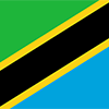
Divided diagonally by a yellow-edged black band from the lower hoist-side corner; the upper triangle (hoist side) is green and the lower triangle is blue; the banner combines colors found on the flags of Tanganyika and Zanzibar; green represents the natural vegetation of the country, gold its rich mineral deposits, black the native Swahili people, and blue the country's many lakes and rivers, as well as the Indian Ocean.

Shortly after achieving independence from Britain in the early 1960s, Tanganyika and Zanzibar merged to form the United Republic of Tanzania in 1964. One-party rule ended in 1995 with the first democratic elections held in the country since the 1970s. Zanzibar's semi-autonomous status and popular opposition led to two contentious elections since 1995, which the ruling party won despite international observers' claims of voting irregularities. The formation of a government of national unity between Zanzibar's two leading parties succeeded in minimizing electoral tension in 2010.
Geography
| Area | ||
|---|---|---|
| Total (World Rank: 32) | 947,300 | sq km |
| Land (World Rank: 32) | 885,800 | sq km |
| Water (World Rank: 12) | 61,500 | sq km |
| Forest (World Rank: 65) | 27.10 | % |
| Comparative | more than six times the size of Georgia; slightly larger than twice the size of California | |
| Note | includes the islands of Mafia, Pemba, and Zanzibar | |
| Coastline | ||
| 1424 | ||
| Landborder | ||
| 4161 | ||
| Elevation | ||
| Highest point (World Rank: 17) | 5,895 | m |
| Agricultural land | ||
| Total (World Rank: 89) | 43.70 | % |
| Arable (World Rank: 83) | 14.30 | % |
| Permanent crops (World Rank: 83) | 2.30 | % |
| Permanent pastures (World Rank: 65) | 27.10 | % |
| Irrigated land (World Rank: 78) | 1,840 | sq km |
| Map reference | ||
| Africa | ||
| Environment | ||
| Issues |
| |
| Agreement party |
| |
| Hazzards |
| |
| Location | ||
| Eastern Africa, bordering the Indian Ocean, between Kenya and Mozambique | ||
| Climate | ||
| varies from tropical along coast to temperate in highlands | ||
| Terrain | ||
| plains along coast; central plateau; highlands in north, south | ||
People
| Population | ||
|---|---|---|
| Total (World Rank: 26) | 53,950,900 | |
| Deathrate (World Rank: 104) | 0.76 | % |
| Birthrate (World Rank: 16) | 3.56 | % |
| Growthrate (World Rank: 12) | 2.75 | % |
| Migration rate (World Rank: 90) | -0.05 | % |
| Fertility rate (World Rank: 19) | 4.77 | % |
| Median age | ||
| Male (World Rank: 214) | 17.50 | |
| Female (World Rank: 214) | 18.00 | |
| Age structure | ||
| 0 14 male (World Rank: 15) | 11,921,400 | |
| 0 14 female (World Rank: 15) | 11,678,500 | |
| 15 24 male (World Rank: 19) | 5,361,750 | |
| 15 24 female (World Rank: 19) | 5,351,790 | |
| 25 54 male (World Rank: 34) | 8,098,180 | |
| 25 54 female (World Rank: 33) | 8,020,290 | |
| 55 64 male (World Rank: 48) | 836,313 | |
| 55 64 female (World Rank: 45) | 1,055,350 | |
| 65 x male (World Rank: 54) | 687,118 | |
| 65 x female (World Rank: 53) | 940,215 | |
| Health | ||
| Infant mortality rate (World Rank: 46) | 3.99 | % |
| Life expectancy total (World Rank: 194) | 63 | years |
| Life expectancy female (World Rank: 195) | 64 | years |
| Life expectancy male (World Rank: 188) | 61 | years |
| Physicians per 1000 (World Rank: 177) | 0.03 | |
| Hospital bed per 1000 (World Rank: 160) | 0.70 | |
| Sanitation access total (World Rank: 200) | 15.60 | % |
| Obesity adult (World Rank: 150) | 8.40 | % |
| Drinking water access (World Rank: 194) | 55.60 | % |
Energy
| Electricity | ||
|---|---|---|
| Production (World Rank: 114) | 6,025,000,000 | kWh |
| Consumption (World Rank: 119) | 4,976,000,000 | kWh |
| Import (World Rank: 99) | 71,000,000 | kWh |
| Source fossil (World Rank: 155) | 46.00 | % |
| Source nuclear (World Rank: 42) | 47.30 | % |
| Source renew (World Rank: 80) | 6.80 | % |
| Refined products | ||
| Consumption (World Rank: 95) | 60,000 | bbl / day |
| Import (World Rank: 74) | 58,700 | bbl / day |
| Natural gas | ||
| Production (World Rank: 65) | 1,100,000,000 | m³ |
| Consumption (World Rank: 89) | 1,500,000,000 | m³ |
| Carbon footprint | ||
| 10000000 | ||
Nation
| Budget | ||
|---|---|---|
| Education (World Rank: 120) | 4 | % of GDP |
| Military (World Rank: 106) | 1 | % of GDP |
| Health (World Rank: 121) | 6 | % of GDP |
| Surplus (World Rank: 120) | -3 | % of GDP |
| National symbol | ||
| Uhuru torch | ||
| National colours | ||
| yellow | ||
| Adjective | ||
| Tanzanian | ||
| Noun | ||
| Tanzanian(s) | ||
| Background | ||
| Shortly after achieving independence from Britain in the early 1960s, Tanganyika and Zanzibar merged to form the United Republic of Tanzania in 1964. One-party rule ended in 1995 with the first democratic elections held in the country since the 1970s. Zanzibar's semi-autonomous status and popular opposition led to two contentious elections since 1995, which the ruling party won despite international observers' claims of voting irregularities. The formation of a government of national unity between Zanzibar's two leading parties succeeded in minimizing electoral tension in 2010. | ||
| Flag description | ||
| divided diagonally by a yellow-edged black band from the lower hoist-side corner; the upper triangle (hoist side) is green and the lower triangle is blue; the banner combines colors found on the flags of Tanganyika and Zanzibar; green represents the natural vegetation of the country, gold its rich mineral deposits, black the native Swahili people, and blue the country's many lakes and rivers, as well as the Indian Ocean | ||
Economy
| Gdp | ||
|---|---|---|
| Purchasing power parity (World Rank: 75) | 150,300,000,000 | USD |
| Real growth rate (World Rank: 13) | 7.00 | % |
| Per capita purchasing power parity (World Rank: 188) | 3,100 | USD |
| Source agriculture (World Rank: 33) | 24.50 | % |
| Source industry (World Rank: 96) | 27.60 | % |
| Source service (World Rank: 184) | 47.30 | % |
| Labourforce | ||
| Total (World Rank: 26) | 24,050,000 | |
| In poverty (World Rank: 89) | 22.80 | % |
| Products | ||
| Industries |
| |
| Agriculture |
| |
| Exports |
| |
| Imports |
| |
Communication
| Phone | ||
|---|---|---|
| Landline total (World Rank: 135) | 129,597 | |
| Landline per 100 (World Rank: 190) | 1.00 | |
| Mobile per 100 (World Rank: 172) | 76.00 | |
| Assessment | 0 | |
| Internet | ||
| Users (World Rank: 61) | 6,822,750 | |
| Population (World Rank: 201) | 13.00 | % |
Transport
| Air | ||
|---|---|---|
| Airports paved (World Rank: 117) | 10.00 | |
| Airports unpaved (World Rank: 25) | 156.00 | |
| Rail | ||
| Total length (World Rank: 41) | 4,567 | |
| Road | ||
| Total length (World Rank: 56) | 86,472 | |
| Paved length (World Rank: 86) | 7,092 | |
| Unpaved length (World Rank: 24) | 79,380 | |
| Water | ||
| Total length (World Rank: 43) | 2,011 | |
This is a list of famous places in this country in alphabetical order.
 Arusha
- Babati
- Bagamoyo
- Bariadi
- Biharamulo
- Bukoba
- Chake Chake
- Chalinze
- Chato
- Dar es Salaam
- Dodoma
- Geiro
- Geita
- Ifakara
- Igugunu
- Igurusi
- Iringa
- Isaka
- Izazi
- Kahama
- Kasulu
- Katumba
- Kibaha
- Kibakwe
- Kibiti
- Kidatu
- Kidodi
- Kigoma
- Kilindoni
- Kilosa
- Kirando
- Kiratu
- Kisarawe
- Kiwengwa
- Kiwira
- Koani
- Kondoa
- Kongwa
- Kyela
- Lembeni
- Lindi
- Longido
- Lushoto
- Magugu
- Mahonda
- Makumbako
- Malinyi
- Masasi
- Masoko
- Mazinde
- Mbamba Bay
- Mbeya
- Mbinga
- Mbulu
- Merelani
- Mikumi
- Misungwi
- Mkokotoni
- Mkwanga
- Mlimba
- Morogoro
- Moshi
- Mpanda
- Mpwapwa
- Mtambile
- Mtinko
- Mto wa Mbu
- Mtwara
- Muheza
- Musoma
- Mwanza
- Nachingwea
- Namanga
- Namanyere
- Ngorongoro
- Njombe
- Nungwi
- Pangani
- Rujewa
- Rulenge
- Same
- Sepuka
- Shelui
- Shinyanga
- Sikonge
- Singida
- Sirari
- Songea
- Sumbawanga
- Tabora
- Tanga
- Tinde
- Tukuyu
- Tunduma
- Usa River
- Ushirombo
- Uvinza
- Vwawa
- Wete
- Zanzibar