Suriname
in South America
South America
 Brazil
 French Guiana
 Guyana
- Currency and Currency Code:
- Dollar - SRD
- Spoken languages:
- Dutch, English, Javanese
- Local electricity:
- 127 V / 230 V - 60 Hz (plugs: A, B, C, F)
- Mobile phone / cellular frequencies (MHz):
- 900 MHz, 1800 MHz, 3G, 4G
- ISO 2-Letter code:
- SR
- Internet top level domain:
- .sr
- Country phone prefix:
- +597
- Local Time (capital):
- Timezone:
- UTC/GMT offset: hours
Safety Score: 2,5 of 5.0 based on data from 9 authorites. Meaning we advice caution when travelling to Suriname.
Travel warnings are updated daily. Source: Travel Warning Suriname. Last Update: 2024-04-18 08:12:24
Explore Suriname
Suriname with its capital Paramaribo is located in South America (Northern South America, bordering the North Atlantic Ocean). It covers some 163,821 square kilometers (slightly larger than Georgia) with a population of 591,919. Dutch, English and Javanese are some of the languages spoken by the majority in Suriname (consider regional differences). Brazil, French Guiana and Guyana are bordering countries.
Surinameformerly the colony of Netherlands Guiana or Dutch Guiana, is a country in Northern South America. With almost a third of the country being declared national reserves, Suriname's main tourist attraction are its vast natural lands and the diversity of flora and fauna in them. Head to the beaches of Galibi and Albina to witness the impressive breeding process of large Leatherback sea turtles, or book a helicopter ride to one of the more remote beaches to see the same, with fewer people around. Spot river dolphins on the way and see the typical mangrove forests between the ocean and the rain forests.
Popular Destinations in Suriname
Administrative regions of Suriname
- Distrikt Brokopondo
- Distrikt Commewijne
- Distrikt Coronie
- Distrikt Marowijne
- Distrikt Nickerie
- Distrikt Para
- Distrikt Paramaribo
- Distrikt Saramacca
- Distrikt Sipaliwini
- Distrikt Wanica
About the country
The terrain is mostly rolling hills having narrow coastal plain with swamps. The average density of population is about 4 per km². The climate in Suriname can be described as tropical with moderated by trade winds. Possible natural disasters include flooding.
To reach someone Suriname dial +597 prior to a number. The local cellular networks are operated on 900 MHz, 1800 MHz, 3G, 4G. Websites typically end with the top level domain ".sr". If you want to bring electric appliances (e.g. battery chaarger), keep in min the local 127 V / 230 V - 60 Hz (plugs: A, B, C, F). The sign for the locally used currency Dollar is SRD.
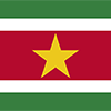
Five horizontal bands of green (top, double width), white, red (quadruple width), white, and green (double width); a large, yellow, five-pointed star is centered in the red band; red stands for progress and love; green symbolizes hope and fertility; white signifies peace, justice, and freedom; the star represents the unity of all ethnic groups; from its yellow light the nation draws strength to bear sacrifices patiently while working toward a golden future.

First explored by the Spaniards in the 16th century and then settled by the English in the mid-17th century, Suriname became a Dutch colony in 1667. With the abolition of African slavery in 1863, workers were brought in from India and Java. The Netherlands granted the colony independence in 1975. Five years later the civilian government was replaced by a military regime that soon declared Suriname a socialist republic. It continued to exert control through a succession of nominally civilian administrations until 1987, when international pressure finally forced a democratic election. In 1990, the military overthrew the civilian leadership, but a democratically elected government - a four-party coalition - returned to power in 1991. The coalition expanded to eight parties in 2005 and ruled until August 2010, when voters returned former military leader Desire BOUTERSE and his opposition coalition to power. President BOUTERSE was reelected unopposed in 2015.
Geography
| Area | ||
|---|---|---|
| Total (World Rank: 93) | 163,820 | sq km |
| Land (World Rank: 91) | 156,000 | sq km |
| Water (World Rank: 58) | 7,820 | sq km |
| Forest (World Rank: 201) | 0.10 | % |
| Comparative | slightly larger than Georgia | |
| Coastline | ||
| 386 | ||
| Landborder | ||
| 1907 | ||
| Elevation | ||
| Lowest point (World Rank: 41) | -2 | m |
| Highest point (World Rank: 154) | 1,230 | m |
| Agricultural land | ||
| Total (World Rank: 223) | 0.50 | % |
| Arable (World Rank: 211) | 0.40 | % |
| Permanent pastures (World Rank: 201) | 0.10 | % |
| Irrigated land (World Rank: 113) | 570 | sq km |
| Map reference | ||
| South America | ||
| Environment | ||
| Issues |
| |
| Agreement party |
| |
| Hazzards | flooding | |
| Location | ||
| Northern South America, bordering the North Atlantic Ocean, between French Guiana and Guyana | ||
| Climate | ||
| tropical; moderated by trade winds | ||
| Terrain | ||
| mostly rolling hills; narrow coastal plain with swamps | ||
People
| Population | ||
|---|---|---|
| Total (World Rank: 171) | 591,919 | |
| Deathrate (World Rank: 156) | 0.61 | % |
| Birthrate (World Rank: 116) | 1.58 | % |
| Growthrate (World Rank: 110) | 1.02 | % |
| Migration rate (World Rank: 61) | 0.06 | % |
| Fertility rate (World Rank: 128) | 1.93 | % |
| Median age | ||
| Male (World Rank: 115) | 29.40 | |
| Female (World Rank: 114) | 30.20 | |
| Age structure | ||
| 0 14 male (World Rank: 169) | 74,247 | |
| 0 14 female (World Rank: 169) | 71,456 | |
| 15 24 male (World Rank: 169) | 52,599 | |
| 15 24 female (World Rank: 169) | 50,618 | |
| 25 54 male (World Rank: 167) | 133,835 | |
| 25 54 female (World Rank: 167) | 128,980 | |
| 55 64 male (World Rank: 167) | 21,940 | |
| 55 64 female (World Rank: 165) | 22,697 | |
| 65 x male (World Rank: 167) | 15,394 | |
| 65 x female (World Rank: 168) | 20,153 | |
| Health | ||
| Infant mortality rate (World Rank: 69) | 2.45 | % |
| Life expectancy total (World Rank: 145) | 73 | years |
| Life expectancy female (World Rank: 147) | 75 | years |
| Life expectancy male (World Rank: 142) | 70 | years |
| Hospital bed per 1000 (World Rank: 72) | 3.10 | |
| Sanitation access total (World Rank: 125) | 79.20 | % |
| Obesity adult (World Rank: 41) | 26.40 | % |
| Drinking water access (World Rank: 112) | 94.80 | % |
Energy
| Electricity | ||
|---|---|---|
| Production (World Rank: 136) | 2,190,000,000 | kWh |
| Consumption (World Rank: 144) | 1,948,000,000 | kWh |
| Source fossil (World Rank: 144) | 54.70 | % |
| Source nuclear (World Rank: 45) | 43.40 | % |
| Source renew (World Rank: 119) | 1.80 | % |
| Crude oil | ||
| Production (World Rank: 72) | 17,000 | bbl / day |
| Proved reserves (World Rank: 73) | 83,980,000 | bbl |
| Refined products | ||
| Production (World Rank: 101) | 7,632 | bbl / day |
| Consumption (World Rank: 151) | 14,000 | bbl / day |
| Export (World Rank: 82) | 10,620 | bbl / day |
| Import (World Rank: 142) | 9,938 | bbl / day |
| Natural gas | ||
| Consumption (World Rank: 161) | 6 | m³ |
| Carbon footprint | ||
| 2400000 | ||
Nation
| Budget | ||
|---|---|---|
| Health (World Rank: 113) | 6 | % of GDP |
| Surplus (World Rank: 185) | -8 | % of GDP |
| National symbol | ||
| royal palm | ||
| National colours | ||
| yellow | ||
| Adjective | ||
| Surinamese | ||
| Noun | ||
| Surinamer(s) | ||
| Background | ||
| First explored by the Spaniards in the 16th century and then settled by the English in the mid-17th century, Suriname became a Dutch colony in 1667. With the abolition of African slavery in 1863, workers were brought in from India and Java. The Netherlands granted the colony independence in 1975. Five years later the civilian government was replaced by a military regime that soon declared Suriname a socialist republic. It continued to exert control through a succession of nominally civilian administrations until 1987, when international pressure finally forced a democratic election. In 1990, the military overthrew the civilian leadership, but a democratically elected government - a four-party coalition - returned to power in 1991. The coalition expanded to eight parties in 2005 and ruled until August 2010, when voters returned former military leader Desire BOUTERSE and his opposition coalition to power. President BOUTERSE was reelected unopposed in 2015. | ||
| Flag description | ||
| five horizontal bands of green (top, double width), white, red (quadruple width), white, and green (double width); a large, yellow, five-pointed star is centered in the red band; red stands for progress and love; green symbolizes hope and fertility; white signifies peace, justice, and freedom; the star represents the unity of all ethnic groups; from its yellow light the nation draws strength to bear sacrifices patiently while working toward a golden future | ||
Economy
| Gdp | ||
|---|---|---|
| Purchasing power parity (World Rank: 163) | 7,885,000,000 | USD |
| Real growth rate (World Rank: 216) | -10.50 | % |
| Per capita purchasing power parity (World Rank: 111) | 14,000 | USD |
| Source agriculture (World Rank: 82) | 11.80 | % |
| Source industry (World Rank: 72) | 30.70 | % |
| Source service (World Rank: 142) | 57.50 | % |
| Labourforce | ||
| Total (World Rank: 176) | 144,000 | |
| In poverty (World Rank: 5) | 70.00 | % |
| Products | ||
| Industries |
| |
| Agriculture |
| |
| Exports |
| |
| Imports |
| |
Communication
| Phone | ||
|---|---|---|
| Landline total (World Rank: 143) | 89,030 | |
| Landline per 100 (World Rank: 114) | 15.00 | |
| Mobile per 100 (World Rank: 41) | 138.00 | |
| Assessment | 0 | |
| Internet | ||
| Users (World Rank: 161) | 265,964 | |
| Population (World Rank: 131) | 45.40 | % |
Transport
| Air | ||
|---|---|---|
| Airports paved (World Rank: 142) | 6.00 | |
| Airports unpaved (World Rank: 61) | 49.00 | |
| Road | ||
| Total length (World Rank: 154) | 4,304 | |
| Paved length (World Rank: 139) | 1,130 | |
| Unpaved length (World Rank: 112) | 3,174 | |
| Water | ||
| Total length (World Rank: 62) | 1,200 | |
This is a list of famous places in this country in alphabetical order.
 Abendanon of Tabbetje
- Acote
- Affivisitie
- Afobaka
- Albina
- Aloepi Twee
- Appera
- Appikalo
- Asidonhopo
- Aurora
- Baikoetoe
- Bakraopposton
- Balin
- Bamboesi
- Belwarde
- Benzdorp
- Berceba
- Berg en Dal
- Bigi Poika
- Botopasi
- Brokooondo
- Brokopondo
- Brownsweg
- Burnside
- Cajana
- Clementie
- Clevia
- Corneliskondre
- Cottica
- Dahomey
- Deboe
- Dehan
- Dirkshoop
- Djoemoe
- Domburg
- Drietabbetje
- Einde Rust
- Elisabeth's Hoop
- Friendship
- GR Chatillon
- Geertruidenberg
- Goddo
- Godowatra
- Groningen
- Hecht en Sterk
- Ingienkondre
- Intelwakondre
- Jagtlust
- Johanna-Margaretha
- Kamaloea
- Klokondre
- Koffikamp
- Kontina
- Laarwijk
- Laduani
- Landsboerderij
- Leasowes
- Lelydorp
- Leonsberg
- Maasstroom
- Mabo I.
- Magdatien
- Makajapiengo
- Mansi
- Marienburg
- Maripaondre
- Meerzorg
- Moengo
- Mongo Tapoe
- Nieuw Amsterdam
- Nieuw Lombe
- Nieuw Nickerie
- Njoeng Jacobkondre
- Onverwacht
- Paramaribo
- Paranam
- Pauwie
- Pepejoe
- Pikienkondre
- Poeketi
- Poesoegroenoe
- Poigron
- Post Leyden
- Prodokaba
- Republiek
- Reynsdorp
- Sangsimasoesa
- Sarah
- Slee
- Smalkalden
- Sola
- Stoelmanseiland
- Tornassie
- Totness
- Vertrouwen
- Vier Kinderen
- Voetoekaba
- Wageningen
- Zanderij
- Zoelen