Safety Score: 3,3 of 5.0 based on data from 9 authorites. Meaning please reconsider your need to travel to Netherlands.
Travel warnings are updated daily. Source: Travel Warning Netherlands. Last Update: 2024-04-24 08:14:40
Explore Capelle-Oostgaarde
The district Capelle-Oostgaarde of in South Holland is located in Netherlands about 33 mi south of Amsterdam, the country's capital.
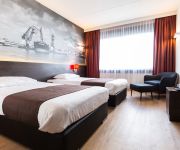
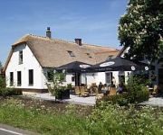
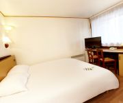
If you need a place to sleep, we compiled a list of available hotels close to the map centre further down the page.
Depending on your travel schedule, you might want to pay a visit to some of the following locations: The Hague, Haarlem, Amsterdam, Utrecht and Heemskerk. To further explore this place, just scroll down and browse the available info.
Local weather forecast
Todays Local Weather Conditions & Forecast: 10°C / 49 °F
| Morning Temperature | 5°C / 41 °F |
| Evening Temperature | 8°C / 47 °F |
| Night Temperature | 6°C / 44 °F |
| Chance of rainfall | 2% |
| Air Humidity | 65% |
| Air Pressure | 1011 hPa |
| Wind Speed | Fresh Breeze with 14 km/h (8 mph) from South-East |
| Cloud Conditions | Overcast clouds, covering 95% of sky |
| General Conditions | Light rain |
Thursday, 25th of April 2024
10°C (49 °F)
8°C (46 °F)
Light rain, moderate breeze, overcast clouds.
Friday, 26th of April 2024
8°C (46 °F)
8°C (46 °F)
Moderate rain, light breeze, overcast clouds.
Saturday, 27th of April 2024
16°C (60 °F)
12°C (53 °F)
Light rain, moderate breeze, broken clouds.
Hotels and Places to Stay
NH Capelle
Van der Valk - Nieuwerkerk aan de IJssel ROTTERDAM
Bastion Hotel Rotterdam Alexander
Novotel Rotterdam Brainpark
Van der Valk Hotel Ridderkerk
Fletcher Hotel-Restaurant De Witte Brug
Campanile - Rotterdam Oost
Bastion Hotel Barendrecht
Videos from this area
These are videos related to the place based on their proximity to this place.
07.02.15 Kaerthuys 3.0 Jusagroove - Bowling, Krimpen aan den IJssel
07.02.15 Kaerthuys 3.0 feat. Jusagroove - Bowling, Krimpen aan den IJssel Video production: www.alessandro-stasi.com.
Gasleiding in de brand Krimpen aan den IJssel 08-07-2008
Gasleiding in de brand Krimpen aan den IJssel 08-07-2008 HV HB.
Lifeliner 2 PH-ULP Stad en Landschap in Krimpen aan den IJssel
Lifeliner 2 PH-ULP Stad en Landschap in Krimpen aan den IJssel.
4 Mei 2010 Dodenherdenking 2010 Krimpen aan den IJssel
http://112krimpen.nl/nieuws.php?nieuws_id=775.
De bewoner aan het woord van woongebouw Het Facet (Krimpen aan den IJssel)
SORgeloos wonen in woongebouw Het Facet, Krimpen aan den IJssel! Bewoners van Het Facet geven u een kijkje in hoe aangenaam het hier wonen is. Een comfortabel woongebouw in een ...
Lifeliner 2 PH-ULP Driekamp Krimpen aan den IJssel
Lifeliner 2 PH-ULP Driekamp Krimpen aan den IJssel.
viswater en stekken krimpen aan de IJssel
Prachtig vissen in het stadswater van Krimpen aan den IJssel. Een viswater voor vele visserij typen en sportvissers. Bekijk de opname van de viswateren en visstekken. Lees meer: http://www.angle...
Videos provided by Youtube are under the copyright of their owners.
Attractions and noteworthy things
Distances are based on the centre of the city/town and sightseeing location. This list contains brief abstracts about monuments, holiday activities, national parcs, museums, organisations and more from the area as well as interesting facts about the region itself. Where available, you'll find the corresponding homepage. Otherwise the related wikipedia article.
Lek (river)
The Lek is a river in the western Netherlands of some 60 km in length. It is the continuation of the Nederrijn after the Kromme Rijn branches off at the town of Wijk bij Duurstede. The main westbound waterway is hereafter called the Lek River. The Nederrijn is, itself, a distributary branch of river Rhine. The name "Lek" is derived either from the Middle Dutch words "lake" and "leek", meaning "watercourse".
Kinderdijk
Kinderdijk is a village in the Netherlands, belonging to the municipality of Molenwaard, in the province South Holland, about 15 km east of Rotterdam. Kinderdijk is situated in a polder in the Alblasserwaard at the confluence of the Lek and Noord rivers. To drain the polder, a system of 19 windmills was built around 1740. This group of mills is the largest concentration of old windmills in the Netherlands. The windmills of Kinderdijk are one of the best known Dutch tourist sites.
Prins Alexander
Prins Alexander is a borough in the northeast of Rotterdam, Netherlands. Prins Alexander has 7 neighbourhoods: Het Lage Land Kralingseveer Nesselande Ommoord Oosterflank Prinsenland Zevenkamp
Zevenkamp
Zevenkamp is a neighborhood of Rotterdam, The Netherlands.
Slikkerveer
Slikkerveer is a village in the municipality of Ridderkerk, South Holland, the Netherlands. In 2004, 8550 people lived in Slikkerveer. It is located about 6 km eastsoutheast of the city of
Krimpen aan de Lek
Krimpen aan de Lek is a town on the Lek River in the municipality Nederlek, province South Holland, the Netherlands. It has 6607 inhabitants in 2008. The name Krimpen comes from the archaic word "Krempener", meaning "river crossing". Therefore Krimpen aan de Lek means "Crossing on the Lek". Krimpen aan de Lek is a quiet and scenic village with 3 elementary schools.
Nesselande
Nesselande' is a new extension on the east side of the city of Rotterdam, in South Holland, the Netherlands. It is part of the borough of Prins Alexander. Formerly Zevenhuizen-Moerkapelle, consists of three development area's: Tuinstad, Badplaats and Waterwijk. On the south side, located near the A20 motorway, there will be a modest businesspark, to form a logical buffer between the motorway and the housing.
IJsselmonde (village)
IJsselmonde is a former village in the Dutch province of South Holland. It was located to the east of the city of Rotterdam. The village ("IJssel mouth") derives its name from the river Hollandsche IJssel, which flows into the Nieuwe Maas opposite from the village. The village gives its name to the large island it's on, IJsselmonde. IJsselmonde was a separate municipality until 1941, when it merged with Rotterdam.
Stormpolder
Stormpolder is a polder and a hamlet in the Dutch province of South Holland. It is located about 7 km east of the center of Rotterdam, in the municipality of Krimpen aan den IJssel. It lies between the Nieuwe Maas and Hollandsche IJssel rivers. Stormpolder was a separate municipality between 1817 and 1855, when it became part of Krimpen aan den IJssel.
A38 motorway (Netherlands)
The A38 motorway is a motorway in the Netherlands. With a total length of just 1.5 kilometers, it is one of the shortest motorways in the Netherlands.
Oosterflank (Rotterdam Metro)
Oosterflank is a subway station on Rotterdam Metro lines A and B, and is situated in the northeastern part of Rotterdam, in the borough Prins Alexander. The station is named after the neighbourhood Oosterflank, situated just east of the subway station. This station was opened on May 28, 1983 when the East-West Line (also formerly the Caland line) was extended from its previous terminus Capelsebrug. Note that this section uses overhead wires to provide traction power.
Nesselande (Rotterdam Metro)
Nesselande is a subway station on Line B of the Rotterdam Metro and is situated in Rotterdam-Nesselande. It is the northern terminus of the line. The station, designed by architect Hans Moor, was opened on August 29, 2005, as part of the one-station extension of the East-West Line or Caland Line from its previous terminus De Tochten. Unlike the section between Capelsebrug and De Tochten, this section does not use overhead wires to provide traction power, but uses a third rail instead.
De Terp (Rotterdam Metro)
De Terp is a subway station on Line C of the Rotterdam Metro and is situated in the town of Capelle aan den IJssel, just east of Rotterdam. It is the northern terminus of the line. The station was opened on May 26, 1994, as part of the extension of the East-West Line or Caland Line from Capelsebrug station. The station consists of an island platform between two tracks.
De Tochten (Rotterdam Metro)
De Tochten is a subway station on Line B of the Rotterdam Metro and is situated in Rotterdam-Zevenkamp. It is penultimate station of the line. The station was opened on April 19, 1984. It has served as terminus for a long time, until the opening of the one-station extension towards the new Nesselande station on August 29, 2005.
Capelle Centrum (Rotterdam Metro)
Capelle Centrum is a subway station on Line C of the Rotterdam Metro and is situated in the town of Capelle aan den IJssel, just east of Rotterdam. It is the penultimate station of the line. The station was opened on May 26, 1994, as part of the extension of the East-West Line or Caland Line from Capelsebrug station towards De Terp station. The station consists of two tracks with a platform on both sides.
Slotlaan (Rotterdam Metro)
Slotlaan is a subway station on Line C of the Rotterdam Metro and is situated in the town of Capelle aan den IJssel, just east of Rotterdam. The station was opened on May 26, 1994, as part of the extension of the East-West Line or Caland Line from Capelsebrug station towards De Terp station. The station consists of two tracks with a platform on both sides.
Prinsenlaan (Rotterdam Metro)
Prinsenlaan is a subway station on Rotterdam Metro lines A and B, and is situated in the northeastern part of Rotterdam, in the borough Prins Alexander. The station is located between the neighbourhoods Het Lage Land and Oosterflank. This station was opened on May 28, 1983 when the East-West Line (also formerly the Caland line) was extended from its previous terminus Capelsebrug. Note that this section uses overhead wires to provide traction power.
Schenkel (Rotterdam Metro)
Schenkel is a subway station on Rotterdam Metro lines A and B, and is situated in the northeastern part of Rotterdam, in the borough Prins Alexander. The station is named after a neighbourhood in nearby Capelle aan den IJssel, situated to the southeast of the subway station. This station was opened on May 28, 1983 when the East-West Line (also formerly the Caland line) was extended from its previous terminus Capelsebrug. Note that this section uses overhead wires to provide traction power.
Nieuw Verlaat (Rotterdam Metro)
Nieuw Verlaat is a station on Line B of the Rotterdam Metro and is situated in the Zevenkamp neighbourhood of Rotterdam.
Ambachtsland (Rotterdam Metro)
Ambachtsland is a station on Line B of the Rotterdam Metro and is situated in the Zevenkamp neighbourhood of Rotterdam.
Beverwaard
Beverwaard is a neighborhood of Rotterdam, Netherlands.
Kralingseveer
Kralingseveer is a neighborhood of Rotterdam, Netherlands.
Oosterflank
Oosterflank is a neighborhood of Rotterdam, Netherlands.
Oud-IJsselmonde
Oud-IJsselmonde is a neighborhood of Rotterdam, Netherlands.
Sagenbuurt
Sagenbuurt is a neighborhood of Rotterdam, Netherlands.


