Marshall Islands
in Micronesia
Oceania
- Currency and Currency Code:
- Dollar - USD
- Spoken languages:
- Marshallese, English
- Local electricity:
- 120 V - 60 Hz (plugs: A, B)
- Mobile phone / cellular frequencies (MHz):
- 900 MHz, 1800 MHz
- ISO 2-Letter code:
- MH
- Internet top level domain:
- .mh
- Country phone prefix:
- +692
- Local Time (capital):
- Timezone:
- UTC/GMT offset: hours
Safety Score: 3,0 of 5.0 based on data from 9 authorites. Meaning we advice caution when travelling to Marshall Islands.
Travel warnings are updated daily. Source: Travel Warning Marshall Islands. Last Update: 2024-04-18 08:12:24
Explore Marshall Islands
Marshall Islands with its capital Majuro is located in Oceania (Oceania, two archipelagic island chains of 29 atolls). It covers some 182 square kilometers (about the size of Washington, DC) with 74,539 citizens. Marshallese and English are the common languages used in Marshall Islands. Thiscountry has no land-based border with any other country.
The Marshall Islands are a group of atolls and reefs in the Pacific Ocean, about half-way between Hawaii and Australia. The Marshall Islands consist of two island chains of 30 atolls and 1,152 islands, of low coral limestone and sand. Bikini and Enewetak are former US nuclear test sites; Kwajalein, the famous World War II battleground, is now used as a US missile test range.
Popular Destinations in Marshall Islands
Administrative regions of Marshall Islands
- Ailinginae Atoll
- Ailinglaplap Atoll
- Ailuk Atoll
- Arno Atoll
- Aur Atoll
- Bikar Atoll
- Bikini Atoll
- Bokak Atoll
- Ebon Atoll
- Enewetak Atoll
- Erikub Atoll
- Jabat Island
- Jaluit Atoll
- Jemo Island
- Kili Island
- Kwajalein Atoll
- Lae Atoll
- Lib Island
- Likiep Atoll
- Majuro Atoll
- Maloelap Atoll
- Mejit Island
- Mili Atoll
- Namdrik Atoll
- Namu Atoll
- Rongelap Atoll
- Rongrik Atoll
- Taka Atoll
- Ujae Atoll
- Ujelang Atoll
- Utrik Atoll
- Wotho Atoll
- Wotje Atoll
About the country
Website: Marshall Islands Tourism
P.O. Box 5
Majuro 96960
Marshall Islands
Phone: +692 625 6482
Fax: +692 625 6771
Mail: tourism@ntamar.com
The topography is low coral limestone and sand islands. The average density of population is about 412 per km². The climate in Marshall Islands can be described as tropicalhot and humid, wet season May to November, islands border typhoon belt. Potential natural disasters are infrequent typhoons.
To reach someone Marshall Islands dial +692 prior to a number. The local cellular networks are operated on 900 MHz, 1800 MHz. Websites typically end with the top level domain ".mh". If you want to bring electric appliances (e.g. battery chaarger), keep in min the local 120 V - 60 Hz (plugs: A, B). The sign for the locally used currency Dollar is USD.
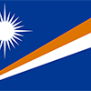
Blue with two stripes radiating from the lower hoist-side corner - orange (top) and white; a white star with four large rays and 20 small rays appears on the hoist side above the two stripes; blue represents the Pacific Ocean, the orange stripe signifies the Ralik Chain or sunset and courage, while the white stripe signifies the Ratak Chain or sunrise and peace; the star symbolizes the cross of Christianity, each of the 24 rays designates one of the electoral districts in the country and the four larger rays highlight the principal cultural centers of Majuro, Jaluit, Wotje, and Ebeye; the rising diagonal band can also be interpreted as representing the equator, with the star showing the archipelago's position just to the north.

After almost four decades under US administration as the easternmost part of the UN Trust Territory of the Pacific Islands, the Marshall Islands attained independence in 1986 under a Compact of Free Association. Compensation claims continue as a result of US nuclear testing on some of the atolls between 1947 and 1962. The Marshall Islands hosts the US Army Kwajalein Atoll Reagan Missile Test Site, a key installation in the US missile defense network. Kwajalein also hosts one of four dedicated ground antennas (the others are on Ascension (Saint Helena, Ascension, and Tristan da Cunha), Diego Garcia (British Indian Ocean Territory), and at Cape Canaveral, Florida (US)) that assist in the operation of the Global Positioning System (GPS) navigation system.
Geography
| Area | ||
|---|---|---|
| Total (World Rank: 214) | 181 | sq km |
| Land (World Rank: 211) | 181 | sq km |
| Forest (World Rank: 121) | 11.70 | % |
| Comparative | about the size of Washington, DC | |
| Note | the archipelago includes 11,673 sq km of lagoon waters and encompasses the atolls of Bikini, Enewetak, Kwajalein, Majuro, Rongelap, and Utirik | |
| Coastline | ||
| 370.4 | ||
| Elevation | ||
| Highest point (World Rank: 230) | 14 | m |
| Agricultural land | ||
| Total (World Rank: 69) | 50.70 | % |
| Arable (World Rank: 130) | 7.80 | % |
| Permanent crops (World Rank: 6) | 31.20 | % |
| Permanent pastures (World Rank: 121) | 11.70 | % |
| Map reference | ||
| Oceania | ||
| Environment | ||
| Issues |
| |
| Agreement party |
| |
| Hazzards | infrequent typhoons | |
| Location | ||
| Oceania, two archipelagic island chains of 29 atolls, each made up of many small islets, and five single islands in the North Pacific Ocean, about halfway between Hawaii and Australia | ||
| Climate | ||
| tropical; hot and humid; wet season May to November; islands border typhoon belt | ||
| Terrain | ||
| low coral limestone and sand islands | ||
People
| Population | ||
|---|---|---|
| Total (World Rank: 199) | 74,539 | |
| Deathrate (World Rank: 206) | 0.42 | % |
| Birthrate (World Rank: 50) | 2.44 | % |
| Growthrate (World Rank: 73) | 1.55 | % |
| Migration rate (World Rank: 154) | -0.47 | % |
| Fertility rate (World Rank: 52) | 3.03 | % |
| Median age | ||
| Male (World Rank: 168) | 22.80 | |
| Female (World Rank: 172) | 23.00 | |
| Age structure | ||
| 0 14 male (World Rank: 191) | 13,261 | |
| 0 14 female (World Rank: 191) | 12,743 | |
| 15 24 male (World Rank: 195) | 6,820 | |
| 15 24 female (World Rank: 195) | 6,594 | |
| 25 54 male (World Rank: 200) | 14,147 | |
| 25 54 female (World Rank: 202) | 13,642 | |
| 55 64 male (World Rank: 209) | 2,189 | |
| 55 64 female (World Rank: 211) | 2,148 | |
| 65 x male (World Rank: 212) | 1,475 | |
| 65 x female (World Rank: 212) | 1,520 | |
| Health | ||
| Infant mortality rate (World Rank: 83) | 1.93 | % |
| Life expectancy total (World Rank: 133) | 73 | years |
| Life expectancy female (World Rank: 136) | 76 | years |
| Life expectancy male (World Rank: 128) | 71 | years |
| Physicians per 1000 (World Rank: 130) | 0.46 | |
| Hospital bed per 1000 (World Rank: 83) | 2.70 | |
| Sanitation access total (World Rank: 129) | 76.90 | % |
| Obesity adult (World Rank: 3) | 52.90 | % |
| Drinking water access (World Rank: 114) | 94.60 | % |
Energy
| Electricity | ||
|---|---|---|
| Production (World Rank: 161) | 620,000,000 | kWh |
| Consumption (World Rank: 170) | 576,600,000 | kWh |
| Source fossil (World Rank: 88) | 80.80 | % |
| Source nuclear (World Rank: 87) | 19.20 | % |
| Refined products | ||
| Consumption (World Rank: 192) | 2,000 | bbl / day |
| Import (World Rank: 186) | 2,060 | bbl / day |
| Carbon footprint | ||
| 300000 | ||
Nation
| Budget | ||
|---|---|---|
| Health (World Rank: 2) | 17 | % of GDP |
| Surplus (World Rank: 16) | 2 | % of GDP |
| National symbol | ||
| a 24-rayed star | ||
| National colours | ||
| white | ||
| Adjective | ||
| Marshallese | ||
| Noun | ||
| Marshallese (singular and plural) | ||
| Background | ||
| After almost four decades under US administration as the easternmost part of the UN Trust Territory of the Pacific Islands, the Marshall Islands attained independence in 1986 under a Compact of Free Association. Compensation claims continue as a result of US nuclear testing on some of the atolls between 1947 and 1962. The Marshall Islands hosts the US Army Kwajalein Atoll Reagan Missile Test Site, a key installation in the US missile defense network. Kwajalein also hosts one of four dedicated ground antennas (the others are on Ascension (Saint Helena, Ascension, and Tristan da Cunha), Diego Garcia (British Indian Ocean Territory), and at Cape Canaveral, Florida (US)) that assist in the operation of the Global Positioning System (GPS) navigation system. | ||
| Flag description | ||
| blue with two stripes radiating from the lower hoist-side corner - orange (top) and white; a white star with four large rays and 20 small rays appears on the hoist side above the two stripes; blue represents the Pacific Ocean, the orange stripe signifies the Ralik Chain or sunset and courage, while the white stripe signifies the Ratak Chain or sunrise and peace; the star symbolizes the cross of Christianity, each of the 24 rays designates one of the electoral districts in the country and the four larger rays highlight the principal cultural centers of Majuro, Jaluit, Wotje, and Ebeye; the rising diagonal band can also be interpreted as representing the equator, with the star showing the archipelago's position just to the north | ||
Economy
| Gdp | ||
|---|---|---|
| Purchasing power parity (World Rank: 219) | 182,000,000 | USD |
| Real growth rate (World Rank: 134) | 2.00 | % |
| Per capita purchasing power parity (World Rank: 183) | 3,400 | USD |
| Source agriculture (World Rank: 133) | 4.40 | % |
| Source industry (World Rank: 204) | 9.90 | % |
| Source service (World Rank: 18) | 85.70 | % |
| Labourforce | ||
| Total (World Rank: 214) | 10,670 | |
| Products | ||
| Industries |
| |
| Agriculture |
| |
| Exports |
| |
| Imports |
| |
Communication
| Phone | ||
|---|---|---|
| Landline total (World Rank: 207) | 2,361 | |
| Landline per 100 (World Rank: 167) | 3.00 | |
| Mobile per 100 (World Rank: 213) | 21.00 | |
| Assessment | 0 | |
| Internet | ||
| Users (World Rank: 202) | 21,857 | |
| Population (World Rank: 157) | 29.80 | % |
Transport
| Air | ||
|---|---|---|
| Airports paved (World Rank: 154) | 4.00 | |
| Airports unpaved (World Rank: 128) | 11.00 | |
| Road | ||
| Total length (World Rank: 174) | 2,028 | |
| Paved length (World Rank: 177) | 75.00 | |
This is a list of famous places in this country in alphabetical order.
 Ailuk
Ailuk- Ailuk
- Airok
- Airuk
- Airuk
- Ajejen
- Ajeltake
- Anemaro
- Arno
- Arno
- Arrak
- Aur
- Aur
- Bigen
- Bikarej
- Buoj
- Chittakain
- Chittoin
- Ebadon
- Ebaye
- Ebeye
- Ebon
- Ejit - relocation of Bikini inhabitants
- Enajet
- Enekoion
- Enewetak
- Enewetak
- Enilok
- Ennylabegan local village
- Enubuj
- Enuebing
- Ewo
- Imiej
- Inroj
- Jabat
- Jabat
- Jabor
- Jabwan
- Jaluit
- Jang
- Japejiroi
- Jebal
- Jeh
- Jelbon
- Jelter
- Jih
- Kaven
- Kearkan
- Kilange
- Kili
- Kili
- Kolalen
- Lae
- Lae
- Laura
- Lib
- Lib
- Likej
- Likiep
- Loen
- Loen
- Loi
- Lukwoj
- Mae
- Majkin
- Majuro
- Malel
- Medyil
- Meidj
- Mejatto
- Mejatto
- Mejit
- Mejrirok
- Melang
- Menge
- Mili
- Namdrik
- Namdrik
- New Rongelap
- Pinglep
- RMI Capitol
- Rairik
- Rita
- Rongelap
- Tabal
- Taroa
- Tinak
- Toka
- Ujae
- Ujae
- Ulien
- Utrik
- Utrik
- Warwir
- Wau
- Wodmej
- Woja
- Wolot
- Wotho
- Wotje