Malawi
in Eastern Africa
Africa
 Mozambique
 Tanzania
 Zambia
- Currency and Currency Code:
- Kwacha - MWK
- Spoken languages:
- Nyanja
- Local electricity:
- 230 V - 50 Hz (plugs: G)
- Mobile phone / cellular frequencies (MHz):
- 900 MHz, 1800 MHz, 3G, 4G
- ISO 2-Letter code:
- MW
- Internet top level domain:
- .mw
- Country phone prefix:
- +265
- Local Time (capital):
- Timezone:
- UTC/GMT offset: hours
Safety Score: 3,0 of 5.0 based on data from 9 authorites. Meaning we advice caution when travelling to Malawi.
Travel warnings are updated daily. Source: Travel Warning Malawi. Last Update: 2024-04-24 08:14:40
Explore Malawi
Malawi with its capital Lilongwe is located in Africa (Southern Africa, east of Zambia). It covers some 118,485 square kilometers (slightly smaller than Pennsylvania) with a population of 19,196,200. Nyanja is the official language spoken by people in Malawi. Mozambique, Tanzania and Zambia are bordering countries.
Malawi is a country in Africa, bordered by Mozambique to the south and east, Tanzania to the north, Zambia to the west. Lake Malawi, the third largest lake in Africa, runs along most of its eastern border. It's described as the Warm Heart of Africa, referring to the friendliness of the people. Much of Malawi is plateau, often reaching to 1,000 m (3,000 ft), and the temperature in these highlands is moderate, with the hottest period occurring during the autumn rainy season and the coolest and chilliest in winter. Malawi has a massive diversity of beautiful landscapes. The highest peaks in Malawi touch 10,000ft (3,000m) while the lowest point is barely above sea level. This range of altitudes in a small area help to make the landscape of Malawi one of the most varied in all Africa. It is generally a green, lush country, with plateaux, highlands, forests, mountains, plains, escarpments and dramatic river valleys.
Popular Destinations in Malawi
Administrative regions of Malawi
About the country
P.O. Box 326
Lilongwe 3
Malawi
Phone: +265 775 499
Fax: +265 770 650
Mail: tourism@malawi.net
The topography is narrow elongated plateau with rolling plains, rounded hills, some mountains. The average density of population is about 162 per km². The climate in Malawi can be described as sub-tropicalrainy season (November to May), dry season (May to November). Potential natural disasters are droughts, earthquakes and flooding.
To reach someone Malawi dial +265 prior to a number. The local cellular networks are operated on 900 MHz, 1800 MHz, 3G, 4G. Websites typically end with the top level domain ".mw". If you want to bring electric appliances (e.g. battery chaarger), keep in min the local 230 V - 50 Hz (plugs: G). The sign for the locally used currency Kwacha is MWK.
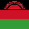
Three equal horizontal bands of black (top), red, and green with a radiant, rising, red sun centered on the black band; black represents the native peoples, red the blood shed in their struggle for freedom, and green the color of nature; the rising sun represents the hope of freedom for the continent of Africa.

Established in 1891, the British protectorate of Nyasaland became the independent nation of Malawi in 1964. After three decades of one-party rule under President Hastings Kamuzu BANDA, the country held multiparty presidential and parliamentary elections in 1994, under a provisional constitution that came into full effect the following year. President Bingu wa MUTHARIKA, elected in 2004 after a failed attempt by the previous president to amend the constitution to permit another term, struggled to assert his authority against his predecessor and subsequently started his own party, the Democratic Progressive Party in 2005. MUTHARIKA was reelected to a second term in 2009. He oversaw some economic improvement in his first term, but was accused of economic mismanagement and poor governance in his second term. He died abruptly in 2012 and was succeeded by vice president, Joyce BANDA, who had earlier started her own party, the People's Party. MUTHARIKA's brother, Peter MUTHARIKA, defeated BANDA in the 2014 election. Population growth, increasing pressure on agricultural lands, corruption, and the scourge of HIV/AIDS pose major problems for Malawi.
Geography
| Area | ||
|---|---|---|
| Total (World Rank: 101) | 118,484 | sq km |
| Land (World Rank: 108) | 94,080 | sq km |
| Water (World Rank: 23) | 24,404 | sq km |
| Forest (World Rank: 92) | 19.60 | % |
| Comparative | slightly smaller than Pennsylvania | |
| Landborder | ||
| 2857 | ||
| Elevation | ||
| Lowest point (World Rank: 35) | 37 | m |
| Highest point (World Rank: 68) | 3,002 | m |
| Agricultural land | ||
| Total (World Rank: 46) | 59.20 | % |
| Arable (World Rank: 19) | 38.20 | % |
| Permanent crops (World Rank: 110) | 1.40 | % |
| Permanent pastures (World Rank: 92) | 19.60 | % |
| Irrigated land (World Rank: 108) | 740 | sq km |
| Map reference | ||
| Africa | ||
| Environment | ||
| Issues |
| |
| Agreement party |
| |
| Agreement signed | Law of the Sea | |
| Hazzards |
| |
| Location | ||
| Southern Africa, east of Zambia, west and north of Mozambique | ||
| Climate | ||
| sub-tropical; rainy season (November to May); dry season (May to November) | ||
| Terrain | ||
| narrow elongated plateau with rolling plains, rounded hills, some mountains | ||
People
| Population | ||
|---|---|---|
| Total (World Rank: 61) | 19,196,200 | |
| Deathrate (World Rank: 92) | 0.79 | % |
| Birthrate (World Rank: 8) | 4.10 | % |
| Growthrate (World Rank: 4) | 3.31 | % |
| Fertility rate (World Rank: 9) | 5.49 | % |
| Median age | ||
| Male (World Rank: 221) | 16.40 | |
| Female (World Rank: 221) | 16.70 | |
| Age structure | ||
| 0 14 male (World Rank: 46) | 4,427,400 | |
| 0 14 female (World Rank: 42) | 4,468,120 | |
| 15 24 male (World Rank: 56) | 1,956,360 | |
| 15 24 female (World Rank: 55) | 1,988,120 | |
| 25 54 male (World Rank: 67) | 2,612,840 | |
| 25 54 female (World Rank: 67) | 2,649,000 | |
| 55 64 male (World Rank: 95) | 275,998 | |
| 55 64 female (World Rank: 96) | 302,286 | |
| 65 x male (World Rank: 98) | 227,582 | |
| 65 x female (World Rank: 98) | 288,537 | |
| Health | ||
| Infant mortality rate (World Rank: 43) | 4.34 | % |
| Life expectancy total (World Rank: 197) | 62 | years |
| Life expectancy female (World Rank: 196) | 64 | years |
| Life expectancy male (World Rank: 197) | 60 | years |
| Physicians per 1000 (World Rank: 181) | 0.02 | |
| Hospital bed per 1000 (World Rank: 135) | 1.30 | |
| Sanitation access total (World Rank: 169) | 41.00 | % |
| Obesity adult (World Rank: 173) | 5.80 | % |
| Drinking water access (World Rank: 135) | 90.20 | % |
Energy
| Electricity | ||
|---|---|---|
| Production (World Rank: 138) | 2,120,000,000 | kWh |
| Consumption (World Rank: 143) | 1,972,000,000 | kWh |
| Source fossil (World Rank: 211) | 0.50 | % |
| Source nuclear (World Rank: 8) | 93.30 | % |
| Source renew (World Rank: 85) | 6.10 | % |
| Refined products | ||
| Consumption (World Rank: 163) | 7,000 | bbl / day |
| Import (World Rank: 150) | 6,843 | bbl / day |
| Natural gas | ||
| Consumption (World Rank: 138) | 17 | m³ |
| Carbon footprint | ||
| 1900000 | ||
Nation
| Budget | ||
|---|---|---|
| Education (World Rank: 42) | 6 | % of GDP |
| Military (World Rank: 139) | 1 | % of GDP |
| Health (World Rank: 9) | 11 | % of GDP |
| Surplus (World Rank: 156) | -6 | % of GDP |
| National symbol | ||
| lion | ||
| National colours | ||
| red | ||
| Adjective | ||
| Malawian | ||
| Noun | ||
| Malawian(s) | ||
| Background | ||
| Established in 1891, the British protectorate of Nyasaland became the independent nation of Malawi in 1964. After three decades of one-party rule under President Hastings Kamuzu BANDA, the country held multiparty presidential and parliamentary elections in 1994, under a provisional constitution that came into full effect the following year. President Bingu wa MUTHARIKA, elected in 2004 after a failed attempt by the previous president to amend the constitution to permit another term, struggled to assert his authority against his predecessor and subsequently started his own party, the Democratic Progressive Party in 2005. MUTHARIKA was reelected to a second term in 2009. He oversaw some economic improvement in his first term, but was accused of economic mismanagement and poor governance in his second term. He died abruptly in 2012 and was succeeded by vice president, Joyce BANDA, who had earlier started her own party, the People's Party. MUTHARIKA's brother, Peter MUTHARIKA, defeated BANDA in the 2014 election. Population growth, increasing pressure on agricultural lands, corruption, and the scourge of HIV/AIDS pose major problems for Malawi. | ||
| Flag description | ||
| three equal horizontal bands of black (top), red, and green with a radiant, rising, red sun centered on the black band; black represents the native peoples, red the blood shed in their struggle for freedom, and green the color of nature; the rising sun represents the hope of freedom for the continent of Africa | ||
Economy
| Gdp | ||
|---|---|---|
| Purchasing power parity (World Rank: 145) | 21,130,000,000 | USD |
| Real growth rate (World Rank: 122) | 2.30 | % |
| Per capita purchasing power parity (World Rank: 221) | 1,100 | USD |
| Source agriculture (World Rank: 20) | 28.30 | % |
| Source industry (World Rank: 170) | 16.00 | % |
| Source service (World Rank: 149) | 55.80 | % |
| Labourforce | ||
| Total (World Rank: 66) | 7,000,000 | |
| In poverty (World Rank: 19) | 50.70 | % |
| Products | ||
| Industries |
| |
| Agriculture |
| |
| Exports |
| |
| Imports |
| |
Communication
| Phone | ||
|---|---|---|
| Landline total (World Rank: 190) | 11,234 | |
| Landline per 100 (World Rank: 219) | 1.00 | |
| Mobile per 100 (World Rank: 207) | 39.00 | |
| Assessment | 0 | |
| Internet | ||
| Users (World Rank: 116) | 1,785,370 | |
| Population (World Rank: 210) | 9.60 | % |
Transport
| Air | ||
|---|---|---|
| Airports paved (World Rank: 130) | 7.00 | |
| Airports unpaved (World Rank: 91) | 25.00 | |
| Rail | ||
| Total length (World Rank: 99) | 767 | |
| Road | ||
| Total length (World Rank: 123) | 15,450 | |
| Paved length (World Rank: 88) | 6,951 | |
| Unpaved length (World Rank: 91) | 8,499 | |
| Water | ||
| Total length (World Rank: 77) | 700 | |
This is a list of famous places in this country in alphabetical order.
 Abisai
- Balaka
- Bandawe
- Bandawe
- Blantyre
- Bumba
- Cape Maclear
- Chelinda
- Chembe
- Chikupizga Village
- Chikwawa
- Chilumba
- Chindozwa
- Chintheche
- Chipoka
- Chiponde
- Chipyela
- Chiradzulu
- Chisani
- Chitimba
- Chitipa
- Chiweta
- Chiweyo
- Cikowi
- Dedza
- Dowa
- Dsoka
- Ekwendeni
- Fukamapiri
- Kamlembo
- Kampambe
- Kamphiningo
- Kaondo
- Karonga
- Karonga
- Kasungu
- Katoto
- Kaudzu
- Kawali
- Kuyu
- Likoma
- Likuni
- Lilongwe
- Livingstonia
- Liwonde
- Loudon
- Luchenza
- Lumbadzi
- Machinga
- Makata
- Makuta
- Malauli
- Mandala
- Mangochi
- Mbaluko
- Mbungu
- Mchenga
- Mchesi
- Mchinji
- Mkhoma
- Mlonga
- Mlowe
- Monkey Bay
- Mount Pleasant
- Mponela
- Msekwa
- Msumbi
- Mtenje
- Mulanje
- Mvela
- Mwanza
- Mwenda
- Mzimba
- Mzuzu
- Namgwagwa
- Ndalankwanda
- Ndomo
- Neno
- Ngoma
- Nkhata Bay
- Nkhotakota
- Nkwazi
- Nsanje
- Ntcheu
- Ntchisi
- Nyambadwe
- Phalombe
- Rumphi
- Salawe
- Salima
- Sauka
- Senga
- Soche
- Songwe
- Sunnyside Suburb
- Thope
- Thyolo
- Yangala
- Yundu
- Zomba