Kiribati
in Micronesia
Oceania
- Currency and Currency Code:
- Dollar - AUD
- Spoken languages:
- English
- Local electricity:
- 240 V - 50 Hz (plugs: I)
- Mobile phone / cellular frequencies (MHz):
- 900 MHz, 3G, 4G
- ISO 2-Letter code:
- KI
- Internet top level domain:
- .ki
- Country phone prefix:
- +686
- Local Time (capital):
- Timezone:
- UTC/GMT offset: hours
Explore Kiribati
Kiribati with its capital Tarawa is located in Oceania (Oceania, group of 33 coral atolls in the Pacific Ocean). It covers some 812 square kilometers (four times the size of Washington, DC) with a population of 108,145. English is the language spoken by people in Kiribati. There are no land based border this country shares with any other country.
Kiribati is an island group in Micronesia straddling the equator and, until 1995, the International Date Line. Kiribati is most emphatically not another Tahiti, Hawaii, etc. where you can go to relax and have nothing to worry about. It has few visitors, and they have to be prepared to rough it. That said, there aren't many countries where the people are more friendly. South Tarawa is one of the most densely populated, severely poverty-stricken places in the world. Other islands have far fewer people, but getting to them can be difficult, and conditions are even more primitive. Most tourists, especially from the USA, go to Kiritimati (Christmas Island). It received some attention on January 1, 2000 as the first location in the world to experience the new millennium.
Popular Destinations in Kiribati
Administrative regions of Kiribati
About the country
The terrain is mostly low-lying coral atolls surrounded by extensive reefs. The average density of population is about 133 per km². The climate in Kiribati can be described as tropical with marine, hot and humid, moderated by trade winds. Possible natural disasters include low level of some of the islands make them sensitive to changes in sea level, occasional tornadoes and typhoons can occur any time, but usually November to March.
To reach someone Kiribati dial +686 prior to a number. The local cellular networks are operated on 900 MHz, 3G, 4G. Websites typically end with the top level domain ".ki". If you want to bring electric appliances (e.g. battery chaarger), keep in min the local 240 V - 50 Hz (plugs: I). The sign for the locally used currency Dollar is AUD.
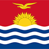
The upper half is red with a yellow frigatebird flying over a yellow rising sun, and the lower half is blue with three horizontal wavy white stripes to represent the Pacific ocean; the white stripes represent the three island groups - the Gilbert, Line, and Phoenix Islands; the 17 rays of the sun represent the 16 Gilbert Islands and Banaba (formerly Ocean Island); the frigatebird symbolizes authority and freedom.

The Gilbert Islands became a British protectorate in 1892 and a colony in 1915; they were captured by the Japanese in the Pacific War in 1941. The islands of Makin and Tarawa were the sites of major US amphibious victories over entrenched Japanese garrisons in 1943. The Gilbert Islands were granted self-rule by the UK in 1971 and complete independence in 1979 under the new name of Kiribati. The US relinquished all claims to the sparsely inhabited Phoenix and Line Island groups in a 1979 treaty of friendship with Kiribati.
Geography
| Area | ||
|---|---|---|
| Total (World Rank: 187) | 811 | sq km |
| Land (World Rank: 184) | 811 | sq km |
| Comparative | four times the size of Washington, DC | |
| Note | includes three island groups - Gilbert Islands, Line Islands, and Phoenix Islands - dispersed over about 3.5 million sq km (1.35 million sq mi) | |
| Coastline | ||
| 1143 | ||
| Elevation | ||
| Highest point (World Rank: 222) | 81 | m |
| Agricultural land | ||
| Total (World Rank: 101) | 42.00 | % |
| Arable (World Rank: 174) | 2.50 | % |
| Permanent crops (World Rank: 4) | 39.50 | % |
| Map reference | ||
| Oceania | ||
| Environment | ||
| Issues |
| |
| Agreement party |
| |
| Hazzards |
| |
| Location | ||
| Oceania, group of 33 coral atolls in the Pacific Ocean, straddling the Equator; the capital Tarawa is about halfway between Hawaii and Australia | ||
| Climate | ||
| tropical; marine, hot and humid, moderated by trade winds | ||
| Terrain | ||
| mostly low-lying coral atolls surrounded by extensive reefs | ||
People
| Population | ||
|---|---|---|
| Total (World Rank: 189) | 108,145 | |
| Deathrate (World Rank: 130) | 0.70 | % |
| Birthrate (World Rank: 74) | 2.12 | % |
| Growthrate (World Rank: 99) | 1.13 | % |
| Migration rate (World Rank: 138) | -0.29 | % |
| Fertility rate (World Rank: 84) | 2.39 | % |
| Median age | ||
| Male (World Rank: 159) | 23.80 | |
| Female (World Rank: 154) | 25.50 | |
| Age structure | ||
| 0 14 male (World Rank: 188) | 16,360 | |
| 0 14 female (World Rank: 188) | 15,734 | |
| 15 24 male (World Rank: 187) | 11,282 | |
| 15 24 female (World Rank: 187) | 11,503 | |
| 25 54 male (World Rank: 192) | 20,300 | |
| 25 54 female (World Rank: 189) | 21,860 | |
| 55 64 male (World Rank: 206) | 2,942 | |
| 55 64 female (World Rank: 200) | 3,590 | |
| 65 x male (World Rank: 209) | 1,802 | |
| 65 x female (World Rank: 205) | 2,772 | |
| Health | ||
| Infant mortality rate (World Rank: 58) | 3.21 | % |
| Life expectancy total (World Rank: 171) | 67 | years |
| Life expectancy female (World Rank: 171) | 69 | years |
| Life expectancy male (World Rank: 171) | 64 | years |
| Physicians per 1000 (World Rank: 148) | 0.20 | |
| Hospital bed per 1000 (World Rank: 138) | 1.30 | |
| Sanitation access total (World Rank: 172) | 39.70 | % |
| Obesity adult (World Rank: 8) | 46.00 | % |
| Drinking water access (World Rank: 181) | 66.90 | % |
Energy
| Electricity | ||
|---|---|---|
| Production (World Rank: 210) | 24,000,000 | kWh |
| Consumption (World Rank: 210) | 22,320,000 | kWh |
| Source fossil (World Rank: 122) | 62.50 | % |
| Source renew (World Rank: 6) | 37.50 | % |
| Refined products | ||
| Consumption (World Rank: 209) | 400 | bbl / day |
| Import (World Rank: 204) | 510 | bbl / day |
| Natural gas | ||
| Consumption (World Rank: 143) | 15 | m³ |
| Carbon footprint | ||
| 58450 | ||
Nation
| Budget | ||
|---|---|---|
| Health (World Rank: 23) | 10 | % of GDP |
| Surplus (World Rank: 3) | 11 | % of GDP |
| National symbol | ||
| frigatebird | ||
| National colours | ||
| yellow | ||
| Adjective | ||
| I-Kiribati | ||
| Noun | ||
| I-Kiribati (singular and plural) | ||
| Background | ||
| The Gilbert Islands became a British protectorate in 1892 and a colony in 1915; they were captured by the Japanese in the Pacific War in 1941. The islands of Makin and Tarawa were the sites of major US amphibious victories over entrenched Japanese garrisons in 1943. The Gilbert Islands were granted self-rule by the UK in 1971 and complete independence in 1979 under the new name of Kiribati. The US relinquished all claims to the sparsely inhabited Phoenix and Line Island groups in a 1979 treaty of friendship with Kiribati. | ||
| Flag description | ||
| the upper half is red with a yellow frigatebird flying over a yellow rising sun, and the lower half is blue with three horizontal wavy white stripes to represent the Pacific ocean; the white stripes represent the three island groups - the Gilbert, Line, and Phoenix Islands; the 17 rays of the sun represent the 16 Gilbert Islands and Banaba (formerly Ocean Island); the frigatebird symbolizes authority and freedom | ||
Economy
| Gdp | ||
|---|---|---|
| Purchasing power parity (World Rank: 218) | 215,000,000 | USD |
| Real growth rate (World Rank: 57) | 4.20 | % |
| Per capita purchasing power parity (World Rank: 206) | 1,900 | USD |
| Source agriculture (World Rank: 26) | 26.30 | % |
| Source industry (World Rank: 206) | 9.20 | % |
| Source service (World Rank: 94) | 64.50 | % |
| Labourforce | ||
| Total (World Rank: 195) | 39,000 | |
| Products | ||
| Industries |
| |
| Agriculture |
| |
| Exports |
| |
| Imports |
| |
Communication
| Phone | ||
|---|---|---|
| Landline total (World Rank: 212) | 1,000 | |
| Landline per 100 (World Rank: 201) | 1.00 | |
| Mobile per 100 (World Rank: 201) | 51.00 | |
| Assessment | 0 | |
| Internet | ||
| Users (World Rank: 206) | 14,649 | |
| Population (World Rank: 198) | 13.70 | % |
Transport
| Air | ||
|---|---|---|
| Airports paved (World Rank: 153) | 4.00 | |
| Airports unpaved (World Rank: 118) | 15.00 | |
| Road | ||
| Total length (World Rank: 192) | 670 | |
| Water | ||
| Total length (World Rank: 109) | 5.00 | |
This is a list of famous places in this country in alphabetical order.
 Abarao Village
- Abatao Village
- Aiaki
- Ambo Village
- Antebuka Village
- Antereen Village
- Aonobuaka Village
- Aontena Gilberts Village
- Autokia Village
- Bainuna Village
- Bairiki Village
- Bakaka Village
- Banana Village
- Bangotantekabaia Village
- Banraeaba Village
- Baretoa Village
- Betania Village
- Betio Village
- Bikenibeu Village
- Bonriki Village
- Borotiam Village
- Buariki Village
- Buariki Village
- Buariki Village
- Buariki Village
- Bubutei Village
- Buota Village
- Buota Village
- Eita Village
- Eita Village
- Eriko Village
- Kabangaki Village
- Kainaba Village
- Kanton Village
- Kariatebike Village
- Keuea Village
- Kiebu Village
- Koinawa Village
- Kuma Village
- Kuria Village
- London Village
- Makin Village
- Manoku Village
- Matang Village
- Morikao Village
- Nabeina Village
- Nanikai Village
- Napari Village
- Napia Village
- Nawerewere Village
- Nikumanu Village
- Nikutoru Village
- Norauea Village
- Nuka Village
- Nuotaea Village
- Poland Village
- Rawannawi Village
- Roreti Village
- Rotuma Village
- Rungata
- Tabewa Village
- Tabiang Village
- Tabiang Village
- Tabiauea Village
- Tabiteuea Village
- Tabonibara Village
- Tabontebike Village
- Tabonuea Village
- Taborio Village
- Taborio Village
- Tabuarorae Village
- Tabuiroa Village
- Tabukiniberu Village
- Taburao Village
- Tabwakea Village
- Takarano Village
- Tamaroa Village
- Tanaeag Village
- Tanaeang Village
- Tanimaiaki Village
- Taratai Village
- Tarawa
- Teaoraereke Village
- Tebanga Village
- Tebanga Village
- Tebunginako Village
- Tekarakan Village
- Tekatirirake Village
- Temaiku Village
- Temao Village
- Temotu Village
- Tenenebo Village
- Tereitaki Village
- Terikiai Village
- Teuabu Village
- Toboiaki Village
- Tuarabu Village
- Ukiangang Village
- Umwa Village
- Utiroa Village