Safety Score: 2,8 of 5.0 based on data from 9 authorites. Meaning we advice caution when travelling to Canada.
Travel warnings are updated daily. Source: Travel Warning Canada. Last Update: 2024-04-25 08:17:04
Discover Dawson City
Dawson City in Yukon with it's 1,319 citizens is a town in Canada about 2,700 mi (or 4,345 km) north-west of Ottawa, the country's capital city.
Current time in Dawson City is now 08:49 AM (Thursday). The local timezone is named America / Dawson with an UTC offset of -7 hours. We know of 3 airports near Dawson City. The closest airport in Canada is Dawson City Airport in a distance of 9 mi (or 15 km), East. Besides the airports, there are other travel options available (check left side).
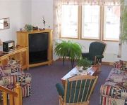
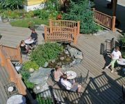
Looking for a place to stay? we compiled a list of available hotels close to the map centre further down the page.
To further explore this place, just scroll down and browse the available info.
Hotels and Places to Stay
Canadas Best Value Inn Downtown Hotel Dawson City
AURORA INN
WESTMARK DAWSON
Videos from this area
These are videos related to the place based on their proximity to this place.
Steamboat Ghosts of the Yukon
Seven great steamboats from the Klondike Gold Rush era sit along the shore in the old West Dawson Shipyard, Yukon Territory, Canada. Since 2007 teams from the Institute of Nautical Archaeology...
Dawson City, Yukon Territory October 1998
Dawson and the Top of the World Highway heading west towards Alaska, October 1998. Video snapshot shows the Klondike River looking east, Eldorado and Bonanza Creeks branching south. For a...
A friendly fox in Dawson City, Yukon - August 2013
Dawson City in the Yukon Territory in the 17of August. A pretty fox visiting at the friend house. Vancouver BC to Whitehorse, Yukon Territory from the Air in Summer to Fall, 2013 http://youtu.be/S...
Motorcycle to Dawson City with MotoQuest
Join MotoQuest on an unforgettable ride through Alaska, the Yukon, and British Columbia. Visit Dawson City, Skagway, Haines and ride the Denali Highway. See the tallest mountains on the continent,.
Aurora Borealis - Northern Lights - Dawson City, Canada
Time Lapse - Northern Lights - Aurora Borealis - Dawson City, Yukon, Canada - Time Lapse with GoPro Hero4 black March, 29th, 2015.
Tok to Dawson City, Yukon via Top of the World Hwy Scoonpooh's photos around Dawson City, Canada
Preview of Scoonpooh's blog at TravelPod. Read the full blog here: http://www.travelpod.com/travel-blog-entries/scoonpooh/3/1216272300/tpod.html This blog preview was made by TravelPod using...
Dawson: Klondike River Float Trip - Holland America Line
Float in comfort down the Klondike River while learning about the area's nature, culture and history. Hear how First Nations People used this area as a gathering and hunting ground and see...
Rockbuster crushing in the Klondike
This is the Rockbuster crushing in the Klondike late summer / fall 2011. We are crushing rock on the Bonanza Creek road between Bonanza Creek and the turn-off to Quartz Creek south east of...
Videos provided by Youtube are under the copyright of their owners.
Attractions and noteworthy things
Distances are based on the centre of the city/town and sightseeing location. This list contains brief abstracts about monuments, holiday activities, national parcs, museums, organisations and more from the area as well as interesting facts about the region itself. Where available, you'll find the corresponding homepage. Otherwise the related wikipedia article.
Klondike, Yukon
The Klondike is a region of the Yukon in northwest Canada, east of the Alaska border. It lies around the Klondike River, a small river that enters the Yukon from the east at Dawson. The Klondike is famed because of the Klondike Gold Rush, which started in 1897 and lasted until 1899. Gold has been mined continuously in that area except for a hiatus in the late 1960s and early 1970s. The name "Klondike" actually evolved from the Hän word Tr'ondëk, which means "hammerstone water".
Klondike Gold Rush
The Klondike Gold Rush, also called the Yukon Gold Rush, the Alaska Gold Rush, the Alaska-Yukon Gold Rush and the Last Great Gold Rush, was a migration by an estimated 100,000 prospectors to the Klondike region of the Yukon in north-western Canada between 1896 and 1899. Gold was discovered here on August 16, 1896 and, when news reached Seattle and San Francisco the following year, it triggered a "stampede" of would-be prospectors.
Tr’ondëk Hwëch’in First Nation
The Tr’ondëk Hwëch’in is a First Nations located in the central Yukon, Canada. Its main population centre is Dawson City, Yukon. Many of today’s Tr’ondëk Hwëch’in, or people of the river, are descendants of the Hän-speaking people who have lived along the Yukon River for thousands of years. They traveled extensively throughout their traditional territory harvesting salmon from the Yukon River and caribou from the Fortymile and Porcupine Herds.
Tr'ochëk
Tr'ochëk is the site of a traditional Han fishing camp at the confluence of the Klondike River and Yukon River. The site is owned and managed by the Tr’ondëk Hwëch’in First Nation, and is operated by the First Nation's Department of Heritage. In the late 19th century Tr'ochëk was the camp of Chief Isaac, the leader of the Tr'ondek Hwech'in during the Klondike Gold Rush.
Yukon School of Visual Arts
The Yukon School of Visual Arts (commonly referred to by its acronym, YSOVA) is Canada's most northern accredited art school. It is located in Dawson City, Yukon, Canada at the fork of the Yukon and Klondike Rivers. SOVA offers the foundational year for a Bachelor of Fine Arts (BFA) and a Bachelor of Design (BDes). The school combines an experiential, integrated curriculum that is studio-based with liberal studies courses.
St. Paul's Anglican Church (Dawson City, Yukon)
St. Paul's Anglican Church is an historic Carpenter Gothic style Anglican church building located on the corner of Front and Church streets in Dawson City, Yukon, Canada. Built of wood in 1902, it once served as the cathedral of the Anglican Diocese of Yukon until the diocesan see was moved to Whitehorse in 1953. Its steep pitched roof, its pointed arch entry through its belfry tower and its lancet windows are typical of Carpenter Gothic churches. St.
SS Keno
The SS Keno is a preserved historic sternwheel paddle steamer and National Historic Site of Canada. The SS Keno is berthed in a dry dock on the waterfront of the Yukon River in Dawson City, Yukon, Canada. The vessel was constructed in 1922, in Whitehorse, by the British Yukon Navigation Company, a subsidiary of the White Pass and Yukon Route railway company.
Yukon Hotel
The Yukon Hotel is a National Historic Site of Canada and part of the Dawson Historical Complex. It is a log building with a three-storey false facade on First Avenue at the corner of Church Street in Dawson City, Yukon. The building was constructed during the Klondike Gold Rush in 1898 by J.E. Binet, who named it Binet Block. A local entrepreneur, he and his brother J.O. Binet also operated Malden House, the Marconi Hotel, and Binet Brothers Saloon, and the Binet Bros.


