Safety Score: 3,3 of 5.0 based on data from 9 authorites. Meaning please reconsider your need to travel to Brazil.
Travel warnings are updated daily. Source: Travel Warning Brazil. Last Update: 2024-04-24 08:14:40
Explore Boiúna
The district Boiúna of in Rio de Janeiro is located in Brazil about 574 mi south-east of Brasilia, the country's capital.
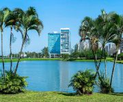
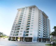
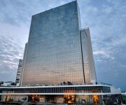
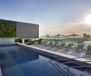
If you need a place to sleep, we compiled a list of available hotels close to the map centre further down the page.
Depending on your travel schedule, you might want to pay a visit to some of the following locations: Nova Iguacu, Rio de Janeiro, Sao Goncalo, Marica and Paraiba do Sul. To further explore this place, just scroll down and browse the available info.
Local weather forecast
Todays Local Weather Conditions & Forecast: 30°C / 86 °F
| Morning Temperature | 21°C / 70 °F |
| Evening Temperature | 26°C / 80 °F |
| Night Temperature | 23°C / 73 °F |
| Chance of rainfall | 0% |
| Air Humidity | 55% |
| Air Pressure | 1017 hPa |
| Wind Speed | Light breeze with 5 km/h (3 mph) from North |
| Cloud Conditions | Few clouds, covering 15% of sky |
| General Conditions | Light rain |
Friday, 26th of April 2024
28°C (82 °F)
22°C (72 °F)
Broken clouds, gentle breeze.
Saturday, 27th of April 2024
33°C (91 °F)
25°C (78 °F)
Sky is clear, light breeze, clear sky.
Sunday, 28th of April 2024
36°C (96 °F)
27°C (81 °F)
Few clouds, light breeze.
Hotels and Places to Stay
Grand Mercure Rio de Janeiro Riocentro
Venit Mio Hotel
Midas Rio Convention Suites
Courtyard Rio de Janeiro Barra da Tijuca
Venit Barra Hotel
Novotel Rio de Janeiro Parque Olimpico
Hilton Barra Rio de Janeiro
Residence Inn Rio de Janeiro Barra da Tijuca
Quality Rio de Janeiro - Barra da Tijuca
Hotel Harmonya
Videos from this area
These are videos related to the place based on their proximity to this place.
SERRA DO VULCÃO O LÍMITE É O CÉU ....
Venha conhecer as melhores trilhas ecolôgicas de Nova Iguaçu, Parque Municipal de Nova Iguaçu, Serra do Vulcão, Céu Aberto, Serra do Tíngua e Jajeruba. Fazemos também Vôos de Parapente...
CDIG!
Meus amigos e eu no 30º ACAMPAMENTO do CLUBE realizado em Xerem... foi o meu 1º de muitos que virão junto a eles...
Marco Antonio cantando Sangrando de Gonzaguinha
"O Melhor da MPB" - Show apresentado pelo cantor Marco Antonio no dia 15 dezembro, na Escola de Música Si-Bemol, que levou o público presente ao delírio, acompanhando-o desde a primeira...
MC Cacau DJ Leandro Karvalho Quero seu Amor
Nós fãs da verdadeira Musica Popular Brasileira divulagamos tudo que é popular e tem boa qualidade .O Wagner Montes do programa Balanço Geral junto com a TV Record abriu um espaço muito...
Videos provided by Youtube are under the copyright of their owners.
Attractions and noteworthy things
Distances are based on the centre of the city/town and sightseeing location. This list contains brief abstracts about monuments, holiday activities, national parcs, museums, organisations and more from the area as well as interesting facts about the region itself. Where available, you'll find the corresponding homepage. Otherwise the related wikipedia article.
Big Brother Brasil
Big Brother Brasil (BBB) is a Brazilian version of the Big Brother reality television show based on the Dutch television series of the same name that was originally created in 1997 by John de Mol.
Bento Ribeiro
Bento Ribeiro is a middle-class neighborhood in the Brazilian city of Rio de Janeiro. Located in Rio's North Zone, it is a suburban area in the vicinity of Marechal Hermes and Oswaldo Cruz. Bento Ribeiro owes its name to Bento Manuel Ribeiro Carneiro Monteiro, mayor of Rio de Janeiro between 1910 and 1914. It is the birthplace of the professional football player Ronaldo and the place where the famous television host [Xuxa Xuxa] lived in her childhood.
Estádio Moça Bonita
The Estádio Proletário Guilherme da Silveira Filho, but usually known as Estádio Moça Bonita is a football stadium inaugurated in 1947 in Bangu neighborhood, Rio de Janeiro, state of Rio de Janeiro, with a maximum capacity of 9,564 people. Estádio Moça Bonita is owned by Bangu Atlético Clube. It hosts the games of Bangu Atlético Clube and Clube Atlético Castelo Branco. The stadium is named after Guilherme da Silveira Filho, who was Bangu's president during the stadium construction.
Bangu (neighborhood)
Bangu is a neighborhood of Rio de Janeiro, RJ. It is a lower-middle-class neighborhood. It is located in the western area of the city being one of the most populated districts, with 244,518 inhabitants (according to the Brazilian Institute of Geography and Statistics - IBGE - Demographic Census 2000) [1 1] distributed in an area of 4570.69 ha. Located in the geographic center of the city, the neighborhood is close to Campo Grande, Senador Camará, Vila Aliança, Padre Miguel and Realengo.
Marechal Hermes
Marechal Hermes is a suburb of Rio de Janeiro, Brazil. It is a working class suburb situated in the North region of Rio surrounded by Bento Ribeiro, Campo dos Afonsos, Deodoro and Guadalupe. It takes its name from an ex-president of Brazil: Marechal Hermes Rodrigues da Fonseca, being marshal the highest possible Army rank in Brazil. Marechal, as it is known locally, gained from being a "planned" suburb. It contains wide avenues, a cinema, theatre, large hospital and a big church.
Realengo
Realengo is a neighborhood in northern Rio de Janeiro. The lower and middle-class neighborhood is between the Mendanha and Pedra Branca mountains. It is located between the mountains of Pedra Branca (White Rock) and Mendanha in the northern of the called West Zone (Zona Oeste) of the city, owned and names the XXXIII Administrative Region which encompasses the entire east around the neighborhood.
Padre Miguel
The neighborhood of Padre Miguel is situated in the western region of the city of Rio de Janeiro, is of midle class, and borders the neighborhoods of Bangu (west) and Realengo (east). The Mocidade Independente de Padre Miguel and Unidos de Padre Miguel schools of samba are located in Padre Miguel. On the weekend, another attraction is the Ponto Chic, bohemian stronghold of the neighborhood. Simonsen College and Castelo Branco University, two private colleges, are found in the West Zone.
Vila Vintém
Vila Vintém is an urban low income living community located between the neighborhoods of Realengo and Padre Miguel, in the west zone of the city of Rio de Janeiro. Situated on the borders of the railroad, it shelters the headquarters of Mocidade Independente de Padre Miguel and also Unidos de Padre Miguel, as well as a lot of their components. Its principal road is called Rua Belisário de Souza, that goes from the ensemble of IAPI, in Padre Miguel, until Realengo.
Museu Aeroespacial
Museu Aeroespacial is a national aviation museum located 25 km west of Rio de Janeiro, Brazil.
Cidade de Deus (Rio de Janeiro)
The neighbourhood of Cidade de Deus (City of God) is part of the borough of Jacarepaguá, in the Western Zone of the city of Rio de Janeiro, Brazil. It is also known as CDD among their inhabitants. The neighbourhood was founded in 1960, planned and executed by the government of Guanabara State as part of the policy to systematically remove favelas from the center of Rio de Janeiro and settling their inhabitants in the suburbs. It is used as backdrop in the 2002 film City of God.
Deodoro Arena
Deodoro Arena is a description of an indoor arena that is currently under construction in Deodoro, Rio de Janeiro, Brazil. The venue will host the fencing events for the 2016 Summer Olympics, and the wheelchair fencing events for the 2016 Summer Paralympics. Construction started in 2009 and be completed in 2011. The arena is expected to cost about $41 million.
National Equestrian Center
National Equestrian Center is a description of an equestrian arena in Rio de Janeiro, Brazil. The venue will host the equestrian events for the 2016 Summer Olympics, and the equestrian events for the 2016 Summer Paralympics.
Deodoro (Rio de Janeiro)
Deodoro is a neighbourhood of the Western Zone of Rio de Janeiro.
Olympic BMX Center
The Olympic BMX Center is a bicycle motocross venue that will be constructed in Rio de Janeiro, Brazil. This venue will be part of the cycling events for the 2016 Summer Olympics.
Olympic Mountain Bike Park
The Olympic Mountain Bike Park is a cycling venue to be constructed in Rio de Janeiro, Brazil. It will host the mountain biking cross-country cycling events for the 2016 Summer Olympics.
Rio de Janeiro school shooting
On the morning of April 7, 2011, 12 children aged between 12 and 14 were killed and 12 others seriously wounded after an armed man entered Tasso da Silveira Municipal School (Escola Municipal Tasso da Silveira), an elementary school in Realengo on the western fringe of Rio de Janeiro, Brazil. It is the first time an incident of this kind — a non-gang school shooting with a sizable number of casualties — has been reported in the country.
Curicica
Curicica is a neighborhood of Rio de Janeiro, Brazil.
Jardim Sulacap
Jardim Sulacap is a neighborhood of Rio de Janeiro, Brazil.
Magalhães Bastos
Magalhães Bastos is a neighborhood of Rio de Janeiro, Brazil.
Pechincha (Rio de Janeiro)
Pechincha is a neighborhood of Rio de Janeiro, Brazil.
Praça Seca
Praça Seca is a neighborhood of Rio de Janeiro, Brazil.
Tanque (Rio de Janeiro)
Tanque is a neighborhood of Rio de Janeiro, Brazil.
Taquara (Rio de Janeiro)
Taquara is a neighborhood of Rio de Janeiro, Brazil.
Vila Valqueire
Vila Valqueire is a neighborhood in Rio de Janeiro, Brazil.
Vila Militar (Rio de Janeiro)
Vila Militar is a neighborhood of Rio de Janeiro, Brazil.


