Safety Score: 3,5 of 5.0 based on data from 9 authorites. Meaning please reconsider your need to travel to Bosnia and Herzegovina.
Travel warnings are updated daily. Source: Travel Warning Bosnia and Herzegovina. Last Update: 2024-04-25 08:17:04
Discover Kulovci
Kulovci in Republika Srpska is a place in Bosnia and Herzegovina about 55 mi (or 89 km) east of Sarajevo, the country's capital city.
Current time in Kulovci is now 01:50 PM (Thursday). The local timezone is named Europe / Sarajevo with an UTC offset of 2 hours. We know of 9 airports near Kulovci, of which 3 are larger airports. The closest is airport we know is Ponikve Airport in Serbia in a distance of 15 mi (or 24 km). The closest airport in Bosnia and Herzegovina is Tuzla International Airport in a distance of 47 mi (or 24 km), South-East. Besides the airports, there are other travel options available (check left side).
There are several Unesco world heritage sites nearby. The closest heritage site in Bosnia and Herzegovina is Mehmed Paša Sokolović Bridge in Višegrad in a distance of 18 mi (or 29 km), South-West. If you need a hotel, we compiled a list of available hotels close to the map centre further down the page.
While being here, you might want to pay a visit to some of the following locations: Bajina Basta, Srebrenica, Ljubovija, Bratunac and Visegrad. To further explore this place, just scroll down and browse the available info.
Local weather forecast
Todays Local Weather Conditions & Forecast: 10°C / 50 °F
| Morning Temperature | 7°C / 45 °F |
| Evening Temperature | 10°C / 50 °F |
| Night Temperature | 5°C / 40 °F |
| Chance of rainfall | 0% |
| Air Humidity | 74% |
| Air Pressure | 1009 hPa |
| Wind Speed | Light breeze with 4 km/h (3 mph) from South |
| Cloud Conditions | Overcast clouds, covering 100% of sky |
| General Conditions | Light rain |
Friday, 26th of April 2024
18°C (64 °F)
9°C (47 °F)
Light rain, light breeze, clear sky.
Saturday, 27th of April 2024
21°C (69 °F)
11°C (52 °F)
Few clouds, light breeze.
Sunday, 28th of April 2024
22°C (72 °F)
13°C (56 °F)
Sky is clear, light breeze, clear sky.
Hotels and Places to Stay
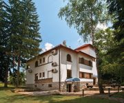
Vila Drina
Videos from this area
These are videos related to the place based on their proximity to this place.
Dino, Jan, Sile, Borko skokovi sa mosta Bajina Basta
Drinska Regata, exzibizioni skokovi sa mosta koji granici Srbiju i Bosnu (skakali sa Bosanske strane :) ). Dino Bajric, Sarajevo, salto unazad, Jan Voncina, Adrenalin k.o., uzvratni pruzeni...
ZABRANJENO PUSENJE-MF2012.-Bos-ili-Hadzija
ZABRANJENO PUSENJE ne MOST FESTU 2012. u Bajinoj Basti u okviru programa Drinske regate.
МОСТ ФЕСТ 2012 : Београдски Синдикат - За све моје људе
Наступ Београдског Синдиката на МОСТ ФЕСТ-у 2012 у оквиру манифестације Дринска регата у Бајиној Башти.
Jernej Klinar, Ales Karnicnik, Marjan Milanovic
Drinska Regata, exzibizioni skokovi sa mosta koji granici Srbiju i Bosnu (skakali sa Bosanske strane :) ). Jernej klinar provlak, Adrenalin k.o. Ales Karnicnik dva salta sa brenijem, Adrenalin...
Zlatibor 2009 Part 4
Sirogojno ethnic village, Manastir Raca, Hidro elektrana Bajina Basta, Perucac, Mitrovac, Potpecka pecina, Zlakusa.
Tara Mountain Part 7: Perućac Lake
Mountain Tara is one of the most beautiful mountains in Serbia. I've spent a week there and visited a lot of fantastic places: river Drina, lakes, monasteries, waterfalls, canyons, viewpoints,...
Videos provided by Youtube are under the copyright of their owners.
Attractions and noteworthy things
Distances are based on the centre of the city/town and sightseeing location. This list contains brief abstracts about monuments, holiday activities, national parcs, museums, organisations and more from the area as well as interesting facts about the region itself. Where available, you'll find the corresponding homepage. Otherwise the related wikipedia article.
Gladovići (Srebrenica)
Gladovići is a village in the municipality of Srebrenica, Bosnia and Herzegovina.
Miholjevine
Miholjevine is a village in the municipality of Srebrenica, Bosnia and Herzegovina.
Pale (Srebrenica)
Pale is a village in the municipality of Srebrenica, Bosnia and Herzegovina.
Postolje
Postolje is a village in the municipality of Srebrenica, Bosnia and Herzegovina.
Radovčići (Srebrenica)
Radovčići is a village in the municipality of Srebrenica, Bosnia and Herzegovina.
Tokoljak
Tokoljak is a village in the municipality of Srebrenica, Bosnia and Herzegovina.
Sulice (Srebrenica)
Sulice (Srebrenica) is a village in the municipality of Srebrenica, Bosnia and Herzegovina.
Toplica (Srebrenica)
Toplica is a village in the municipality of Srebrenica, Bosnia and Herzegovina.


