Delve into Kobble
The district Kobble of in Queensland is a subburb in Australia about 596 mi north of Canberra, the country's capital town.
If you need a hotel, we compiled a list of available hotels close to the map centre further down the page.
While being here, you might want to pay a visit to some of the following locations: Brisbane, Sunshine Coast, Carrolls Creek, and . To further explore this place, just scroll down and browse the available info.
Local weather forecast
Todays Local Weather Conditions & Forecast: 25°C / 78 °F
| Morning Temperature | 18°C / 65 °F |
| Evening Temperature | 22°C / 71 °F |
| Night Temperature | 18°C / 64 °F |
| Chance of rainfall | 1% |
| Air Humidity | 63% |
| Air Pressure | 1018 hPa |
| Wind Speed | Light breeze with 3 km/h (2 mph) from West |
| Cloud Conditions | Overcast clouds, covering 100% of sky |
| General Conditions | Light rain |
Friday, 19th of April 2024
29°C (83 °F)
17°C (63 °F)
Light rain, gentle breeze, clear sky.
Saturday, 20th of April 2024
21°C (69 °F)
17°C (63 °F)
Moderate rain, gentle breeze, overcast clouds.
Sunday, 21st of April 2024
18°C (65 °F)
19°C (65 °F)
Heavy intensity rain, moderate breeze, overcast clouds.
Hotels and Places to Stay
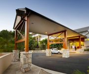
Mercure Clear Mountain Lodge
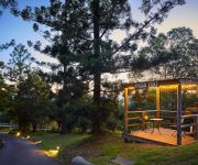
Dayboro Cottages & Llama Walks
Videos from this area
These are videos related to the place based on their proximity to this place.
Prime Foodservice Meats - A Visit to Samford Valley
Prime Foodservice Meats knows quality and buys quality brands that offer a consistent and good eating product for consumers.
24 Vera Court - Samford (4520) Queensland by Michelle Franci...
Property Video shoot of 24 Vera Court - Samford (4520) Queensland by PlatinumHD http://www.platinumhd.tv for.
Paintball at Skirmish Samford
On the 29th of June, a group of friends and I went to Skirmish Samford for a day of bushball. Filmed with the Gopro Hero 3 black edition and Hero 3+ Black edition.
Casual Paintball Club Day at Samford
This is my first in my series of paintball videos. This is just a taste of the upcoming helmet POV clips I'll be making. Subscribe to follow my progress.
SAMFORD BOWLS CLUB
The Samford Bowls Club officially opened its redeveloped centre on Sunday 19th October. The works included a new surface and shade covers. We asked members and other bowlers what they ...
32 Seraya Court, Samford
"Bigger than Average" 6.4 Private Acres of Native trees and Horse paddocks. 5 year old lowset home with over 500 sq.metres under roof. Huge open plan kitchen, dining and living space with...
5 Cedardell Court - Yugar (4520) Queensland by Brett Crompton
Property Video shoot of 5 Cedardell Court - Yugar (4520) Queensland by PlatinumHD http://www.platinumhd.tv for.
54 Coronata Crescent Narangba Your next family home? RE/MAX Platinum Leanne Kroes
You will LOVE, LOVE, LOVE this home at 54 Coronata Crescent, Narangba ! Call Leanne Kroes on 0407 96 77 96 NOW. Light the Barbie, open a bottle of wine and sit back and relax with family &...
68 Ridge View Drive Narangba 4504 QLD by Trent Regan
Property Video shoot of 68 Ridge View Drive Narangba 4504 QLD by PlatinumHD http://www.platinumhd.tv for Narangba Valley Real Estate.
Videos provided by Youtube are under the copyright of their owners.
Attractions and noteworthy things
Distances are based on the centre of the city/town and sightseeing location. This list contains brief abstracts about monuments, holiday activities, national parcs, museums, organisations and more from the area as well as interesting facts about the region itself. Where available, you'll find the corresponding homepage. Otherwise the related wikipedia article.
D'Aguilar National Park
D'Aguilar is a national park in Queensland, Australia, 31 km northwest of Brisbane. The southern part of the park was formerly known as Brisbane Forest Park, while the northern part of the park is at Mount Mee. The park contains expanses of eucalypt woodland, sheltered pockets of subtropical rainforest, remote gorges and spectacular views to Moreton Bay and the Glass House Mountains. The popular Walkabout Creek Visitor Centre is located at the edge of the park.
Division of Dickson
The Division of Dickson is an Australian Electoral Division in Queensland, Australia. The division was formed in 1992 and is named after Sir James Dickson, a leading advocate in Australian Federation, Premier of Queensland and Minister for Defence in first Australian Ministry. It is located in the outer north-western suburbs of Brisbane, including Albany Creek, Kallangur and Strathpine. The 2006 redistribution added the Shire of Esk to and removed part of Kallangur from the district.
Narangba railway station
Narangba is a railway station on the Caboolture Line of Brisbane, Australia. It is part of the QR Citytrain network. It is located in Zone 7 of the TransLink integrated public transport system.
Mount Pleasant (Queensland)
Mount Pleasant, is a mountain which is a part of the D'Aguilar Range. Other mountains in the D'Aguilar Range include Mount Nebo, Mount Glorious and Mount Mee.
Mount Glorious
Mount Glorious in Queensland is a mountain which is part of the D'Aguilar Range and is a suburb in Moreton Bay Region roughly 30 km north west of Brisbane. Five blocks on the mountain were made available early in the 20th century, with the first block being bought by James O'Hara in 1903. The forest that surrounds the mountain village is part of Brisbane Forest Park and the D'Aguilar National Park. Other mountains in the D'Aguilar Range include Mount Nebo, Mount Pleasant and Mount Mee.
Warner, Queensland
Warner is a suburb north of Brisbane, Queensland, Australia. Its local government area is the Moreton Bay Region 22 kilometres north of the Brisbane central business district. Warner is situated east of Lake Samsonvale and west of the urban localities of Strathpine, Brendale, Bray Park and Lawnton.
Eatons Hill, Queensland
Eatons Hill is a suburb located approximately 20 kilometres north-west of Brisbane, Australia. It is located in Moreton Bay Region. Its postcode is 4037. Eatons Hill generally consists of low-density residential housing with acreage properties in the western portions. Most of the suburb has been developed since the 1980s. New subdivisions are still being built.
Dayboro, Queensland
Dayboro is a town in the Moreton Bay Region, approximately 46 km north-northwest of Brisbane, the state capital of Queensland, Australia. To the north of Dayboro lies the D'Aguilar Range and the mountain township of Mount Mee. Other nearby towns include Petrie and Samford. The land surrounding the town supports avocado and pineapple plantations, as well as dairy cattle.
Samford, Queensland
Samford is a valley community located in South East Queensland, Australia. It is roughly 21 km north west of Brisbane. The hilly area was first settled in the mid-1850s. The community is well catered for, with sporting facilities, parks and museums.
North Pine Dam
North Pine Dam is built across the North Pine River, north-west of Brisbane, within Moreton Bay in Queensland, Australia. The damming of North Pine River created an artificial lake called Lake Samsonvale to secure a supply of drinking water for the Moreton Bay region and Brisbane's northern suburbs.
Narangba Valley State High School
Narangba Valley State High School (NVSHS) is a co-educational, state secondary school in Narangba, Queensland. It is one of the newest schools in the state, having only been established in 2000.
Bray Park, Queensland
Bray Park is a suburb north of Brisbane, Queensland, Australia. Its Local Government Area is the Moreton Bay Regional Council. Bray Park is located north of Brisbane. It is named after John Bray, a former Shire councillor. Bray Park is bounded by Four Mile Creek in the south, the Caboolture railway line in the east, Francis Road in the north, and Old North Road in the west. Bray Park is on the Caboolture line of the Citytrain network; see Bray Park railway station, Brisbane.
Genesis Christian College
Genesis Christian College is an independent school (P–12) located at Bray Park, Brisbane, Australia. The college was established in 1991 by members of the Reformed Church. It is presently affiliated to the Bray Park Community Church.
Lakeside International Raceway
Lakeside Park, formerly known as Lakeside International Raceway is a motor racing circuit located at Pine Rivers 30 km north of Brisbane and lies adjacent to Lake Kurwongbah. The circuit is known as the spiritual home of Queensland motorsport was built by volunteers and borrowed machinery in the 1960s. The 2.41 km circuit opened in 1961 and was closed in mid 2001. The circuit reopened on 5 April 2008, with a race meeting held the following day.
Moreton Bay Region
The Moreton Bay Region is a local government area in South East Queensland, Australia, immediately to the north of Brisbane, the state capital. Established in 2008, it replaced three established local government areas, the City of Redcliffe and the Shires of Pine Rivers and Caboolture.
Narangba, Queensland
Narangba is a suburb north of Brisbane, Queensland, Australia. It is located in the Moreton Bay Region. This suburb has rural origins, but is being redeveloped as a residential suburb on the outskirts of the greater Brisbane metropolitan area.
Lake Kurwongbah
Lake Kurwongbah is a potable water supply for urban areas in Moreton Bay in Queensland, Australia. Its catchment adjoins the localities of Petrie, Kallangur and Dakabin. To the east of the lake is the Lakeside Park motor racing circuit. The lake was created in 1958 after the construction of Sideling Creek Dam wall just to the north of Dayboro Road. The lake is just 2 km east of North Pine Dam and 4 km northwest of Petrie. The primary inflow is Sideling Creek, a tributary of the North Pine River.
Cashmere, Queensland
Cashmere is an outer suburb on the north-western outskirts of Brisbane, Queensland, Australia. Its Local Government Area is the Moreton Bay Region. The origin of the suburb name is from an early property owner by the name of James Cash. Cashmere is located near the foothills of the D'Aguilar Range surrounded by dense forest. Cashmere is bounded to the north by Lake Samsonvale and is located west of Warner.
Closeburn, Queensland
Closeburn is part of the wider Samford valley located in South East Queensland, Australia. It is roughly 28 km north west of Brisbane. It is located in the Moreton Bay Region local government area. Closeburn is a blend of acreage properties and small farms. Access to Closeburn from Brisbane is along Samford Road and Mount Samson Road.
King Scrub, Queensland
King Scrub is a farming district located on the northern outskirts of Dayboro in Queensland, Australia. Its municipality is the Moreton Bay Region.
Armstrong Creek, Queensland
Armstrong Creek is a locality within the Moreton Bay Region of Queensland, Australia.
England Creek, Queensland
England Creek is a suburb of Somerset Region, Australia. England Creek was previously part of Brisbane City Council until council reforms occurred. It is now part of Somerset Region and lies a short distance south-east of Lake Wivenhoe.
Kobble Creek, Queensland
Kobble Creek is a locality within the Moreton Bay Region of Queensland, Australia. Kobble Creek, the locality, is situated along Mount Samson Road to the south of Dayboro, approximately 45 km NW of Brisbane central business district. The locality is named after the creek with that forms part of the catchment area of Lake Samsonvale, one of the three main water-suppliers to the metropolitan region.
Samsonvale, Queensland
Samsonvale is a locality within the Moreton Bay Region of Queensland, Australia. The district is dominated by Lake Samsonvale, the waters of North Pine Dam, one of the three main water-suppliers to the metropolitan region. Samsonvale sits below the highest peak in the area, Mount Samson.
Clear Mountain, Queensland
Clear Mountain is a suburb of Moreton Bay, Queensland, Australia in the Moreton Bay Region.


