Discover Sans Souci
The district Sans Souci of in New South Wales is a district in Australia about 145 mi north-east of Canberra, the country's capital city.
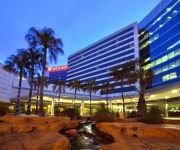
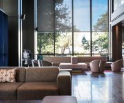
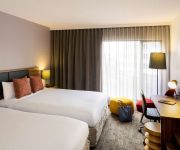
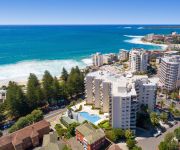
Looking for a place to stay? we compiled a list of available hotels close to the map centre further down the page.
When in this area, you might want to pay a visit to some of the following locations: Parramatta, Katoomba, Canberra, and . To further explore this place, just scroll down and browse the available info.
Local weather forecast
Todays Local Weather Conditions & Forecast: 20°C / 68 °F
| Morning Temperature | 17°C / 62 °F |
| Evening Temperature | 20°C / 67 °F |
| Night Temperature | 19°C / 66 °F |
| Chance of rainfall | 0% |
| Air Humidity | 66% |
| Air Pressure | 1024 hPa |
| Wind Speed | Gentle Breeze with 7 km/h (4 mph) from North-West |
| Cloud Conditions | Broken clouds, covering 50% of sky |
| General Conditions | Scattered clouds |
Wednesday, 17th of April 2024
20°C (67 °F)
17°C (62 °F)
Light rain, gentle breeze, overcast clouds.
Thursday, 18th of April 2024
20°C (68 °F)
17°C (63 °F)
Light rain, moderate breeze, clear sky.
Friday, 19th of April 2024
17°C (63 °F)
17°C (62 °F)
Light rain, fresh breeze, few clouds.
Hotels and Places to Stay
Stamford Plaza Sydney Airport
Pullman Sydney Airport
Quest Mascot
Novotel Sydney Brighton Beach
Adina Sydney Airport
Mercure Sydney International Airport
QUEST CRONULLA BEACH SERVICED APTS
EVENTHOUSE CRONULLA
Holiday Inn SYDNEY AIRPORT
Sutherland Motel
Videos from this area
These are videos related to the place based on their proximity to this place.
SOLD 14 Beach Street Blakehurst
Welcome to 14 Beach Street Blakehurst, a magnificent home with an awesome waterfront lifestyle to boot. Over 1200sqm of rare level waterfront land on the beautiful shores of Kogarah Bay. There...
Dz Husky | Exposed V2
Hey guys, can we get this guy he has Ddosed me twice alredy Please like, Comment and subscribe for more gameplay also suggest games! ~~~~~~~Further Links~~~~~~ fkEden- ...
Sydney City Motorcycles introduces the FOX 2011 Proframe Roost Deflector
A glimpse of the FOX 2011 FOX 2011 Proframe Roost Deflector.
Sydney City Motorcycles ~ Fox Protection
Sydney City Motorcycles ~ FOX 2011 MX Gloves Kogarah Store 46-48 Princes Highway Kogarah, NSW 2217 Ph: (02) 9587 3000 Fax (02) 9587 3999 Our Location:: ...
Sydney City Motorcycles ~ FOX 2011 MX Helmets
Sydney City Motorcycles. Presents the FOX 2011 MX Helmets Available OnLine:: http://shop.sydneycitymotorcycles.com.au.
Sydney City Motorcycles introduces the FOX 2011 range
A glimps of the FOX 2011 clothing range featuring their stars!!
Learning to Scuba Dive with Abyss Scuba Diving
See how Morgan from Travel Bug learns to Scuba Dive with Abyss Scuba Diving and how this opens up a whole new world for him. http://www.abyss.com.au/scuba/pc/Learn-To-Dive-c91.htm.
Sydney Document Shredding Service
Established 1990, Sydney Document Shredding Service is Sydney's leading Secure Document Shredding Company. Based at Kogarah, in Sydney's southern suburbs we offer a multitude of shredding.
Wedding Highlight :D
2014.3.22 Laurel & Hannix's Wedding at 3pm, Carlton Methodist Church, NSW, Australia Filmed and Edited by Weidong Enjoy! :DDD 我们婚礼的精华篇,2014年3月22日下午3点于悉尼卫理...
kalee projectors
A short promotion for the English Gaumont Kalee 35mm cinema projectors. The picture is unsteady as the film is warped and shrunk. The projectors show a steady picture PS After enhancement by...
Videos provided by Youtube are under the copyright of their owners.
Attractions and noteworthy things
Distances are based on the centre of the city/town and sightseeing location. This list contains brief abstracts about monuments, holiday activities, national parcs, museums, organisations and more from the area as well as interesting facts about the region itself. Where available, you'll find the corresponding homepage. Otherwise the related wikipedia article.
Dolls Point, New South Wales
Dolls Point is a small suburb in southern Sydney, in the state of New South Wales, Australia. Dolls Point is located 17 km south of the Sydney central business district and is part of the St George area. Dolls Point is in the local government area of the City of Rockdale. Dolls Point takes its name from the geographical formation on Botany Bay. Cook Park runs along the eastern border and the beach stretches from Dolls Point to Sandringham Bay.
Kogarah, New South Wales
Kogarah is a suburb of southern Sydney, in the state of New South Wales, Australia. Kogarah is located 14 kilometres south of the Sydney central business district and is considered to be the centre of the St George area. Kogarah is the administrative centre for the local government area of the Municipality of Kogarah, although a small part of the suburb is located in the City of Rockdale.
Municipality of Kogarah
The City of Kogarah is a local government area in the St George region of southern Sydney, in the state of New South Wales, Australia. The centre of the city is located 14 kilometres south–south–west of the Sydney central business district and west of Botany Bay. The Municipality of Kogarah was established on 22 December 1885 and in 2008 Kogarah became the first local government area in New South Wales to become a city by popular vote.
Allawah, New South Wales
Allawah is a suburb in southern Sydney, in the state of New South Wales, Australia. Allawah is located 16 kilometres south of the Sydney central business district and is part of the St George area. Allawah lies mostly in the local government area of the Municipality of Kogarah and partly in the City of Rockdale. The postcode is 2218, which is shared by the neighbouring suburb of Carlton.
Sans Souci, New South Wales
Sans Souci is a southern Sydney suburb in the state of New South Wales, Australia. Sans Souci is 17 kilometres south of the Sydney central business district and lies across the local government areas of the City of Rockdale and the Municipality of Kogarah. It is part of the St George area. Sans Souci sits on the western shore of Botany Bay. Lady Robinsons Beach and Cook Park run along the eastern border. Kogarah Bay runs along the western border.
Carlton railway station, Sydney
Carlton railway station is located on the CityRail Illawarra line in the southern Sydney suburb of Carlton. The station opened in 1887. It is the closest station to WIN Jubilee Stadium, the northern home ground of the St George Illawarra Dragons, and has signage advertising this fact.
Kogarah railway station
Kogarah railway station is located on the CityRail Illawarra line. It serves the southern Sydney suburb of Kogarah, a residential and commercial area including the head-office complex of the St George Bank and the administrative centre for the local government area of the Municipality of Kogarah. The station concourse links directly to a small shopping mall called Kogarah Town Centre, which has been built directly over the railway platforms and beside them on Railway Parade.
Sandringham, New South Wales
Sandringham is a suburb in southern Sydney, in the state of New South Wales, Australia. Sandringham is located 18 kilometres south of the Sydney central business district and is part of the St George area. Sandringham is in the local government area of the City of Rockdale. Sandringham is a quiet residential suburb on the western shore of Botany Bay, at the mouth of the Georges River.
Ramsgate, New South Wales
Ramsgate is a suburb in southern Sydney, in the state of New South Wales, Australia 16 km south of the Sydney central business district. It is part of the St George area. Ramsgate is in the local government area of the City of Rockdale. Ramsgate Beach is a separate suburb, to the east. Ramsgate is surrounded by the suburbs of Ramsgate Beach, Monterey, Kogarah, Beverley Park and Sans Souci.
Monterey, New South Wales
Monterey is a suburb in southern Sydney, in the state of New South Wales, Australia 15 km south of the Sydney central business district and is part of the St George area. Monterey is in the local government area of the City of Rockdale. Monterey sits on the western shores of Botany Bay. Lady Robinsons Beach and Cook Park run along the eastern border. Scarborough Park, which features a pond, runs along the western border.
Kogarah Bay, New South Wales
Kogarah Bay is a suburb in southern Sydney, in the state of New South Wales, Australia 16 kilometres south of the Sydney central business district. It is part of the St George area. Kogarah Bay is in the local government area of the Municipality of Kogarah. Kogarah Bay takes its name from the small bay on the northern shore of the Georges River. The suburb is surrounded by the suburbs of Carss Park, Blakehurst, Carlton, Beverley Park and Sans Souci.
Beverley Park, New South Wales
Beverley Park is a suburb in southern Sydney, in the state of New South Wales, Australia. Beverley Park is located 15 kilometres south of the Sydney central business district, in the Municipality of Kogarah and is part of the St George area. Beverley Park is surrounded by the suburbs Kogarah Bay, Carlton, Beverley Park, Ramsgate and Sans Souci. It is a predominantly residential area around a large recreational area, Beverley Park Golf Course.
Carlton, New South Wales
Carlton is a suburb in southern Sydney, in the state of New South Wales, Australia. Carlton is located 15 kilometres south of the Sydney central business district and is part of the St George area. Carlton lies across the boundary of two local government areas, the Municipality of Kogarah and the City of Rockdale.
Blakehurst, New South Wales
Blakehurst is a suburb in southern Sydney, in the state of New South Wales, Australia 18 kilometres south of the Sydney central business district, in the local government area of the Municipality of Kogarah. It is part of the St George area. Blakehurst is connected to Sylvania, in the Sutherland Shire, to the south, by Tom Uglys Bridge over the Georges River. Tom Uglys Point is the southernmost part. The eastern border runs along Kogarah Bay and the western border runs along Kyle Bay.
Carss Park, New South Wales
Carss Park is a suburb in southern Sydney, in the state of New South Wales, Australia 17 kilometres south of the Sydney central business district in the local government area of the Municipality of Kogarah. Carss Park is part of the St George area.
Jubilee Oval
Jubilee Oval, also known as Kogarah Oval, is a multipurpose stadium in Carlton, New South Wales, Australia. The stadium is primarily used for rugby league and is the home of National Rugby League (NRL) team St. George Illawarra Dragons. The oval has also hosted soccer matches, including hosting Sydney Olympic FC during the 2003–04 National Soccer League (NSL) season.
Ramsgate Beach, New South Wales
Ramsgate Beach is a suburb in southern Sydney, in the state of New South Wales, Australia. Ramsgate Beach is located 16 kilometres south of the Sydney central business district, in the City of Rockdale and is part of the St George area. The postcode is 2217. Ramsgate is a separate suburb, to the west. Ramsgate Beach is surrounded by the suburbs of Monterey, Ramsgate and Sans Souci. Lady Robinson Beach and Cook Park run along the eastern border of Ramsgate Beach, on Botany Bay.
St George Hospital (Sydney)
The St George Hospital and Community Health Service is a tertiary referral hospital located in Kogarah, a southern suburb of Sydney, NSW, Australia. It is part of the South East Sydney Local Health Network and is an accredited principal teaching Hospital of the University of New South Wales.
St George Christian School
St George Christian School is an independent, co-educational, day school, located in Hurstville and Sans Souci, both suburbs of southern Sydney, in the St George area of New South Wales, Australia. Established in 1981, the school has a non-selective enrolment policy, and currently caters for approximately 800 students from Kindergarten to Year Twelve. Students come to St George Christian School mainly from the southern Sydney region.
Tom Uglys Bridge
Tom Uglys Bridge is one of three major road crossings of the Georges River in southern Sydney, New South Wales, Australia. It consists of two separate bridges that carry the Princes Highway, linking the St George area at Blakehurst to the Sutherland Shire at Sylvania.
Kogarah High School
Kogarah High School is a comprehensive co-educational school located in Kogarah NSW
Lady Robinsons Beach
Lady Robinsons Beach is the stretch of beach between the mouth of the Cooks River and the mouth of Georges River on the western shore of Botany Bay. Originally the beach was known as Seven Mile Beach. The beach was renamed after the wife of the then Governor, Sir Hercules Robinson. Isolated settlements separated from the beach by sand dunes were also given the name of Lady Robinson's Beach as their postal address.
Blakehurst High School
Blakehurst High School is a public, co-educational, specialist Languages high school for years 7-12 located in Blakehurst, Sydney, New South Wales, Australia. The school has around 1130 students, 75 teaching staff and 12 administrative staff. 40% of students are from an Anglo Celtic background and 60% of students identify as having a non-English speaking background (NESB), many of whom were born in Australia.
James Cook Boys Technology High School
James Cook Boys' Technology High School is a boys' school situated on Princes Highway in Kogarah, Australia.
Bicentennial Park South
Bicentennial Park South is a football (soccer) stadium in Rockdale, a suburb of Sydney in New South Wales, Australia. Redevelopment of the venue started in October 2008, and finished in September 2009 to become the new home of New South Wales Premier League team, the Rockdale City Suns.


