Discover Bay View
The district Bay View of in New South Wales with it's 3,093 citizens Bay View is a district in Australia about 167 mi north-east of Canberra, the country's capital city.
Looking for a place to stay? we compiled a list of available hotels close to the map centre further down the page.
When in this area, you might want to pay a visit to some of the following locations: Sydney, Parramatta, Katoomba, Canberra and . To further explore this place, just scroll down and browse the available info.
Local weather forecast
Todays Local Weather Conditions & Forecast: 21°C / 70 °F
| Morning Temperature | 16°C / 61 °F |
| Evening Temperature | 20°C / 67 °F |
| Night Temperature | 18°C / 64 °F |
| Chance of rainfall | 0% |
| Air Humidity | 65% |
| Air Pressure | 1024 hPa |
| Wind Speed | Gentle Breeze with 7 km/h (4 mph) from North-West |
| Cloud Conditions | Broken clouds, covering 57% of sky |
| General Conditions | Broken clouds |
Wednesday, 17th of April 2024
20°C (68 °F)
17°C (62 °F)
Moderate rain, light breeze, overcast clouds.
Thursday, 18th of April 2024
20°C (68 °F)
16°C (61 °F)
Light rain, moderate breeze, clear sky.
Friday, 19th of April 2024
18°C (64 °F)
16°C (61 °F)
Light rain, moderate breeze, few clouds.
Hotels and Places to Stay
Miramare Gardens
Metro Mirage Hotel Newport
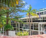
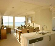
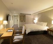
Quality Hotel Sands
Bellagio by the Sea
Miramare Gardens
Checkers Resort & Conference Centre
ZZ TO BE DELETED - JONAHS
Videos from this area
These are videos related to the place based on their proximity to this place.
The Masters Bayview Golf Course Northern Beaches Sydney Australia Prestige John McGrath
The Masters Residences, Bayview Golf Course, Northern Beaches Sydney Australia, Prestige Living, Pittwater, Palm Beach, Whale Beach, Avalon Beach, Bungan Beach, Bilgola Beach, Newport Beach ...
Green Tree Snake. Bayview. NSW. Australia.
A Green Tree Snake on the fence in our garden. Bayview, NSW, Australia.
The Cold Water Challenge
The Cold Water Challenge - Rowland Reserve Bayview (take 2 as when I first dipped my camera slipped)
Pacific Boating - Pittwater Adventure
Just a taste of the Pittwater experience in the Pacific Boating 44 footer. From the Quays Mariner to Refuge Bay. I can highly recomend it!
51 Crescent Rd, Newport - Presented by Nick Scarf 0411 197 486
51 Crescent Road is a beautifully constructed contemporary family home on a very large scale. Offering approx 500 sqm total area, the home has cavernous, open living spaces flooded with natural ...
Superyacht Deck Crew Training
Get certified to be a deck crew member of superyachts anywhere in the world with Superyacht Crew Academy in Sydney Australia. graduate with three internationally recognised certificates; ...
Videos provided by Youtube are under the copyright of their owners.
Attractions and noteworthy things
Distances are based on the centre of the city/town and sightseeing location. This list contains brief abstracts about monuments, holiday activities, national parcs, museums, organisations and more from the area as well as interesting facts about the region itself. Where available, you'll find the corresponding homepage. Otherwise the related wikipedia article.
Avalon, New South Wales
Avalon is a northern beachside suburb of Sydney, in the state of New South Wales, Australia. Avalon is located 35 kilometres north of the Sydney central business district, in the local government area of Pittwater Council, in the Northern Beaches region.
Pittwater Council
Pittwater Council is a local government area on the northern beaches of Sydney, in the state of New South Wales, Australia. It covers a region adjacent to the Tasman Sea about 30 kilometres north of the Sydney central business district. The area is named after Pittwater, the body of water adjacent to much of the area governed. The Mayor of Pittwater Council is Cr. Jacqui Townsend, an independent politician.
Ingleside, New South Wales
Ingleside is a suburb in northern Sydney, in the state of New South Wales, Australia. Ingleside is located 28 kilometres north of the Sydney central business district, in the local government areas of Pittwater Council and Warringah Council. Ingleside is part of the Northern Beaches region, about 2 kilometres from the coast at Mona Vale. Ingleside Heights and Tumbledown Dick are localities in the west of the suburb.
Elanora Heights, New South Wales
Elanora Heights is a suburb in northern Sydney, in the state of New South Wales, Australia. Elanora Heights is 27 kilometres north-east of the Sydney central business district, in the local government area of Pittwater Council. Elanora Heights is part of the Northern Beaches region.
Mona Vale, New South Wales
Mona Vale is a suburb in northern Sydney, in the state of New South Wales, Australia. It is located 28 kilometres north of the Sydney central business district and is the administrative centre of the local government area of Pittwater Council. Mona Vale is also part of the Northern Beaches region.
Barrenjoey High School
Barrenjoey High School is a co-educational high school located in the Sydney suburb of Avalon, in the Northern Beaches of Sydney, Australia. The campus backs onto the Northern end of Avalon Beach. The first student intake was in 1968 with a single grade (known at the time as 'Form 1') which formally graduated from the school in 1973.
Newport, New South Wales
Newport is a suburb in northern Sydney, in the state of New South Wales, Australia 31 kilometres north of the Sydney central business district, in the local government area of Pittwater Council. It is part of the Northern Beaches region.
Bilgola, New South Wales
Bilgola is a suburb in northern Sydney, in the state of New South Wales, Australia 33 kilometres north-east of the Sydney central business district, in the local government area of Pittwater Council. It is part of the Northern Beaches region. Bilgola Plateau is a locality in the western part of the suburb.
Bilgola Plateau, New South Wales
Bilgola Plateau is a locality in Sydney, within the suburb of Bilgola in the state of New South Wales, Australia. The neighbourhood is mainly residential, with two small rows of shops, a small park and a primary school located on the top of the plateau. The beach on the eastern side features a surf club and kiosk. The locality has views of the beach on the eastern side, and views of the body of water, Pittwater on the western side.
Careel Bay
Careel Bay is located in Sydney, in the state of New South Wales, Australia. It is within the suburb of Palm Beach. It has the largest stand of mangroves, one of the last bits of saltmarsh and the largest sea grass beds in Pittwater. Careel Bay is a fish nursery and is important to Pittwater and nearby coastal waters. Careel Bay has some rare and unusual birds, who visit or live in Careel Bay. Some of these birds, from East-Asia, use Careel Bay as a stop off area.
Church Point, New South Wales
Church Point is a suburb in northern Sydney, in the state of New South Wales, Australia. Church Point is 32 kilometres north of the Sydney central business district, in the local government area of Pittwater Council and is part of the Northern Beaches region.
Clareville, New South Wales
Clareville is a suburb in northern Sydney, in the state of New South Wales, Australia. Clareville is 36 kilometres north-east of the Sydney central business district, in the local government area of Pittwater Council. Clareville is part of the Northern Beaches region. Clareville is bordered by Avalon, Bilgola and Newport. Clareville Beach and Taylors Point are localities within the suburb. Bilgola Plateau is an adjoining locality in the suburb of Bilgola.
Bayview, New South Wales
Bayview is a suburb in northern Sydney, in the state of New South Wales, Australia. Bayview is located 31 kilometres north of the Sydney central business district, in the local government area of Pittwater Council and is part of the Northern Beaches region.
Dee Why-class ferry
The Dee Why class ferries, Dee Why and Curl Curl, (named after popular beaches in Sydney's northern suburbs), were, from 1928 until 1938, the largest and fastest ferries on Sydney Harbour, being used on the Circular Quay–Manly route.
Mona Vale Hospital
Mona Vale Hospital is a 156 bed district hospital located in the suburb of Mona Vale in the Northern Beaches area of Sydney, Australia. The Northern Sydney and Central Coast Health Service is responsible for the management of Mona Vale Hospital.
Pittwater Park
Pittwater Park is a rugby stadium in Warriewood, New South Wales, Australia. It is located 500 metres from North Narrabeen beach within the reserve of the area. The park is more colloquially known as Rat Park being named after the Warringah Rugby Club who's official mascot is a rat. The ground was established in 1971, over the years, basic facilities have been added, such as the 1,500-seat grandstand, clubhouse, and training field. Lights have also been installed on the main field.
Newport Arms Hotel
The Newport Arms Hotel is a historical hotel located on the shores of Pittwater. The hotel was first constructed in 1880, and is still a popular spot for tourists and visitors to visit on the weekend.
Turimetta Beach
Turimetta Beach is a beach in Sydney's Northern Beaches. It is 350 metres long and is backed by steep bluffs. Swimming can be hazardous because of rips that usually form at the centre and both ends of the beach. The beach is not patrolled by lifeguards. Turrimetta is more often than not a swimmers' beach only. The surf quality is poor and surfers usually frequent North Narrabeen Beach to the south or Warriewood Beach to the north.
Elvina Bay, New South Wales
Elvina Bay is a locality in northern Sydney, in the state of New South Wales, Australia. It is located 35 kilometres north of the Sydney central business district, in the local government area of Pittwater Council. Elvina Bay is within the Ku-ring-gai Chase National Park, on the western shores of Pittwater, beside Lovett Bay. Scotland Island, Church Point, Morning Bay Paradise Beach and Clareville are located nearby. An attractive location, often used for picnics and other family recreation.
Lovett Bay
Lovett Bay is in northern Sydney, in the state of New South Wales, Australia. It is 36 kilometres north of the Sydney central business district, in the local government area of Pittwater Council. Lovett Bay is in Ku-ring-gai Chase National Park, on the western shores of Pittwater, beside Elvina Bay. Scotland Island, Church Point and Morning Bay are nearby.
Radio Northern Beaches
Radio Northern Beaches (callsign 2MWM) is an Australian volunteer-based community radio station transmitting from studios located in the suburb of Belrose serving the Northern Beaches area of Sydney. It broadcasts on 88.7MHz to the north of the peninsula, covering from Palm Beach on the coast, inland to Terrey Hills in the west.
Taylors Point, New South Wales
Taylors Point is a locality and point in Clareville, a suburb of Sydney, New South Wales, Australia, situated on the Northern Beaches. It was named after John Taylor, who was an early owner of property on Taylors Point.
Towlers Bay, New South Wales
Towlers Bay is a locality and bay in Ku-ring-gai Chase National Park, north of the city of Sydney, New South Wales, Australia, situated on the Northern Beaches. The name of the bay comes from Bill Toler, who used to camp in the area in the 19th century. The locality of Towlers Bay was named after the bay, but the bay's name was changed on 31 August 1984 to Morning Bay. The locality still takes the old name of the bay.
Narrabeen Sports High School
Narrabeen Sports High School, (abbreviation NSHS) is a school located in North Narrabeen, New South Wales, Australia, on Namona Street and Pittwater Road. It is a co-educational Sports high school operated by the New South Wales Department of Education and Training with students from years 7 to 12. The school was originally established in 1954 as a Girls High School and a Boys High School in 1959.
Pittwater High School
Pittwater High School, (abbreviation PHS) is a school located in Mona Vale, New South Wales, Australia, on Mona Street and Pittwater Road. It is a co-educational high school operated by the New South Wales Department of Education and Training with students from years 7 to 12. The school was established in 1963. Many of its students have gone on to notable success, some holding public office.


